Earth Science Information Partners Celebrate 25 Years of Collaboration
13 min read
Earth Science Information Partners Celebrate 25 Years of Collaboration
Allison Mills, Earth Science Information Partners, allisonmills@esipfed.org
Susan Shingledecker, Earth Science Information Partners, susanshingledecker@esipfed.org
Introduction
In 2023, the Earth Science Information Partners (ESIP) community celebrated 25 years since the nonprofit’s founding. Serving as a home for Earth science data and computing professionals, ESIP has evolved alongside the tools and vast expansion of Earth science data available now.
Building on the deep roots of collaboration that ground ESIP and honoring the 2023 Year of Open Science, the 2023 July ESIP Meeting’s theme focused on “Opening Doors to Open Science.” Open science is a collaborative culture enabled by technology that empowers the open sharing of data, information, and knowledge within the scientific community and the wider public to accelerate scientific research and understanding. This definition of open science comes from the 2021 article on the topic published in Earth and Space Science. (To learn more about how open science is being implemented within the context of NASA’s Earth Science Division – see Open Source Science: The NASA Earth Science Perspective, in the September–October 2021 issue of The Earth Observer [Volume 33, Issue 5, pp. 5–9, 11].)
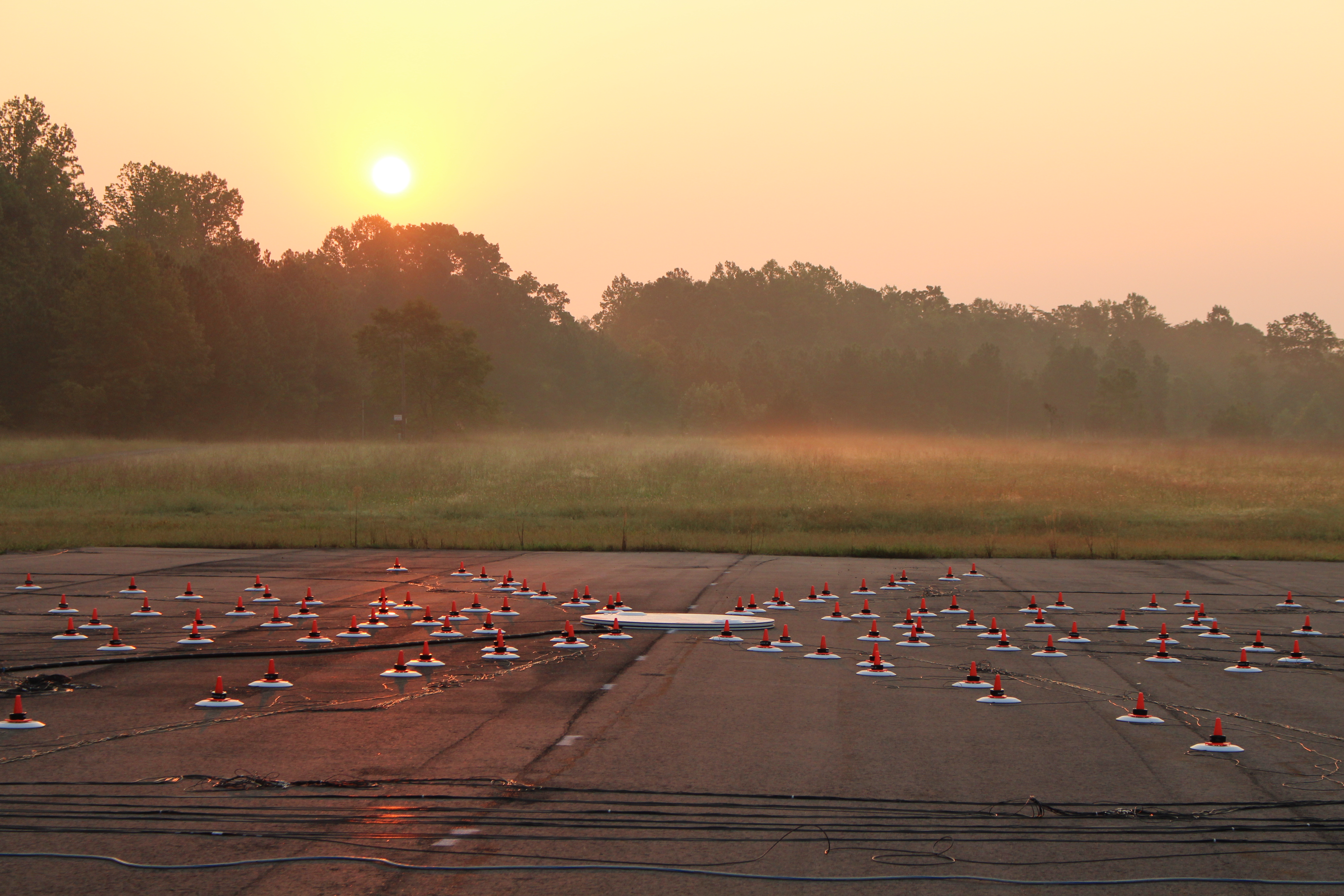
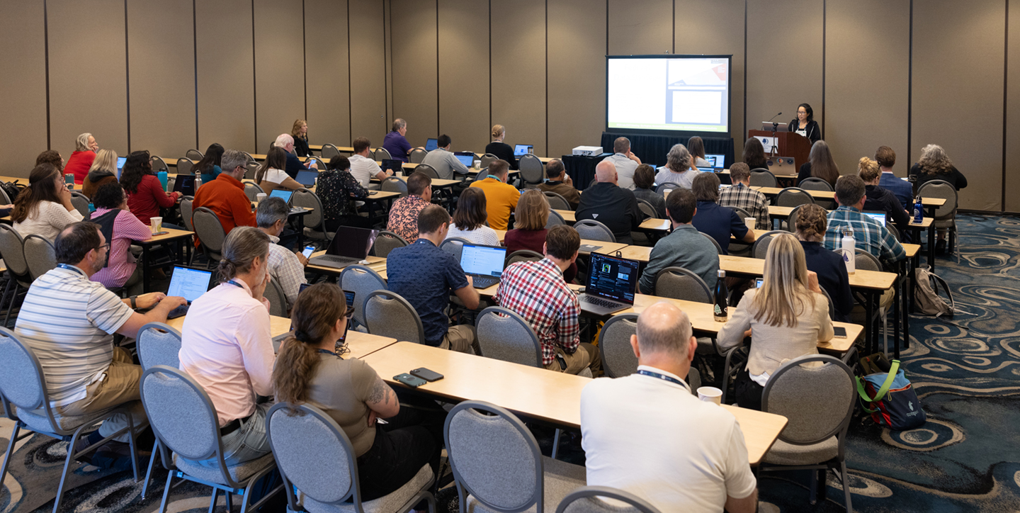
Participants from around the world gathered July 18–21, 2023, in Burlington, VT to explore this theme. One of the strengths of the ESIP community is how it brings people together from government agencies, academia, and industry to work toward common goals. Altogether, nearly 400 attendees from nearly as many institutions, spanning many technical domains and career stages, gathered for the 4-day meeting, which featured a hybrid format that allowed for both in-person participation and virtual access to all plenaries and breakout sessions. Some of the in-person attendees are shown in Photo 1.
This article begins with a brief section on the history and purpose of ESIP followed by a summary of the highlights from each day of the July 2023 meeting.
History and Purpose of ESIP
ESIP was created in response to a National Research Council (NRC) review of the Earth Observing System Data and Information System (EOSDIS). (To learn more about EOSDIS, see Earth Science Data Operations: Acquiring, Distributing, and Delivering NASA Data for the Benefit of Society, in the March–April 2017 issue of The Earth Observer [Volume 29, Issue 2, pp. 4–18].) As NASA’s first Earth Observing System (EOS) missions were launching or preparing to launch, the NRC called on NASA to develop a new, distributed structure that would be operated and managed by the Earth science community and would include observation and research, application, and education data.
ESIP began with 24 NASA-funded partners, whose purpose was to experiment with and evolve methods to make Earth science data easy to preserve, locate, access, and use by a broad community encompassing research, education, and commercial interests. NASA adopted a deliberate and incremental approach in developing ESIP by starting with a limited set of prototype projects called ESIPs, representing both the research and applications development communities. These working prototype ESIP projects were joined by nine NASA distributed active archive centers (DAACs) to form the core of what was then known as the Federation of ESIPs and were responsible for creating its governing structures and the collaborative community it is today.
Although it started as a federation of partners connected due to a NASA mandate, ESIP has grown into an organization of organizations — and its membership has increased exponentially and diversified significantly. Today, there are more than 170 partner organizations – with room to grow. ESIP holds twice-annual meetings, which have run nonstop since 1998, and all past meeting material is available online. (To see an example of topics discussed at an early ESIP Federation meeting, see Meeting of the Federation of Earth Science Information Partners in the September–October 2001 issue of The Earth Observer [Volume 13, Issue 5, pp. 19–20, 26].)
ESIP also currently supports about 30 collaboration areas, which include 11 standing committees and numerous smaller clusters, or working groups. These committees and clusters conduct business both during and especially between meetings. ESIP also started the ESIP Lab, a microfunding initiative that supports learning objectives alongside technical skill-building. The establishment of an ESIP Community Fellows program has carved out a stronger foothold for early career professionals while the Awards, Endorsement, and programs offers knowledge sharing and recognition at all career stages.
ESIP still brings people together to work on complex Earth science issues — an important task that has not changed in over 25 years — but clearly the world is not the same as it was in 1998 when ESIP was established. This holds true for the hardware, software, remote sensing tools, and computing resources that have changed along with the people and communities who use them. In recognition of this, ESIP has developed a new mission and vision statements, and a new list of core values. A key moment in the 2023 July ESIP meeting (reported on below) was the revelation of these new statements, which were then refined during the meeting and voted on by the Board on July 17, 2023 — see ESIP Vision, Mission, and Core Value Statements below.
ESIP Vision and Mission Statements and Core Values
Vision. We envision a world where data-driven solutions are a reality for all by making Earth science data actionable by all who need them anytime, anywhere.
Mission. To empower innovative use and stewardship of Earth science data to solve our planet’s greatest challenges.
Core Values. Integrity, inclusiveness, collaboration, openness, and curiosity.
The new vision statement was intentionally worded to acknowledge how much power is at the fingertips of all data users. The new mission statement honors the depth of knowledge that is required to make data-driven decisions. Much like open science itself, there is a productive tension between wanting to make data as easy to use as possible while upholding the rigor of scientific standards.
All ESIP collaborations are open to everyone, whether an individual’s home institution is an ESIP partner or not.
Overview of the 2023 July ESIP Meeting
The 2023 July ESIP Meeting showcased how the attitudes, behaviors, connections, engagement, and responses of people to the natural environment as well as to agricultural and food systems – known as human dimensions – inform the ways the community tackles technical challenges and how important it is to gather, work together, and find inspiration. Summary highlights from the meeting follow – organized by day. All the meeting sessions were recorded and are available publicly through the ESIP YouTube channel. The reader is referred to these recordings to learn more about the topics mentioned here.
The 2023 July ESIP meeting brought together 366 attendees – including 120 first-time participants. Through 4 plenaries and 44 breakout sessions, more than 100 organizers and speakers addressed the latest updates in Earth science data. Through the lens of open science, the community considered both the impact of the past 25 years of ESIP as well as how to move forward into the next quarter century.
Opening Doors – and Knocking Down Barriers – to Open Science
Throughout its history, ESIP meetings have brought together the most innovative thinkers and leaders around Earth observation data, forming a community dedicated to making Earth observations more discoverable, accessible, and useful to researchers, practitioners, policy makers, and the public. Openness is simply how work is done in ESIP.
Many participants are drawn to ESIP’s approach, because they find roadblocks to open collaboration and innovation elsewhere. While the ESIP community values the transparency and accountability that is fundamental to open science processes, ESIP participants also recognize the challenges in implementing those practices more broadly.
The 2023 July meeting was an excellent example. The “Opening Doors to Open Science” theme provided a space for participants to talk honestly about the institutional inertia, lack of incentives, and unintended consequences that hinder the open science approach. Often, the barriers are specific to particular domains, organizations, or roles. The ESIP meeting content explored such challenges – and solutions – for researchers, agencies, repositories, data managers, software developers, curriculum designers, and many other groups.
DAY ONE
Susan Shingledecker [ESIP—Executive Director] gave the opening remarks and rallied the audience with interactive activities codesigned with Charley Haley [Way Foragers Consulting]. As a collaborative space, ESIP often breaks the norm of lecture-and-listen modes. The discussion and audience-driven talking points helped the community frame the week’s explorations of open science in Earth science data and computing.
Ken Casey [NOAA, National Center for Environmental Information (NCEI)—Deputy Chief of Data Stewardship and ESIP President 2021–2023] shared ESIP’s new mission, vision, and core values.
Kari Jordan [The Carpentries—Chief Executive Officer (CEO)] addressed the importance of authentic diversity and inclusion as a key function of open science. While she laid out systemic issues and barriers, her presentation focused mostly on action and solutions. She advised the ESIP community to use the organization’s core values and mission to continue opening doors to communities that have been historically left out of Science, Technology, Engineering, and Math (STEM) careers, leadership, and tech development.
The rest of the day was filled with rich, deep dives into many Earth science data and computing topics. Notable highlights include the hands-on, knowledge-sharing sessions led by the ESIP Cloud Computing Cluster, chaired by Aimee Barciauskas [Development Seed]. The sessions – from kerchunk tutorials to overviews of geospatial packages for the Python programming language, to lightning talks where speakers gave walkthroughs of tools used for cloud computing applications (e.g. GeoZarr, a geospatial extension to the Zarr specification for processing multidimensional arrays, or tensors, and storing and manipulating them on the cloud, and JupyterHub) – were often standing room only.
In addition to exploring technical tools, another breakout session motif centered around discussions on engaging stakeholders. One session featured Lesley-Ann Dupigny-Giroux [University of Vermont—State Climatologist], who spoke about climate preparedness for small communities, which was particularly relevant in light of the record-setting flooding that had taken place in Vermont just prior to the meeting. In another session, a team from NASA, including Grace Llewellyn [NASA/Jet Propulsion Laboratory—Software Engineer], Stephanie Schollaert Uz [NASA’s Goddard Space Flight Center (GSFC)—Applied Sciences Manager], and Jennifer Wei [GSFC—Scientist] alongside their collaborators Robert Gradeck [University of Pittsburgh], Mukul Sonwalkar [George Mason University], and Michiaki Tatsubori [IBM Research– Tokyo—Senior Technical Staff Member and Manager], focused on broader collaborations for natural disaster response. Several other sessions focused on specific end users in data centers, repositories, and universities.
DAY TWO
The second day of ESIP’s in-person meetings was nicknamed “Workshop Wednesday.” The day began with the ESIP Lab Plenary, followed by longer, in-depth sessions, and capped with the crowd-favorite Research Showcase Poster and Demo Reception.
Annie Burgess [ESIP—ESIP Lab Director] gave the opening remarks and welcomed Corine Farewell [University of Vermont Innovations] to share her perspective on open science and technology transfer. Many in the research community see the two at odds fundamentally – which the audience made clear during the question-and-answer session – but Farewell laid out how interactions between open science and technology transfer can open opportunities to tailor licensing and rollouts and to help ensure technology is shared and supported.
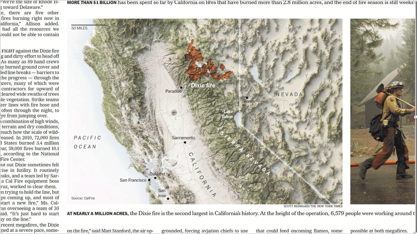
Scott Reinhard [New York Times—Graphics Editor] took the stage and showed a room full of data managers, researchers, and program directors just how powerful their work can be with the right color choice and analytical filtering for an audience’s intuitive ease – see Figure. As a data visualization expert, Reinhard laid out his creative process for making award-winning news graphics, built with data from sources such as the Moderate Resolution Imaging Spectroradiometer (MODIS) on NASA’s Terra and Aqua platforms, and from instruments on NASA–U.S. Geological Survey Landsat missions. His advice during the question-and-answer session was that “less is more.” He said sharing data with public audiences should be about meeting their needs with clarity and succinctness, which means removing ancillary data that is often included in more dense, scientific presentations.
The rest of the day continued with community-led breakout sessions that dove into additional tools like OPeNDAP, Amazon Web Service’s SageMaker, and open data resources in NASA’s Earth Science Division. The day also featured a special plated lunch with presentations from ESIP Award winners. Falkenberg Awardees Angelia Seyfferth [University of Delaware] and Raskin Scholar Alexis Garretson [Tufts University] each shared their domain specialties, Seyfferth focusing on arsenic uptake in crops and Garretson on the ecology of mouse genomes.
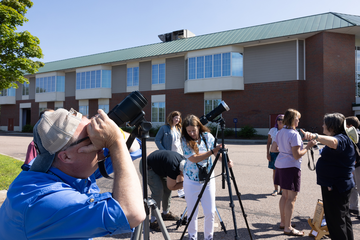
In the afternoon, the ESIP Education Committee led the annual ESIP Teacher’s Workshop. The organizers brought together about a dozen instructors keen to learn more about Earth science data tools for use in their middle and high school classrooms. Every participant was given a solar eclipse kit, including eclipse glasses and lesson plans – see Photo 2.
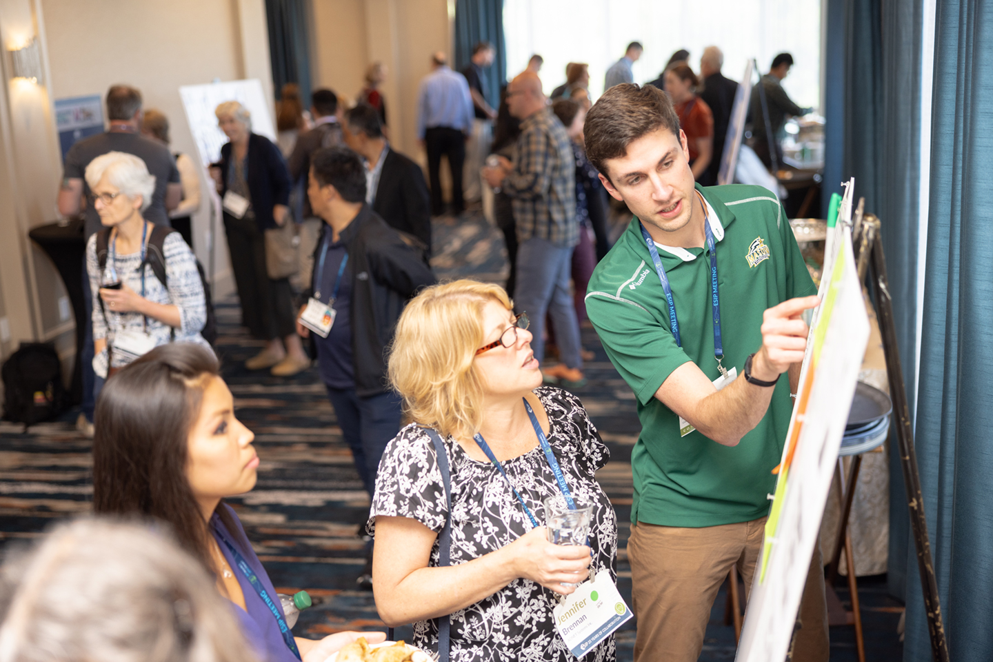
The evening concluded with the Research Showcase, which featured 47 posters and demonstrations. This is a particularly important event for early career meeting attendees, including the ESIP Community Fellows.
DAY THREE
While there was no plenary to start the day, breakout sessions continued throughout the morning and late afternoon. Covering artificial intelligence (AI) tools for wildfires, the United Nations Decade of Ocean Science for Sustainable Development (2021–2030), and the Ocean Decade, these ESIP sessions spanned the interdisciplinary breadth of the community. While many attendees have different backgrounds and career paths, it is the technical challenges and opportunities that bring everyone together.
A longer scheduled lunch break transitioned to the unconference, a space for on-the-fly and emergent discussions. Organizers pitched their mini-session ideas, the audience voted, then everyone split into discussion groups similar to organized coffee-break hallway chats. ESIP meeting feedback data shows that in-person attendees value time to integrate new knowledge and network; a short unconference has proven to be a productive way to encourage this.
Another key networking opportunity was the FUNding Friday microfunding competition. On Thursday night, participants gathered at a local eatery to ideate, write, and even draw their projects, which would be pitched the next morning.
DAY FOUR
While short, the final day of the ESIP meeting proved to be lively. The morning started with the FUNding Friday pitches and voting followed by the closing plenary and Partner Assembly Business meeting. The day concluded with the final breakout sessions, which highlighted the human and social aspects of implementing open science in an Earth data context. From the process of public comments to AI and large-language models, the breakouts illustrated how entangled human challenges are with technical and environmental ones.
Conclusion
Celebrating the organization’s twenty-fifth anniversary at the 2023 July ESIP Meeting tapped into the community’s deep roots while highlighting how much the gathering has grown and evolved. Over the next 25 years, the Earth sciences and its technology will continue to expand – and so will the user base.
To help make Earth science data and its tools accessible, ESIP is committed to making its meetings as open as possible. All ESIP meeting content is made freely available on the ESIP YouTube channel with no time limit.
In general, the ESIP community is open to all people interested in making Earth science data accessible and actionable. The community gathers twice each year in January and July, but the ESIP Collaboration Areas host monthly gatherings throughout the year. Additionally, the ESIP Lab offers seed funding for pilot projects.
Readers who wish to stay informed on the latest from ESIP, Earth science data community events, jobs, and resources are invited to subscribe to the weekly ESIP Update. The next ESIP meeting will take place in July 2024; watch the ESIP website and other social media for more details.
Powered by WPeMatico
Get The Details…