NASA’s Juno Takes Temperature of Jupiter’s Fiery Moon Io
5 min read
Preparations for Next Moonwalk Simulations Underway (and Underwater)
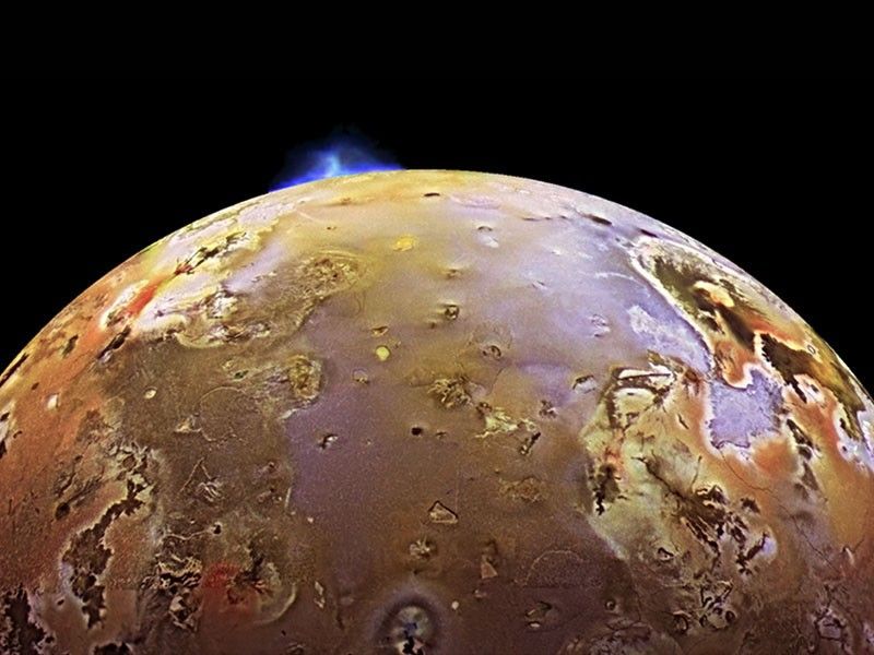
NASA’s Juno mission has provided the first measurements of the temperature below the surface of Jupiter’s moon Io, revealing significant heating within the shallow subsurface of the most volcanically active world in the solar system. Collected during two close flybys, the data also shows that most of Io’s surface is remarkably smooth and composed of material of very low density.
Published Wednesday in the Journal of Geophysical Research: Planets, these findings break new observational ground for both fiery and icy worlds beyond our planet.
Io’s extreme volcanism is powered by tidal heating. The moon is constantly stretched and squeezed by Jupiter’s immense gravity as it travels its slightly elliptical orbit, generating internal heat output many times greater than Earth’s. Until now, virtually everything known about that heat came from infrared observations, which sense only the temperature of the top surface. The latest findings are derived from data collected by the spacecraft’s Microwave Radiometer (MWR) instrument.
“The Juno Microwave Radiometer directly observed Io’s heat output by looking below the surface,” said Scott Bolton, study coauthor and Juno’s principal investigator at Southwest Research Institute in San Antonio. “The surprising discovery that we could see below a rocky moon’s surface has important implications for studying Earth’s volcanoes. Juno has taught us that if we look with an MWR-type instrument near a volcano on Earth, we might see a similar signature in the subsurface temperature gradient, providing new information on how terrestrial volcanoes work.”
Fire, ice
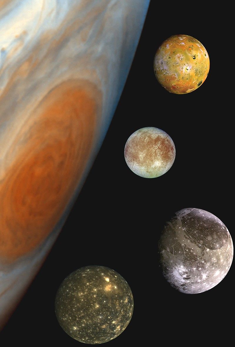
Juno’s Microwave Radiometer was designed by Bolton to peer beneath Jupiter’s cloud tops to investigate the dynamics and composition of the gas giant’s deep atmosphere. The MWR’s six microwave antennas serve as a single instrument, simultaneously detecting microwaves at a wide range of wavelengths, from about half an inch to 20 inches (1.3 to 51 centimeters). During the mission’s extended phase, the MWR instrument has provided the opportunity to observe three of the planet’s Galilean moons: Ganymede, Europa, and Io.
“The technique is novel in that each wavelength explores different depths, providing a new way to characterize the deep atmosphere of giant planets and the subsurface crusts of icy and rocky moons,” said Bolton. “At Ganymede and Europa, we explored tens of miles below the surface, assuming their ice shells were mostly pure water, but the ability to probe into the volcanic rock at Io was an unexpected discovery.”
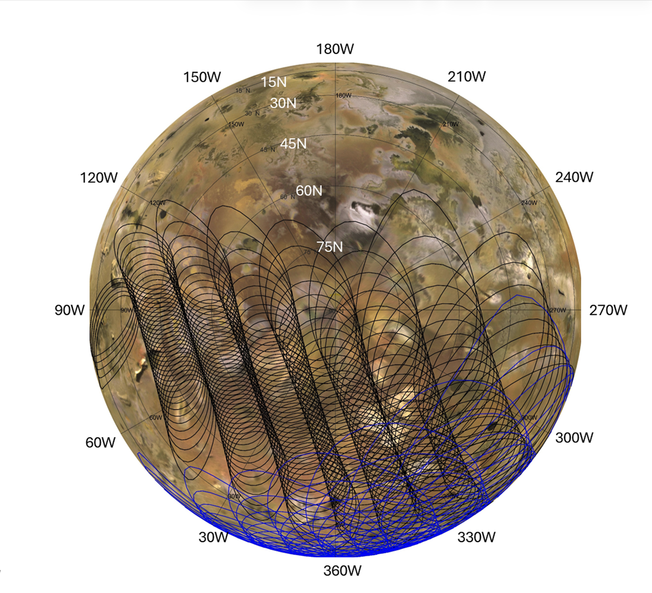
During flybys on Dec. 30, 2023, and Feb. 3, 2024, the solar-powered Juno spacecraft came within about 930 miles (1,500 kilometers) of the moon’s surface.
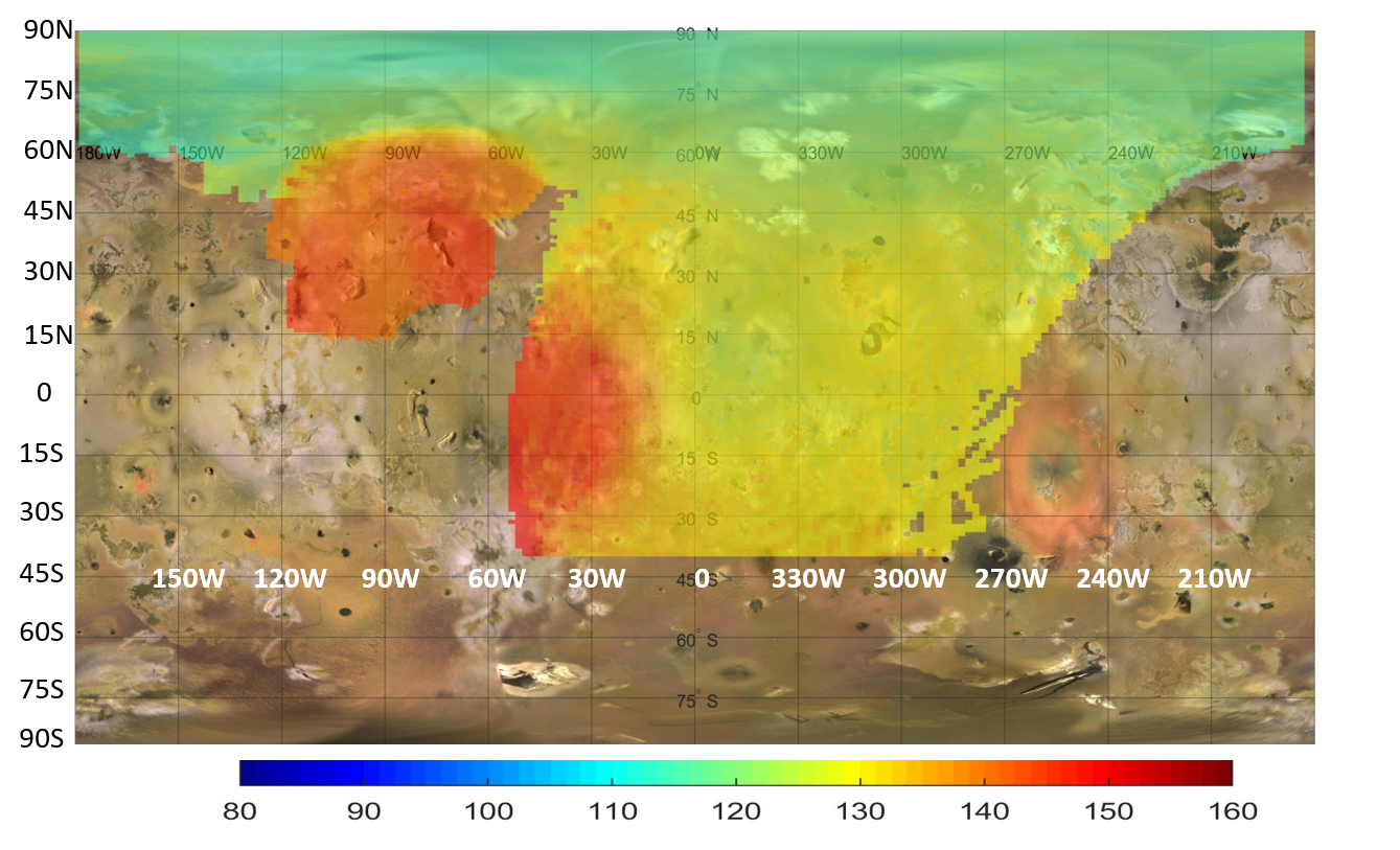
“The instrument measured Io’s thermal emission at depths ranging from a few inches down to tens of feet. Everywhere we looked, we found the temperature rising by more than 40 degrees Fahrenheit just several feet into the surface — a gradient far steeper than solar heating alone can explain,” said Shannon Brown, the paper’s lead author at NASA’s Jet Propulsion Laboratory in Southern California.
The data suggests two possible explanations. First, heat could be rising steadily through a conductive crust. While this background heat flow — measured at 1 to 3 watts per square meter — is relatively gentle on a local scale (roughly equivalent to a small nightlight glowing under every square yard), across the entire moon it represents a release of energy up to 30 times Earth’s average. Alternatively, the signal could be coming from cooling lava flows, capped by roughly 30 to 35 feet (9 to 11 meters) of solidified crust, that cover about 10% of the moon’s surface at any given time.
“Io provides a unique window into learning how tidal heating works throughout the cosmos, a fundamental process that provides energy and heat to worlds that are far from their parent star,” said Bolton. “This process can not only create the most volcanic body in the solar system, in the case of Io, but also fuels the subsurface oceans on the moons of giant planets, such as Europa and Ganymede. Up until this point we could only observe the heat escaping at the surface or through eruptions. Now we can characterize how the heat is moving from the interior toward the surface.”
Great plains of Io
Another big insight gained from the two flybys is just how smooth Io is. Prior to the recent findings, the moon was known for its tall mountains, but the MWR indicates that apart from this visible topography, the surface features expansive smooth patches that stretch for 60 miles (100 kilometers) or more. Because Juno flew by overlapping regions of Io at different angles, the team was able to map how the surface reflects microwaves, much like an airline passenger might see the ocean flash with sunlight only at specific angles.
“Away from its mountains, the surface is more like the Great Plains of North America, and even though Io is a rocky body, the surface material has a very low density — more like pumice or a fluffy volcanic ash than solid rock,” said Brown.
More about Juno
A division of Caltech in Pasadena, California, JPL manages the Juno mission for the principal investigator, Scott Bolton, of the Southwest Research Institute. Juno is part of NASA’s New Frontiers Program, which is managed at the agency’s Marshall Space Flight Center in Huntsville, Alabama, for the NASA’s Science Mission Directorate in Washington. Lockheed Martin Space in Denver built and operates the spacecraft. More information about Juno is at:
https://science.nasa.gov/mission/juno
News Media Contacts
DC Agle
Jet Propulsion Laboratory
818-393-9011
agle@jpl.nasa.gov
Karen Fox / Molly Wasser
NASA Headquarters, Washington
202-358-1600
karen.c.fox@nasa.gov / molly.l.wasser@nasa.gov
Deb Schmid
Southwest Research Institute, San Antonio
210-522-2254
dschmid@swri.org
2026-050
Keep Exploring
Discover Related Topics
Powered by WPeMatico
Get The Details…
Stephen Carney