Students Celebrate Rockets, Environment at NASA’s Kennedy Space Center

Students Celebrate Rockets, Environment at NASA’s Kennedy Space Center
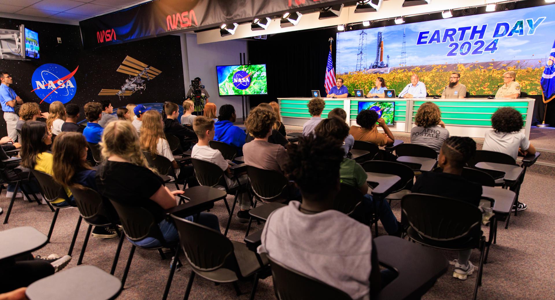
Students from Andrew Jackson Middle School in Titusville, Florida, participate in an environmentally focused Earth Day briefing on Tuesday, April 2, 2024, inside the news auditorium at the agency’s Kennedy Space Center in Florida. The panelists from left to right are Messod Bendayan, NASA Communications; Kelly McCarthy, NASA’s Office of STEM Engagement, Bob Kline, Kennedy’s Environmental Assurance Branch; Spencer Davis, Kennedy’s Exploration Ground Systems; Kim King-Wrenn, Merritt Island National Wildlife Refuge.
NASA/Kim Shiflett

At NASA’s Kennedy Space Center, sustainability and preservation efforts here on Earth are as much of a priority as rocket launches, spacecraft, and the exploration of worlds beyond our own.

In celebration of Earth Day 2024, nearly 100 students from Andrew Jackson Middle School in Titusville, Florida, and a virtual audience of students across the country, attended NASA’s Next Gen STEM Earth Day panel at the NASA News Center’s John Holliman Auditorium and press site “bullpen.”  

On hand were NASA environmental and educational experts who discussed Kennedy’s unique role balancing space launch technology and protected habitat, the center’s new electric vehicle charging stations, and NASA’s Earthrise educational initiative that aims to increase science, technology, engineering, and mathematics literacy. 

Bob Kline, acting chief of Kennedy’s Environmental Assurance Branch, helped students learn about the importance of protecting the habitat that is refuge to more than 1,500 species of plants and animals. NASA Kennedy shares a boundary with the Merritt Island National Wildlife Refuge and the Canaveral National Seashore, which encompass over 140,000 acres of land, waters, and protected habitats.   

“Because we’re a wildlife refuge, it’s easy to think the launches would impact the wildlife, but it’s mostly the buildings that might get impacted by wildlife trying to live on them,” said Kline. “During renovations we’ve had to do special things to protect bats and other birds who live in roofs or under bridges. Everything we do, we’re very mindful of the animals, whether they’re endangered or not. We care about them deeply.” 

Panelist Kim King-Wrenn, a park ranger from Merritt Island National Wildlife Refuge, echoed Kline’s message. She told students that the spaceport is one of the most biologically diverse places in the world. 

Home to everything from the Florida scrub jay to endangered green sea turtles, King-Wrenn classifies Kennedy as the goldilocks of climate zones.  

“Right here is where the northern temperate zone and the southern, subtropical zones come together,” King-Wrenn said. “The more habitat diversity there is, the more diverse homes there are for more kinds of animals.”  

Students like 7th grader Zoe Oderman were fascinated by the coexistence of nature and technology across the spaceport. “The Vehicle Assembly Building was awesome, but I love that the beaches at Kennedy Space Center give turtles a place to lay their eggs, because other places in the area don’t,” Oderman said.  

Kennedy employee Spencer Davis discussed the installation of 56 electric vehicle charging stations during his time at the NASA Transportation Office on center. The new infrastructure helps support a fleet of electric government vehicles including the all-electric crew transport vehicles that will take Artemis astronauts from their crew quarters to the launch pad.  
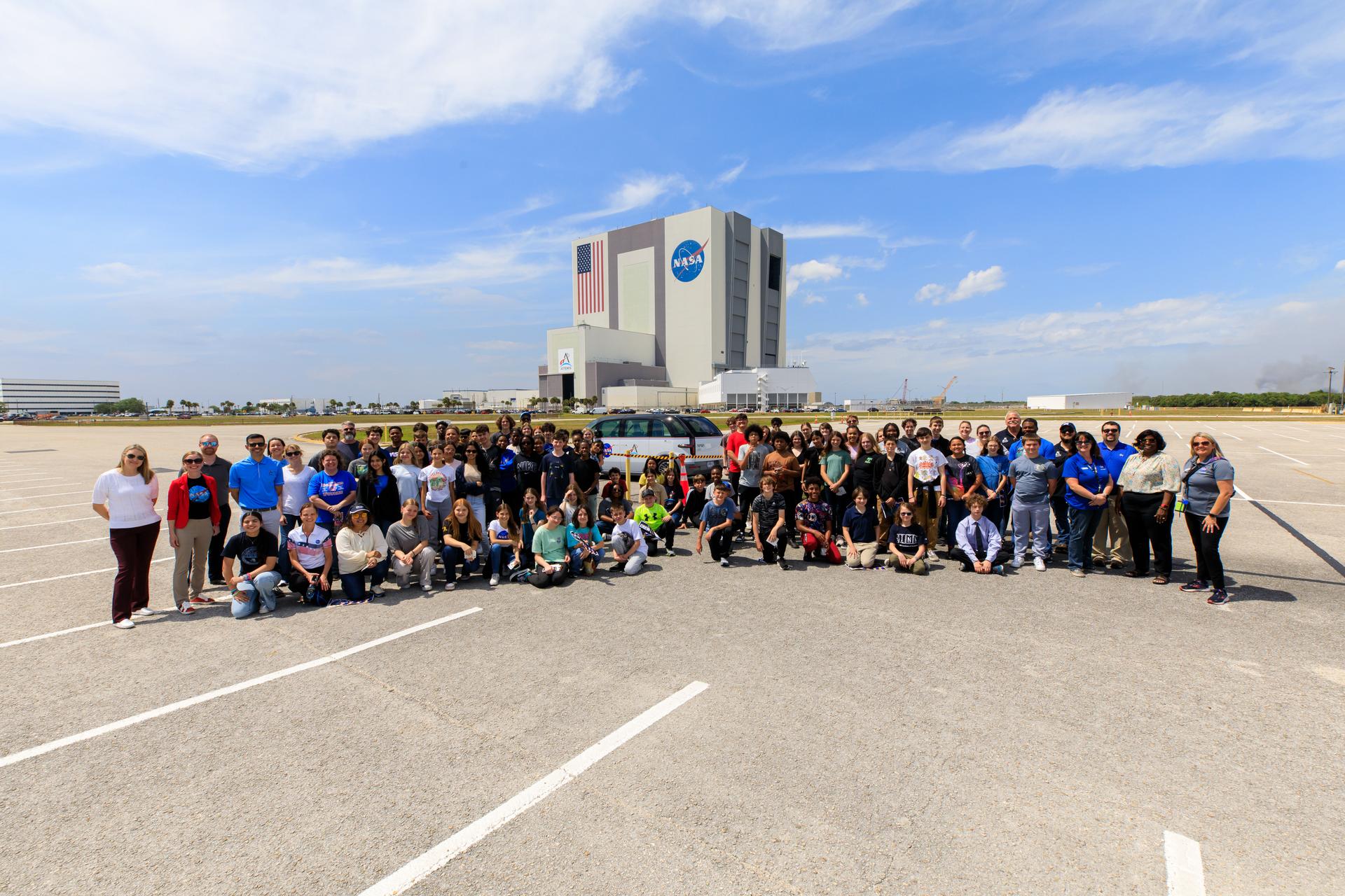
Students from Andrew Jackson Middle School in Titusville, Florida, pose for a photo with one of the Artemis crew transportation vehicles in front of the Vehicle Assembly Building at NASA’s Kennedy Space Center in Florida on Tuesday, April 2, 2024. As part of NASA’s NextGen STEM project, the students joined others from across the country who participated virtually for an environmentally focused Earth Day briefing held inside Kennedy’s news auditorium to discuss how technology and science coexist with nature at the spaceport.
NASA/Kim Shiflett

Later this summer, Davis and his team will be honored at the White House for these efforts to facilitate a future of zero carbon emission government vehicles and help save taxpayer money.  

“The big takeaway here is in order to charge up and drive one of Kennedy’s Chevrolet Bolts 100 miles, it only costs $2.80,” Davis said. “That’s basically the price of a soft drink.”  

The students also learned about Earthrise from panelist Kelly McCarthy, program specialist with NASA’s Office of STEM Engagement at the agency’s Stennis Space Center in Mississippi.  

The NASA education initiative provides educators with access to monthly collections of resources aimed at increasing STEM literacy and understanding the importance of protecting our home planet.  

“Earthrise is a really good way to find out the most relevant and useful solutions-based resources that exist right now,” McCarthy said. 

Besides offering their expertise on sustainable practices as well as words of encouragement to the future stewards of our planet, the panelists inspired students to pursue STEM careers, including at Kennedy. 

“You can do anything you want to do out here, and if you really apply yourself you can get into any field,” Davis told the students. “Don’t be afraid to step outside the box. Don’t be afraid to do something completely different, even if it’s scary. Take every opportunity and seize the moment.”

The event was coordinated through the Next Gen STEM project in NASA’s Office of STEM Engagement, which reaches students in schools and informal classrooms across the county.  

View NASA’s Next Gen STEM Earth Day Student Briefing here:

Powered by WPeMatico

Get The Details…
Jason Costa

AI for Earth: How NASA’s Artificial Intelligence and Open Science Efforts Combat Climate Change

AI for Earth: How NASA’s Artificial Intelligence and Open Science Efforts Combat Climate Change

4 min read

AI for Earth: How NASA’s Artificial Intelligence and Open Science Efforts Combat Climate Change

Lights brighten the night sky in this image of Europe
Lights brighten the night sky in this image of Europe, including Poland, taken from the International Space Station.
NASA

As extreme weather events increase around the world due to climate change, the need for further research into our warming planet has increased as well. For NASA, climate research involves not only conducting studies of these events, but also empowering outside researchers to do the same. The artificial intelligence (AI) efforts spearheaded by the agency offer a powerful tool to accomplish these goals.

In 2023, NASA teamed up with IBM Research to create an AI geospatial foundation model. Trained on vast amounts of NASA’s widely used Harmonized Landsat and Sentinel-2 (HLS) data, the model provides a base for a variety of AI-powered studies to tackle environmental challenges. In keeping with open science principles, the model is freely available for anyone to access.

Foundation models serve as a baseline from which scientists can develop a diverse set of applications, enabling powerful and efficient solutions. “Foundation models only know what things are represented in the data,” explained Manil Maskey, the data science lead at NASA’s Office of the Chief Science Data Officer (OCSDO). “It’s like a Swiss Army Knife—it can be used for multiple different things.”

Once a foundation model is created, it can be trained on a small amount of data to perform a specific task. To date, the Interagency Implementation and Advanced Concept Team (IMPACT) along with collaborators have demonstrated the geospatial foundation model’s capabilities by fine-tuning it to detect burn scars, to delineate flood water, and to classify crop and other land use categories.

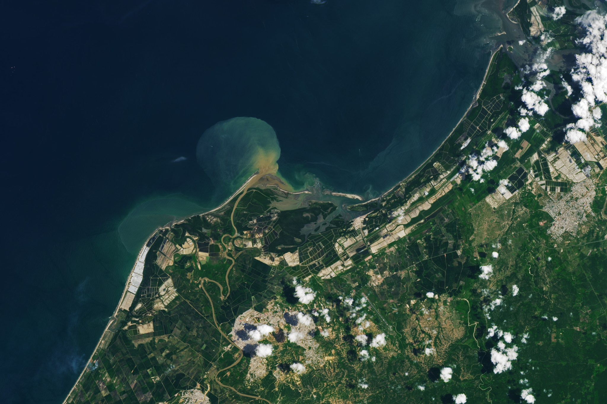
Green and white aquaculture ponds extend across the Tumbes River Delta shown in this image, acquired on March 14, 2024, by the OLI-2 (Operational Land Imager-2) on Landsat 9. The ponds on the west side of the delta are likely topped with white pond covers, providing some shade.
Rectangular ponds for shrimp farming line the coast of northern Peru in this image captured on March 14, 2024 by the OLI-2 (Operational Land Imager-2) on Landsat 9.
NASA Earth Observatory / Lauren Dauphin

Because of the computational resources required to create the initial foundation model, a partnership was necessary for success. In this case, NASA brought the data and scientific knowledge, while IBM brought the computing power and AI algorithm optimization expertise. The team’s shared commitment to making their research accessible through open science principles ensures that their model can be useful to as many researchers as possible.

“To build a foundation model at scale, we realized early on that it’s not feasible for one institution to build it,” Maskey said. “Everything we have done on our foundation models has been open to the public, all the way from pre-training data, code, best practices, model weights, fine-tuning training data, and publications. There’s transparency, so researchers can trace why certain things were used in terms of data or model architecture.”

Following on from the success of their geospatial foundation model, NASA and IBM Research are continuing their partnership to create a new, similar model for weather and climate studies. They are collaborating with Oak Ridge National Laboratory (ORNL), NVIDIA, and several universities to bring this model to life.

This time, the main dataset will be the Modern-Era Retrospective analysis for Research and Applications, Version 2 (MERRA-2), a huge collection of atmospheric reanalysis data that spans from 1980 to the present day. Like the geospatial foundation model, the weather and climate model is being developed with an open science approach, and will be available to the public in the near future.

Covering all aspects of Earth science would take several foundation models trained on different types of datasets. However, Maskey believes those future models might someday be combined into one comprehensive model, leading to a “digital twin” of the Earth that would provide unparalleled analysis and predictions for all kinds of climate and environmental events.

Whatever innovations the future holds, NASA and IBM’s geospatial and climate foundation models will enable leaps in Earth science like never before. Though powerful AI tools will enhance researchers’ work, the team’s dedication to open science supercharges the possibilities for discovery by allowing anyone to put those tools into practice and pave the way for groundbreaking research to help better care for the planet.

For more information about open science at NASA, visit:
https://science.nasa.gov/open-science/

By Lauren Leese
Web Content Strategist for the Office of the Chief Science Data Officer

Share

Details

Last Updated
Apr 18, 2024

Related Terms

Powered by WPeMatico

Get The Details…

Sols 4159-4160: A Fully Loaded First Sol

Sols 4159-4160: A Fully Loaded First Sol

3 min read

Sols 4159-4160: A Fully Loaded First Sol

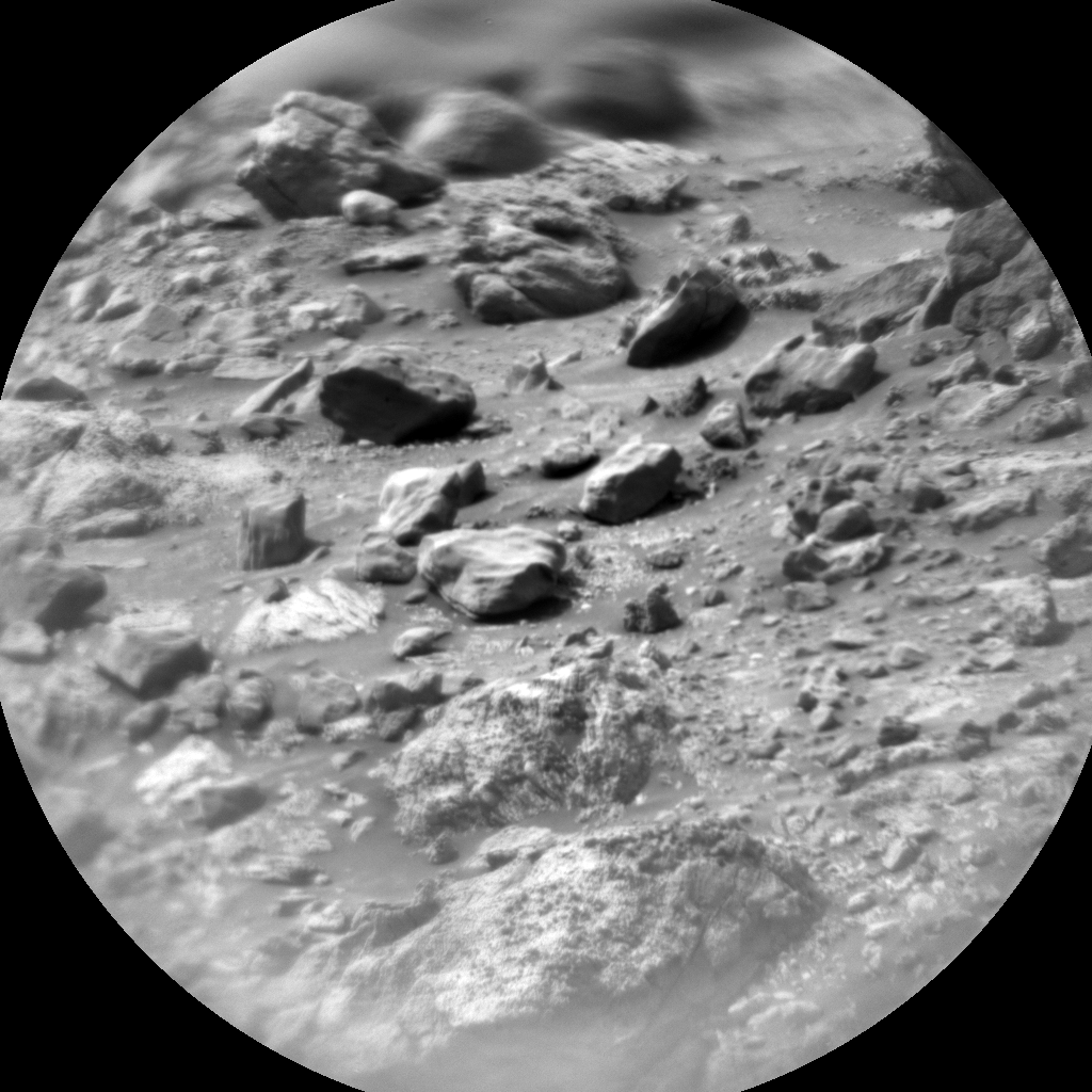
Image of Mars was taken by Chemistry & Camera (ChemCam) onboard NASA's Mars rover Curiosity
This image was taken by Chemistry & Camera (ChemCam) onboard NASA’s Mars rover Curiosity on Sol 4158 (2024-04-17 07:52:27 UTC).
NASA/JPL-Caltech/LANL

Earth planning date: Wednesday, April 17, 2024

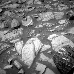
Curiosity continues to make progress along the margin of upper Gediz Vallis ridge, investigating the broken bedrock in our workspace and acquiring images of the ridge deposit as the rover drives south.

Today’s 2-sol plan focused on a DRT, contact science, and drive on the first sol, followed by untargeted remote sensing on the second sol.  The team had to make some decisions at the start of planning about whether to drive on the first or second sol of this plan, and how that would affect the upcoming weekend activities.  As it turned out, the team was able to fit all of the desired contact science and remote sensing activities on the first sol, in addition to the drive on the first sol, which means we’ll be able to downlink more information about our end-of-drive location to better inform planning for the weekend.  Weekend plans provide opportunities for a lot of great contact science, so it will be really helpful to have that additional data down for planning.

That means the first sol of this plan is fully loaded!  The plan begins with a DRT activity to expose a fresh surface on the bedrock target “Tilden Lake,” followed by APXS integrations to investigate its composition. Then the Geology theme group planned several hours of remote sensing activities, including ChemCam LIBS on the bedrock target “Curry Village,” which has a similar “dragon scale” texture (or “tire tracks”) to what we had observed in the previous workspace. This big remote sensing block also includes ChemCam long distance RMI mosaics to assess the stratigraphy at Gediz Vallis ridge and the distant butte Kukenan.  These long distance RMI images reveal a lot of great detail about distant targets, like the diversity of clasts at Gediz Vallis ridge, as seen in the above image.  

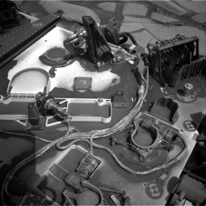
The plan also includes a number of Mastcam activities to characterize local textures, sedimentary structures, dark rocks, and sandy aeolian bedforms (known as Transverse Aeolian Ridges, aka TARs) in a nearby trough.  The Environmental theme group also planned activities to monitor the movement of fines on the rover deck, search for dust devils, and monitor atmospheric dust.  After this big remote sensing block, Curiosity will use MAHLI to image the contact science target, and then continue driving south.  The second sol includes untargeted activities like an autonomously selected ChemCam AEGIS target, additional Navcam deck monitoring, and Navcam line-of-sight observations. After the drive we’ll take post drive imaging to prepare for the next plan.

Looking forward to seeing what other surprises our next workspace will reveal!

Written by Lauren Edgar, Planetary Geologist at USGS Astrogeology Science Center

Share

Details

Last Updated
Apr 18, 2024

Powered by WPeMatico

Get The Details…

Water Touches Everything

Water Touches Everything

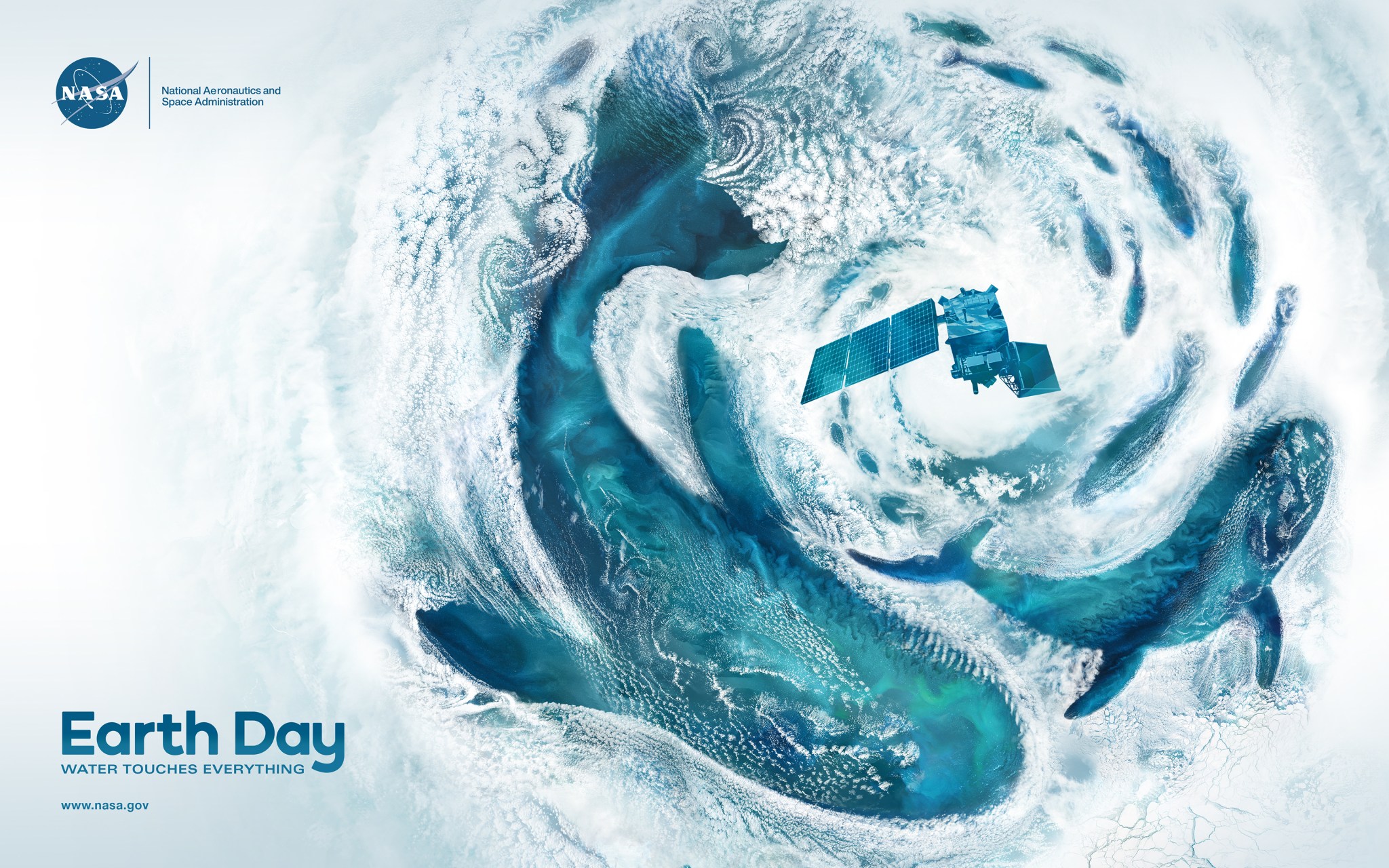
This 2024 Earth Day poster is an ocean themed vertical 15x30 illustration created from NASA satellite cloud imagery overlaid on ocean data. The white cloud imagery wraps around shapes, defining three whales and a school of fish. Swirly cloud patterns, called Von Kármán Vortices, create the feeling of movement in the composition. The focal point is a cyclone in the upper third of the poster. At the center flies the recently launched PACE satellite. The ocean imagery – composed of blues, aquas, and greens – is filled with subtle color changes and undulating patterns created by churning sediment, organic matter and phytoplankton.
The ocean holds about 97 percent of Earth’s water and covers 70 percent of our planet’s surface. According to the United Nations, the ocean may be home to 50 to 80 percent of all life on Earth. Even if you live hundreds of miles from a coast, what happens in the ocean is fundamental to your life.
NASA/Jenny Mottar

Real satellite imagery from NASA’s Terra, Aqua, and Landsat missions takes the shape of whales and swirling clouds in the agency’s Earth Day 2024 poster, “Water Touches Everything.”

The major ocean basins – Atlantic, Pacific, Arctic, Indian, and Southern – shape our planet’s climate and weather by absorbing, storing, and moving heat, water, and carbon dioxide. For nearly five decades, NASA missions have enabled researchers to observe from above and measure changes in the ocean across days, months, seasons, and years. Scientists use our satellite and sub-orbital data and climate models to study ocean dynamics, sea level rise, hydrological cycles, marine life, and the intersections of land and sea.

Hear NASA Science Mission Directorate Art Director, Jenny Mottar, explain her inspiration behind this year’s poster concept and design.

Image Credit: NASA/Jenny Mottar

Powered by WPeMatico

Get The Details…
Monika Luabeya

NASA’s Juno Gives Aerial Views of Mountain, Lava Lake on Io

NASA’s Juno Gives Aerial Views of Mountain, Lava Lake on Io

This animation is an artist’s concept of Loki Patera, a lava lake on Jupiter’s moon Io, made using data from the JunoCam imager aboard NASA’s Juno spacecraft. With multiple islands in its interior, Loki is a depression filled with magma and rimmed with molten lava. Credit: NASA/JPL-Caltech/SwRI/MSSS

Imagery from the solar-powered spacecraft provides close-ups of intriguing features on the hellish Jovian moon.

Scientists on NASA’s Juno mission to Jupiter have transformed data collected during two recent flybys of Io into animations that highlight two of the Jovian moon’s most dramatic features: a mountain and an almost glass-smooth lake of cooling lava. Other recent science results from the solar-powered spacecraft include updates on Jupiter’s polar cyclones and water abundance.

The new findings were announced Wednesday, April 16, by Juno’s principal investigator Scott Bolton during a news conference at the European Geophysical Union General Assembly in Vienna.

Juno made extremely close flybys of Io in December 2023 and February 2024, getting within about 930 miles (1,500 kilometers) of the surface, obtaining the first close-up images of the moon’s northern latitudes.

“Io is simply littered with volcanoes, and we caught a few of them in action,” said Bolton. “We also got some great close-ups and other data on a 200-kilometer-long (127-mile-long) lava lake called Loki Patera. There is amazing detail showing these crazy islands embedded in the middle of a potentially magma lake rimmed with hot lava. The specular reflection our instruments recorded of the lake suggests parts of Io’s surface are as smooth as glass, reminiscent of volcanically created obsidian glass on Earth.”

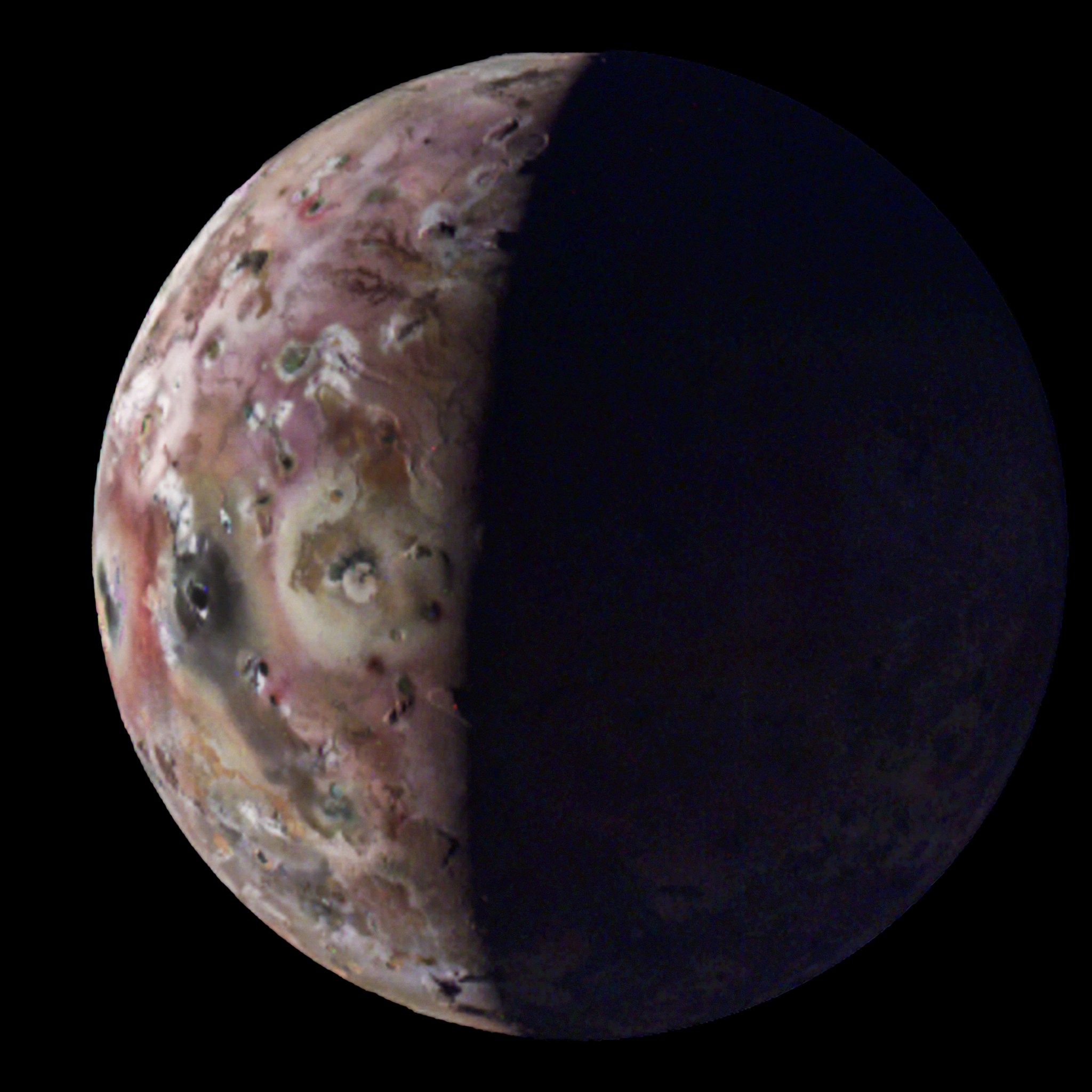
The JunoCam instrument on NASA’s Juno captured this view of Jupiter’s moon Io — with the first-ever image of its south polar region — during the spacecraft’s 60th flyby of Jupiter on April 9.
Image credit: NASA/JPL-Caltech/SwRI/MSSS. Image processing: Gerald Eichstädt/Thomas Thomopoulos (CC BY).

Maps generated with data collected by Juno’s Microwave Radiometer (MWR) instrument reveal Io not only has a surface that is relatively smooth compared to Jupiter’s other Galilean moons, but also has poles that are colder than middle latitudes.

Pole Position

During Juno’s extended mission, the spacecraft flies closer to the north pole of Jupiter with each pass. This changing orientation allows the MWR instrument to improve its resolution of Jupiter’s northern polar cyclones. The data allows multiwavelength comparisons of the poles, revealing that not all polar cyclones are created equal.

“Perhaps most striking example of this disparity can be found with the central cyclone at Jupiter’s north pole,” said Steve Levin, Juno’s project scientist at NASA’s Jet Propulsion Laboratory in Southern California. “It is clearly visible in both infrared and visible light images, but its microwave signature is nowhere near as strong as other nearby storms. This tells us that its subsurface structure must be very different from these other cyclones. The MWR team continues to collect more and better microwave data with every orbit, so we anticipate developing a more detailed 3D map of these intriguing polar storms.”

Jovian Water

One of the mission’s primary science goals is to collect data that could help scientists better understand Jupiter’s water abundance. To do this, the Juno science team isn’t hunting for liquid water. Instead, they are looking to quantify the presence of oxygen and hydrogen molecules (the molecules that make up water) in Jupiter’s atmosphere. An accurate estimate is critical to piecing together the puzzle of our solar system’s formation.

Created using data collected by the JunoCam imager aboard NASA’s Juno during flybys in December 2023 and February 2024, this animation is an artist’s concept of a feature on the Jovian moon Io that the mission science team nicknamed “Steeple Mountain.” Credit: NASA/JPL-Caltech/SwRI/MSSS

Jupiter was likely the first planet to form, and it contains most of the gas and dust that wasn’t incorporated into the Sun. Water abundance also has important implications for the gas giant’s meteorology (including how wind currents flow on Jupiter) and internal structure.

In 1995, NASA’s Galileo probe provided an early dataset on Jupiter’s water abundance during the spacecraft’s 57-minute descent into the Jovian atmosphere. But the data created more questions than answers, indicating the gas giant’s atmosphere was unexpectedly hot and — contrary to what computer models had indicated — bereft of water.

“The probe did amazing science, but its data was so far afield from our models of Jupiter’s water abundance that we considered whether the location it sampled could be an outlier. But before Juno, we couldn’t confirm,” said Bolton. “Now, with recent results made with MWR data, we have nailed down that the water abundance near Jupiter’s equator is roughly three to four times the solar abundance when compared to hydrogen. This definitively demonstrates that the Galileo probe’s entry site was an anomalously dry, desert-like region.”

The results support the belief that the during formation of our solar system, water-ice material may have been the source of the heavy element enrichment (chemical elements heavier than hydrogen and helium that were accreted by Jupiter) during the gas giant’s formation and/or evolution. The formation of Jupiter remains puzzling, because Juno results on the core of the gas giant suggest a very low water abundance — a mystery that scientists are still trying to sort out. 

Data during the remainder of Juno’s extended mission may help, both by enabling scientists to compare Jupiter’s water abundance near the polar regions to the equatorial region and by shedding additional light on the structure of the planet’s dilute core. 

During Juno’s most recent flyby of Io, on April 9, the spacecraft came within about 10,250 miles (16,500 kilometers) of the moon’s surface. It will execute its 61st flyby of Jupiter on May 12.

More About the Mission

NASA’s Jet Propulsion Laboratory, a division of Caltech in Pasadena, California, manages the Juno mission for the principal investigator, Scott Bolton, of the Southwest Research Institute in San Antonio. Juno is part of NASA’s New Frontiers Program, which is managed at NASA’s Marshall Space Flight Center in Huntsville, Alabama, for the agency’s Science Mission Directorate in Washington. The Italian Space Agency (ASI) funded the Jovian InfraRed Auroral Mapper. Lockheed Martin Space in Denver built and operates the spacecraft.

More information about Juno is available at:

https://www.nasa.gov/juno

News Media Contacts

DC Agle
Jet Propulsion Laboratory, Pasadena, Calif.
818-393-9011
agle@jpl.nasa.gov

Karen Fox / Charles Blue
NASA Headquarters, Washington
301-286-6284 / 202-802-5345
karen.c.fox@nasa.gov / charles.e.blue@nasa.gov

Deb Schmid
Southwest Research Institute, San Antonio
210-522-2254
dschmid@swri.org

2024-045

Share

Details

Last Updated

Apr 18, 2024

Powered by WPeMatico

Get The Details…
Naomi Hartono