NASA Satellites Help Map Ocean Nutrient Stress 

NASA Satellites Help Map Ocean Nutrient Stress 

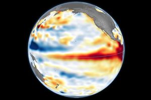
A flat map of the world shows regions in the ocean colored red to indeicate elevated levels of stress on plankton due to a lack of nutrients.
Warming waters decrease upwelling and lead to stress on marine microorganisms due to limited availability of vital nutrients. Red indicates the regions of highest nutrient-related stress.
Kel Elkins/NASA’s Scientific Visualization Studio

Editor’s note: This article was updated on June 5.

A new study combining NASA satellite observations, ocean surveys, and genetic testing on marine microorganisms found evidence that warming ocean waters may be limiting nutrient availability across much of the global ocean. The researchers report that this nutrient stress affects microscopic marine organisms and could influence marine ecosystems over time.

The research, published June 5 in Science Advances, tracked the condition of phytoplankton, which form the base of ocean food webs. Rather than measuring nutrients like nitrogen, iron, and phosphorus directly, the researchers inferred stress by tracking subtle shifts in the ratio of carbon to chlorophyll in phytoplankton observed from space. When the amount of chlorophyll decreases relative to carbon as seen in satellite data, it’s an indication that the plankton are stressed. 

“As our ocean continues to change, the ability to observe and track ocean conditions through sustained, high quality remote sensing observations has never been more important,” said Laura Lorenzoni, Program Scientist for NASA’s Ocean Biology and Biogeochemistry Program at NASA Headquarters in Washington. “This is fundamental, as plankton communities are the base of the marine food web on which important economic activities rely.” 

The research team combined two decades of data from NASA’s Aqua satellite’s Moderate Resolution Imaging Spectroradiometer (MODIS) sensor with plankton samples collected on research cruises around the world. The approach linked large-scale satellite observations with genetic markers in Prochlorococcus, a tiny but abundant marine microbe that shows signs of nutrient stress in its DNA. The result is a global map revealing where phytoplankton are thriving and where they’re struggling. 

Ocean chlorophyll, as observed with NASA’s Moderate Resolution Imaging Spectroradiometer (MODIS) instrument between January 2010 through May 2016.
Marit Jentoft-Nilsen/NASA’s Goddard Space Flight Center

The strongest indications of nutrient stress on plankton appeared in the subtropical gyres, which are vast, relatively calm regions of the Atlantic, Pacific, and Indian oceans. In these areas, a layer of warm surface water stifles the flow of colder water from deeper in the ocean.  

“When the surface of the ocean warms, it generates this very stable situation where a layer of low-density water sits on top of higher-density cold water,” said study coauthor Adam Martiny, an oceanographer at the University of California, Irvine. “You’ve probably experienced that if you’ve ever been to a lake in the summertime—it’s super warm right on the surface, and very cold deeper down when you stick your legs in.” 

This layering blocks the upward flow of nutrient-rich water, limiting the availability of ocean surface nutrients that are crucial for plankton. In the South Pacific, one of the most nutrient-poor regions, a layer of warm surface water contributed to nitrogen and iron shortages, producing the most severe nutrient-related stress that the team discovered. 

But the researchers were surprised to find that parts of the North Atlantic experience less nutrient stress than expected. Although there was evidence of a lack of phosphorus, the impact on microorganisms was comparatively mild. 

That difference may reflect the biology of the organisms themselves. Phytoplankton can partially compensate for phosphorus shortages by recycling phosphorus more efficiently or replacing phosphorus-rich molecules inside their cells. Nitrogen shortages are harder to overcome because nitrogen is crucial for the proteins and cellular machinery required for photosynthesis and nutrient uptake. 

The study revealed that nutrient stress is strongly correlated with seasons and major weather cycles such as El Niño and the Pacific Decadal Oscillation, which lead to warming waters in the Pacific Ocean. During La Niña events, which cool water over a large part of the Pacific, stronger upwelling brought more nutrients to surface waters and reduced stress in some regions. Superimposed on those multi-year cycles, however, was a longer-term trend. 

From 2002 through 2021, average sea-surface temperatures increased across nearly 90% of the ocean area examined in the study. Over the same period, nutrient stress generally intensified, consistent with previous hypothesis that warming oceans may become increasingly stratified and less able to replenish surface nutrients. 

In many nutrient-poor regions of the Southern Hemisphere, however, the researchers found evidence that nutrient stress had not increased as much as expected despite significant warming. They suspect that microbes capable of capturing nitrogen from the air may partially offset the effects of reduced nutrient mixing. 

That finding hints that marine ecosystems may possess more resilience to warming climates than some models predict. It also underscores the complexity of forecasting how ocean biology will respond to continued warming. 

“We have two really powerful tools,” said study coauthor Michael Behrenfeld, a biochemist with Oregon State University in Corvallis, Oregon. The tools include satellite observations and cellular studies. “Both produce big data sets, but they are kind of opposites. We have very detailed data about microscopic phytoplankton … and then we have global coverage with satellites.”   

By combining satellites that monitor the entire ocean with genetic clues carried inside microscopic plankton, the researchers say they are gaining a new way to track biological responses to changing environmental conditions near real time. 

By James Riordon
NASA’s Earth Science News Team

Media contact: Elizabeth Vlock
NASA Headquarters

About the Author

James Riordon

James Riordon

Senior Science Writer

Powered by WPeMatico

Get The Details…

NASA Concludes Antenna Mishap Investigation, Releases Report

NASA Concludes Antenna Mishap Investigation, Releases Report

5 min read

Preparations for Next Moonwalk Simulations Underway (and Underwater)

NASA’s Deep Space Station 14, a 230-foot wide radio antenna at the Goldstone Deep Space Communications Complex near Barstow, California is silhouetted against a glowing sunset sky of deep blues, purples, oranges, and yellows. Several support building can also be seen illuminated behind the antenna structure.
This sunset photo shows Deep Space Station 14, the 230-foot-wide (70-meter) antenna at the Goldstone Deep Space Communications Complex near Barstow, California, part of NASA’s Deep Space Network.
NASA/JPL

NASA has completed the investigation into the damage sustained last year at its 70-meter radio-frequency antenna, known as the Deep Space Station 14 (DSS-14), at the Goldstone Deep Space Communications Complex near Barstow, California. The agency has classified the event as a Type A mishap based on the total cost of damages. The antenna will remain offline to complete repairs and previously scheduled upgrades.

“NASA takes safety and any departure from established procedures seriously, and the investigation at Goldstone made clear that we must strengthen our processes. We are acting on the investigation’s findings,” said Joel Montalbano, acting associate administrator for NASA’s Space Operations Mission Directorate at the agency’s headquarters in Washington. “We will update and improve procedures, rebuild core in-house capabilities, and reinforce operational discipline across the Deep Space Network. NASA remains focused on learning from this and modernizing systems, so DSS-14 and the broader network are ready to support our ambitious future missions.”

On Sept. 16, 2025, the DSS‑14 antenna over‑rotated while actively tracking the Juno mission, placing excessive stress on cabling and associated structural supports. Water lines tied to the antenna’s fire‑suppression system also were damaged, causing significant flooding in the facility. There were no injuries.

NASA convened a Mishap Investigation Board, bringing together experts from across the agency to examine the technical, organizational, and cultural factors behind the incident. The board conducted on‑site inspections, interviews, and detailed reviews of technical documentation and operational logs from all three Deep Space Network sites. The board completed its final report in April and submitted it for agency concurrence.

The investigation issued findings and recommendations that emphasize training, technical rigor, operational procedures, system design, clear roles and responsibilities, and safety assurance. At the same time, teams already are applying lessons learned across all network sites to improve operational consistency. These steps will help bolster the network and reduce the risk of future mishaps.

In its final report, the board found the mishap primarily stemmed from software weaknesses, human error, and an undetected failure in the antenna’s hydraulic limit system. Investigators determined an electrical issue at the antenna the previous day caused the control system to misreport the antenna’s rotation state, an issue that went unnoticed and triggered multiple limit-stops during the Juno track on Sept. 16. While working to identify the limit-stop problem, operators performed several troubleshooting steps that inadvertently bypassed software and hardware safeguards, which ultimately led to the over-rotation incident. After flooding in the antenna base was observed, operators attempted to stow the antenna as a safety precaution, however, because the system had already passed the rotation limits, this action drove the antenna further into over‑rotation, causing additional damage.

Additionally, the investigation found the antenna’s hydraulic limit system, its final mechanical safeguard, was inoperable on Sept. 16 after being damaged in an undocumented prior incident. The system also had not been adequately tested for an undetermined period of time.

Investigators also concluded workplace culture pressured operators to work as expeditiously as possible, often stretching beyond their usual roles, expertise, and training, to keep the antenna operating. The board states the cultural conditions observed at Goldstone were not present at the network’s other sites, where roles and responsibilities are followed more consistently. Other contributing factors outlined in the report include inadequate procedures, reliance on undocumented practices and tacit knowledge, and gaps in the antenna’s control logic. NASA will accept this as the final report.

The agency estimates repairs will cost between $4.1 and $4.6 million, with a final figure to be determined after the antenna’s systems are fully assessed. The antenna will remain offline as it enters its previously scheduled extended maintenance and upgrade period, originally set to begin in August and expected to be completed by October 2028. These upgrades are part of broader network improvements essential to supporting future exploration and science missions, as well as enhancing the nation’s planetary defense capabilities.

“We are committed to learning everything we can from this incident, and we’ve already begun putting those lessons into practice,” said Kevin Coggins, deputy associate administrator for NASA’s SCaN (Space Communications and Navigation) Program at the agency’s headquarters. “Our teams are working to strengthen and standardize processes and training across all three network sites to ensure it remains resilient, consistent, and ready to support the next generation of missions. Every challenge is an opportunity to improve, and this is no exception.”

The Deep Space Network continues to provide full coverage for more than 40 missions despite the DSS‑14 incident. The network’s 13 other antennas, located at complexes in California, Australia, and Spain, are supporting all tracking needs without interruption. A dedicated scheduling team allocates antenna time across the network to meet each mission’s science and data‑return objectives. The team also maintains continuous coverage when an antenna goes offline for maintenance or an unexpected outage.

To view the report, which includes redactions to protect proprietary and privacy-sensitive material, visit:

https://www.nasa.gov/wp-content/uploads/2026/06/dss14-mishap-investigation-board-report-signed-final-redacted-hm-tagged-508.pdf?emrc=74c749

Powered by WPeMatico

Get The Details…
jjrussel

First Steps: America’s Grueling Second Spacewalk

First Steps: America’s Grueling Second Spacewalk

Gemini IX-A astronaut Gene Cernan is backdropped by the blackness of space during America’s second spacewalk on June 5, 1966. His umbilical drifts across the foreground, partially obscuring the view of the astronaut.
A year after America’s first spacewalk, Gemini IX-A Eugene Cernan stepped outside his spacecraft for an ambitious extravehicular activity scheduled for 167 minutes. The challenges he faced led NASA to reevaluate plans, equipment, and training for future spacewalks.
NASA

One year after Gemini IV astronaut Edward H. White completed NASA’s first spacewalk the agency prepared for a demanding second excursion. Originally scheduled for Gemini VIII, the extravehicular activity (EVA) was reassigned to Gemini IX-A after that mission ended early, with Gene Cernan taking on the task.

On June 5, 1966—the mission’s third day—Cernan exited the spacecraft and quickly found himself fighting his own equipment. His spacesuit was so rigid that even simple movements required intense effort. He struggled to complete the simplest maneuvers.

Within minutes, Cernan was exhausted and sweating profusely. His spacesuit was cooled only through the circulation of oxygen and as he worked to complete the goals of the EVA, his helmet fogged over completely, obstructing his view and his heart rate rose to about 180 beats per minute. As concerns grew that he might lose consciousness, the EVA was called off and Cernan’s spacewalk ended after two hours and eight minutes.

When Gemini IX-A returned to Earth, doctors found that Cernan had lost 13 pounds during the three-day mission, most of it water lost during his EVA.

The challenges Cernan faced that day reshaped NASA’s approach to spacewalking. His experience directly influenced improved training methods, refined EVA procedures, and precipitated advances in spacesuit design—key steps in preparing astronauts for lunar surface missions just a few years later.

Credit: NASA

Powered by WPeMatico

Get The Details…
Michele Ostovar

Fighting Fire With Fire

Fighting Fire With Fire

Several gray smoke plumes are visible drifting over a green landscape.
Smoke streams from fires in Australia’s Northern Territory in an image captured by the MODIS (Moderate Resolution Imaging Spectroradiometer) on NASA’s Aqua satellite on May 28, 2026.
NASA Earth Observatory/Michala Garrison

In May and June of most years, NASA satellites typically begin to detect large numbers of wildland fires throughout the Top End and Arnhem Land regions of Australia’s Northern Territory. On some days, especially in the afternoon, the blazes can resemble sizable wildfires in satellite imagery, spreading widely and producing expansive smoke plumes.

That was the case when NASA’s Aqua satellite acquired this image of smoke and fires on the afternoon of May 28, 2026. Often, however, fires burning in this area look smaller and less imposing. In the mornings just a few days earlier and later, for instance, NASA satellites detected little smoke despite observing many thermal anomalies, or hotspots, that indicated fire activity.

The pattern of burning, location, and timing are consistent with prescribed fires lit intentionally to manage the landscape. Land managers tend to light fires in the morning, and smoke builds over the course of the day. The process sometimes creates sizable plumes when there are updrafts and winds of moderate strength that carry smoke away from the fires, as happened on May 28 and again on June 2. The fires typically burn through the fire-adapted grasses, underbrush, and scattered trees in the region’s tropical savanna ecosystems.

Over the past few decades, the region’s land managers have combined deep-rooted Indigenous land management practices and modern technologies to establish large-scale landscape management programs such as the West Arnhem Land Fire Abatement project and Arnhem Land Fire Abatement. The goal of such efforts is to intentionally burn some of the savanna underbrush to create firebreaks and reduce fuel loads early in the dry season, reducing more destructive and emissions-intensive fires later in the season. The dry season generally begins in May and extends through September, according to Australia’s Bureau of Meteorology.

While research is ongoing, there are signs that the prescribed burning efforts are having the intended effect. Analysis of satellite observations of the fires suggests that prescribed burning efforts have shifted fire activity from late to early in the dry season, leading to a reduction in high-intensity fires and emissions.

NASA Earth Observatory image by Michala Garrison, using MODIS data from NASA EOSDIS LANCE and GIBS/Worldview. Story by Adam Voiland.

References & Resources

You may also be interested in:

Stay up-to-date with the latest content from NASA as we explore the universe and discover more about our home planet.

Fires Tear Through Nebraska Grasslands

3 min read

Dry, warm, and windy conditions across the U.S. Great Plains led to extreme fire activity in March 2026.

Article

Fires Rage in Georgia

3 min read

Firefighters are battling two destructive blazes in the southern part of the state as drought grips the U.S. Southeast.

Article

Fire’s Footprint on Santa Rosa Island

3 min read

A wildland fire charred grassland, coastal sage scrub, and chaparral across one-third of the island, the second largest of the…

Article

Powered by WPeMatico

Get The Details…

NASA Hosts 2026 Review on Advanced Composite Manufacturing

NASA Hosts 2026 Review on Advanced Composite Manufacturing

2 min read

Preparations for Next Moonwalk Simulations Underway (and Underwater)

Large aircraft fuselage section under assembly inside a manufacturing facility as part of composite aircraft production work.
Boeing assembles a composite aircraft fuselage section in one of its production facilities. Composite materials are used in major portions of modern aircraft, including sections of the fuselage and wings on aircraft such as the Boeing 787. NASA’s HiCAM project aims to help accelerate manufacturing processes for future composite aircraft.
Boeing

NASA’s Hi-Rate Composite Aircraft Manufacturing (HiCAM) project brought together its full team of Advanced Composites Consortium partners for a 2026 spring review at NASA’s Langley Research Center in Hampton, Virginia.  

The meeting took place May 5-7, bringing together about 150 people from the consortium, a 22-member public-private partnership.  

The review gave NASA and industry partners a chance to look at recent progress and plan for the work ahead. NASA announced recent portfolio decisions, selecting technologies that can have the greatest impact on manufacturing rate for the next airplane program.   

During the meeting, teams reviewed the latest results from the project’s Development Phase and discussed early progress under Phase 2, known as the Demonstration Phase. This phase will scale up key manufacturing technologies in the coming years.  

A major part of the event included full-day workshops focused on assembly demonstrations of two large aircraft structures: the wing and fuselage. These sessions brought together NASA researchers, industry engineers, and partners to share updates, exchange ideas, and discuss long-term plans. Many teams said they noticed stronger collaboration and coordination across the group this year.  

That collaboration supports HiCAM’s goal of large-scale manufacturing demonstrations of a composite fuselage barrel and wing box in 2028 and 2029. These demonstrations represent major project milestones and will help show how advanced composite materials and processes could support faster, lower cost aircraft production.  

NASA and its partners continue to make steady progress toward the project’s goals. The project’s work could help pave the way for new manufacturing methods for lightweight composite structures that make future aircraft easier to build and more efficient to operate. 

Kimiko Booker
NASA Langley Research Center

Share

Details

Last Updated

Jun 04, 2026

Powered by WPeMatico

Get The Details…
Joseph Atkinson