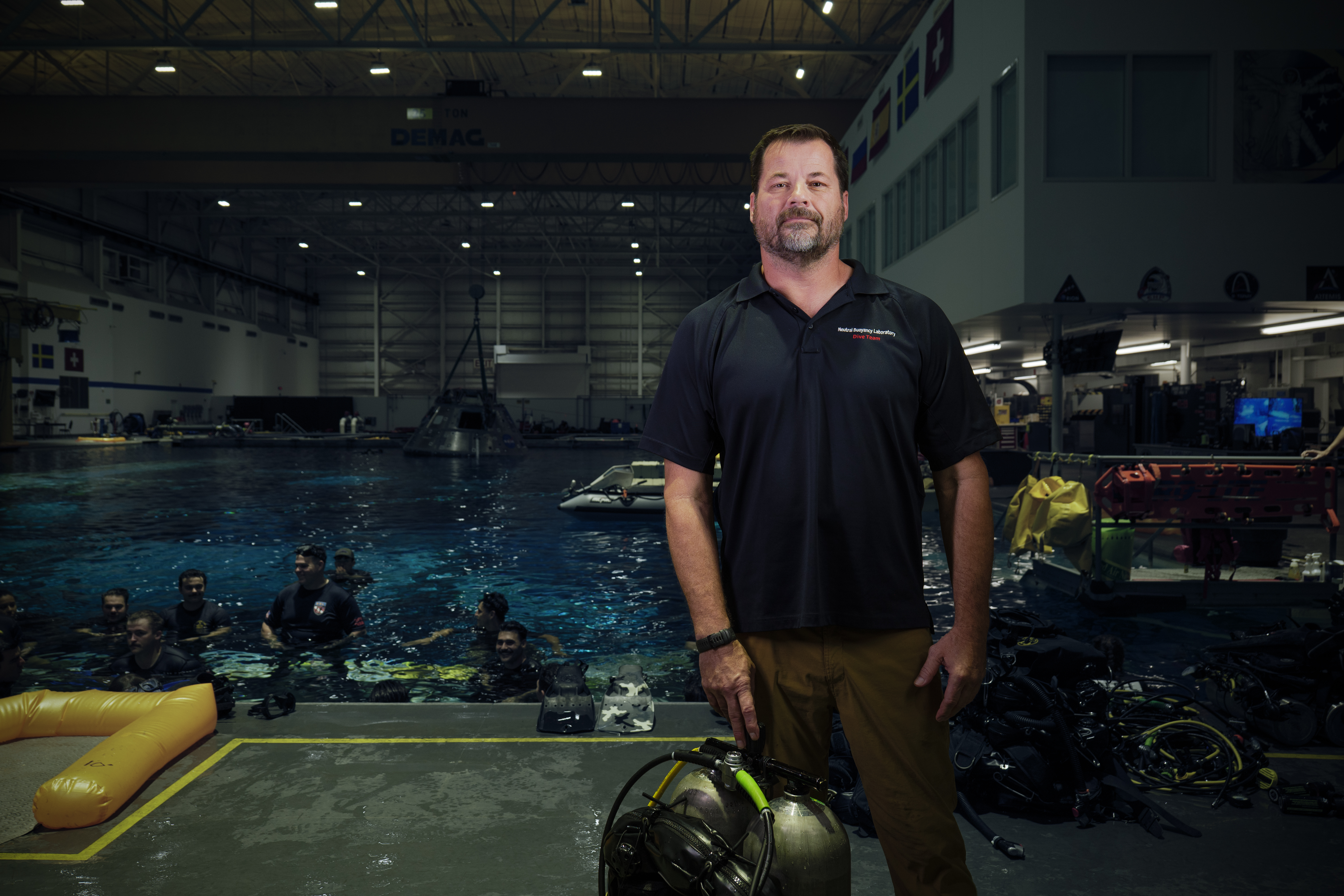
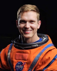
I Am Artemis: Tim Goddard
I Am Artemis: Tim Goddard

NASA/Rad Sinyak
Listen to this audio excerpt from Tim Goddard, NASA open water lead:
0:00 / 0:00
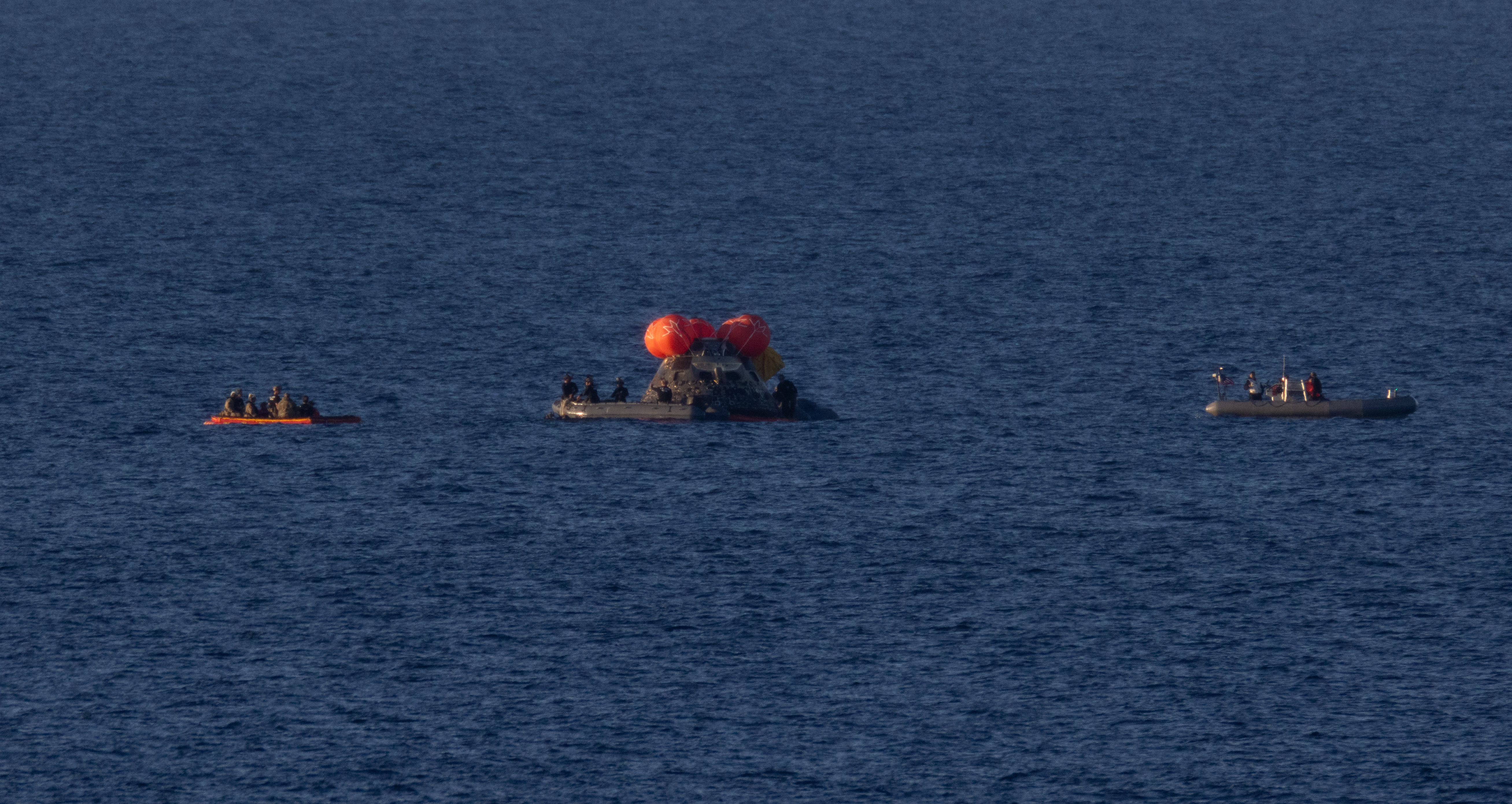
At the end of their mission around the Moon, NASA’s Artemis II astronauts were recovered from their Orion spacecraft by a team of U.S. Navy divers and NASA personnel. This included Tim Goddard, NASA open water lead, who helped guide the complex open water recovery of both Orion and the crew members, once they safely splashed down in the Pacific Ocean off the coast of San Diego.
As the open water lead, Goddard is responsible for the design, certification, procurement, and training, for both the NASA and Navy team. He also oversees the hardware and operations that are needed to recover the crew and spacecraft from the open ocean and bring them to safety aboard an amphibious Navy ship after splashdown.
“This is a very complex set of operations,” said Goddard. “We have six small boats in the water. We’re relying on four separate helicopters and the host Navy ship at the same time. We have over 50 folks in the water and in different boats. I have team members underwater, on the surface, and small boats moving all around.”
And that’s just Goddard’s portion of the recovery — the larger operation entails coordination of activities that includes the Navy ship’s operations, communications, vessel traffic, medical needs, aviation operations, and more.
It’s a large orchestration of personnel and hardware to just enable recovery of the astronauts from the capsule — and then, we have to recover the spacecraft in the well deck of the Navy ship, which can be up to nine hours later.

Tim Goddard
NASA Open Water Lead
Goddard and his team practice, practice, practice long before recovery day to ensure the complicated dance goes smoothly. They start by performing training runs with representative Orion hardware at the Neutral Buoyancy Laboratory at NASA’s Johnson Space Center in Houston, one of the world’s largest indoor pools that can support large-scale underwater and topside operations. The team then pushes out to San Diego, starting with bay operations and working their way up to open ocean conditions similar to what they’ll see on recovery day.
“By the time they do the real mission, they have hours and hours on each type of facet or each phase of that recovery,” said Goddard. “We bring them out and then we just go through repetition after repetition. When we do the real thing, it’s not their first time seeing it.”
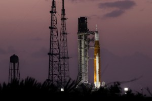
It’s actually Goddard’s third time recovering Orion — the team recovered the capsule on Orion’s first flight, Exploration Flight Test-1 in 2014, and Artemis I, Orion’s first uncrewed test flight around the Moon in 2022.
“We were strictly focused on capsule recovery for both of those flights,” said Goddard. “Now we introduced humans to the loop with a flight crew being in the capsule. Our primary focus has shifted from recovering the capsule to recovering the crew first. Once we get the crew safe and sound on the ship, we transfer our focus and shift our operations to the recovery of the capsule.”
Goddard joined the initial Orion recovery team in 2007, and has served as the open water lead for over 10 years. He joined NASA in the 1990s after a 27-year career as a Navy diver, initially serving in dive operations in the Neutral Buoyancy Lab and then pursuing mechanical engineering.
Over half of my time at NASA has been supporting this operation. That’s a long time, and to finally have the Moon mission go off and bring the folks back — it’s an immense pleasure. I am very excited and proud to be able to support this mission.

Tim Goddard
NASA Open Water Lead
With crew aboard, there was an immense responsibility along with the pleasure of getting them home safely for Goddard.
“There was a lot of weight and stress that the other folks and I carried,” he said. “I can tell you under the previous two missions, once we set the capsule down, that was the moment of elation and ‘I can sleep now.’ That was tenfold when we recovered the crew. Once they were recovered and the capsule was back in San Diego, I had an immense feeling of relief.”
About the Author
Erika Peters
Share
Details
Related Terms
Explore More


Powered by WPeMatico
Get The Details…
Erika Peters