Curiosity Blog, Sols 4982–4987: Back to Our Regularly Scheduled Programming

Curiosity Blog, Sols 4982–4987: Back to Our Regularly Scheduled Programming

3 min read

Curiosity Blog, Sols 4982–4987: Back to Our Regularly Scheduled Programming
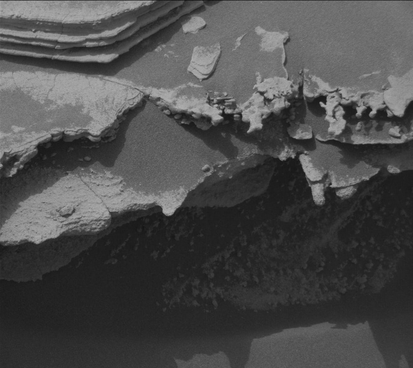
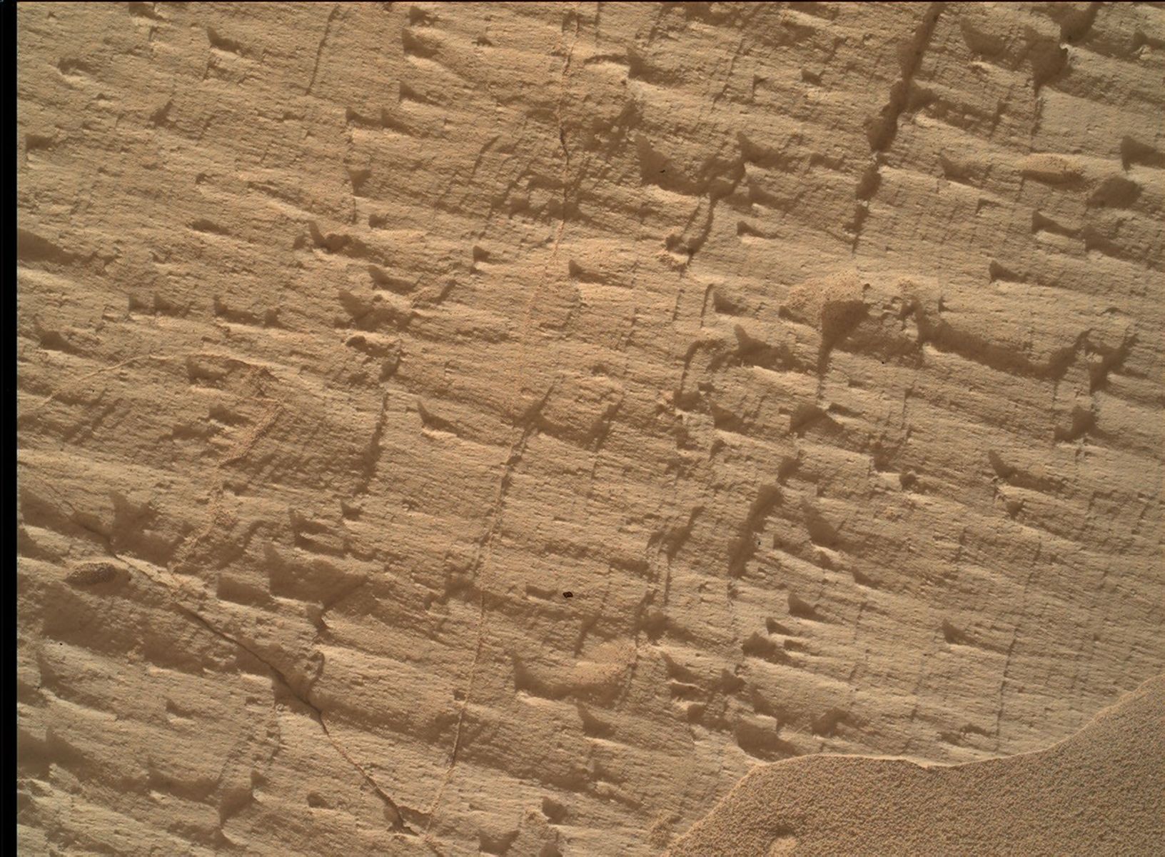
A black-and-white close-up from the Curiosity rover showing a jagged, deeply eroded rock ledge casting a dark shadow, with thinly layered, flat sedimentary rocks visible in the upper left corner.
NASA’s Mars rover Curiosity acquired this image, of thin, ledge-like layers at target “Los Toldos,” using its Right Mast Camera (Mastcam). Curiosity captured the image on Aug. 12, 2026 — Sol 4982, or Martian day 4,982 of the Mars Science Laboratory mission — at 01:05:04 UTC.
NASA/JPL-Caltech/MSSS

By Allison Dries-Padilla, Missions Operations Specialist at Malin Space Science Systems

Earth planning date: Friday, Aug. 14, 2026

This week of Curiosity Mars rover operations takes us back to our “regularly scheduled programming.” After taking a slight detour to investigate the “erosional surface” we are back on course to ascend Mount Sharp. As we transition into fall in Gale Crater, temperatures and the likelihood of dust storms begins to drop, but Curiosity is still on the lookout for the last gasp of late-season local and regional dust storms.

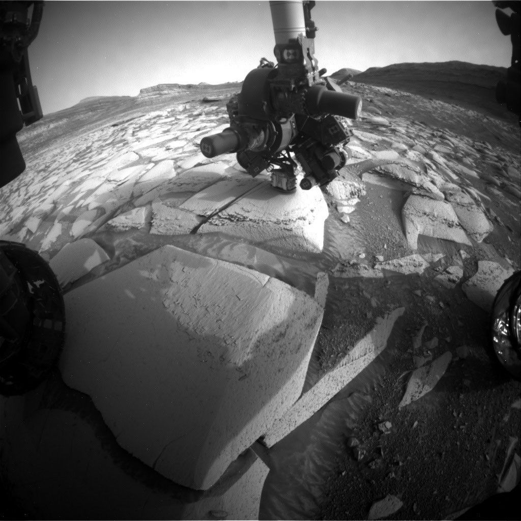
Monday’s plan for Sols 4982 to 4985 began with Curiosity standing face to face with a unique geologic feature just above the erosional supersurface contact. As you might have read in the previous blog, the team was fortunate enough to spend two planning cycles at this amazing location. MAHLI used this opportunity to reacquire selected images for the mosaic of target “Tres Morros.” This will allow the science team to have a detailed and focused view of the underside of this feature. APXS took measurements of the bedrock target “El Motacusal” after it had been brushed with the DRT. APXS took a second measurement on the “as is” bedrock target “Alto de Carmen.” Both of these APXS targets were documented with high-resolution images taken by MAHLI. ChemCam activities include LIBS spectroscopy on bedrock targets “Lagunas Bravas” and “Parququcha” and ChemCam Remote Micro-Imaging on Mishe Mokwa. I had the pleasure to be on the Mastcam uplink shift for this plan. Mastcam took a near-field mosaic of the erosional ridge, dubbed “Los Toldos,” as well as a mosaic on further away bedrock exposure above the erosional surface, named “Los Ladrillos.” In addition to these mosaics, Mastcam also provided color documentation of the previous plan’s ChemCam Remote Micro-Imaging on Cordillera and the ChemCam LIBS activities taken in this plan.

Curiosity then drove 100 feet (30 meters) to take us to our location for Friday’s plan for Sols 4985 to 4987. Although we had plenty of flat and tasty bedrock in this new location, we could not place the robotic arm in a safe position to DRT the bedrock. The left-front wheel was perched on a small rock, and we had to account for a risk the rover could slip off this rock as we move the arm around. MAHLI and APXS were still able to safely perform contact science on two bedrock targets, “Mamorecillo” and “Aguas Claras.” MAHLI had an additional housekeeping activity to image the calibration target. ChemCam plans to use its laser spectrometer to gather geochemistry on three targets in this vicinity, followed by Mastcam documentation. Today’s ChemCam LIBS targets include a dark-toned resistant layer in the bedrock “Yura Kasa.” Mastcam is planning a series of mosaics to continue imaging the stratigraphy in the unit above the erosional contact.

Today’s plan was packed with environmental monitoring activities to monitor for dust storms. Mastcam took a flurry of dust-imaging observations to measure optical depth, or “tau,” of the atmosphere. A higher tau value is associated with an increased amount of dust in the atmosphere. APXS joined in on the action by planning an overnight atmospheric measurement. Navcam took on most of the heavy lifting to monitor for dust storms. These activities include multiple large dust-devil surveys, zenith observation, in-crater line-of-sight observations, and suprahorizon cloud movies.

Curiosity will then continue to climb Mount Sharp; the planned drive distance of 150 feet (47 meters) will take the rover southwest of our current location. We will return Monday to start a new week full of contact science, remote sensing, and driving on Mars.
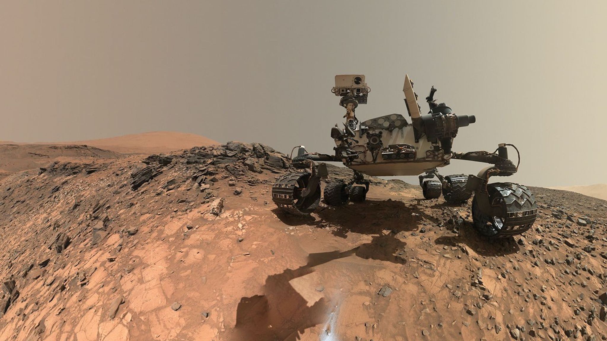
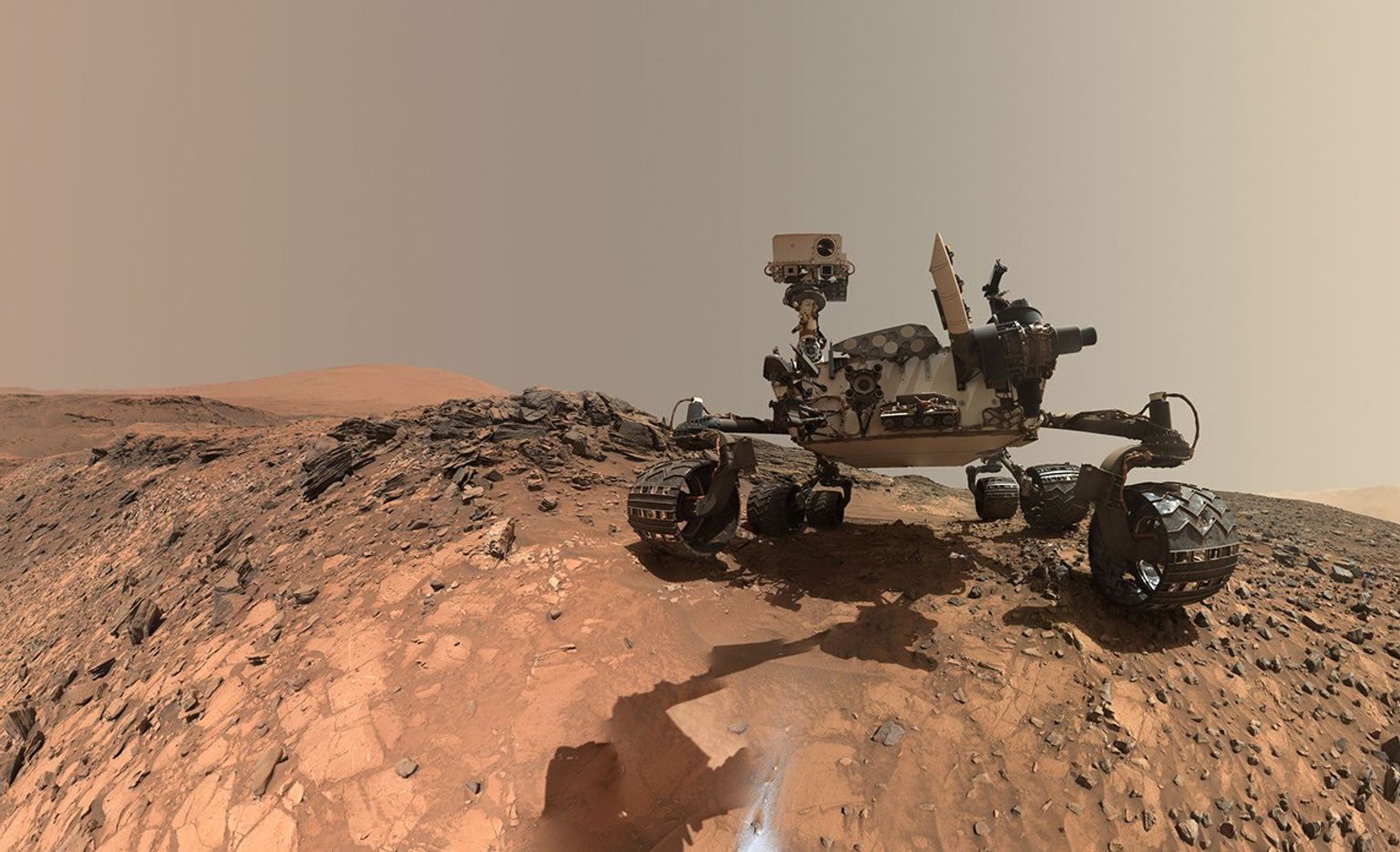
A rover sits on the hilly, orange Martian surface beneath a flat grey sky, surrounded by chunks of rock.
NASA’s Curiosity rover at the base of Mount Sharp
NASA/JPL-Caltech/MSSS

Share

Details

Last Updated
Aug 23, 2026

Related Terms

Powered by WPeMatico
Get The Details…

APOD: 2026 August 22 – Mostly Perseids

APOD: 2026 August 22 – Mostly Perseids

APOD

Astronomy Picture of the Day

Discover the cosmos! Each day a different image or photograph of our fascinating universe is featured, along with a brief explanation written by a professional astronomer.

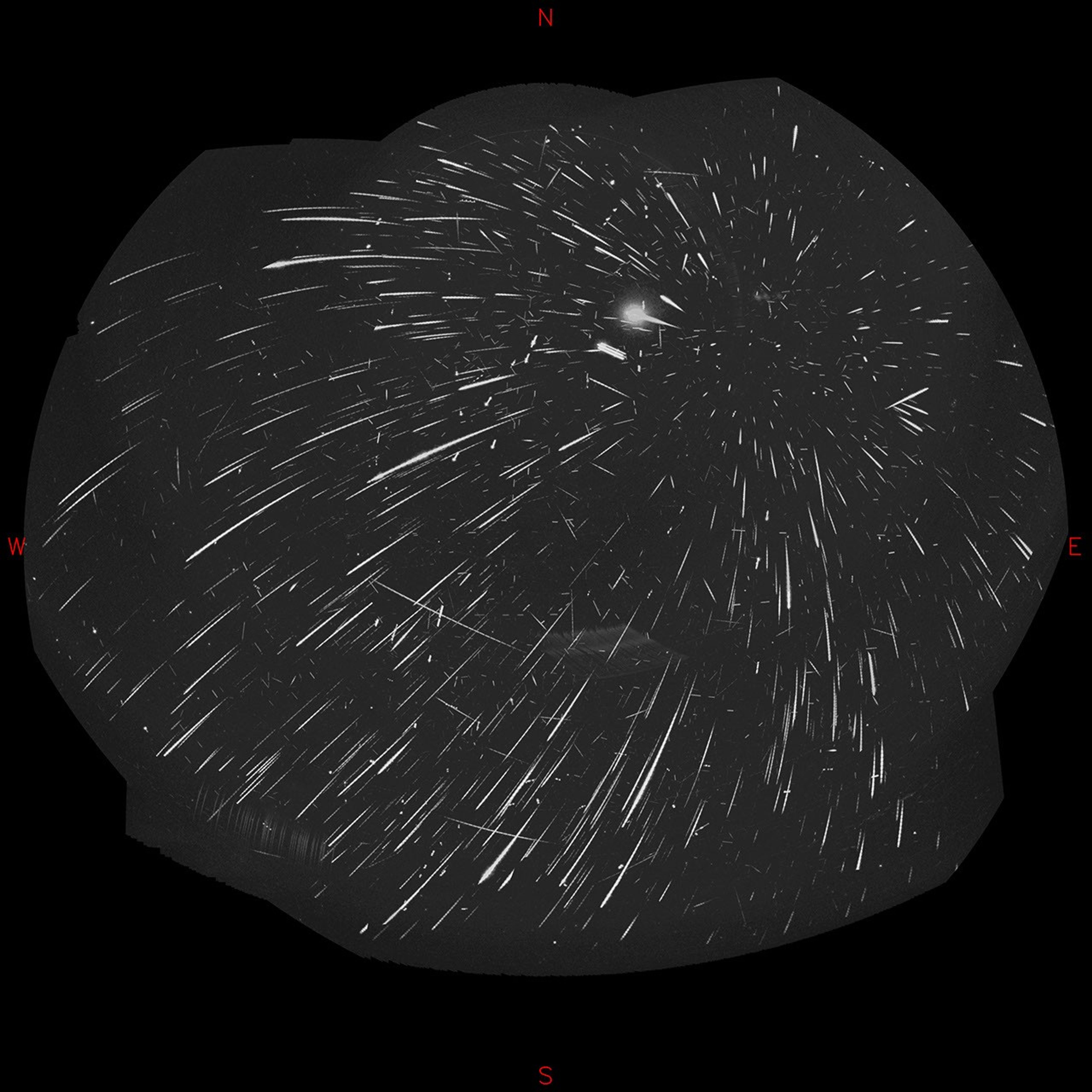
An allsky camera view of the Perseid meteor shower.

Mostly Perseids

Explanation: Recorded the night of August 12-13, images from four dedicated meteor-monitoring cameras at an astronomical observatory in Czechia were aligned and combined to create this all-night, all-sky view. On that night, the total count came to 1,706 meteors. And since that coincided with the peak activity of the 2026 Perseid Meteor Shower, most are perseids. Their overwhelming numbers make them easy to spot. Quite convincingly, perseid trails all trace back to a single radiant on the sky at the upper right, a region in the annual shower’s eponymous constellation Perseus. But meteors belonging to other much less active showers can be revealed by finding their radiants too. For example, seen crossing the perseid trails are meteors from a shower whose radiant lies in Cygnus, known as Kappa Cygnids. The antihelion complex, a general region near Aquarius and opposite the Sun in the sky, is also identifiable as a weak source for meteors.

Tomorrow’s picture: interplanetary road trip

Date August 22, 2026
Credit & Copyright: Jakub Koukal (Valašské Meziříčí Observatory)
Authors & editors: Jerry Bonnell, Cecilia Chirenti, Robert Nemiroff, Keighley Rockcliffe
A service of: ASD at NASA / GSFC,
NASA Science Activation & Michigan Tech. U.

Powered by WPeMatico
Get The Details…

Week Ends With Spacewalk Preps and Space Exercise Research

Week Ends With Spacewalk Preps and Space Exercise Research

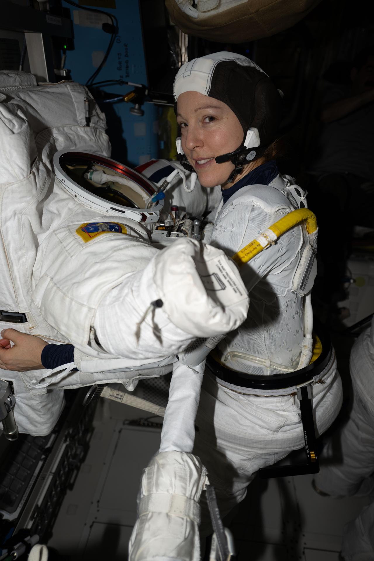
ESA (European Space Agency) astronaut and Expedition 74 flight engineer Sophie Adenot is pictured inside the Quest airlock preparing to try on a spacesuit to verify its comfort, mobility, and functionality. Adenot was conducting an on-orbit fit verification of the suit before conducting her first spacewalk outside of the International Space Station.
ESA astronaut Sophie Adenot tries on a spacesuit to verify its comfort, mobility, and functionality inside the International Space Station’s Quest.
NASA/Jessica Meir

The Expedition 75 crew wrapped up the work week getting ready for a spacewalk to finish installing a high-speed antenna on the International Space Station. The orbital residents also explored new space exercise techniques, studied the human respiratory system, and completed an Earth observation session.

On Friday, flight engineers Anil Menon of NASA and Sophie Adenot of ESA (European Space Agency) took turns inside the Quest airlock organizing the tools they will use during a spacewalk scheduled for 8:35 a.m. EDT on Tuesday. The pair configured the tethers they will use to stay secured to the orbital outpost, checked the bags carrying an array of specialized tools and parts, and staged them for readiness inside Quest. Adenot also studied her spacewalking procedures on a computer using 3D animation software that depicts her tasks outside of the orbital outpost.

The spacewalkers will be assisted throughout Tuesday’s excursion by flight engineer Jack Hathaway and station commander Jessica Meir, both NASA astronauts. Hathway and Meir joined each other Friday and studied the Canadarm2 robotic arm maneuvers necessary to support Menon and Adenot as they install a spare space-to-ground antenna to the Z1 truss segment above the station’s Unity module.

During Tuesday’s spacewalk, Menon will ride the Canadarm2 and retrieve a spare antenna released by Adenot from an external platform. The duo will then translate to Z1, install the antenna, and make the precise electrical and data connections required to activate high‑speed transmissions with mission control. Next, Adenot will hand Menon the failed space-to-ground antenna from its temporary stowage on Z1. They will then install the old antenna on the same external platform that housed the spare finishing the swap. If time allows, the spacewalkers will also replace a retroreflector on the forward port of the Harmony module, which improves navigation, tracking, and alignment data for visiting spacecraft such as the SpaceX Dragon.

Hathway and Adenot still had time scheduled on Friday to study advanced workout methods to maintain muscle and bone health while living and working in microgravity. Hathaway began his shift collecting his blood sample to be analyzed as part of the Muscle Stimulation experiment. Afterward, he applied electrodes to his legs that sent electrical signals stimulating his muscles as he strapped himself in the Columbus laboratory module and relaxed. Adenot wore the EasyMotion-2 suit packed with electrodes that triggered muscle contractions while she jogged on the Tranquility module’s treadmill. Results from the investigations may enhance space exercise and enable faster muscle recovery after returning to Earth’s gravity.

Menon and Meir focused on hardware maintenance with their extra time at the end of the week. Menon worked in the Kibo laboratory module and removed a scientific payload from Kibo’s airlock that had been exposed to the vacuum of space. Meir refilled a spacesuit tank and a liquid cooling and ventilation garment with water to provide thermal conditioning to suit systems and keep astronauts comfortable during a spacewalk.

Roscosmos flight engineer Andrey Fedyaev started Friday helping scientists understand how weightlessness affects the respiratory system by wearing an acoustic sensor around his neck that recorded his rapid exhalation. Next, he documented radiation exposure measurements collected from the Nauka, Zvezda, and Zarya modules. Flight engineers Pyotr Dubrov and Anna Kikina joined each other at the beginning of their shift and uninstalled automated Earth observation gear that photographed landmarks on the ground during the crew’s sleep shift. Dubrov then inspected ethernet cables and network connections while Kikina took inventory and photographed lab hardware stowed throughout the station’s Roscosmos segment.

Learn more about station activities by following the space station blog, @space_station on X, as well as the ISS Facebook and ISS Instagram accounts.

Get the latest from NASA delivered every week. Subscribe here.

Powered by WPeMatico
Get The Details…

Mark A. Garcia

NASA Shares Views of August Solar Eclipse from Ground, Air, Space

NASA Shares Views of August Solar Eclipse from Ground, Air, Space

3 Min Read

NASA Shares Views of August Solar Eclipse from Ground, Air, Space

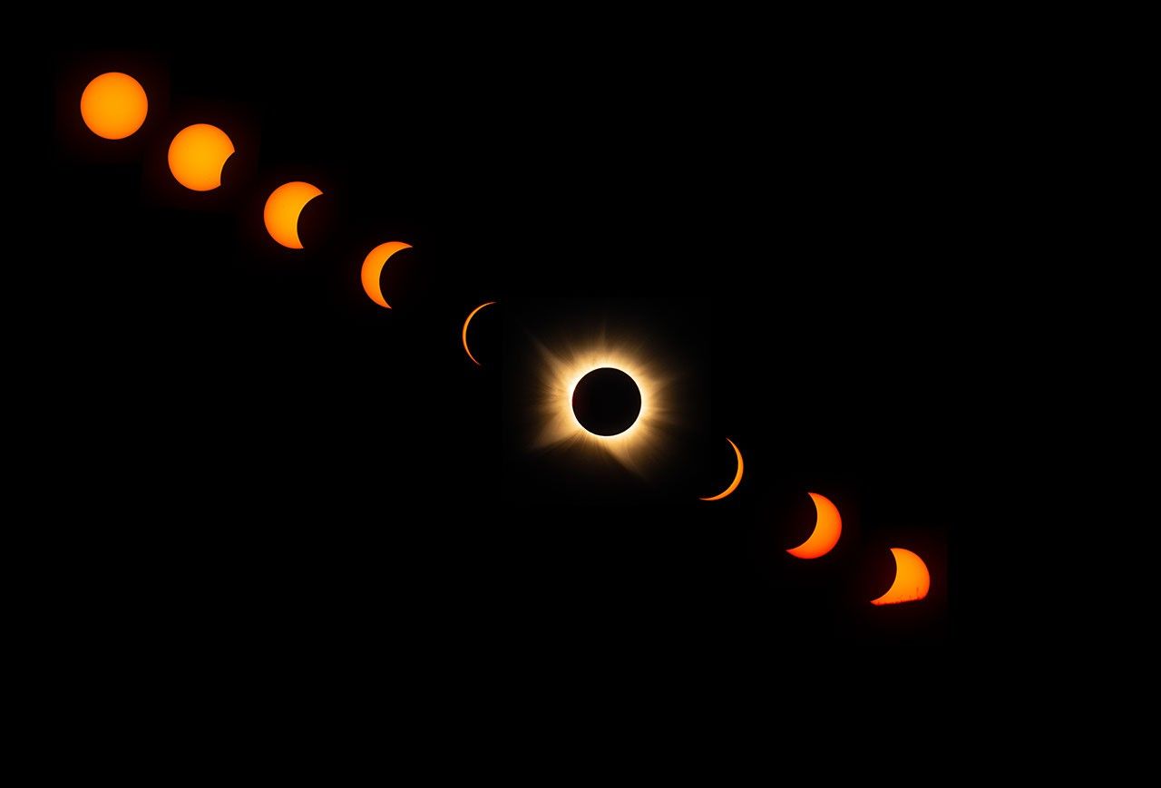
A sequence of images in a diagonal line from upper left to lower right shows the progression of a total solar eclipse, with an uneclipsed Sun in the upper left and other images showing the Sun becoming more and more eclipsed toward the lower right. A total eclipse, with the white corona around the dark disk of the Moon, appears in the line of eclipse images, near the center. Three more images to the lower right of the total eclipse show a crescent Sun becoming less eclipsed. The final image in the lower right shows the Sun starting to dip below the horizon, with its lower portions covered by the foreground.
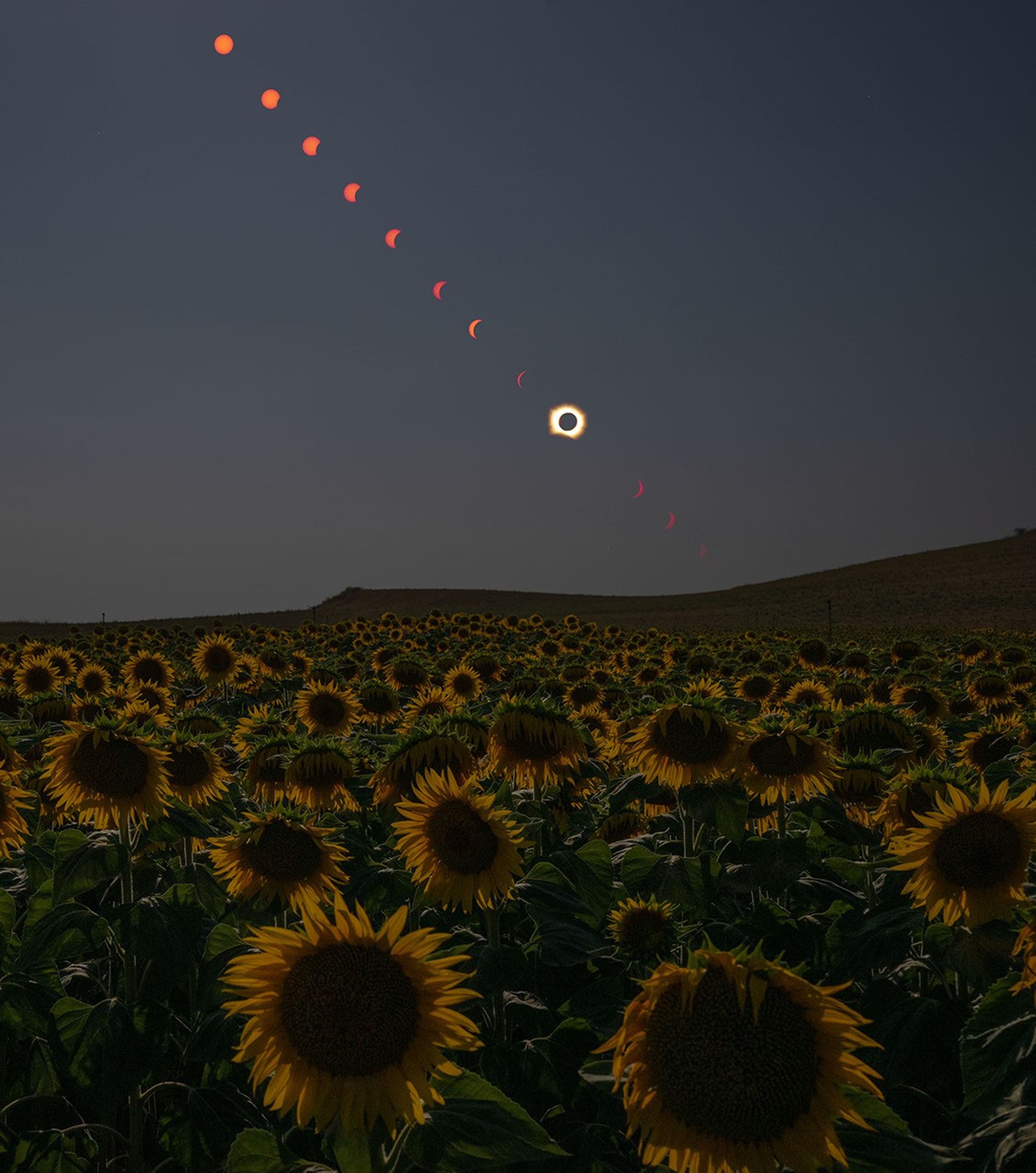
This composite image shows the progression of a total solar eclipse as the Sun sets over San Millán de los Caballeros, Spain, on Wednesday, Aug. 12, 2026.
Credits:
NASA/Bill Ingalls

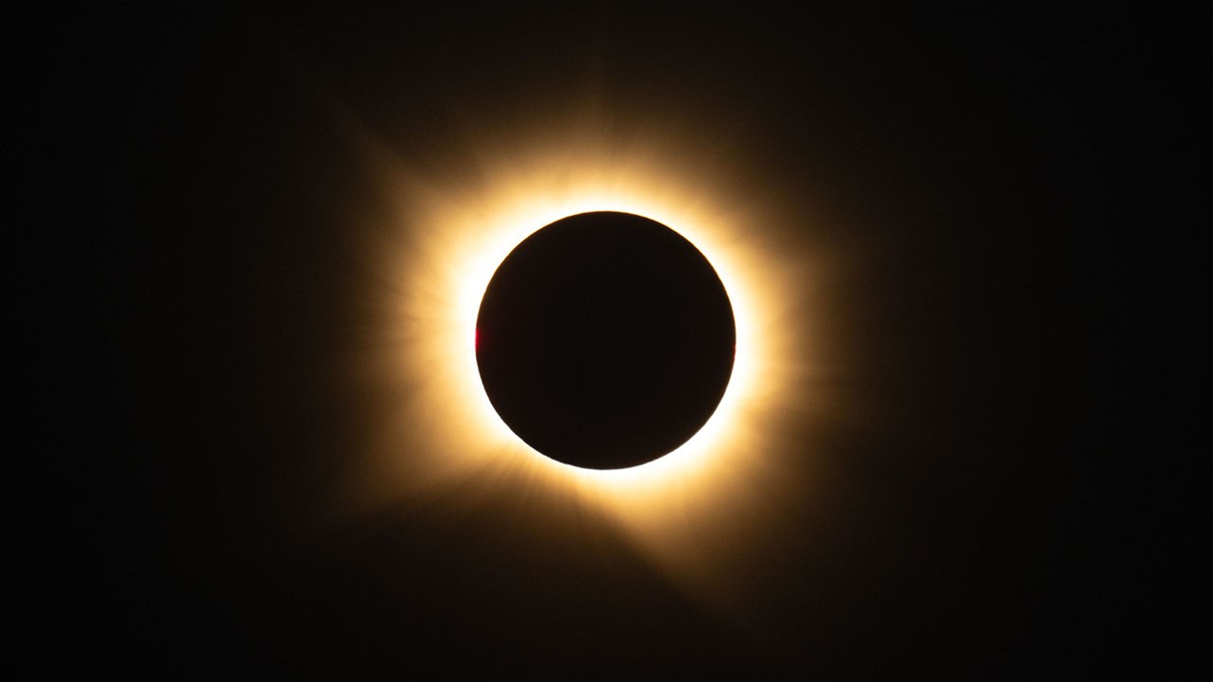
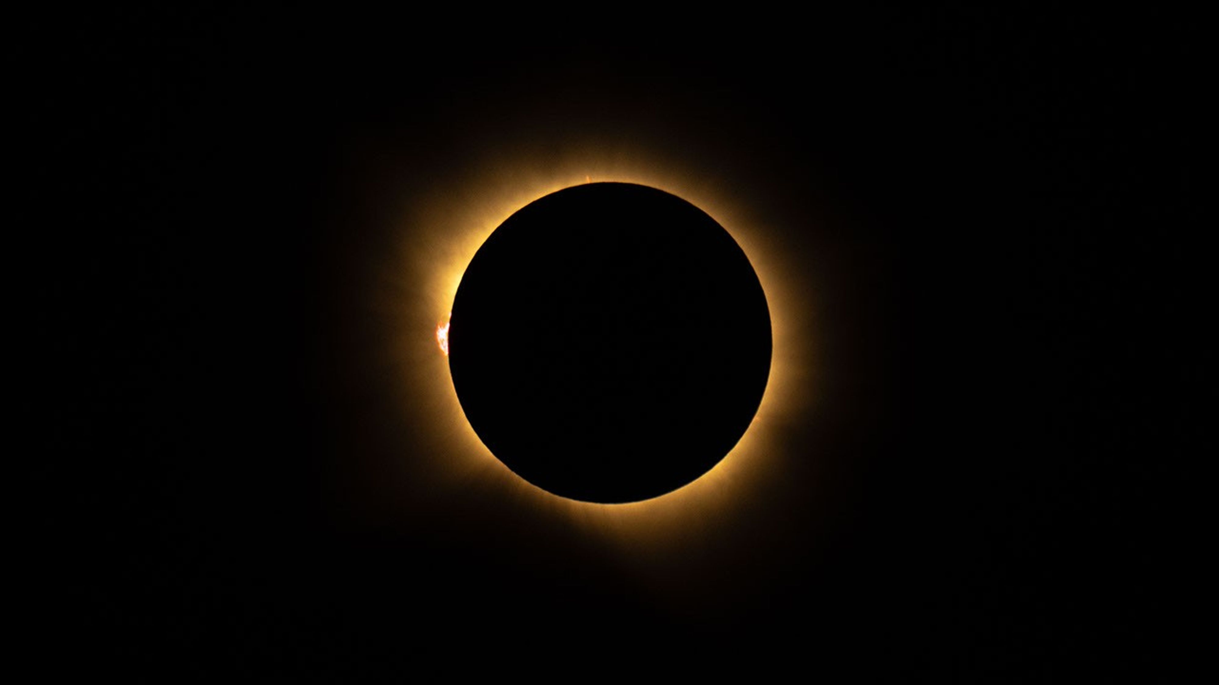
On Aug. 12, a total solar eclipse darkened skies over Greenland, Iceland, and Spain. As the Moon covered the Sun, it briefly revealed the Sun’s wispy outer atmosphere — the corona — to those in the path of totality who were lucky enough to have clear skies. NASA researchers and photographers were along the eclipse path to study the corona, capture the phenomenon, and observe how the eclipse affected our planet.

One NASA photographer in Spain captured the total solar eclipse as well as the partial phases before and after, until the Sun set below the horizon.

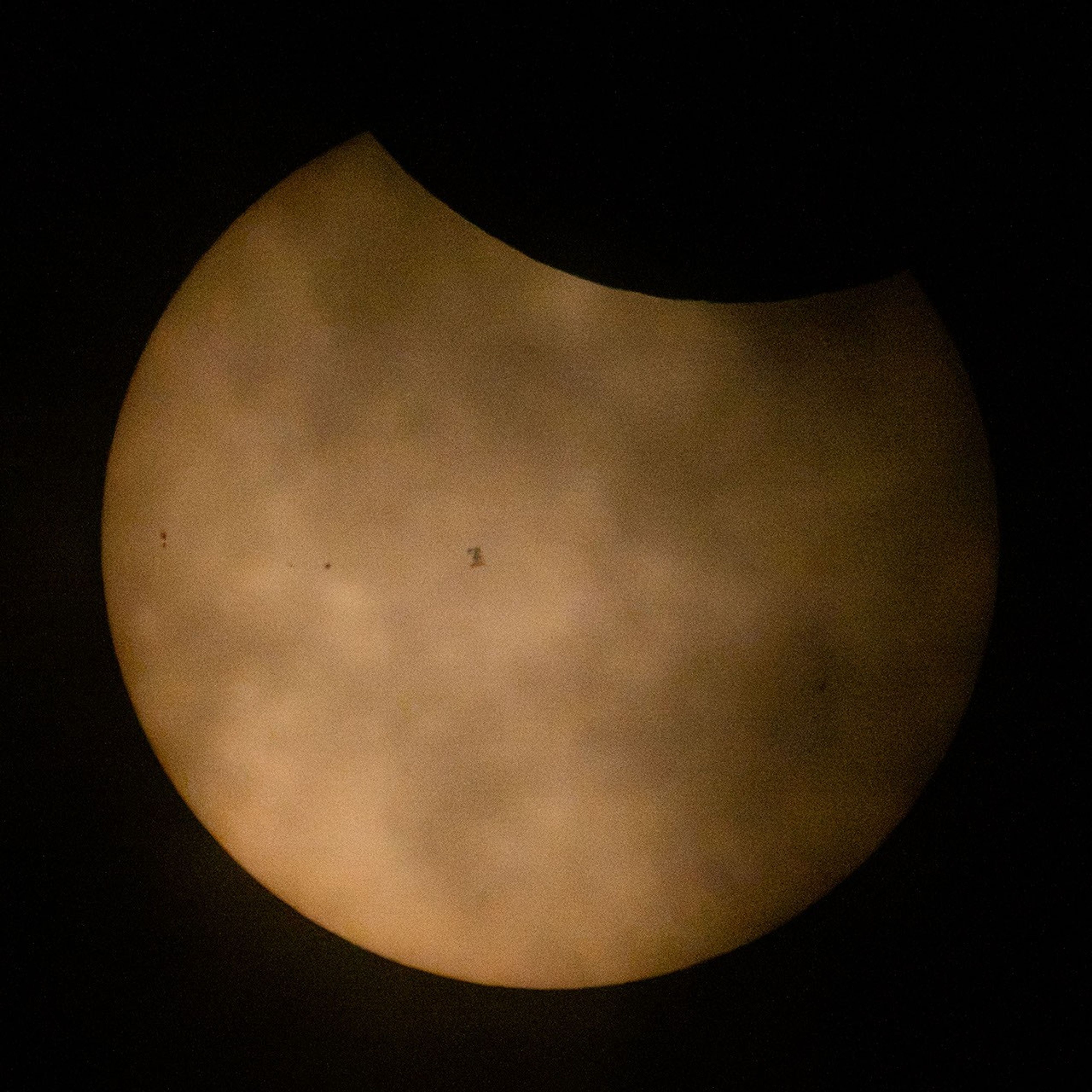
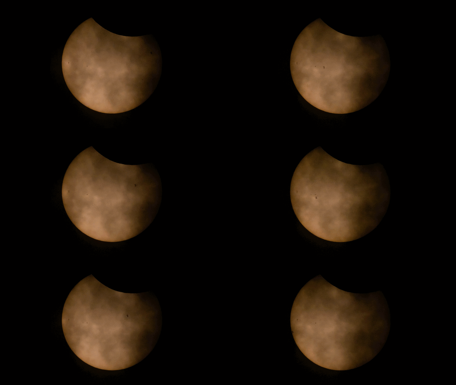
In northern Maine, where only a partial eclipse was visible, another NASA photographer captured the International Space Station, with its crew of seven aboard, speeding past the partially eclipsed Sun.

Meanwhile, from about 250 miles above the ground, a NASA astronaut aboard the International Space Station snapped a few photos of the partial eclipse from their perspective as well.

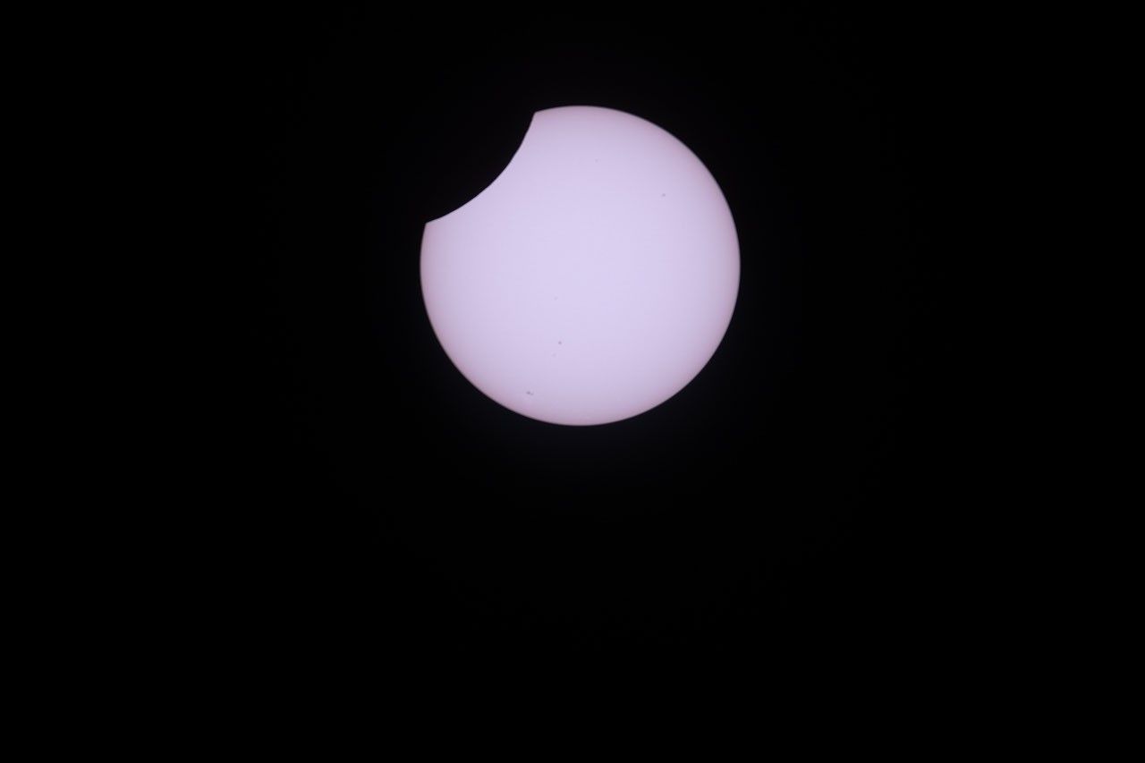
A photo shows the partially eclipsed Sun as a white disk, set against a black sky, with a small
NASA astronaut Jessica Meir captured this photo of the partial solar eclipse from the International Space Station on Aug. 12, 2026, as the orbital outpost soared 262 miles above southern Quebec, Canada. From the station, the Moon covered about 18% of the Sun at the peak of the eclipse. Credit: NASA/Jessica Meir

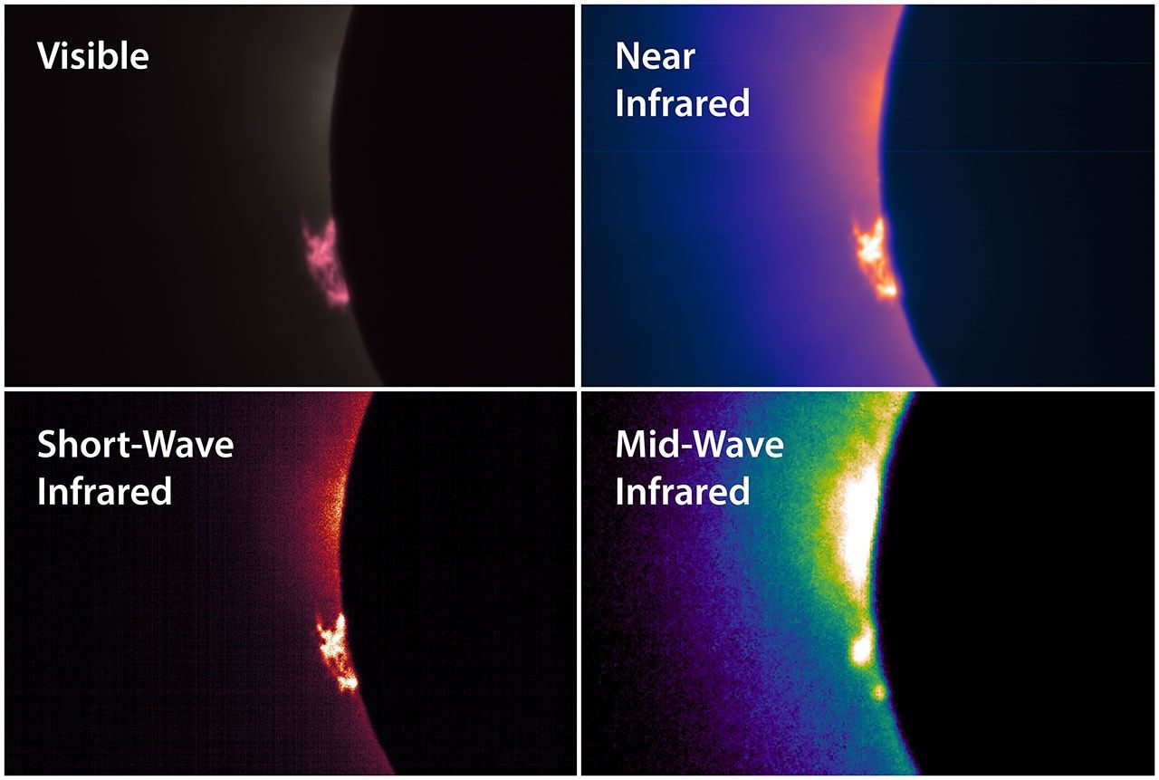
Between the ground and the space station, NASA pilots flew NASA’s WB-57F research jet at an altitude of 50,000 feet, passing through the eclipse’s shadow to lengthen their time in the eclipse. The jet carried a suite of cameras that captured high-resolution images of the corona and prominences, plumes of electrically charged gas rising off the Sun, in several different wavelengths of light.

The total solar eclipse on Aug. 12, 2026, was captured by a camera mounted inside the cockpit window of NASA’s WB-57F aircraft as it flew around 50,000 feet altitude off the coast of Iceland.
NASA
Four panels show the left edge of the eclipsed Sun in different wavelengths of light. In each image is a cloud of material, a prominence, rising off the left edge of the Sun. The prominence appears in different colors and resolutions in each image. The four images are labeled Visible, Near Infrared, Short-Wave Infrared, and Mid-Wave Infrared.
A suite of cameras installed on NASA’s WB-57F aircraft captured images of the solar corona and prominences in different wavelengths of visible and infrared light during the total solar eclipse on Aug. 12, 2026. A science team led by the Southwest Research Institute in Boulder, Colorado, will analyze the images to learn more about complex and dynamic features in the Sun’s outer atmosphere. Credit: NASA/SwRI/Will Ashfield

In both Iceland and Spain, teams of students participating in the NASA-funded Nationwide Eclipse Ballooning Project launched scientific balloons that carried instruments to capture images of the eclipse’s shadow and study the eclipse’s effects on our atmosphere. Even though clouds obscured the view of the eclipse from the ground in Iceland, the weather did not interfere with the balloon-borne instruments’ ability to gather information about how the brief loss of light and heat affected the lower atmosphere.

Four students in jackets hold a large white balloon in a grassy field under a gray, cloudy sky.
Students participating in the NASA-funded Nationwide Eclipse Ballooning Project prepare to launch a scientific balloon in Mosfellsbær, Iceland, during the total solar eclipse on Aug. 12, 2026. Credit: NASA/Abbey Interrante
The Moon’s shadow passes over the atmosphere during the total solar eclipse on Aug. 12, 2026. The video was taken by a camera carried by a scientific balloon launched from Spain by a student team from Montana State University participating in the NASA-funded Nationwide Eclipse Ballooning Project. The video captures about six minutes of time but is sped up to play at four times real speed. Passing through the foreground are some other science instruments carried by the same balloon.
Nationwide Eclipse Ballooning Project/Montana State University

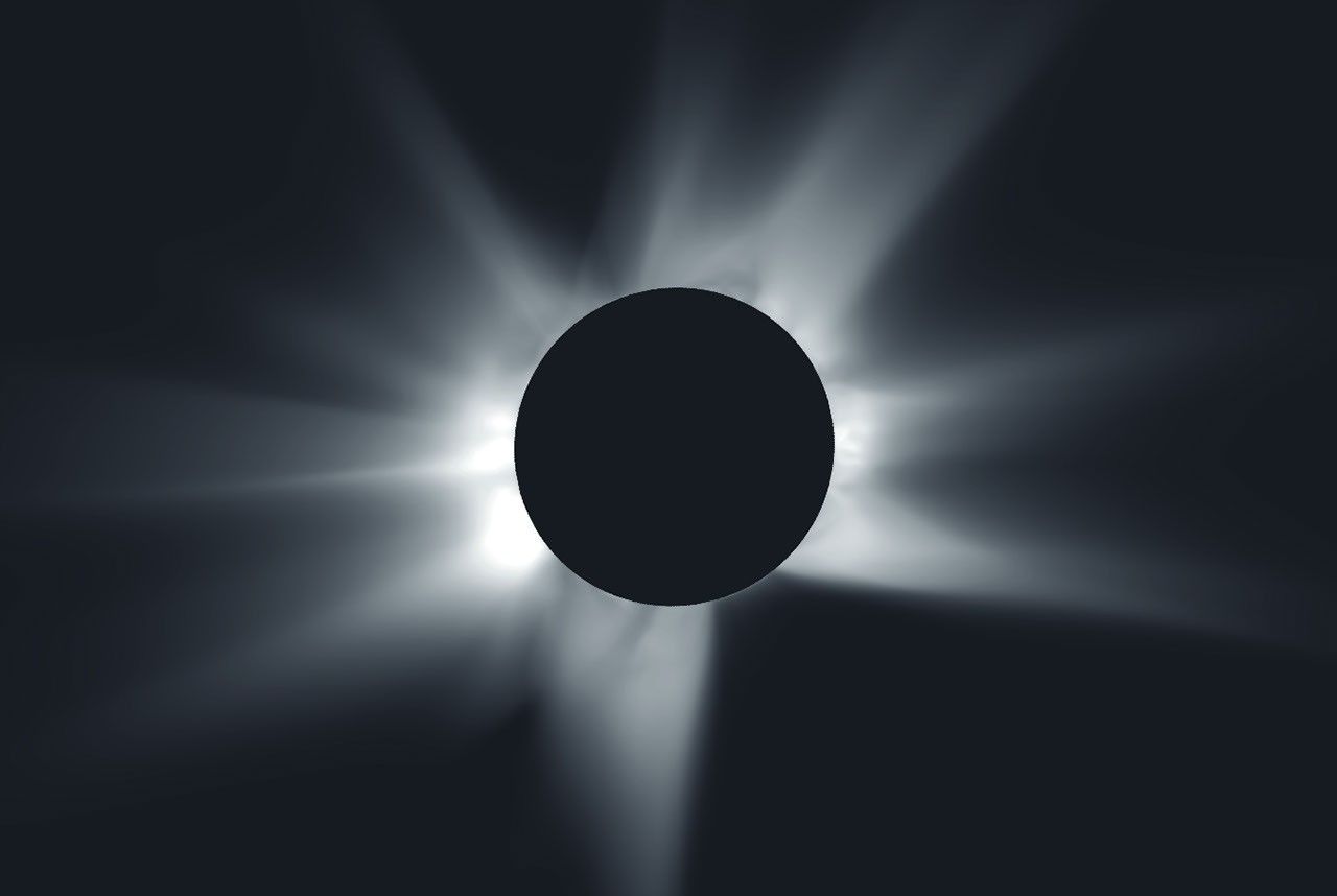
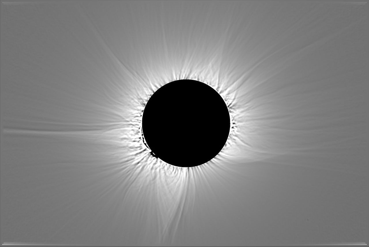
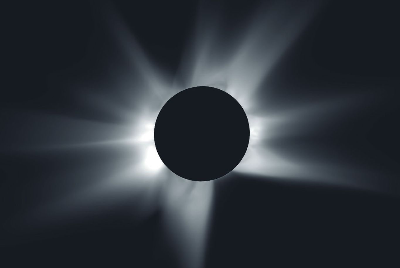
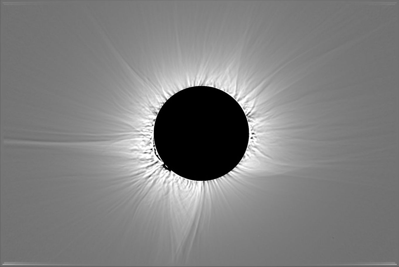
Before the eclipse, scientists at Predictive Science Inc., with support from NASA grants and supercomputers, used observations of the Sun from NASA spacecraft and ground-based telescopes to predict what the corona would look like during the eclipse. Below, their corona prediction is compared to a composite image of the corona, which combines multiple images captured by the NASA-supported DEB Initiative project during the total eclipse near León, Spain.


prediction
image

A simulated image of a total solar eclipse shows the Moon as a black disk at the center surrounded by white rays extending outward around the Moon, set against a black background. Some of the rays are longer or thicker than others.
This image shows a prediction from the morning of Aug. 12, 2026, of what the solar corona would look like to the human eye during the total solar eclipse that day.
Predictive Science Inc.

An image of a total solar eclipse shows the Moon as a black disk at the center surrounded by white rays extending outward around the Moon, set against a gray background. Some of the rays are longer or thicker than others.
This processed, composite image of the corona combines multiple images captured near León, Spain, during the total solar eclipse on Aug. 12, 2026.
DEB Initiative Team/Zack Stockbridge

A simulated image of a total solar eclipse shows the Moon as a black disk at the center surrounded by white rays extending outward around the Moon, set against a black background. Some of the rays are longer or thicker than others.
This image shows a prediction from the morning of Aug. 12, 2026, of what the solar corona would look like to the human eye during the total solar eclipse that day.
Predictive Science Inc.
An image of a total solar eclipse shows the Moon as a black disk at the center surrounded by white rays extending outward around the Moon, set against a gray background. Some of the rays are longer or thicker than others.
This processed, composite image of the corona combines multiple images captured near León, Spain, during the total solar eclipse on Aug. 12, 2026.
DEB Initiative Team/Zack Stockbridge

prediction

image


The left image shows a prediction from the morning of Aug. 12, 2026, of what the solar corona would look like to the human eye during the total solar eclipse that day. The right image is processed, composite image of the corona that combines multiple images captured near León, Spain, during the total solar eclipse on Aug. 12, 2026. Left image credit: Predictive Science Inc.; right image credit: DEB Initiative Team/Zack Stockbridge

Over the coming months, scientists will analyze the observations and images captured during the solar eclipse on Aug. 12 and present what they have learned about the Sun and its effects on our home planet. These observations will also help prepare science teams to investigate future solar eclipses, such as a much longer total solar eclipse that will be visible from southern Spain and northern Africa on Aug. 2, 2027.

Read more about NASA’s research during the eclipse and rewatch NASA’s eclipse broadcast to hear from some of the scientists and students who conducted the experiments.

About the Author

Vanessa Thomas

Vanessa Thomas

Vanessa Thomas is a science writer with the heliophysics communications team at NASA’s Goddard Space Flight Center in Greenbelt, Maryland.

Share

Details

Last Updated
Aug 21, 2026
Keep Exploring

Discover More Topics From NASA

Powered by WPeMatico
Get The Details…

TB 26-04 Updates and Modernization of NASA’s Chemical Equilibrium with Applications (CEA) Code

TB 26-04 Updates and Modernization of NASA’s Chemical Equilibrium with Applications (CEA) Code

For more information, contact Mark K. Leader, Glenn Research Center, mark.leader@nasa.gov

Download the PDF version

NASA’s Chemical Equilibrium with Applications (CEA) code is a foundational tool for propulsion system analysis. It provides equilibrium chemistry, rocket performance, shock, and detonation calculations used across NASA and the broader aerospace community. NASA Engineering and Safety Center (NESC) Activity TI-22-01730 modernized the legacy CEA2 Fortran code into CEA v3, a Fortran 2008, object-oriented software package with expanded interface support, updated thermochemical data, improved maintainability, and substantially improved workflow integration. The modernized code preserves backward compatibility with legacy CEA input workflows while enabling direct use from modern analysis environments, including Python, C, MATLAB, and automated design studies.

Background

CEA2 was released in 2002 and has remained widely used for propulsion and thermochemistry analysis. However, the original procedural Fortran implementation became increasingly difficult to maintain, extend, and integrate into modern engineering workflows due to the lack of a subroutine interface. Current propulsion analysis increasingly requires automated parametric sweeps, integration with other modeling tools and engineering workflows, and support for emerging propellants and fuels, including green propellants and sustainable aviation fuels. These needs motivated a comprehensive modernization effort to preserve CEA’s validated technical basis while improving its maintainability, usability, and integration with modern engineering software.

Technical Improvements

Modern Software Architecture

CEA v3 is implemented in Fortran 2008 using object-oriented data structures, stricter typing, and a thread-safe equilibrium solver architecture. The software supports Fortran, C, Python, MATLAB, and Excel interfaces. These interfaces allow CEA to be used directly in automated analysis pipelines, multidisciplinary design frameworks, and high-volume designof- experiments studies. Backward compatibility is supported through a legacy command-line interface, allowing existing CEA input files and workflows to be carried forward with minimal disruption.

Expanded Species and Thermodynamic Data

The thermodynamic database has been expanded to support additional propellants and fuels relevant to current NASA applications, including green propellant constituents such as ADN, HAN, and LMP-103S, and sustainable aviation fuel candidates such as n-Butanol. This expanded species coverage improves the applicability of CEA for next-generation propulsion, green propellant, and sustainable aviation fuel studies.

New Modeling Capabilities

CEA v3 adds or improves support for several modeling capabilities,
including:

  • Subroutine interface enabling direct integration and high-volume calculations
  • Negative reactant amounts
  • Inert hydrocarbon fuel representations, including RP-1, Jet-A, and JP-series fuels
  • Analytic total derivatives for coupling with optimization and sensitivity analysis workflows

Performance Improvements

For standalone use, individual equilibrium calculations in CEA v3 are moderately slower than comparable CEA2 calculations because the modernized architecture and added robustness introduce additional computational overhead. In representative testing, a single calculation was approximately 40 percent slower, but the absolute difference was only about 0.004 seconds per case. However, the modernized architecture provides substantial performance advantages for multi-case workflows, which are common in design-of-experiments studies, parametric sweeps, optimization, and uncertainty analyses. In one benchmark, a sweep of 108,500 cases completed in approximately 1.11 seconds with CEA v3, compared with approximately 15 minutes using CEA2. This corresponds to an approximately 800-times reduction in runtime for that workflow. These improvements make large-scale propulsion trade studies and automated design-space exploration significantly more practical.

Guidance for Engineering Use

NASA engineering users should consider the following guidance:

  • Use CEA v3 for new propulsion and thermochemistry analyses when possible to take advantage of the modernized interfaces, expanded database, and improved workflow integration.
  • Use the Python, MATLAB, or C interfaces for automated workflows, including parametric sweeps, optimization studies, and iterative design analyses.
  • Use the updated species database for green propellant and sustainable aviation fuel studies when the relevant species are included and validated for the intended application.
  • Use the classic command-line interface when continuity with legacy CEA workflows or input files is required.
  • Retain appropriate engineering review and validation when transitioning established CEA2 workflows to CEA v3, particularly for mission-critical analyses or cases that depend on legacy assumptions.

References

  1. NASA/TM–20260007987
  2. CEA documentation: https://nasa.github.io/cea
  3. CEA repository: https://github.com/nasa/cea

For more information, contact Mark K. Leader, Glenn Research Center, mark.leader@nasa.gov

Powered by WPeMatico

Get The Details…
Daniel Hoffpauir