Snow Buries the U.S. Interior and East

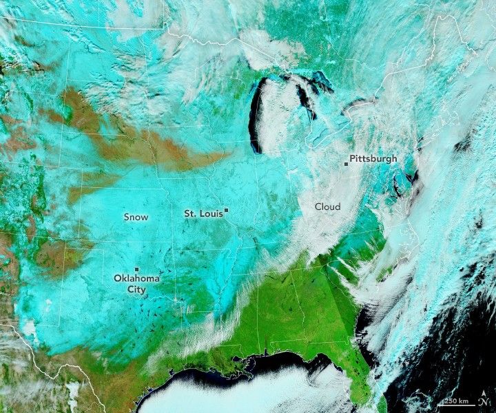

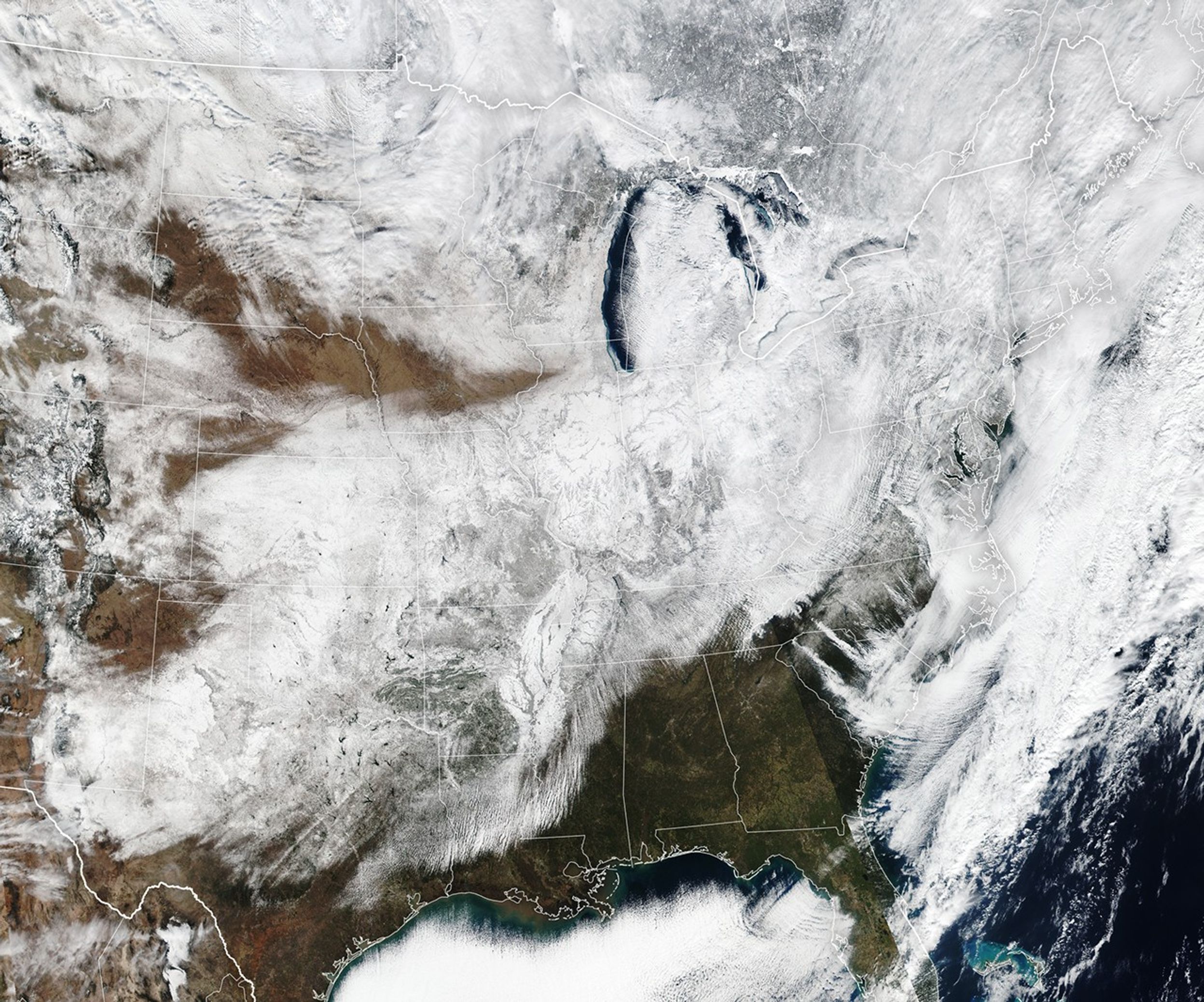
Natural Color
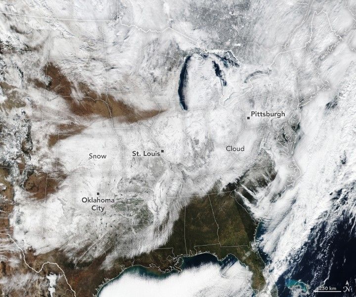
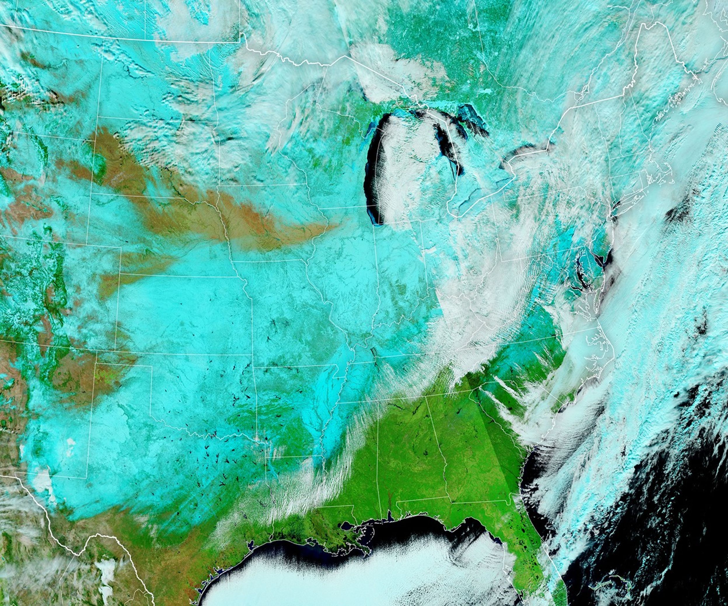
False Color
January 26, 2026
A potent winter storm left a wide band of snow stretching from the U.S. Southwest to New England in late January 2026. The heavy snow, along with bitterly cold temperatures, sleet, and ice, created treacherous travel conditions, toppled power lines, and caused widespread school closures, according to news reports.
On the afternoon of January 26, the VIIRS (Visible Infrared Imaging Radiometer Suite) on the Suomi NPP satellite observed new snow covering a large swath of the country. The left image is natural color, while the false-color image on the right uses a combination of visible and infrared light (bands M11-I2-I1) to distinguish snow (blue) from clouds (white).
Preliminary National Weather Service data indicate snow accumulations of up to 12 inches (30 centimeters) in parts of Oklahoma between the mornings of January 23 and January 26, with higher accumulation across the Midwest and in New England. Totals of around 20 inches were reported in several Northeast states.
Some locations were digging out from record daily accumulations, including 5.1 inches in St. Louis, Missouri, on January 24, and 11.2 inches in Pittsburgh, Pennsylvania, on January 25. Several inches of snow and sleet also fell in parts of North Texas, a rare occurrence for the area. With temperatures remaining below freezing in many places, the snow and ice may stick around.
NASA’s Disasters Response Coordination System has been activated to support federal partners responding to the winter storm. The team will be posting maps and data products on its open-access mapping portal as new information becomes available.
NASA Earth Observatory images by Lauren Dauphin using VIIRS data from NASA EOSDIS LANCE, GIBS/Worldview, the Suomi National Polar-orbiting Partnership. Story by Lindsey Doermann.
References & Resources
- CBS News (2026, January 27) Power out for hundreds of thousands, roadways snarled with ice and snow after deadly storm. Accessed January 27, 2026.
- NASA (2026) US Winter Storm January 2026. Accessed January 27, 2026.
- NWS National Operational Hydrologic Remote Sensing Center (2026, January) National Gridded Snowfall Analysis. Accessed January 27, 2026.
- NWS Weather Prediction Center (2026, January 26) Storm Summary Message. Accessed January 27, 2026.
- The Washington Post (2026, January 27) See how much snow fell — and where it broke records. Accessed January 27, 2026.
You may also be interested in:
Stay up-to-date with the latest content from NASA as we explore the universe and discover more about our home planet.

A blanket of snow spanned Michigan and much of the Great Lakes region following a potent cold snap.

December and January brought a series of intense winter storms to the peninsula in far eastern Russia.

A moderately intense season of surface melting left part of the ice sheet dirty gray in summer 2025, but snowfall…


Powered by WPeMatico