NASA Watches Earth’s Weight, Finds Center of Mass

NASA Watches Earth’s Weight, Finds Center of Mass

5 min read

Preparations for Next Moonwalk Simulations Underway (and Underwater)
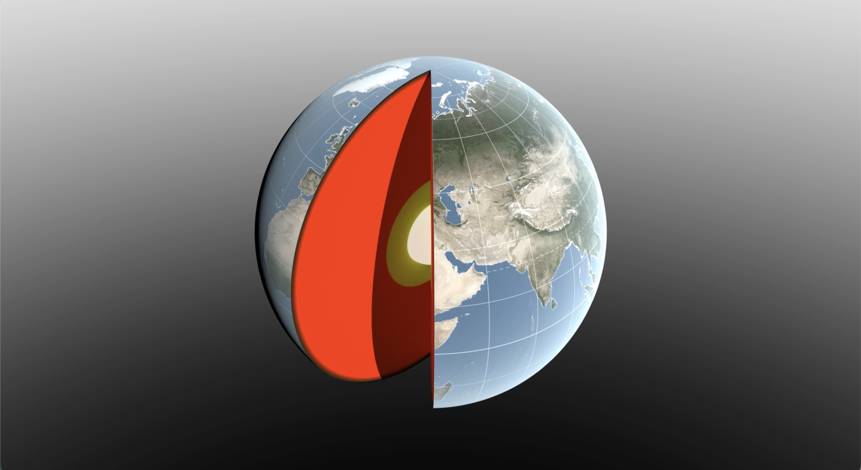
A 3D digital illustration of Earth with a slice cut away to reveal its internal layers. The exterior shows a realistic view of the globe, focusing on Europe, Asia, and Africa with visible geographic features and grid lines.
Water sloshing between the land and oceans shifts Earth’s center of mass relative to its geometric center. NASA scientists have developed a new technique using ultraprecise satellite tracking to estimate the displacement to within fractions of inches.
NASA’s Scientific Visualization Studio

Seasonal changes redistribute enough water around Earth to shift the planet’s center of mass back and forth by fractions of an inch relative to its geometric center. NASA scientists are on the case, tracking the oscillations because Earth’s center of mass is a crucial reference point for satellite navigation and elevation measurements.

A team, led by NASA’s Jet Propulsion Laboratory in Southern California, has proposed a way to calculate the seasonal swings with extreme precision. The technique and findings are detailed in a new study published in Geophysical Journal International. The authors paint a vivid picture of springtime thaws, churning oceans, and dense winter air shifting massive surface loads from season to season.

The study isn’t the first attempt to pin down Earth’s center of mass. Scientists over the decades have pioneered several space-based techniques to define and locate it. But it’s a moving goalpost. If Earth were a hard blue marble, its center of mass would simply overlap its geometric center. In reality, the planet is sloshing and sagging under the weight of water, ice, and air. Because of this, Earth’s center of mass continually swivels around its geometric center by as much as several millimeters.

NASA’s Space Geodesy Project currently uses a variety of space- and land-based techniques to track Earth’s center of mass (also called the geocenter) moving up and down and side to side. This animation traces the millimeter-scale motion from 1993 to 2017.
NASA’s Scientific Visualization Studio

How accurate are existing methods to measure the size of the swivel? The last two international estimates, made in 2017 and 2023, differ by 0.27 inches (7 millimeters), about the height of three stacked nickels. The difference is almost as large as the motion itself.

To reduce uncertainty, JPL geoscientist Donald Argus led the development of a new technique based on ultraprecise satellite tracking.

Driven by gravity, satellites naturally orbit Earth’s center of mass, as if bound by invisible tethers. Tiny changes in the distance between satellites and ground stations reflect Earth’s shifting center of mass.

Using satellites to locate Earth’s center of mass is not a new idea. In fact, dense metal satellites, launched in 1976 and 1992, are dedicated exclusively to this purpose. Resembling 900-pound (408-kilogram) disco balls, both Laser Geodynamics Satellites (LAGEOS 1 and 2) are studded with reflective prisms and tracked with laser precision via ground stations globally distributed across more than 20 countries.

However, one limitation of satellite laser ranging is the uneven distribution of ground stations around Earth. The new technique improves accuracy in two ways: It adds GPS tracking into the mix along with orbital data from several satellites in low Earth orbit to provide a diverse array of targets. And it considers how the weight of water and ice deforms Earth’s crust, taking ground stations along for the ride.

The technique was developed by Argus along with researchers from JPL’s satellite orbit determination team, the University of Nevada, University of Montana, and the Helmholtz Centre for Geosciences in Germany.

“We’re now estimating the size of the movement of Earth’s mass center back and forth each year to be about half of what we believed it to be eight years ago,” said Argus. “Our findings suggest that the mass of Earth’s water and air moving between the hemisphere is smaller than previously thought.”

Felix Landerer, one of the study’s coauthors at JPL, noted that “while these movements might appear tiny, our modern world relies on extremely accurate positioning measurements. By unraveling and understanding the mechanisms that change reference systems, we can build better reference systems that ultimately benefit mapping and navigation — from global shipping logistics to precision agriculture.”

What they found

The study authors tracked Earth’s center of mass oscillating seasonally and attributed the cause to three categories: oceans, atmosphere, and continental water (made up of land ice, snow, lake and river water, soil moisture, and groundwater).

They found that snow accumulation in North America and Eurasia reaches a maximum in March and shifts Earth’s center of mass about 3 millimeters toward the North Pole. A month later, in April, rainwater in the Amazon River basin peaks at 2,400 gigatons, swinging Earth’s center of mass 2.2 millimeters toward South America. Monsoon water in southeast Asia attains a maximum of 600 gigatons six months later in November, adding slightly to the annual oscillation.

Between August and October, the oceans swell with meltwater and rain, and Earth’s center of mass shifts toward the South Pacific Ocean. The Pacific Ocean is so large that mass changes there overshadow the loss or gain in other oceans, though seasonal dynamics in the Mediterranean, Red, North, Baltic, and Barents seas all help shift Earth’s center of mass in their own small way.

The researchers used a model developed by the European Centre for Medium-Range Weather Forecasts to estimate how atmospheric changes affect Earth’s center of mass throughout the seasons. They found that cold, dense, winter air helps tip the scales over Arabia, Asia, and northern Africa around Dec. 21 each year, and over South America and South Africa around June 21.

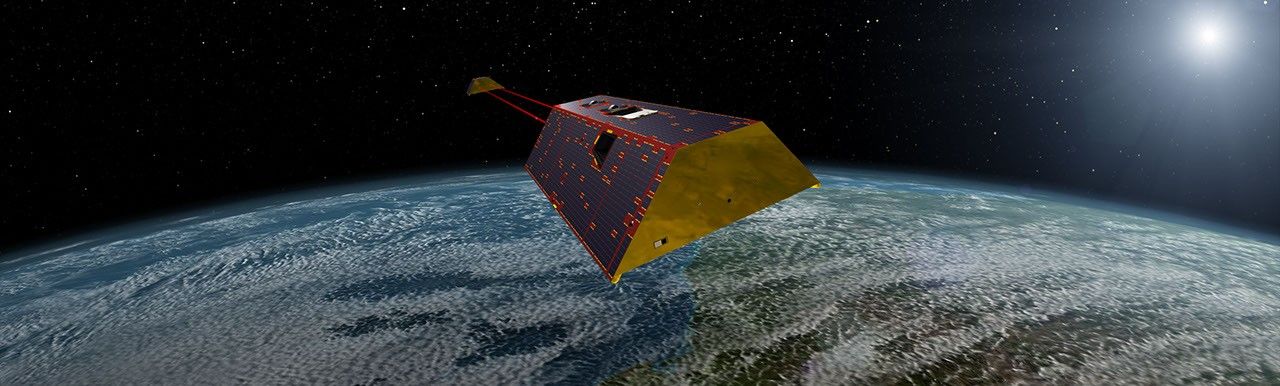
The mass calculations in the study are consistent with observations made by the Gravity Recovery and Climate Experiment Follow-On (GRACE-FO) mission. Launched in 2018, the mission is made up of twin satellites that map monthly fluctuations in Earth’s gravitational pull due primarily to the mass movement of water above and below ground. The two satellites fly in precise formation, and when the lead satellite passes over a dense body, like a swollen river basin, the extra gravitational tug changes the distance between its twin by a small but measurable amount.

The GRACE-FO mission is a joint partnership between NASA and the German Research Centre for Geosciences (GFZ). The next-generation GRACE-Continuity (GRACE-C) mission is targeting a launch in late 2028 to extend the nearly 25-year GRACE-series data record.

-end-

Written by Sally Younger

2026-061

Powered by WPeMatico

Get The Details…
albarne1
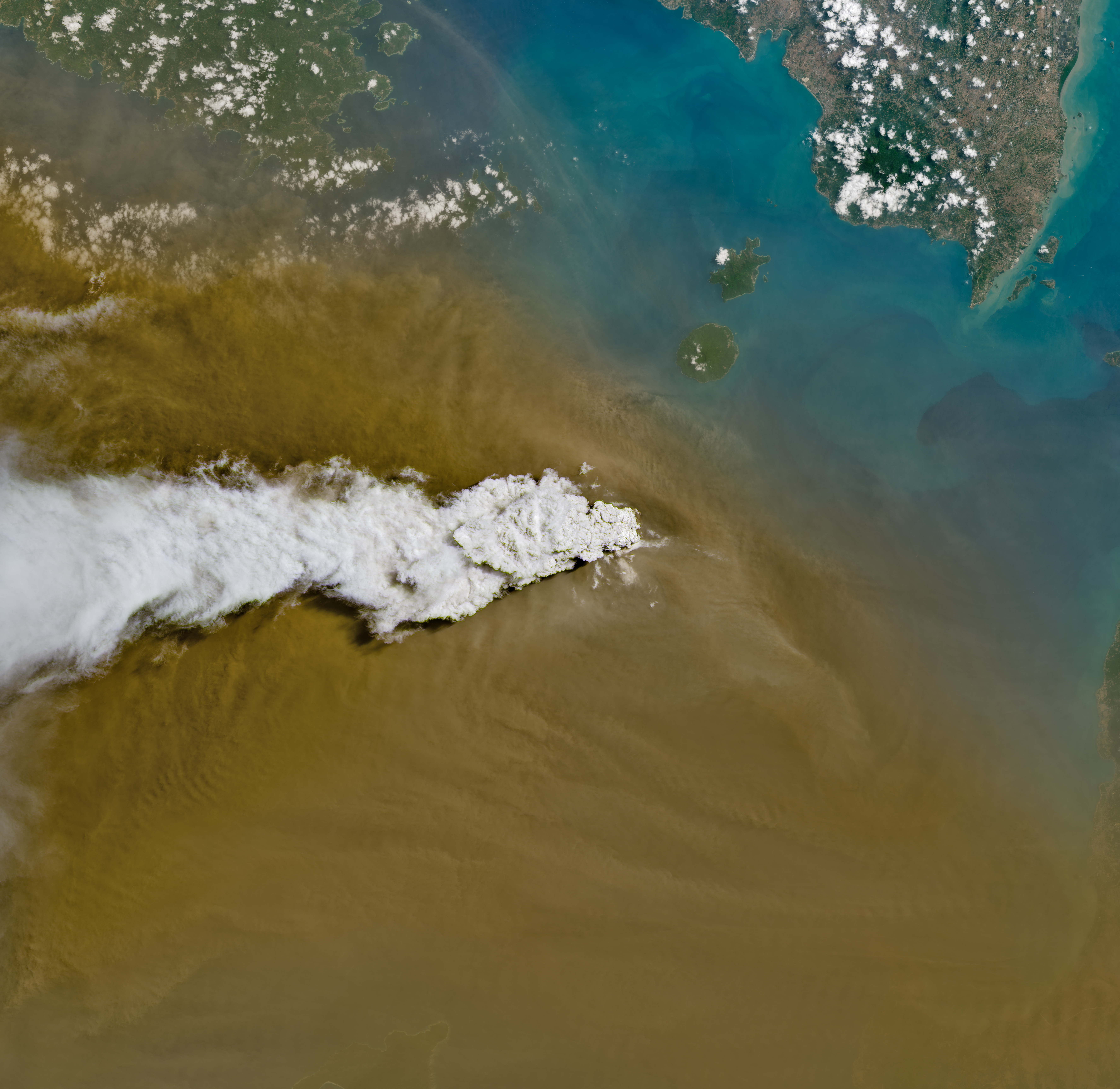
Indonesia’s Anak Krakatau

Indonesia’s Anak Krakatau

A white volcanic plume streams left over a tan ash cloud that fills most of the image. A small green island and blue water are visible in the upper right.
NASA/Michala Garrison

Anak Krakatau erupts ash and volcanic gases in this Sept. 5, 2026, image acquired with the OLI (Operational Land Imager) on Landsat 8. Eruptions are a regular occurrence at Anak Krakatau, a small volcano between the Indonesian islands of Java and Sumatra. Much of its activity remains relatively mild, but it occasionally puts on more impressive and hazardous shows of force. In early September 2026, a booming eruption lasting more than 24 hours sent gas and ash high into the atmosphere, disrupting thousands of flights and degrading air quality in parts of the country, including the capital city of Jakarta.

Learn more about the recent eruption.

Image credit: NASA/Michala Garrison

Powered by WPeMatico

Get The Details…
HQ Web Team

Curiosity Postcard Celebrates Rover’s 5,000th Day on Mars

Curiosity Postcard Celebrates Rover’s 5,000th Day on Mars

2 Min Read

Curiosity Postcard Celebrates Rover’s 5,000th Day on Mars

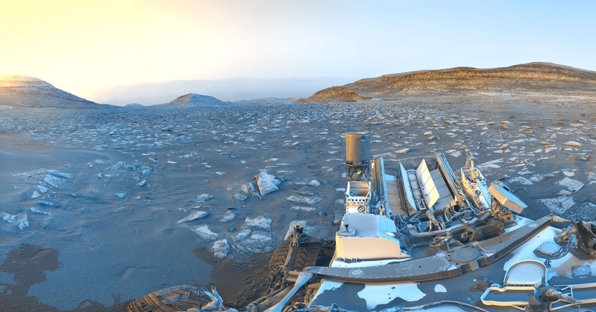
NASA’s Curiosity rover traverses the rocky, desert landscape of Mars beneath a soft sky. The scene is captured in striking blue and yellow hues.

PIA26700

Credits:
NASA/JPL-Caltech

Description

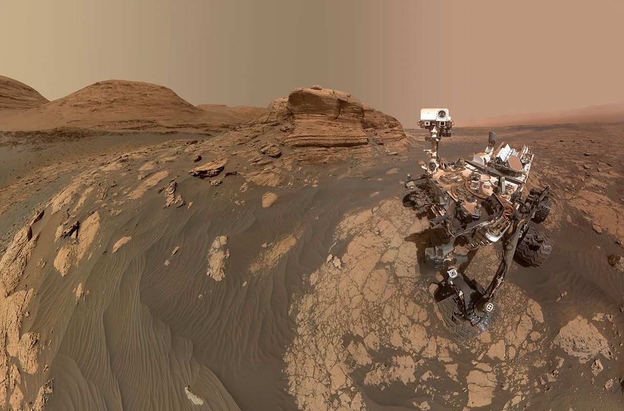
While parked at a sand ridge nicknamed “Chocolatal,” NASA’s Curiosity Mars rover used its black-and-white navigation cameras to capture panoramas at two times of day. The first was taken on Aug. 30, 2026, at 9:56 a.m. local Mars time; the second was taken on Sep. 2, 2026, at 5:39 p.m. local Mars time. Those dates correspond to the 5,000th and 5,003rd Martian days, or sols, of the mission.

After being sent back to Earth, the two images were merged together. Color was added for an artistic interpretation of the scene, with blue representing the morning panorama and yellow representing the afternoon one. The resulting “postcard” is similar to past examples created with rover images, such as one taken in November 2021.

The rover’s deck can be seen in the foreground, including its can-shaped UHF antenna, used for sending data to orbiting spacecraft, and its finned Multi-Mission Radioisotope Thermoelectric Generator (MMRTG), a nuclear power source, at its rear. The rover’s tracks can be seen trailing off in the distance. 

Curiosity is in the lower foothills of Mount Sharp, a 3-mile-tall (5-kilometer-tall) mountain that sits within Gale Crater. This image looks down toward the crater floor, with the crater rim barely perceptible on the horizon.

Curiosity was built by NASA’s Jet Propulsion Laboratory, which is managed by Caltech in Pasadena, California. JPL leads the mission on behalf of NASA’s Science Mission Directorate in Washington as part of NASA’s Mars Exploration Program portfolio.

To learn more about Curiosity, visit:

https://science.nasa.gov/mission/msl-curiosity/

Powered by WPeMatico

Get The Details…

NASA Visits Schools Strengthening Florida’s Skilled Workforce

NASA Visits Schools Strengthening Florida’s Skilled Workforce

NASA recently awarded $10.5 million to seven organizations nationwide through its new State Hubs initiative. Space Florida was selected for Project ORBIT, which aims to expand opportunities for middle and high school students, boost enrollment in key career and technical programs, and create a statewide portal connecting skilled workers with aerospace employers.

Two people looking at a computer screen
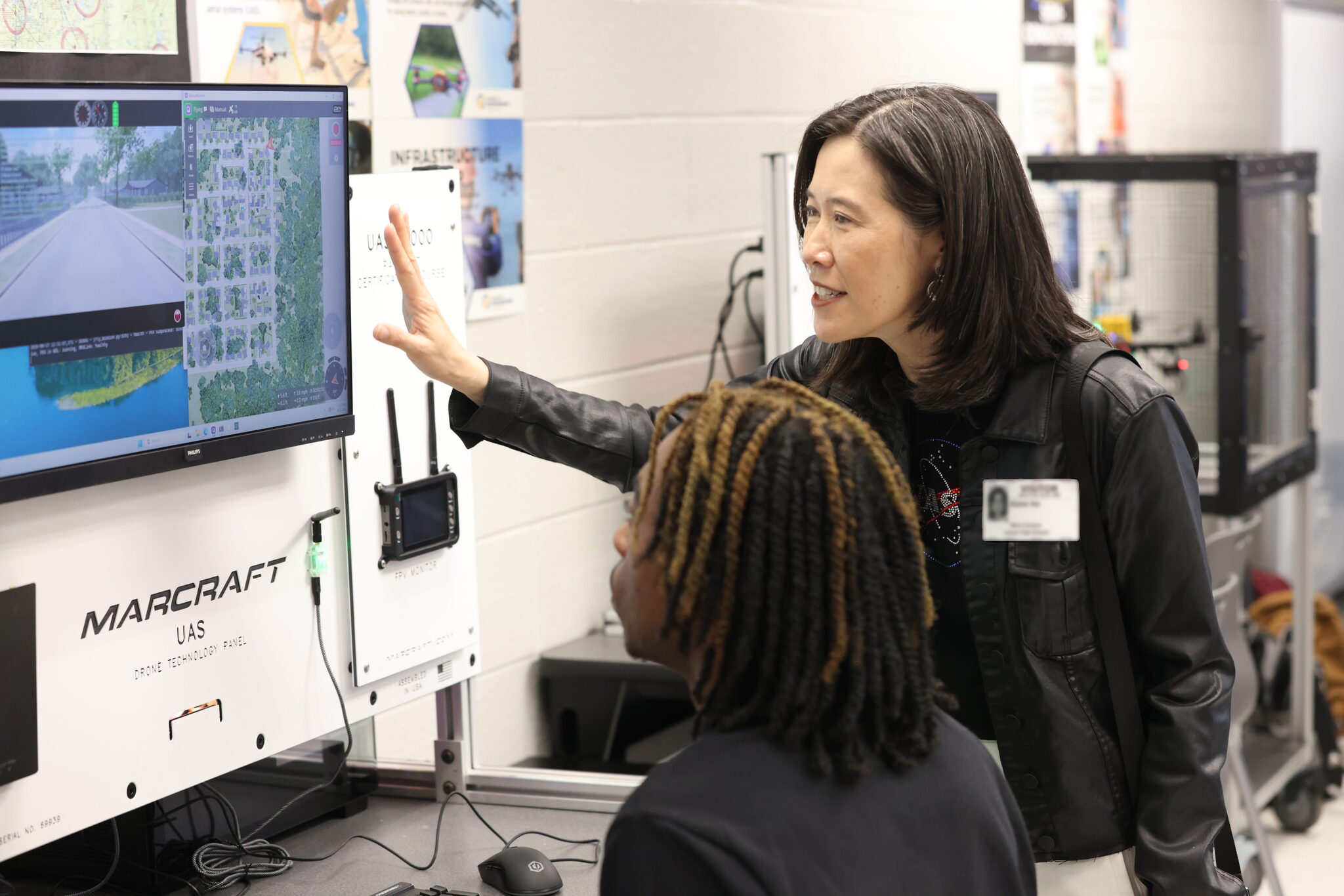
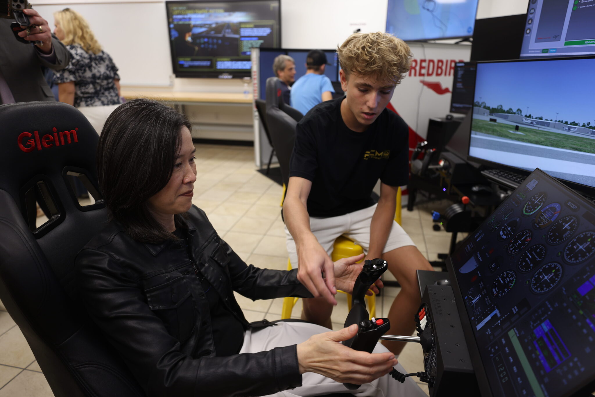
Elaine Ho, right, associate administrator for NASA’s Office of STEM Engagement, discusses training software with a student at Lyman High School in Longwood, Florida on on Aug. 27, 2026.
Credit: NASA/Clayton Rougelot

Elaine Ho, associate administrator for NASA’s Office of STEM Engagement, joined local leaders and industry partners recently to see Space Florida Academy students in action at three Central Florida schools. Students at Lyman High School in Longwood, Florida, demonstrated their skills in aerospace engineering, robotics, building trades, welding, and more. Later, in Merritt Island, Florida, Ho and the other leaders stopped by the Aeronautics & Flight Exploration (AFEX) program and cloud computing classrooms at Merritt Island High School and the robotics lab at nearby Edgewood Junior/Senior High School.

Since its launch in August 2024, the Space Florida Academy has expanded from 23 to 42 participating school districts, preparing students for careers in aviation and aerospace, advanced manufacturing, construction, cybersecurity, logistics, and semiconductors.

A group of students posing with Elaine Ho wearing matching t-shirts
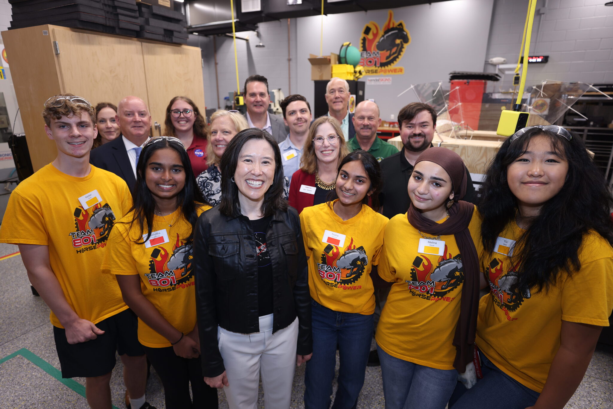
Elaine Ho, center, poses for a photo with Space Florida representatives, public school officials, aerospace industry partners, and students at Edgewood Junior/Senior High School in Merritt Island, Florida on Aug. 27, 2026.
Credit: NASA/Clayton Rougelot

“It’s all about showing students what’s possible and then giving them the tools to achieve it,” said Dean Cuke, Merritt Island High School AFEX astronautics and aviation flight instructor. “There are far more possible pathways to be part of the space industry than I think they realize. We’re showing them ways that they can attain that, through learning, through motivation and chasing after their dreams. I’m excited for them.”

Merritt Island High School juniors and student pilots Olivia Street and Troy Wallenburg have both benefited from the program.

“It makes you feel like you’re a part of something way bigger than just a high school class. I learned what I want to do when I grow up – to be a pilot,” Street said.

“My entire life, I’ve just loved space,” Wallenburg said. “It’s great knowing that I’m actually somewhat involved in it, too.”

Elaine Ho sitting in a chair with her hands on controller with a student helping set up the simulator
A student in the Merritt Island High School Aeronautics and Flight Exploration program shows Elaine Ho, left, how to use a flight simulator on Aug. 27, 2026.
Credit: NASA/Clayton Rougelot

“I’m so impressed by how this region holds so many opportunities for our students, who are incredibly capable of solving hard problems, who can build our hardware, who want to be part of something bigger than themselves,” Ho said. “NASA is really focused on ensuring that those opportunities are easier to reach.”

Powered by WPeMatico

Get The Details…
Sandra May

NASA Astronaut Reid Wiseman to Join NFL Fans in Baltimore

NASA Astronaut Reid Wiseman to Join NFL Fans in Baltimore

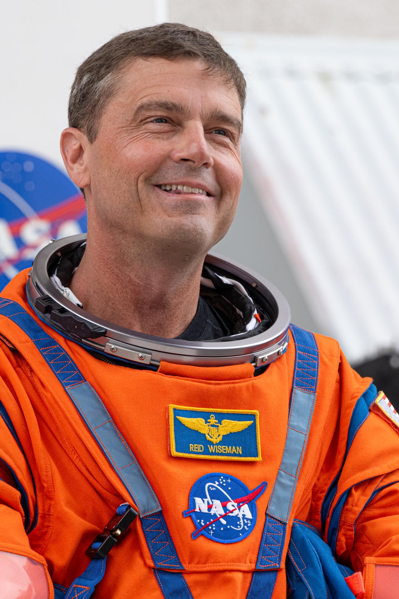
Reid Wiseman looks toward supporters, smiling, wearing an orange spacesuit with his name and a NASA meatball patch.
NASA astronaut Reid Wiseman prepares to depart the Neil A. Armstrong Operations and Checkout Building for Launch Complex 39B at the agency’s Kennedy Space Center in Florida to board NASA’s Artemis II SLS (Space Launch System) rocket and Orion spacecraft for the agency’s Artemis II launch on April 1, 2026.
Credit: NASA/John Kraus

As part of NASA’s new Inspiration Tour, Reid Wiseman, NASA astronaut and commander of the agency’s Artemis II mission, will highlight America’s strengths in space exploration and aeronautics innovation at the Baltimore Ravens vs. New Orleans Saints game in Baltimore on Sunday, Sept. 20.

A Baltimore native, Wiseman is a 27-year Navy veteran and NASA astronaut who spent 175 days in space over two missions. On April 1, Wiseman launched from NASA’s Kennedy Space Center in Florida on a SLS (Space Launch System) rocket as part of the Artemis II mission. Wiseman and his fellow Artemis II crew members completed a historic lunar flyby, marking humanity’s return to the vicinity of the Moon for the first time in more than 50 years.

Wiseman also will be available for media interviews inside the stadium at 12:20 p.m. To RSVP for the media availability, please contact Shaneequa Vereen at: shaneequa.y.vereen@nasa.gov.

NASA team members will engage with fans at the agency’s Experience Zone, located outside the stadium from 10 a.m. to 1 p.m. before the game. Fans can learn more about NASA’s return to the Moon through the agency’s Artemis program, enjoy interactive games, and capture photos at a selfie station and with a large, inflatable NASA logo.

With stops across the nation, NASA’s Inspiration Tour convenes academic, industry, and public sector stakeholders to connect the agency with the people, technologies, and organizations that drive American leadership in space.

The tour will culminate in MAX POWER, a public exposition of American air and space innovation, Saturday, Nov. 7, and Sunday, Nov. 8, on and near the agency’s Kennedy Space Center in Florida. Held in honor of America’s historic 250th anniversary, the multi-day, family-friendly event will showcase the next-generation aircraft, spacecraft, autonomous vehicles, and technologies that will help define the future of transportation in air and space.

For more information about MAX POWER and the agency’s missions, visit:

https://www.nasa.gov/maxpower

-end-

Camille Gallo / Jessica Taveau
Headquarters, Washington
202-358-1600
camille.m.gallo@nasa.gov / jessica.c.taveau@nasa.gov

Share

Details

Last Updated

Sep 16, 2026

Editor
Jessica Taveau

Powered by WPeMatico

Get The Details…
Jessica Taveau