Tropical Storm Arthur

Tropical Storm Arthur


Natural color
brightness temperature

Tropical Storm Arthur’s white storm clouds cover the waters off the U.S. Gulf Coast. Some clouds extend inland over parts of Texas and Louisiana.
NASA Earth Observatory/Michala Garrison

White and purple areas of cloud off the Gulf Coast indicate the cooler areas of cloud tops associated with Tropical Storm Arthur.
NASA Earth Observatory/Michala Garrison

Tropical Storm Arthur’s white storm clouds cover the waters off the U.S. Gulf Coast. Some clouds extend inland over parts of Texas and Louisiana.
NASA Earth Observatory/Michala Garrison
White and purple areas of cloud off the Gulf Coast indicate the cooler areas of cloud tops associated with Tropical Storm Arthur.
NASA Earth Observatory/Michala Garrison

Natural color

brightness temperature


Images from the MODIS (Moderate Resolution Imaging Spectroradiometer) on NASA’s Terra satellite show Tropical Storm Arthur on the morning of June 17, 2026. The left image is natural color; the right shows infrared signals known as brightness temperature. NASA Earth Observatory images by Michala Garrison.

Tropical Storm Arthur, the first named storm of the 2026 Atlantic hurricane season, brought high winds and heavy rain to the U.S. Gulf Coast in mid-June.

NASA’s Terra satellite captured this natural-color image (left) at 10:30 a.m. Central Time (15:30 Universal Time) on June 17. The second image (right) depicts infrared signals known as brightness temperature, which help distinguish cooler cloud tops (white and purple) from the warmer surface below (yellow and orange). Around the time these images were acquired, the system had just recently been designated a tropical storm, according to the National Hurricane Center (NHC).

Though Arthur stayed below hurricane strength, it still delivered strong winds to parts of the Gulf Coast as it tracked northeast. The storm had maximum sustained winds of 40 miles (65 kilometers) per hour around the time these images were captured. Tropical-storm-force winds extended 175 miles (280 kilometers) from the storm’s center, the NHC reported. Measurements at Galveston, Texas, for instance, showed a gust of 48 miles per hour.

The storm also produced heavy rainfall that the National Weather Service warned could lead to life-threatening flash flooding. Estimates from IMERG (the Integrated Multi-Satellite Retrievals for GPM), a product of the GPM (Global Precipitation Measurement) mission, showed high rainfall rates over Gulf waters and extending inland on June 17.

As Arthur weakened and became less organized, it continued to bring abundant moisture to central Gulf Coast states on June 18. The National Weather Service reported rainfall rates of 3 inches (7.6 centimeters) per hour in southeastern Louisiana. Forecasts indicated that storm-total rainfall amounts could exceed 12 inches (30 centimeters) in areas, with some locations seeing totals approaching 20 inches (51 centimeters).

NASA Earth Observatory images by Michala Garrison, using MODIS data from NASA EOSDIS LANCE and GIBS/Worldview. Story by Kathryn Hansen.

References & Resources

You may also be interested in:

Stay up-to-date with the latest content from NASA as we explore the universe and discover more about our home planet.

Typhoon Jangmi

2 min read

The sprawling storm promised to deliver torrential rain across a wide swath of southern Japan.

Article

Tropical Cyclone Narelle Crosses Australia

3 min read

The powerful storm lashed the northern edge of the continent with damaging winds and drenching rain as it made landfall…

Article

Super Typhoon Sinlaku

3 min read

The violent storm aimed at the U.S. Northern Mariana Islands and Guam in mid-April 2026.

Article

Powered by WPeMatico

Get The Details…

Curiosity Blog, Sols 4920-4926: Surveying the Bands

Curiosity Blog, Sols 4920-4926: Surveying the Bands

3 min read

Curiosity Blog, Sols 4920-4926: Surveying the Bands

A black-and-white image of a barren Martian landscape featuring a prominent, roughly pyramidal rock outcropping in the foreground. The rock's lower half is rugged with deep cracks and textured layers, while its peak appears lighter and smoother, possibly covered in dust. The surrounding terrain stretches into the background with scattered smaller rocks and another low mound in the distance.
NASA’s Mars rover Curiosity acquired this image of small butte, “Miraflores,” using its Mast Camera (Mastcam) on June 11, 2026 — Sol 4922, or Martian day 4,922 of the Mars Science Laboratory mission — at 09:12:13 UTC.
NASA/JPL-Caltech/MSSS

Written by William Farrand, Senior Research Scientist, Space Science Institute

Earth planning date: Friday, June 12, 2026

Rather than going from stage to stage at a music festival to hear different bands playing different varieties of music, Curiosity has been ascending up Mount Sharp through physical bands of exposed rocks with textural and tonal differences.

Planning for sols 4920 and 4921 were done with the rover in the middle of a unit with a rougher texture and dark-toned bedrock. With the rougher-textured bedrock, brushing wasn’t possible, but APXS chemistry and MAHLI micro-imaging were planned on “as is” bedrock targets “Salto La Cascada” and “Puerto de Rosas.” ChemCam was targeted to perform LIBS spectroscopy on a bedrock target “Kishuara” and a small, layered float rock “La Rosita.” ChemCam’s Remote Micro-Imager (RMI) collected views of the “Mishe Mokwa” butte and another looking at dunes with tonal differences. Mastcam mosaics were collected on the “Valle Grande” channel, “Kimsa Chata” butte, nearby troughs, and the aircraft carrier shaped rock “El Matir.”

Another drive brought Curiosity closer to the upper border of the dark-toned band. Again, brushing of the rocks was not possible, but APXS and MAHLI were collected on dark-toned bedrock targets “Santa Gracia” and “Laguna San Rafael” with ChemCam LIBS also targeting the bedrock. Mastcam mosaics were collected of a layered rock and nearby troughs and a mosaic of the nearby smaller butte, “Miraflores” which displays an interesting layered structure with ragged dark-toned rocks on one side and a stack of dust piled on top (see accompanying image). Other activities included a long-distance RMI mosaic of a bright unit on “Mishe Mokwa”, and Navcam dust-devil surveys in both sols.

Communicating between Earth and Mars has come to seem routine, but at times can still be a challenging endeavor and this was demonstrated to the team on Friday when we did not get a timely downlink of data for the drive planned for Sol 4923. Without these images another drive, in situ examinations, or targeted remote sensing could not be planned. However, there are always interesting things to be done on Mars and the three-sol plan (4924 to 4926) included a 360-degree Mastcam mosaic, the automatic AEGIS targeting of LIBS measurements on each sol, a Navcam dust-devil survey, APXS atmospheric measurements, as well as several other environmental activities.

On Monday, the delayed downlink will be used to plan the first investigation of the next band of surface materials, this one being smooth-textured and light-toned, as well as another drive to continue the surveying of the bands.

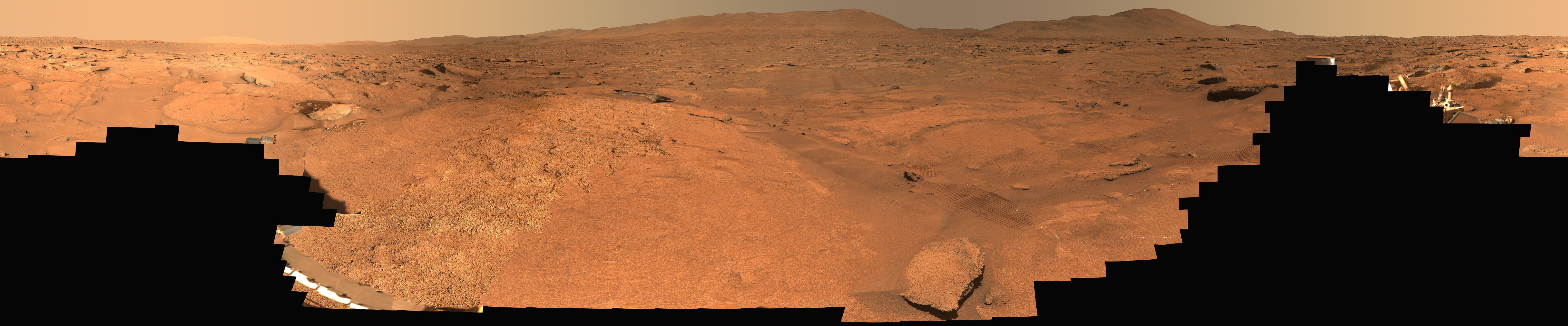
A rover sits on the hilly, orange Martian surface beneath a flat grey sky, surrounded by chunks of rock.
NASA’s Curiosity rover at the base of Mount Sharp
NASA/JPL-Caltech/MSSS

Share

Details

Last Updated
Jun 18, 2026

Related Terms

Powered by WPeMatico
Get The Details…

Advanced Tech on Station Informing Space-Designed Health Treatments

Advanced Tech on Station Informing Space-Designed Health Treatments

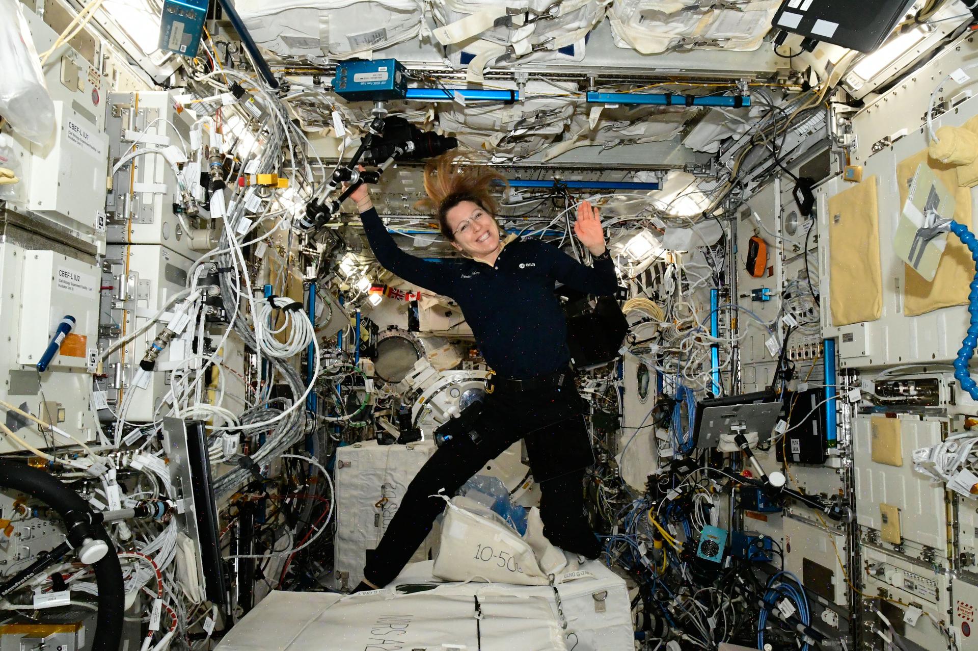
Expedition 74 flight engineers, from left, Jessica Meir of NASA and Sophie Adenot of ESA (European Space Agency), show off a Cygnus mission sticker for Northrop Grumman's 24th cargo mission to the International Space Station. The sticker is affixed to the vestibule between the orbital outpost's Earth-facing port on the Unity module and the company’s Cygnus XL cargo spacecraft.
Astronauts, from left, Jessica Meir and Sophie Adenot show off a Cygnus mission sticker for Northrop Grumman’s 24th cargo mission to the International Space Station.
NASA/Chris Williams

The Expedition 74 crew explored how weightlessness affects cartilage growth and the digestive system on Thursday to protect crew health and improve patient care on Earth. The orbital residents are also gearing up for a robotics maintenance spacewalk at the end of the month on the International Space Station.

Conducting research in the microgravity environment of the orbiting laboratory provides unique insights unobtainable in Earth’s gravity. This helps scientists, doctors, and engineers develop space-influenced therapies, medicines, and products leading to advances in human health, industrial processes, spacecraft designs, and more.

Cartilage cells are growing aboard the orbital outpost that may inform new ways to treat disabilities and repair injuries. NASA flight engineers Jessica Meir and Chris Williams worked together on the biotechnology investigation using the Kibo laboratory module’s Life Science Glovebox. Williams retrieved the cartilage cell samples preserved in a science freezer then thawed them to begin scientific operations. Next, Meir nourished the cell samples inside the glovebox and stowed them inside a research incubator so they could begin growing. Manufacturing cartilage tissues in space could lead to self-repairing implants on Earth and advanced fitness techniques for astronauts on a long-term spaceflight.

Roscosmos cosmonauts Sergey Kud-Sverchkov and Sergei Mikaev joined each other after breakfast and scanned their abdominal region using an ultrasound device for a digestion study. The real-time biomedical data will give doctors insight into how microgravity affects the blood flow and shape of a crew member’s digestive organs after a meal. Results may help advance methods to monitor and improve digestive health both on Earth and in space.

Meir and flight engineer Sophie Adenot of ESA (European Space Agency) also conducted ultrasound scans using ESA’s EchoFinder-2 device to image the major blood vessels and key organs in their abdomen. The human research experiment uses augmented reality to assist with the scans and artificial intelligence to recognize organs. The lightweight, easy-to-use gear may enable independent crew health monitoring on spacecraft travelling to the Moon, Mars, and beyond.

Adenot then joined NASA flight engineer Jack Hathaway and studied procedures necessary to prepare astronauts for a spacewalk. The duo reviewed spacesuit handling techniques, Quest airlock pressurization and depressurization steps, and emergency responses. Adenot also partnered with Meir and Williams and serviced the lithium-ion batteries that power the spacesuits. NASA will soon announce the two astronauts who will exit the space station on June 30 to repair a wrist joint on the Canadarm2 robotic arm.

Roscosmos flight engineer Andrey Fedyaev had a busy day of science and maintenance beginning his shift downloading and reading data collected from a station radiation detector. Afterward, Fedyaev transferred water from the Progress 94 resupply ship into tanks inside the orbital outpost’s Roscosmos segment. Finally, the two-time cosmonaut wrapped up his shift testing artificial intelligence tools to boost crew efficiency and communications in space.

Learn more about station activities by following the space station blog, @space_stationon X, as well as the ISS Facebook and ISS Instagram accounts.

Get the latest from NASA delivered every week. Subscribe here.

Powered by WPeMatico

Get The Details…

Mark A. Garcia

NASA Mission to Study Space Weather Impacts of Earth’s Atmosphere

NASA Mission to Study Space Weather Impacts of Earth’s Atmosphere

Artist’s rendition of the DAPHNE (Dynamic Atmosphere-Ionosphere Explorer) mission concept.
Artist’s rendition of the DAPHNE (Dynamic Atmosphere-Ionosphere Explorer) mission concept. The coloring represents auroras and atmospheric waves in Earth’s atmosphere.
Credit: Laboratory for Atmospheric and Space Physics/Mary Tostanoski

NASA selected a mission concept to research how space weather and dynamics within Earth’s atmosphere influence the space environment and help improve prediction capabilities for impacts on crucial technology, such as GPS and low Earth orbit satellites, as well as astronauts in space.

The DAPHNE (Dynamic Atmosphere-Ionosphere Explorer) mission will enter Phase B of development, which includes planning and design for flight and mission operations. It will use identical twin satellites to study how changes in Earth’s lower atmosphere influence our planet’s upper atmosphere, where space weather is manifested.

“NASA is advancing the United States’ leadership as a space weather-ready nation, and by providing new insights into Earth’s atmosphere we can better predict and prepare for impacts in our daily lives on Earth and in space,” said Nicky Fox, associate administrator, Science Mission Directorate, NASA Headquarters in Washington. “As NASA sends astronauts beyond Earth’s magnetic protection to the Moon, Mars, and beyond, DAPHNE will join the NASA science fleet strategically located across the solar system to provide data that will help mission planners predict and mitigate the effects of space weather for the benefit of all.”

The DAPHNE mission’s low-risk high-return concept will provide coordinated, multi-point measurements of neutral winds, temperature, and composition in the thermosphere. The ionosphere and thermosphere regions are where Earth’s neutral atmosphere transitions into the ionized plasma of space. In this thin shell that surrounds the planet, the atmosphere is in constant motion, shaped by the influence of solar activity and changes in the lower atmosphere and in near-Earth space.

Fundamental observations and physical insights from the DAPHNE mission will incorporate lower-atmospheric energy data to advance space weather predictive capabilities. The mission is led by Aimee Merkel from the Laboratory for Atmospheric and Space Physics at the University of Colorado, Boulder.

The mission will be subject to a confirmation review in 2027, which will assess the progress of the mission and the availability of funds. If confirmed, the total estimated cost of the mission, excluding launch, will not exceed $250 million in fiscal year 2023 dollars, with a mission launch date of no earlier than 2029.

The DAPHNE mission was proposed as a concept study in response to the DYNAMIC (Dynamical Neutral Atmosphere-Ionosphere Coupling) mission announcement of opportunity. Funding and management oversight for this mission is provided by the Solar Terrestrial Probes program at NASA’s Goddard Space Flight Center in Greenbelt, Maryland.

For more information on NASA’s heliophysics missions, visit:

https://science.nasa.gov/heliophysics

-end-

Abbey Interrante / Karen Fox
Headquarters, Washington
202-358-1600
abbey.a.interrante@nasa.gov / karen.c.fox@nasa.gov

Share

Details

Last Updated

Jun 18, 2026

Powered by WPeMatico

Get The Details…
Lauren E. Low

NASA Awards Contract for Commercial Satellite Data Acquisition

NASA Awards Contract for Commercial Satellite Data Acquisition

NASA insignia.
Credit: NASA

NASA has selected eight new companies and will acquire new data products from six existing Commercial Satellite Data Acquisition contract holders to expand the range of commercial satellite data available to researchers, civil agencies, and decision-makers. Such measurements supplement NASA’s Earth satellites by contributing high-resolution and frequent observations to enhance the agency’s set of data.

Leveraging commercial data demonstrates NASA’s commitment to strong public-private partnerships, allowing the agency to expand scientific insight while reducing costs and accelerating the delivery of data to researchers and decision-makers.

Collectively, NASA and commercial Earth observations provide insight into our home planet – benefitting Americans, providing environmental intelligence, strengthening disaster response, and improving public safety.  

The Commercial Satellite Data Acquisition Program On-Ramp 2 Multiple Award contract is a firm-fixed-price, indefinite-delivery/indefinite-quantity multiple-award contract. The original maximum contract value was $476 million, with a performance period that began in 2023 and continues through Nov. 15, 2028.

Contract awardees are:

  • Airbus DS Geo Inc.
  • GHGSat Inc.
  • Hydrosat Inc.
  • ICEYE US Inc.
  • ImageSat International
  • Kuva US Inc.
  • Muon Space Inc.
  • Orbital Sidekick Inc.
  • OroraTech USA Inc.
  • Planet Labs Federal Inc.
  • Space Sciences and Engineering LLC, doing business as PlanetiQ
  • SATLANTIS US
  • Tomorrow Companies Inc., doing business as Tomorrow.io
  • Wyvern Inc.

The agency’s Commercial Satellite Data Acquisition mission works to execute a cost-effective way to augment and complement the suite of Earth observations captured by NASA and its partners by identifying, evaluating, and acquiring commercial satellite data.

For more information about NASA’s Commercial Satellite Acquisition program, visit:

https://science.nasa.gov/earth-science/csda

-end-

Liz Vlock
Headquarters, Washington
202-358-1600
elizabeth.a.vlock@nasa.gov

Share

Details

Last Updated

Jun 18, 2026

Editor
Jessica Taveau

Powered by WPeMatico

Get The Details…
Jessica Taveau