Satellite Spots a Spawn
Spawning season has sprung for Pacific herring (Clupea pallasii) in the waters off British Columbia, Canada. From mid-February through early May each year, thousands of the small, silvery fish congregate in shallow coastal areas around Vancouver Island and create a spectacle sometimes visible to satellites.
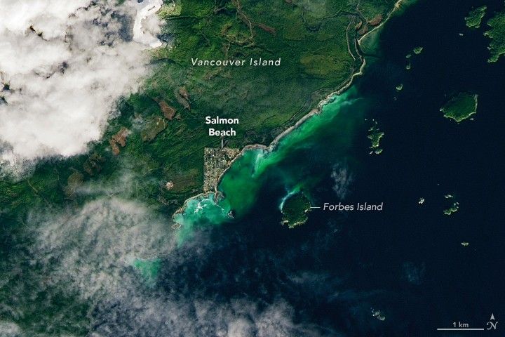
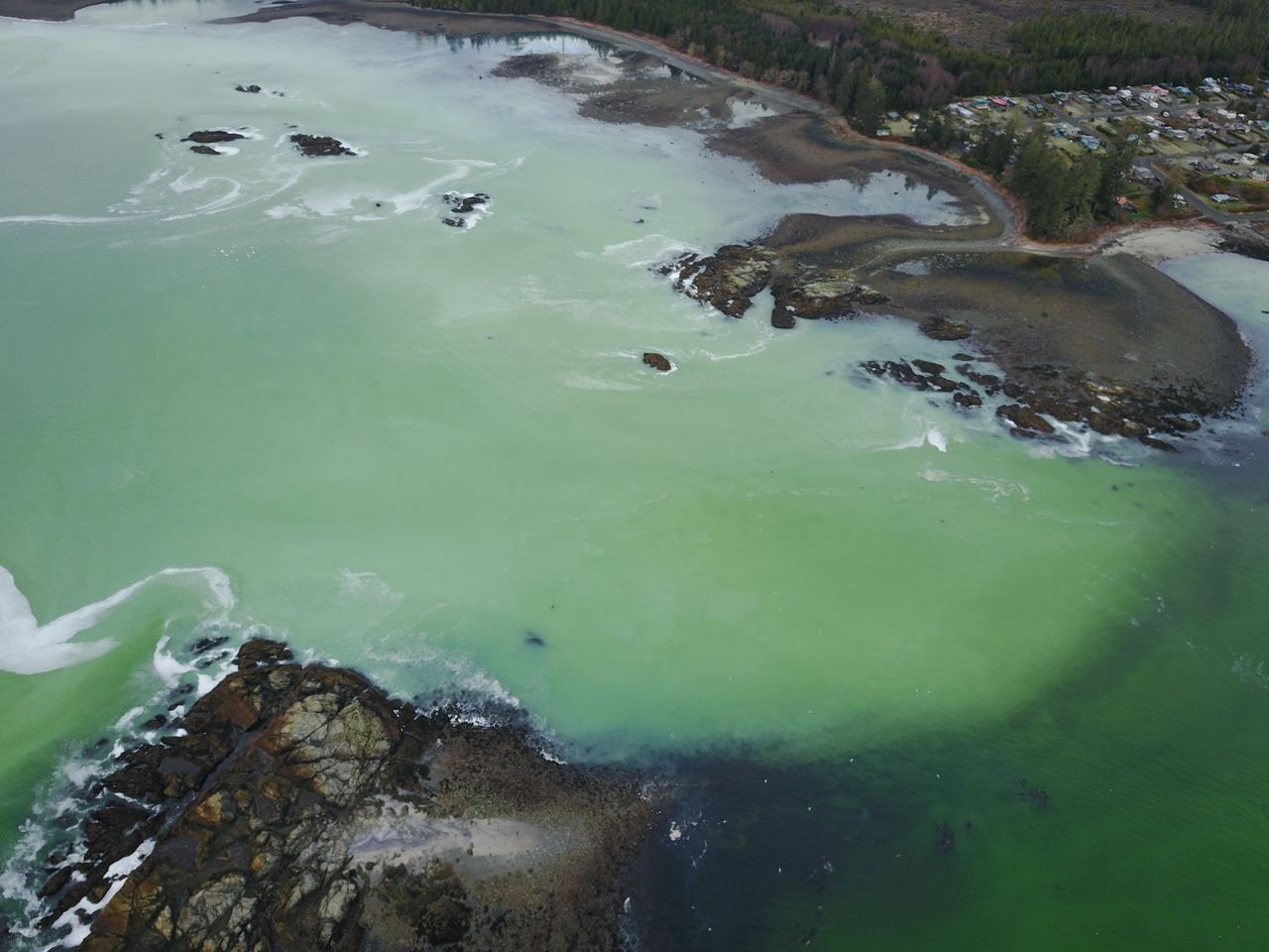
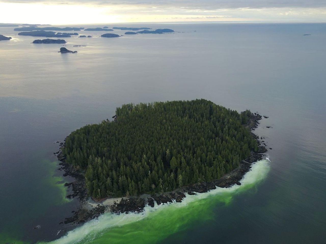
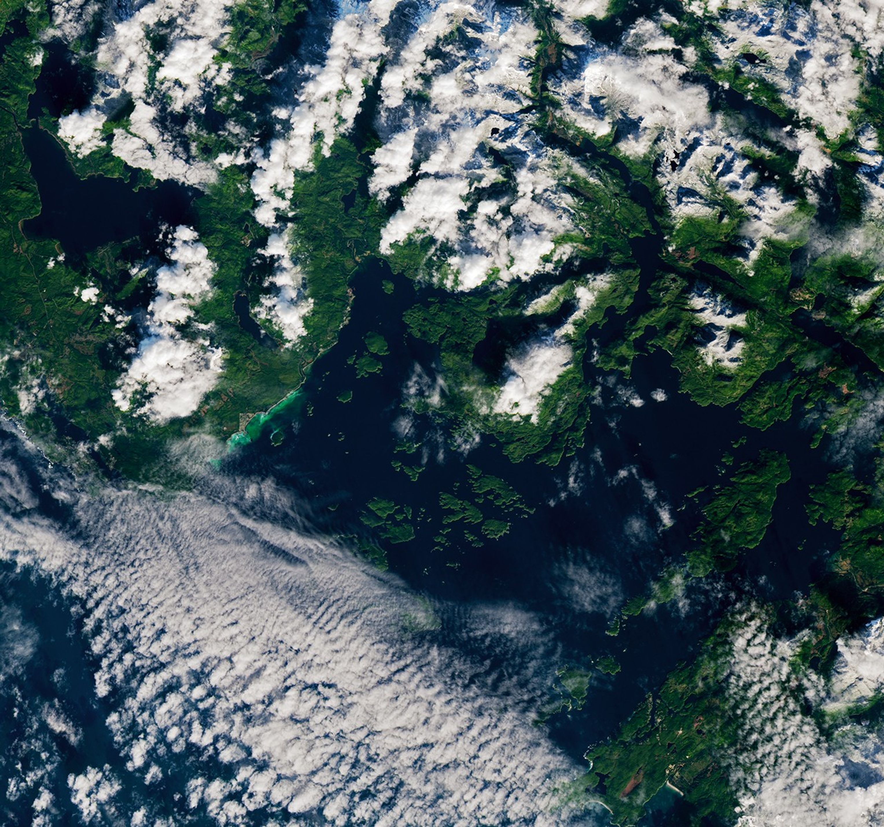
Sheltered waters in Barkley Sound, on the southwestern side of Vancouver Island, are regular sites for spawn events. On February 19, 2026, the Landsat 9 satellite caught a glimpse of early-season activity underway along the shore near Forbes Island. In these events, female herring produce eggs that stick to a variety of materials, from kelp and seagrass to rock surfaces. Males release a sperm-containing fluid called milt into the water, giving it a cloudy green or turquoise look.
Spawns near Forbes Island have been observed most years since the 1970s, according to Fisheries and Oceans Canada (DFO) records. “Herrings prefer spawning locations that are more protected, have rocky substrate, and allow them to select areas with reduced salinity,” said Jessica Moffatt, biologist with the Island Marine Aquatic Working Group (IMAWG), which works to strengthen First Nations fisheries through traditional knowledge, modern science, and management guidance. “Barkley Sound hits the sweet spot” in many of these regards, she said, adding that collective memory, predation pressure, and other factors also play a role in spawn size and location.
Spawning events last from several hours to several days. At Forbes Island in 2026, local observers saw that fish were staging in the area by February 13 (schools can arrive up to two weeks before spawning, Moffatt noted), and activity was reported to IMAWG from February 19 to February 21.
Along with changes in water color, spawns often come with increased wildlife presence, which can include whales and sea lions swimming nearby and eagles, wolves, and bears lurking on shore. After spawning, the fish will migrate back to summer feeding areas in deeper, more nutrient-rich waters, sometimes sticking with their same large school for several years.
Records of spawn activity have historically been constrained by the timing of aerial and dive surveys, the availability of reports from remote locations, and fisheries priorities. But observations by satellites, including Landsat, can help monitor herring activity over larger areas and longer periods of time. Researchers at the University of Victoria in Canada have used decades of satellite observations to augment historical spawn records and develop methods to streamline future detections.
Herring and their roe are valuable both as a cultural food source and harvest practice by First Nations and for British Columbia’s commercial fisheries. As a forage fish species, Pacific herring are vital to salmon and other marine life, and a fuller picture of the locations of spawning areas could provide clues about changes in the marine ecosystem.
NASA Earth Observatory images by Lauren Dauphin, using Landsat data from the U.S. Geological Survey. Photos by Ryan Cutler. Story by Lindsey Doermann.
References & Resources
- California Marine Species Portal (2024) Pacific Herring Enhanced Status Report. Accessed March 26, 2026.
- CBC (2026, February 25) First signs of herring spawn spark excitement on Vancouver Island. Accessed March 26, 2026.
- Fisheries and Oceans Canada (2026, January 20) Pacific herring fisheries. Accessed March 26, 2026.
- Ha-Shilth-Sa (2024, November 29) No commercial catch in 2025, despite herring population growth, say Ha’wiih – but spawn-on-kelp being explored. Accessed March 26, 2026.
- IMAWG (2026) Island Marine Aquatic Working Group. Accessed March 26, 2026.
- Island Marine Aquatic Working Group, via Facebook (2026) Pacific Herring Spawn Reporting – IMAWG. Accessed March 26, 2026.
- NASA Earth Observatory (2025, May 5) Spawning Spectacle. Accessed March 26, 2026.
- Spectral and Remote Sensing Laboratory, University of Victoria, Herring Spawn Habitat: Spatiotemporal analysis of historical spawning sites using satellite remote sensing. Accessed March 26, 2026.
You may also be interested in:
Stay up-to-date with the latest content from NASA as we explore the universe and discover more about our home planet.

Winds blowing past the volcanic landmass near the Korean Peninsula created a trail of spiraling clouds, while murky water churned…

An astronaut photographed the island’s striking mix of mountains, forests, and expanding urban areas.

A vibrant display of phytoplankton encircled the remote New Zealand islands.


Powered by WPeMatico