NASA Announces New Spacecraft Technology Demonstration Mission at Moon    

NASA Announces New Spacecraft Technology Demonstration Mission at Moon    

4 min read

Preparations for Next Moonwalk Simulations Underway (and Underwater)
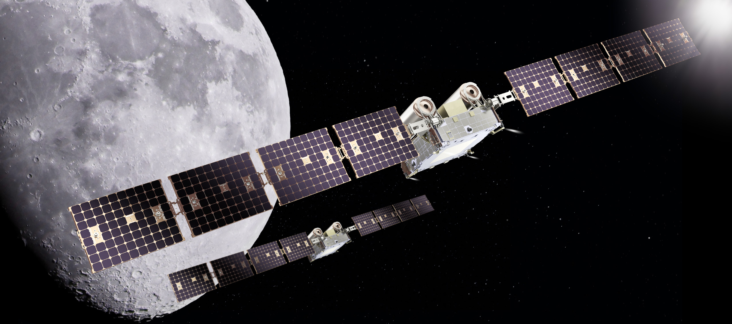
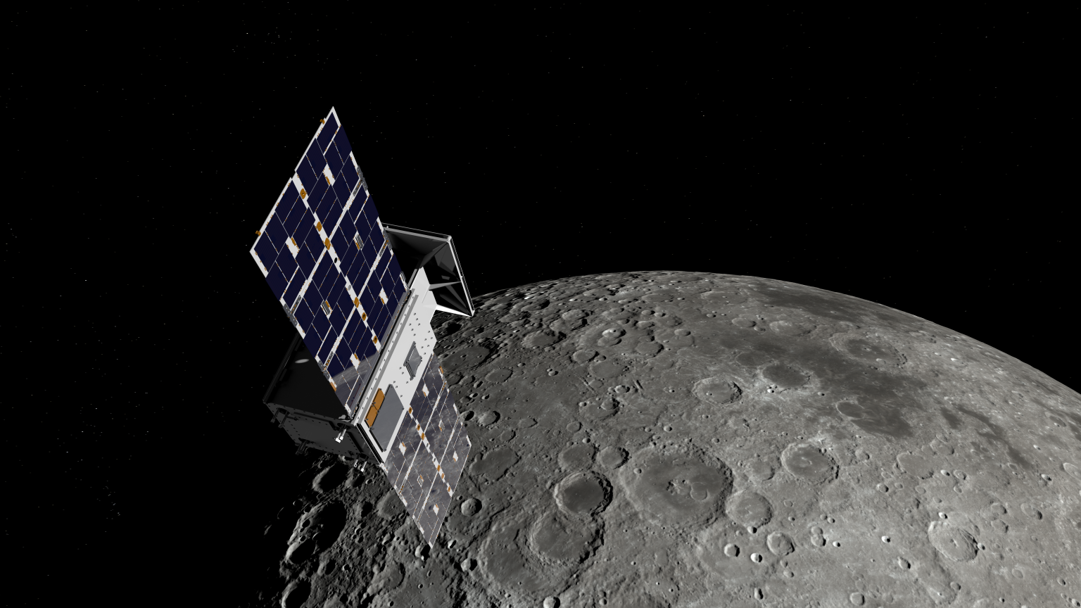
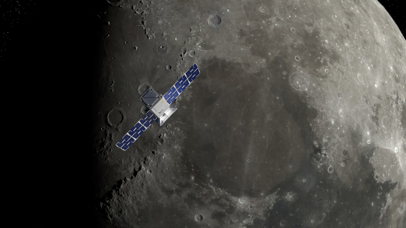
Artist rendition of two Capstone 2 in space above the Moon.
An artist’s rendering of NASA’s CAPSTONE 02 spacecraft in lunar orbit. The mission features two identical small spacecraft that will further mature technologies to support Artemis, Moon Base, and deep space exploration.
Terran Orbital

NASA is working with industry to advance the next phase of cislunar infrastructure for the agency’s Artemis program and Moon Base, including orbital assets and demonstrations. Under a contract awarded to Advanced Space, the agency’s CAPSTONE 02 mission will demonstrate rendezvous and proximity operations, autonomous navigation, and cislunar communication capabilities while continuing to characterize the radiation environment at the Moon.  

The CAPSTONE 02 mission, targeted for launch in 2027, will use two small spacecraft in lunar orbit to facilitate these demonstrations to support future NASA lunar and deep space missions.  

NASA’s original CAPSTONE demonstration, short for Cislunar Autonomous Positioning System Technology Operations and Navigation Experiment, became the first U.S. commercial mission to the Moon and the first spacecraft to operate in a near rectilinear halo orbit around the Moon. This is a nearly stable orbit, thanks to the interactive pull of gravity from both the Earth and the Moon.  

The mission successfully validated communications, networking, and autonomous navigation capabilities while gathering operational experience in cislunar space. The second CAPSTONE mission expands upon these accomplishments by transitioning from orbit validation to demonstrations that will inform future lunar exploration and infrastructure development. 

Achieving our most ambitious space exploration goals requires iterative, risk-tolerant demonstrations in partnership with industry. Technology development through flight testing is how we convert hard problems into the lasting capabilities needed for a permanent presence at the Moon.

Christopher Baker

Christopher Baker

Lead of the In‑Space Infrastructure portfolio within the Research and Technology Mission Directorate at NASA Headquarters in Washington, DC.

NASA’s CAPSTONE 02 mission will demonstrate advanced relative navigation technologies for rendezvous and proximity operations in cislunar space. These techniques are more sophisticated than those used in low Earth orbit and are designed to support NASA astronauts as they dock with Moon landers in cislunar orbit, enabling safe crew transfers to and from the lunar surface. 

The demonstration will fly two identical spacecraft of approximately 400 kilograms (882 pounds) from Terran Orbital Systems, Inc. Mission operators will conduct a series of rendezvous and proximity operations and loitering – or formation flying – techniques in lunar orbit with each spacecraft to better understand the trajectories of the spacecraft under the simultaneous influence of Earth and Moon gravities, otherwise known as three-body orbits.   

The CAPSTONE 02 mission will use ground tracking measurements, optical sensors, and celestial bodies to help one spacecraft locate and rendezvous with another. The mission will apply  navigation strategies similar to those planned for Orion’s approach to a lunar lander in deep space, helping NASA build confidence in these techniques for future exploration. 

Each CAPSTONE 02 spacecraft will have the ability to switch between ‘chaser’ and ‘target’ roles, testing a broad range of operational scenarios under a variety of environmental conditions in cislunar space. Transporting crew to the lunar surface from cislunar orbit depends on knowing how well navigation systems will perform during these operations. Since these conditions can’t be fully recreated on Earth, they must be tested in space. 

The CAPSTONE 02 mission also will serve as an operational testbed, enabling testing of three NASA-developed navigation software suites. Each software application will collect data during CAPSTONE 02’s low energy transfer trajectory, which will take it from the Earth to beyond the Moon before settling into a lunar orbit. The spacecraft will carry an optical imaging payload from Lawrence Livermore National Laboratory to support the navigation demonstration as well as capture imagery of the Moon. In addition, the mission will further mature the Cislunar Autonomous Positioning System navigation software that was first demonstrated on CAPSTONE as a method of determining spacecraft position relative to other spacecraft without relying on Earth-based tracking.  

The suite of technologies on CAPSTONE 02 are designed to automate routine navigation tasks, reduce reliance on traditional space-to-ground data, and enable new mission concepts that may be derived from increased inter-satellite coordination. Additionally, the CAPSTONE 02 spacecraft are designed for cost-effective, rapid deployment, demonstrating a scalable and repeatable mission model. 

“This mission represents an important step in the maturation of cislunar capabilities,” said Sean Fuller, Moon Base CAPSTONE manager. “By expanding on the lessons learned from CAPSTONE to demonstrate increasingly sophisticated operational concepts, CAPSTONE 02 lays the foundation for lunar infrastructure and commercial services that support Artemis, Moon Base, and future missions to deep space.”  

The CAPSTONE 02 mission is funded by NASA’s Human Spaceflight Mission Directorate with support from the Research and Technology Mission Directorate. The mission is managed by Small Spacecraft & Distributed Systems, based at NASA’s Ames Research Center in California’s Silicon Valley, within the Research and Technology Mission Directorate. NASA used a Small Business Innovation Research Phase III contract to fund the mission.  

To learn more about NASA’s CAPSTONE mission, visit: 

https://www.nasa.gov/mission/capstone02/

Powered by WPeMatico

Get The Details…
Loura Hall
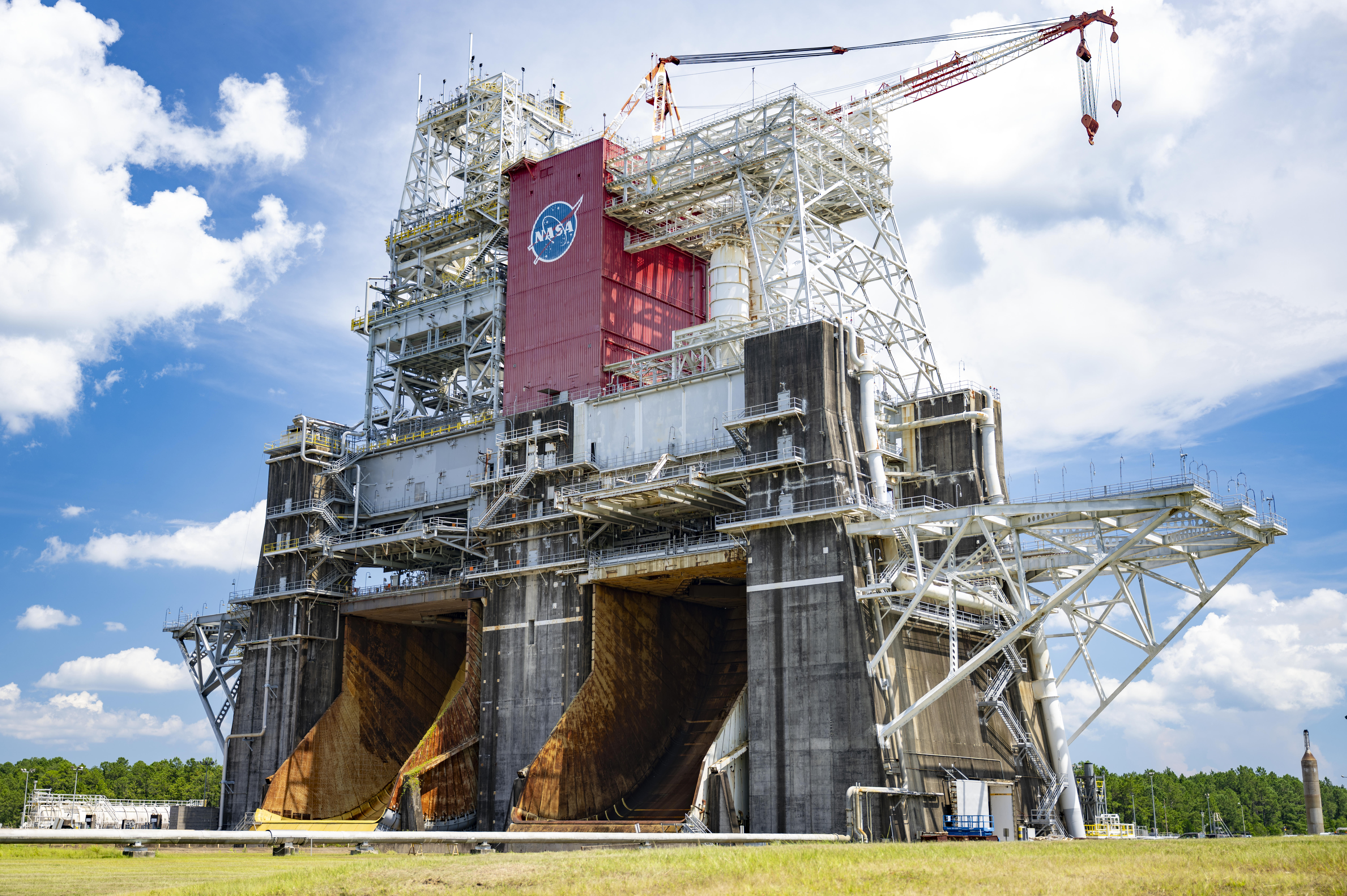
NASA to Support Blue Origin New Glenn Rocket Testing, Advance Artemis

NASA to Support Blue Origin New Glenn Rocket Testing, Advance Artemis

An image shows the B-1 and B-2 test stands at NASA’s Stennis Space Center near Bay St. Louis, Mississippi, on July 7, 2026. The test stand features dual, vertical firing positions built in the 1960s to test Saturn V rocket stages that carried humans to the Moon during the Apollo Program. The B-1 position, right, is equipped for single engine tests, while the B-2 position is designed to test full rocket stages. NASA announced an agreement with Blue Origin on July 24, 2026, to use the B-2 test stand for engine testing to advance rocket development for future missions to the Moon under the Artemis program.
Credit: NASA/Danny Nowlin

NASA and Blue Origin announced Friday they recently agreed to conduct second stage hot fire testing for the company’s New Glenn rocket on the B-2 test stand at the agency’s Stennis Space Center near Bay St. Louis, Mississippi.

The annex to a reimbursable Space Act Agreement signed earlier this month highlights NASA’s commitment to working alongside commercial partners toward Artemis missions in 2027 and beyond.

“Stennis continues to be a hub for the commercial space industry,” said Sen. Roger Wicker. “Mississippi warmly welcomes Blue Origin’s return to the coast and to our legendary rocket testing facilities.”

“The success of Artemis II has roots at NASA Stennis, and I’m excited about the prospect of Blue Origin establishing a rigorous test program in Mississippi as part of future American crewed missions to the Moon and beyond. I hope its use of B-2 test stand becomes a long-term arrangement that broadens our state’s contribution to space exploration. I will certainly do what I can to make that a reality,” said Sen. Cindy Hyde-Smith.

“Mississippi continues to play a vital role in America’s space program, and this agreement between NASA and Blue Origin is another major win for Stennis Space Center. The world-class capabilities at the B-2 test stand will help advance the next generation of rocket propulsion while supporting high-skilled jobs and strengthening our nation’s leadership in space exploration. I look forward to seeing the innovation that comes from this partnership,” said Rep. Mike Ezell.

Testing, targeted to begin this fall, directly supports NASA’s work to achieve the national goal of landing American astronauts on the surface of the Moon and building a Moon Base near the lunar South Pole. These efforts aim to strengthen American leadership in space, unlock scientific discovery, drive innovation with industry, and prepare for human missions to Mars.

 “Winning the new space race means moving faster and working alongside a strong commercial industry. Supporting Blue Origin at NASA’s Stennis Space Center puts world-class American infrastructure to work advancing the capabilities needed to return astronauts to the Moon, establish a sustained lunar presence, and prepare for Mars. Partnerships like this strengthen our industrial base and help ensure the United States remains the world’s leader in space,” said NASA Administrator Jared Isaacman.

Building on the successful Artemis II flight from April, Artemis III is a highly choreographed, multi-launch campaign that will require four astronauts to test rendezvous and docking capabilities of NASA’s Orion spacecraft with commercial human landing systems from Blue Origin and SpaceX in low Earth orbit.

In addition, Blue Origin’s New Glenn will be used to launch missions that will land on the Moon.

“We are proud to partner with NASA and build on our shared commitment to returning America to the Moon and our broader mission to build a road to space for the benefit of Earth,” said Blue Origin CEO Dave Limp. “Stennis helped take Americans to the Moon, and through this partnership, it will help take us back.”

In May, NASA announced the first three Moon Base missions to begin building sustained operations, including an award to Blue Origin to launch a robotic mission this fall. The company’s Blue Moon Mark 1 Endurance lander will deliver NASA payloads to the lunar South Pole’s Shackleton Connecting Ridge, demonstrating capabilities that reduce risk for astronauts to land on the Moon during Artemis IV and V in 2028.

To support upcoming testing at Stennis, NASA will provide the engineers, equipment, and building services needed to design, build, and install parts that will prepare the B-2 for second stage testing of the rocket named in honor of the late NASA astronaut John Glenn, the first American to orbit Earth. The rocket’s second stage is powered by two BE‑3 engines that use liquid oxygen and liquid hydrogen propellants, with each engine generating 200,000 pounds of thrust in vacuum.

In addition to providing hands‑on technical support, NASA also will assist Blue Origin’s test operations by providing dedicated workspace and sharing agency expertise and lessons learned from propulsion testing conducted at the test stand.

Blue Origin will work toward second stage rocket testing on a stand with a history of testing rocket stages for Moon missions dating back to the 1960s. The agency constructed the stand to test the Saturn V rocket stages that carried humans to the Moon during the Apollo Program. More recently, NASA conducted a Green Run test series of the SLS core stage on the stand before the Artemis I test flight.

For more information about NASA’s Artemis program, visit:

https://www.nasa.gov/artemis

-end-

Camille Gallo / Cheryl Warner
Headquarters, Washington
202-358-1600
camille.m.gallo@nasa.gov / cheryl.m.warner@nasa.gov

Sallie Bilbo
Stennis Space Center, Bay St. Louis, Mississippi
228-342-6512
sallie.n.bilbo@nasa.gov

Share

Details

Last Updated

Jul 24, 2026

Powered by WPeMatico

Get The Details…
Lauren E. Low

Hubble Spies One-Sided Spiral

Hubble Spies One-Sided Spiral

3 min read

Hubble Spies One-Sided Spiral

A spiral galaxy. It has a prominent spiral arm on one side (lower left) and a wide, glowing core. Dark brown filaments of dust swirl through its disk, while blue clusters of stars are visible mostly going out to its arm. On the opposite side of the arm (upper right), gas trails off from the disk, beyond the field of view in this image. A matching spiral arm is not visible on this side. The galaxy lies on a dark background.
This NASA/ESA Hubble Space Telescope image features the spiral galaxy NGC 4654, located 72 million light-years away in the constellation Virgo (the Maiden).
NASA, ESA/Hubble, D. Thilker, J. Lee, and the PHANGS-HST Team

The subject of this NASA/ESA Hubble Space Telescope image is a spiral galaxy struggling against titanic forces that appear on galactic scales in space. This is NGC 4654, an intermediate spiral galaxy in the constellation Virgo (the Maiden). It is classified as an “intermediate” because its overall shape lies between spiral galaxies that have a bar across their centers and those that don’t. NGC 4654 has a weak bar structure at its center and is located 72 million light-years from Earth in the Virgo Cluster, a particularly massive and populous galaxy cluster.

NGC 4654 is particularly asymmetric, with a rounded and clearly-defined edge on one side and a long tail of gas stretching out from the opposite side — outside the field of view captured in this image. This gaseous tail is the result of ram pressure stripping, a force that galaxies can experience as they plow through space. NGC 4654 moves with such high velocity that it sweeps up and rams through the hot, rarefied gas filling the space between the Virgo Cluster’s galaxies. This intracluster medium in turn exerts a “ram pressure” on the galaxy, compressing the galaxy’s leading edge and dragging its gas behind the galaxy, creating the elongated tail.

It’s not just the galaxy’s gas that is unevenly distributed: its stars are too, and this is more unusual for a spiral galaxy. While the spiral arm on its leading edge is rich with stars and gas, the opposite arm noticeably lacks stars, influencing the galaxy’s lopsided spiral shape. Astronomers think that ram pressure alone is unlikely to cause this effect. Rather, NGC 4654 was also subjected to the gravitational force of fellow Virgo Cluster galaxy NGC 4639. While the two galaxies are far apart now, it’s thought that a fly-by interaction between them around 500 million years ago ripped away NGC 4654’s gas along one side, limiting star formation there and creating the asymmetry in its shape.

Many galaxies that undergo ram pressure stripping suffer reduced star formation rates as the cold gas that collapses to form their stars is pulled away and lost. NGC 4654, however, is still forming nearly two Suns’ worth of stars every year, a rate comparable to other galaxies of similar size. The active star formation is visible in the latest Hubble data included in this image. The data picks up on a wavelength of red light emitted by the clouds of energized gas where newborn stars lurk. The bright pink bubbles that appear across NGC 4654 — from its forward spiral arm, to around its weak bar, and out to the edge of its disk — are areas where these newborn stars shine.

The data used in this image came from two observing programs (#15654, #17502) that aim to link the gas in galaxies with star formation. By observing many prominent galaxies in the vicinity of our own, researchers hope to better understand how gas moves in galaxies, where and when it collapses to form stars and star clusters, and what effect those new stars have on the gas around them.

Text Credit: ESA/Hubble

Media Contact:

Claire Andreoli
NASA’s Goddard Space Flight Center, Greenbelt, MD
claire.andreoli@nasa.gov

Powered by WPeMatico

Get The Details…

A Million-Panel Project

A Million-Panel Project


June 16, 2024
June 6, 2026

A dry, tan-colored valley containing a few circular irrigated fields runs roughly north-south through the image.
NASA Earth Observatory / Lauren Dauphin

Grid-like arrays of solar panels cover parts of a valley floor in a brown, dry-looking area of Utah.
NASA Earth Observatory / Lauren Dauphin

A dry, tan-colored valley containing a few circular irrigated fields runs roughly north-south through the image.
NASA Earth Observatory / Lauren Dauphin
Grid-like arrays of solar panels cover parts of a valley floor in a brown, dry-looking area of Utah.
NASA Earth Observatory / Lauren Dauphin

June 16, 2024

June 6, 2026


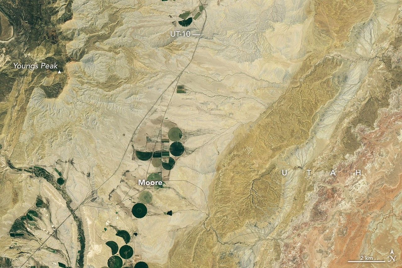
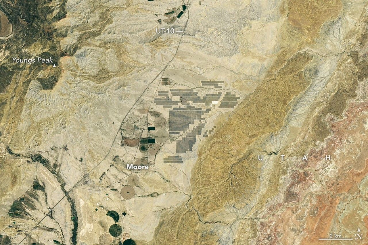
The nearly one million photovoltaic panels of a solar energy and battery storage facility in Utah appear in the right image, acquired with the OLI (Operational Land Imager) on Landsat 8 on June 6, 2026. The same sensor captured the left image on June 16, 2024. NASA Earth Observatory images by Lauren Dauphin.

Historically, central Utah’s Castle Valley has been a coal hub, with mining operations on the slopes of the Wasatch Plateau to the west active since the late 1800s. A different energy development arrived in the region in June 2026, when a large solar power and battery storage plant came online in the sunny valley about 130 miles (210 kilometers) southeast of Salt Lake City.

The recently constructed Green River Energy Center, seen in the Landsat 8 image above (right), features nearly one million solar panels and roughly 500 batteries on several square miles of previously undeveloped land. The facility has 400 megawatts of solar-generating capacity with another 400 megawatts of battery storage. That places it among the many utility-scale solar power and battery storage projects that the U.S. Energy Information Administration expects to be plugged into the country’s grid in 2026.

The Utah facility is slated to supply power to Salt Lake City and other areas across the state, according to news reports, and project staff estimate it could produce enough electricity for more than 100,000 homes. With its integrated battery storage, the plant has the potential to generate power at all hours, even when the Sun isn’t shining. And the Green River Energy Center can build on Castle Valley’s energy legacy by utilizing existing transmission lines originally built for coal-fired power plants in the area.

Though Utah adopted coal as its state rock and has long relied on it for energy, other sources, such as solar and geothermal, are becoming larger parts of the state’s energy mix. In 2025, coal fueled about half of the state’s electricity generation, down from about 75 percent in 2015. Meanwhile, solar grew to account for about 14 percent of generation in 2025, up from nearly zero a decade before. Satellite data can be useful to planners and policymakers involved in energy transitions for assessing the potential of renewable energy systems and tracking their adoption and performance.

NASA Earth Observatory images by Lauren Dauphin, using Landsat data from the U.S. Geological Survey. Story by Lindsey Doermann.

References & Resources

You may also be interested in:

Stay up-to-date with the latest content from NASA as we explore the universe and discover more about our home planet.

Picturing Earth in a New Light

3 min read

A recent analysis revealed where artificial light at night has intensified, as well as where it has diminished.

Article

Ahuachapán and Its Restive Neighbors

3 min read

From a geothermal hotspot to the one-time “Lighthouse of the Pacific,” the heat is on beneath the volcanic landscape of…

Article

A Moonlit Earth as Seen From Artemis II

4 min read

An astronaut’s photo, taken en route to the Moon, reveals our planet and its place in space in a novel…

Article

Powered by WPeMatico

Get The Details…

Curiosity Blog, Sols 4954–4960: Celebrating Our Rover Engineers Past and Present

Curiosity Blog, Sols 4954–4960: Celebrating Our Rover Engineers Past and Present

3 min read

Curiosity Blog, Sols 4954–4960: Celebrating Our Rover Engineers Past and Present

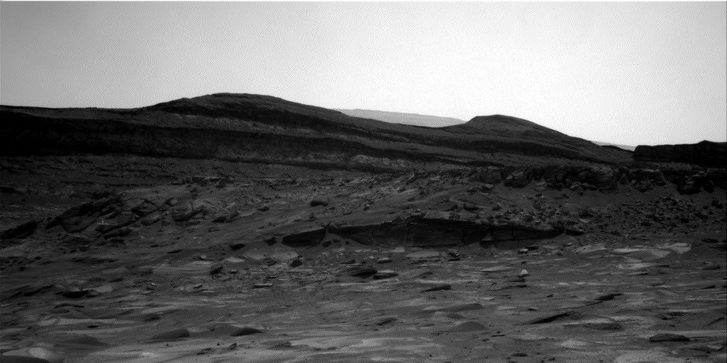
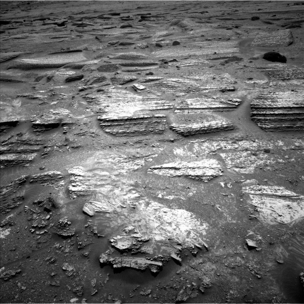
A black and white landscape photograph taken on Mars by the Curiosity rover. In the foreground, scattered rocks and uneven sandy terrain lead up to a rocky outcropping with distinct horizontal geological layers. Behind this ridge, dark, smooth-topped hills rise against a bright, featureless sky.
In this image acquired by NASA’s Mars rover Curiosity, the relatively light-toned bedrock in the foreground gives way to darker-toned rocks in the middle of the image, along what could be an erosional surface. Curiosity acquired the image using its Right Navigation Camera on July 15, 2026 — Sol 4955, or Martian day 4,955 of the Mars Science Laboratory mission — at 05:51:59 UTC.
NASA/JPL-Caltech

Written by Lucy Thompson, Senior Research Scientist, University of New Brunswick, Canada

Earth planning date: Friday, July 27, 2026

As an APXS uplink lead and strategic planner, I have the privilege of working with the rover engineers most days that I am on operations. The APXS instrument measures the chemistry of rocks, unconsolidated materials and the atmosphere, and is situated on the end of Curiosity’s robotic arm. This means that any target of interest that we wish to analyze has to be safe to deploy the arm, APXS, and MAHLI (the closeup imager) to. We therefore rely on the rover engineers for their assessment and to sequence the arm moves to place us safely on the targets. Recently, our workspaces have been dusty with varied relief, but the rover engineers have successfully found areas that they have been able to brush and deploy APXS and MAHLI. This week was no exception, despite some of our workspaces appearing less than ideal upon initial observation. The team managed to find rock targets of interest (x5), which the rover engineers were able to safely place the arm on and brush so that we could analyze them with APXS and MAHLI. This ensures that we acquire high-quality compositional data and images as we continue our ascent of Mount Sharp, through rock layers of varying tone and texture, tracking potential changes in chemistry, and the depositional and alteration environment. 

The rover engineers are also responsible for safely driving Curiosity to the areas of interest identified by the science team. They must assess the terrain for potential hazards such as large resistant blocks that could damage the rover wheels, sand/soil patches where we could get stuck, and high slopes that the rover could slip on. Despite unexpected damage to the wheels early in the mission and getting a little bogged down in some soil/sand just as we started to climb Mount Sharp, the engineers have successfully navigated us safely along more than 23 miles (37 kilometers) of drive distance and more than 4,400 feet (about 1.35 kilometers) of elevation gain. We recently requested to drive to specific locations in order to image what the team thinks could be an erosional surface within the Mg-sulfate/carbonate-bearing unit (see the image accompanying this post). Of course, the engineers were able to accommodate our desires, with the first stop crossed off in Monday’s plan, and the drive that is being planned this weekend taking us toward the next stop.

The rover engineers also ensure that our drilling activities execute safely and successfully, and are responsible for sequencing the arm motion required to deliver the drilled samples to our internal CheMin and SAM instruments. This required completely reconfiguring how we drill after a motor failed back in 2016, with extensive behind-the-scenes work at JPL for nearly a year and a half before we resumed. Curiosity has since drilled more than 20 rock targets.

So, thanks to the rover engineers and all the engineers and scientists on Curiosity’s team, we have had another full week of activities at Gale crater. We continue to track the chemistry, textures, tone and sedimentary structures of the sulfate/carbonate unit as we climb Mount Sharp and get ever closer to the Yardang unit with APXS, ChemCam, MAHLI and Mastcam. Curiosity continues to also monitor the local environment within Gale and the atmosphere in general. 

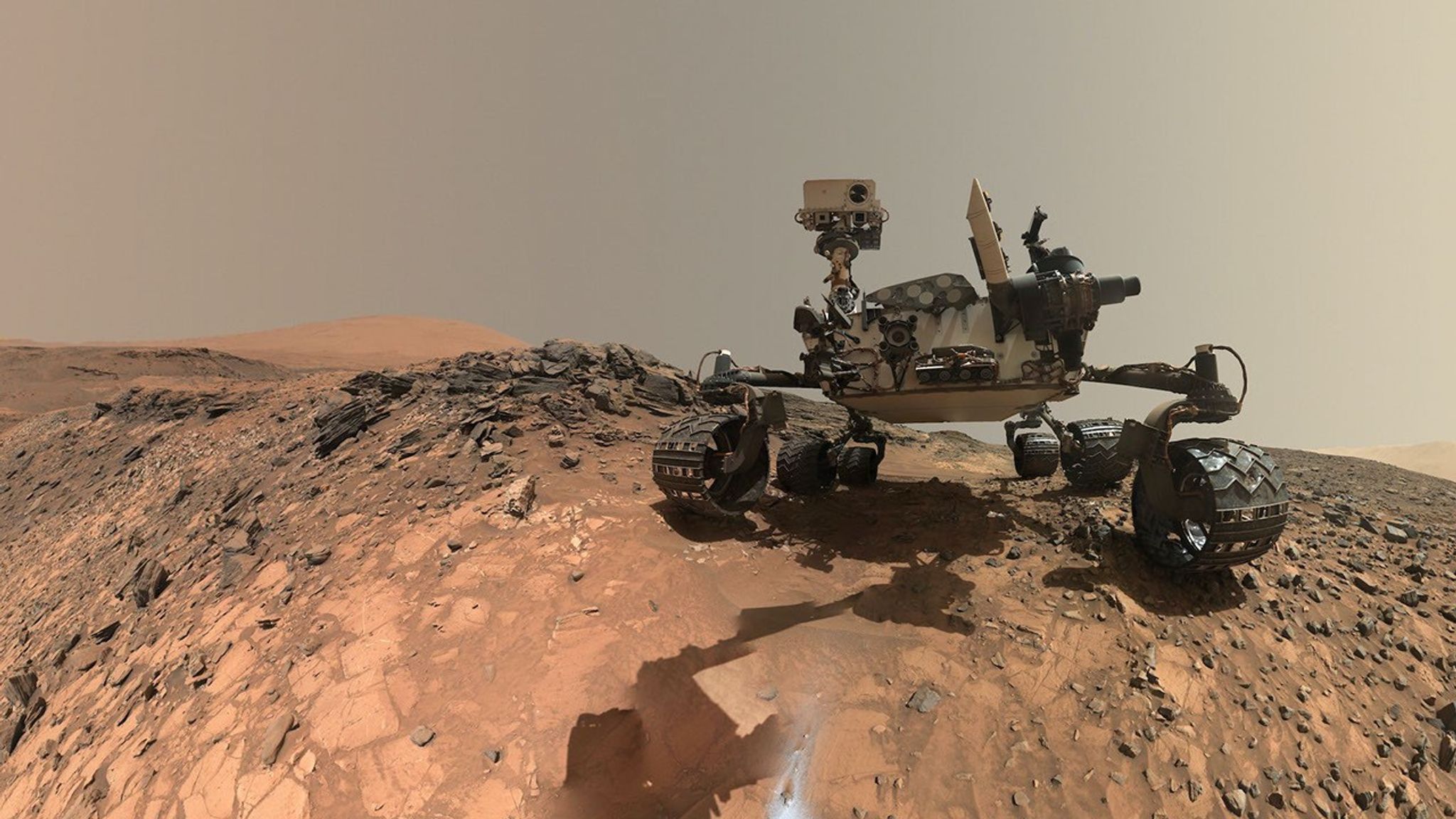
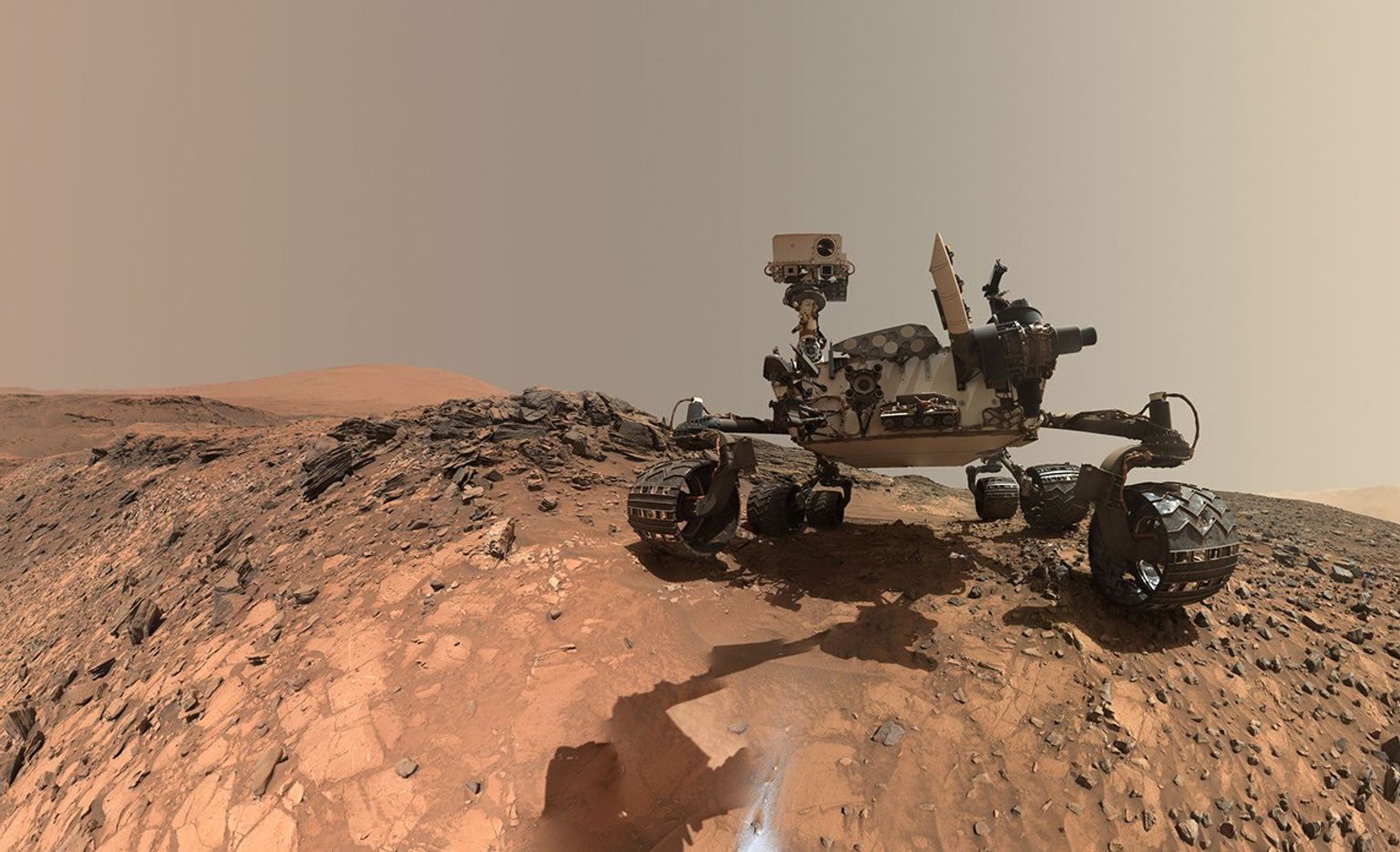
A rover sits on the hilly, orange Martian surface beneath a flat grey sky, surrounded by chunks of rock.
NASA’s Curiosity rover at the base of Mount Sharp
NASA/JPL-Caltech/MSSS

Share

Details

Last Updated
Jul 23, 2026

Related Terms

Powered by WPeMatico

Get The Details…