Curiosity Blog, Sols 4961-4967: Approaching a Break in the Rock Record?
3 min read
Curiosity Blog, Sols 4961-4967: Approaching a Break in the Rock Record?
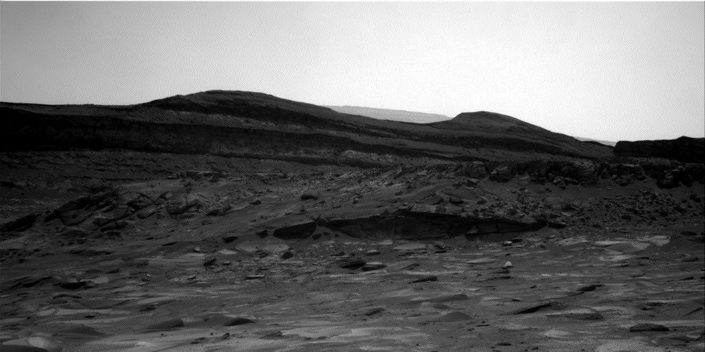
NASA’s Mars rover Curiosity acquired this image showing distant light-colored rocks sitting directly underneath dark-colored rocks, a possible “erosional supersurface” — a geologic term that describes places where layers of sediment have been stripped away by wind or water at a regional scale before newer layers are deposited atop them, marking a break in the rock record. Curiosity captured the image using its Left Navigation Camera on July 23, 2026 — Sol 4963, or Martian day 4,963 of the Mars Science Laboratory mission — at 15:53:13 UTC.
NASA/JPL-Caltech
Written by Abigail Fraeman, Deputy Project Scientist, Jet Propulsion Laboratory, California Institute of Technology
Earth planning date: Friday, July 24, 2026
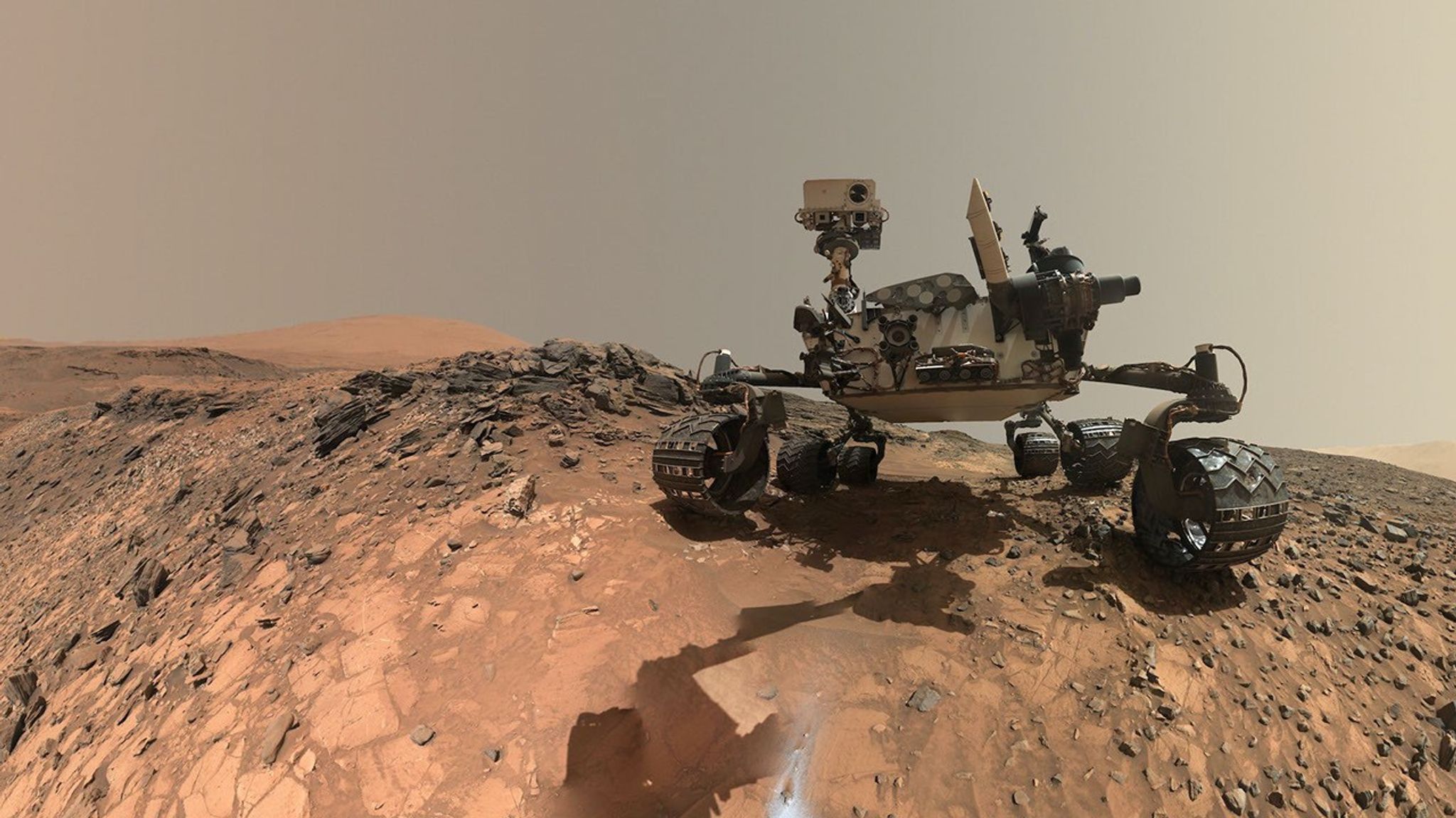
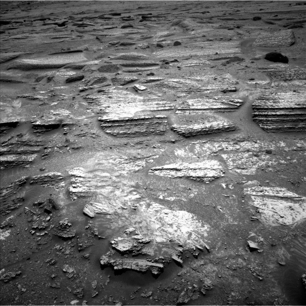
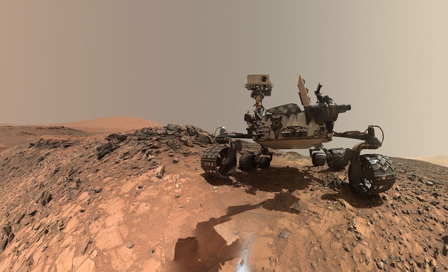
Curiosity spent the week continuing to climb her way up through the layers of Mount Sharp, exploring the sedimentary rock strip chart of Martian history. The rover has reached a layer where the science team had spotted a possible “erosional supersurface” by analyzing orbital data alongside images of the layers in the buttes above us. “Erosional supersurface” is a geologic term that describes places where layers of sediment have been stripped away by wind or water at a regional scale before newer layers are deposited atop them. These surfaces are common in wind-blown sand (aeolian) deposits, and they mark a break in the rock record. After eyeing this unusual section of Mount Sharp for the last few months, it’s exciting to finally be so close to this feature. Curiosity’s science instruments will give us the geologist’s-eye view of this region that we need to really understand this feature, including its composition and centimeter-scale geometry.
Our two plans this week focused on imaging the possible supersurface from a few different locations. This past weekend we backed away from the feature to get a good rover’s-eye view of the feature, which set us up nicely on Monday to collect two massive Mastcam mosaics across the entire layer. ChemCam provided additional support by collecting some long-distance RMI images of the most interesting areas of the supersurface. We also took the time to measure the composition of rocks at the bottom of this surface with a MAHLI and APXS target named “Monte Darwin” and ChemCam LIBS targets named “Patacamaya,” “Tarucachi,” and “Mojoncasa.”
Monday’s drive took us closer to the supersurface, while taking some MAHLI and Mastcam images of our wheels along the way, and the drive we planned today will bring us right up to the base of the layer. The science team was able to use Monday’s image to pick the most scientifically interesting spot to cross this surface, while also juggling constraints made by the reality of where we can drive our rather large rover — there’s some pretty sandy and steeply sloping terrain around here, so we also found a spot that looks like it’ll be one of the easier areas to traverse. Hopefully next week we’ll go up and over the supersurface — stay tuned.
NASA’s Roman Telescope to Carry 1.35 Million Names to Deep Space
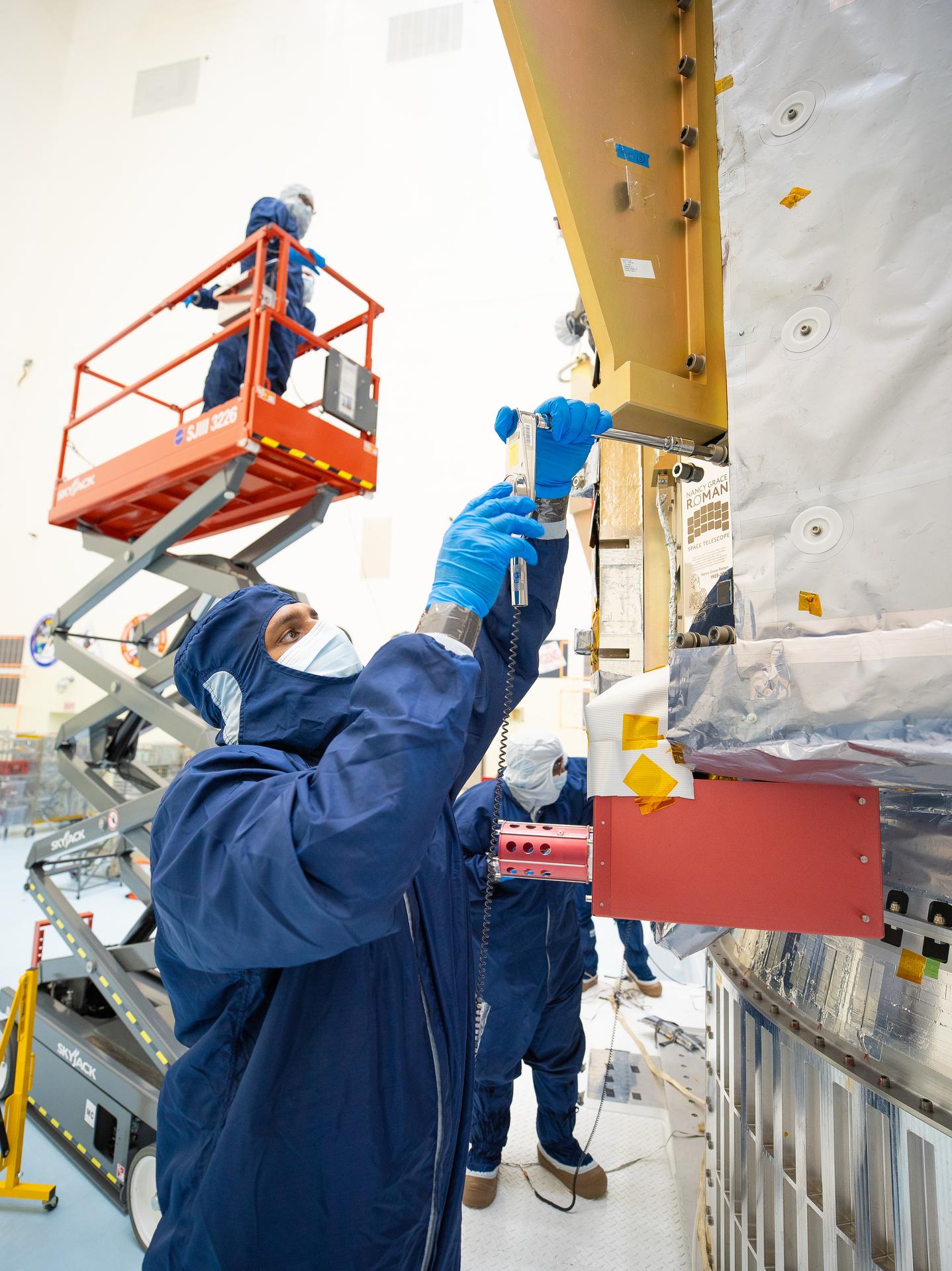
On July 27, technicians at NASA’s Kennedy Space Center in Florida installed a memory card containing 1,350,144 names as part of a commemorative plaque on the Nancy Grace Roman Space Telescope. The names were submitted by people globally, including astronauts from Artemis II and Artemis III. The memory card will travel with the Roman observatory to the Sun-Earth Lagrange point 2, or L2, about one million miles from Earth, where the Sun’s and Earth’s gravity balance out.
Roman is named after Dr. Nancy Grace Roman, NASA’s first chief astronomer and one of the architects of the agency’s modern science program. Roman championed space-based observatories that could study the universe from above Earth’s hazy atmosphere while making their data broadly available to the scientific community.
NASA and SpaceX are targeting launch for no earlier than 7:26 a.m. EDT Sunday, Aug. 30 aboard a SpaceX Falcon Heavy from Launch Complex 39A at Kennedy.
Discover the cosmos! Each day a different image or photograph of our fascinating universe is featured, along with a brief explanation written by a professional astronomer.
NGC 4372 and the Dark Doodad
Explanation: The Dark Doodad Nebula drifts through southern skies, a tantalizing target for binoculars toward the small constellation Musca, The Fly. A dusty interstellar cloud, it’s seen against rich starfields just south of the Coalsack Nebula and the Southern Cross. Stretching for about 3 degrees across this telescopic field of view, the Dark Doodad is punctuated near its southern tip (upper right) by yellowish globular star cluster NGC 4372. Of course NGC 4372 roams the halo of our Milky Way galaxy, a background object some 20,000 light-years away and only by chance along our line-of-sight to the Dark Doodad. About 700 light-years distant and over 30 light-years long, the Dark Doodad’s well defined silhouette belongs to the potentially star-forming Musca molecular cloud. The dusty Dark Doodad’s delightfully alliterative moniker was first coined by astro-imager and writer Dennis di Cicco in 1986 while observing Comet Halley from the Australian outback.
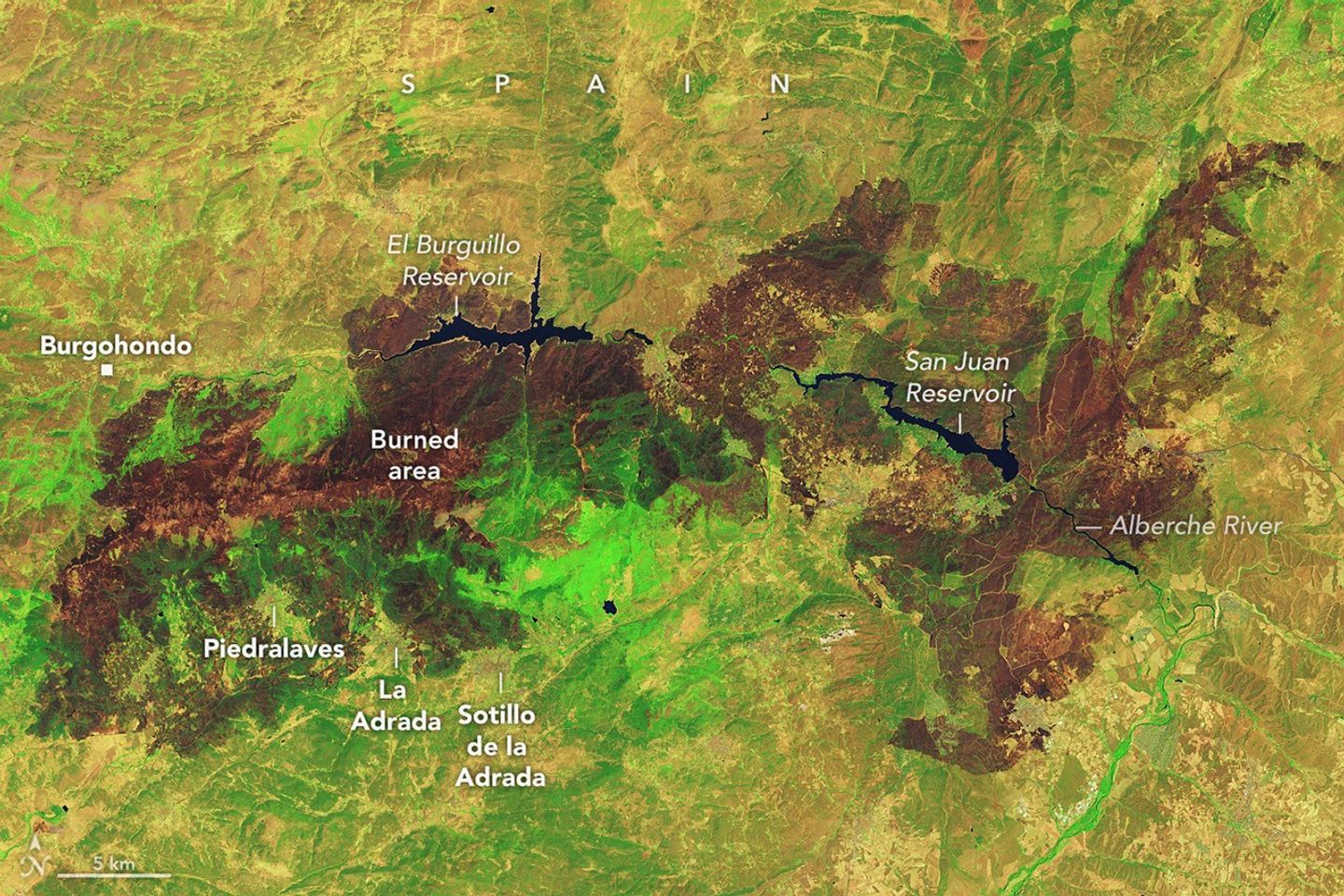
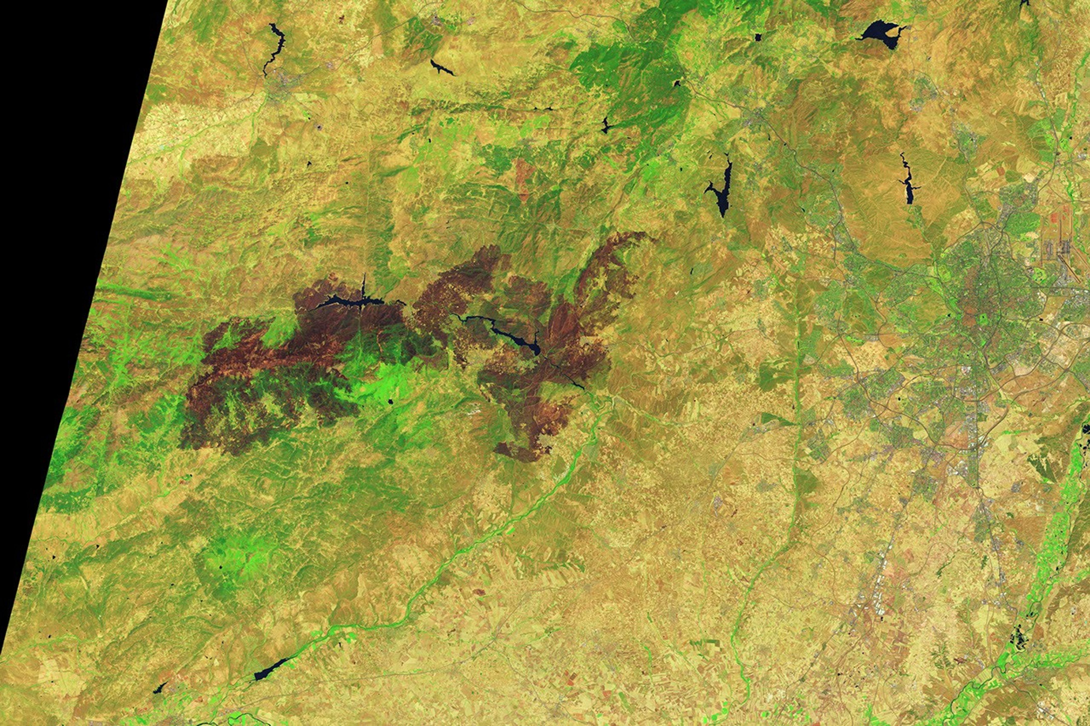
Charred landscapes surround reservoirs in central Spain in an image captured by the OLI (Operational Land Imager) on Landsat 9 on July 29, 2026. The false-color image combines observations at visible, near-infrared, and shortwave-infrared wavelengths (bands 6-5-3), making it easier to distinguish brown burned vegetation from green unburned vegetation.
NASA Earth Observatory / Lauren Dauphin
Wildland fires occur across Europe every summer, but those that erupted in Spain and France in July 2026 were among the largest and most disruptive the two countries have faced in decades. Some of the most consequential fires emerged in southwestern France’s Gironde Department and Spain’s Ávilaand Madrid provinces in mid-July, where blazes forced hundreds of thousands of people to evacuate and destroyed hundreds of homes.
Government officials in Spain say that a fire in Ávila, after charring around 50,000 hectares(124,000 acres), isthe largest on record, surpassing a blazethat burned in Larouco, Quiroga, and Oencia in 2025. NASA satellites first observed signs of the Ávila fire burning near Burgohondo on July 22 and July 23. By July 24, it had merged with fires in neighboring provinces, pushing the total area burned to 77,000 hectares, an area about the size of New York City.
The image above, captured by Landsat 9, shows charred landscapes around Burgohondo on July 29, 2026. In the false-color image, unburned vegetation appears light green, and burned areas appear brown. The two reservoirs in the center of the image were heavily affected. Flames tore through homes, restaurants, campgrounds, marinas, and other infrastructure surrounding the reservoirs, according to news reports.
A similar crisis unfolded in southwestern France, west of Bordeaux. One of the largest fires to burn in France this decade charred more than 42,000 hectares, prompting large-scale evacuations and devastating the village of Le Porge. As of late July, fires had burned more than 90,000 hectares across France, more than any other season in decades, according to data from the European Forest Fire Information System.
Environmental conditions months before the fires ignited made the landscape in both Spain and France particularly susceptible to burning, according to an analysis conducted by researchers with The State of Wildfires Project. Unusually wet winter weather enhanced vegetation growth in grasslands, shrublands, and forest understories, and then a series of sweltering heat waves and a period of drought parched the vegetation and primed it to burn. Several days of strong winds reaching 65 kilometers (40 miles) per hour at times served as the final trigger, the researchers found, fanning flames and encouraging rapid spread.
On July 25, conditions at fires in southwestern France grew so intense that French firefighters reported the formation of a pyrocumulonimbus—a towering type of “fire cloud” that draws convective energy from the heat of the fires. An international group of atmospheric scientists and fire experts who track the unusual clouds has documented the occasional formation of the clouds in Spain and Portugal in recent decades, but members of the group note that this is the first report of a fire in France producing one.
Thousands of firefighters and military personnel have battled fires in both countries. Crews have used aircraft to attack the fires with water and flame retardant, while teams on the ground have constructed firebreaks using tools ranging from bulldozers to hand tools. Firefighters gained the advantage by late July, allowing authorities to start lifting evacuation orders. However, forecasters are warning that the risk of fire in the coming days remains high due to the persistence of hot, dry conditions.
Government satellite data are part of a global system of observations used to track fire behavior and analyze emerging trends. Among the real-time wildfire monitoring tools that NASA makes available are FIRMS (Fire Information for Resource Management System) and the Worldview browser.
NASA Earth Observatory image by Lauren Dauphin, using Landsat data from the U.S. Geological Survey. Story by Adam Voiland.
Spacewalk Preps, Bioprinting, and Exercise Research Top Station Schedule
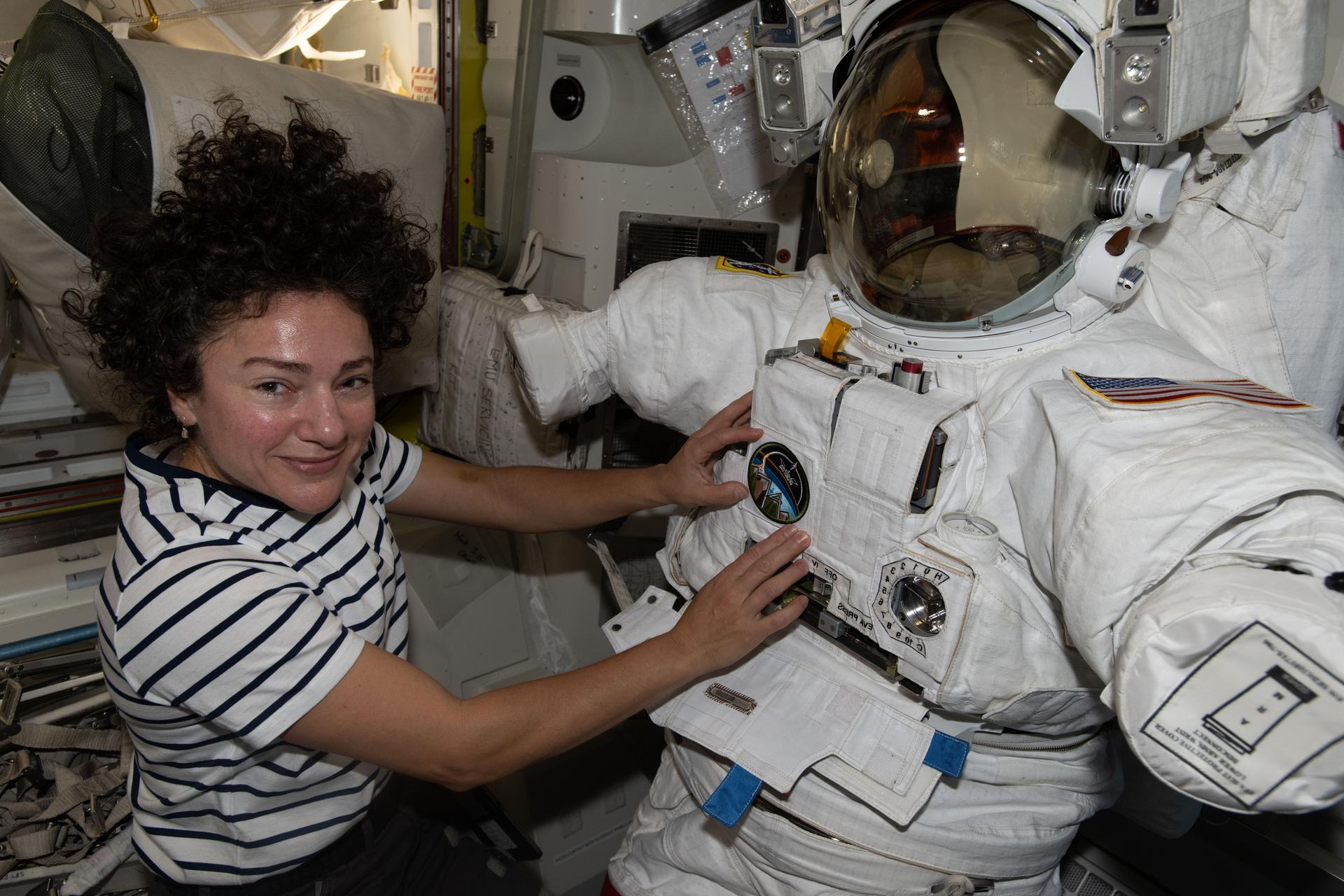
NASA astronaut Jessica Meir works inside the International Space Station’s Quest airlock installing leg and arm components on a spacesuit.
NASA/Jack Hathaway
Expedition 75 is gearing up for a busy August with three spacewalks planned at the International Space Station. The orbital residents are also printing living cells and tissues and studying how to increase the effectiveness of exercising in space.
Mission managers discussed a series of spacewalks and their associated tasks during a news conference on Thursday. NASA flight engineers Jessica Meir and Anil Menon will conduct the first spacewalk at 7:35 a.m. EDT on Thursday, August 6, for solar array work. NASA will soon announce the astronauts who will participate in the spacewalks scheduled on Aug. 13 and 25 for communications and electronics maintenance. All three spacewalks will be broadcast live on NASA+ and a variety of platforms.
Meir and Menon spent Thursday practicing using the spacewalking tools and familiarizing themselves with the parts they will use to prepare the orbital outpost for the future installation of its seventh roll out solar array to augment its power system. The astronauts also studied their spacewalking procedures, staged their spacesuits, and organized hardware inside the Quest airlock in advance of the upcoming excursion.
Bioprinting, or manufacturing living cells and tissues using bioinks, has been a key research objective aboard the space station for several years. The lack of gravity enables the cells to grow naturally in three dimensions resulting in higher-quality tissues than those produced on Earth. Flight engineers Jack Hathaway of NASA and Sophie Adenot of ESA (European Space Agency) partnered together in the Kibo laboratory module continuing the advanced biotechnology investigation. Adenot mixed cartilage cells with bioink then injected the mixture into cartridges. Next, Hathaway collected the cartridges from Adenot and loaded them inside the InSPA-Auxilium Bioprinter installed in Kibo’s Life Science Glovebox. The bioprinted samples will be frozen and returned to Earth for analysis. Results may lead to the development of advanced treatments for cartilage injuries on Earth and in space.
Hathaway and Adenot also took turns conducting exercise research with a futuristic suit and new equipment to stay fit in weightlessness. Adenot tried on the EasyMotion-2 Suit and jogged on the COLBERT treadmill in the Tranquility module. The suit sends electrical impulses and triggers muscle contractions to supplement a space workout. Hathaway performed a rowing session on the European Enhanced Exploration Exercise Device (E4D) installed in the Columbus laboratory module. The E4D is optimized for working out in microgravity and is being evaluated for use on future space exploration missions.
Roscosmos flight engineers Pyotr Dubrov and Anna Kikina took turns wearing virtual reality goggles and responding to computerized visual stimuli. The long-running Virtual experiment tests how a crew member’s sense of balance and direction adapts to microgravity. Flight engineer Andrey Fedyaev jogged on the Zvezda service module’s treadmill while attached to electrodes for a physical fitness assessment. Afterward, Fedyaev configured radiation detection hardware to measure the neutron environment the station is exposed to and studied materials that may shield a spacecraft from space radiation.