Sols 1151-1152: Rocky Roads in the Margin Unit

Sols 1151-1152: Rocky Roads in the Margin Unit

2 min read

Sols 1151-1152: Rocky Roads in the Margin Unit
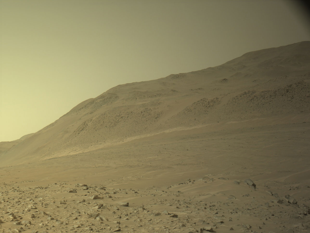
Perseverance’s afternoon view looking towards the northwest. The rocky terrain in the foreground is part of the margin unit that is currently being investigated by the team. Beyond lies Nereteva Vallis, an ancient river channel that the team hopes to explore in the coming weeks.
Mars Perseverance Sol 1150 – Left Navigation Camera: Perseverance’s afternoon view looking towards the northwest. The rocky terrain in the foreground is part of the margin unit that is currently being investigated by the team. Beyond lies Nereteva Vallis, an ancient river channel that the team hopes to explore in the coming weeks.
NASA/JPL-Caltech

Earth planning date: Wednesday, May 15, 2024

Recently, our intrepid rover has been channeling its namesake while navigating through difficult terrain as we march on through the margin unit. Despite the shorter drives, the team continues to make good progress investigating the rocks around us while scouting our traverse ahead.

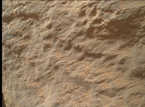
On Wednesday, we took advantage of being parked during a routine flight software update to take a closer look at the local rocks with our proximity science instruments. While there was limited outcrop in the vicinity of the rover, the team surveyed some options within reach and selected to abrade a target named “Old Faithful Geyser.” Such abrasion will allow us to look at a fresh and clean rock surface unobscured by dust or rock coatings. Since our last abrasion at the Bunsen Peak workspace almost 1 km to the east, the team has been working hard to understand the potential textural and compositional variability across the margin unit that may give important insight into the geologic history of these rocks. Following abrasion, the team will plan detailed chemical measurements with the PlXL instrument over the weekend.

In addition to our abrasion activities, we planned some remote science observations on nearby rocks with the SuperCam and Mastcam-Z instruments. Mastcam-Z was also used to acquire longer distance imaging looking east down into Neretva Vallis, an ancient river valley carved by water over 3 billion years ago. After wrapping up our investigations of the abrasion patch, Perseverance will head a short distance northwest to a high point named Overlook Mountain. There the team will assess a potential traverse path down into Neretva Vallis to take advantage of more benign terrain and investigate outcrops and boulders within the valley. Such investigations will hopefully reveal important clues about the timing of geologic events in Jezero and the relationship of the margin unit rocks with the surrounding units.

Written by Bradley Garczynski, Postdoctoral Scientist at Western Washington University

Share

Details

Last Updated
May 22, 2024

Related Terms

Powered by WPeMatico

Get The Details…

Sols 4191-4192: Communication

Sols 4191-4192: Communication

2 min read

Sols 4191-4192: Communication

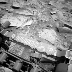
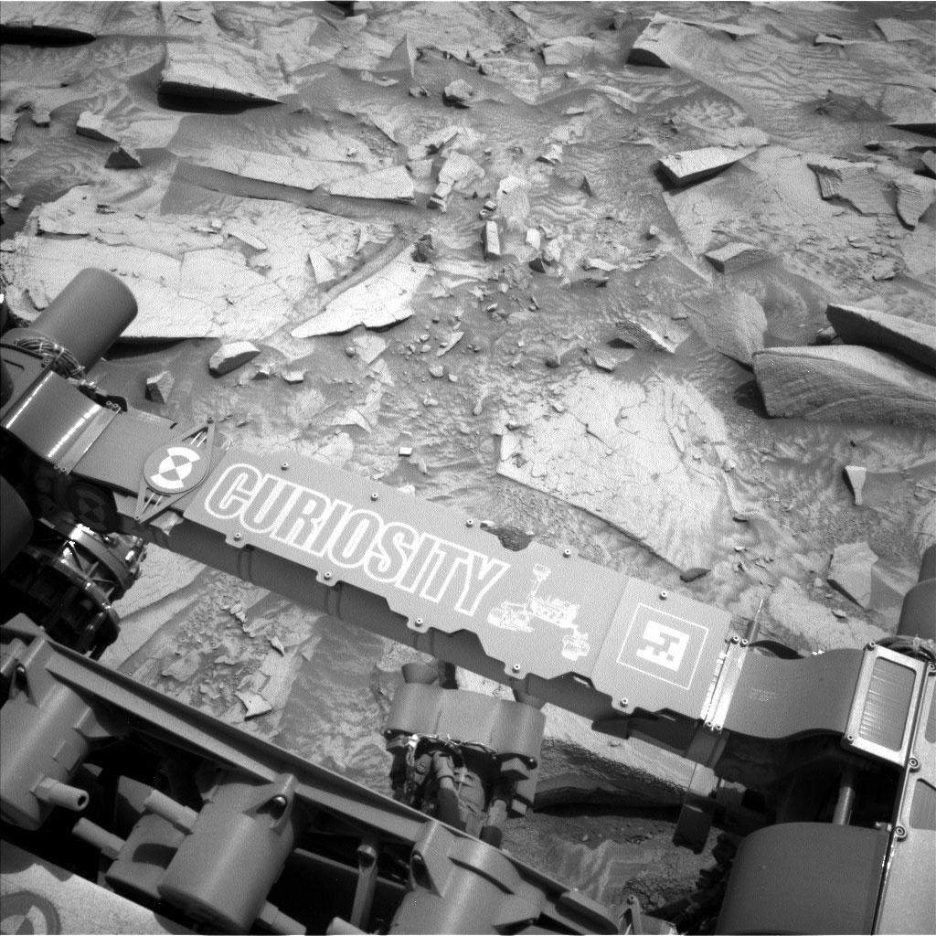
This image was taken by Left Navigation Camera onboard NASA's Mars rover Curiosity on Sol 4190 (2024-05-20 07:37:47 UTC).
This image was taken by Left Navigation Camera onboard NASA’s Mars rover Curiosity on Sol 4190 (2024-05-20 07:37:47 UTC).
NASA/JPL-Caltech

Earth planning date: Monday, May 20, 2024

A number of national holidays are taking place around the world this week and next, unofficially marking the start of summer for residents of the northern hemisphere. Holidays and extended weekends are seen as a time to catch up with family and friends, often centered around food and meaningful conversation. As a Canadian, my family, friends, and several of my Curiosity colleagues back in Canada may be doing exactly that for Victoria Day right now as I write today’s blog from St. Louis Missouri, where I am currently engulfed by the steady and deafening drone of a double brood of both 13-year and 17-year periodical cicadas communicating with each other, something that hasn’t happened since 1803.

While Curiosity may not know a holiday, it too is transitioning to summer, with perihelion only just recently passed and (southern) summer solstice a mere couple weeks ahead. Curiosity’s operations are not only supported by a number of team members located all over the world, but also by multiple spacecraft orbiting Mars (as well as their respective teams). These orbital assets provide vital communication relays, primarily from Mars to Earth. 

It was a pretty standard Monday plan for our intrepid rover, with the science team electing to utilize the rover’s contact science instruments before a drive in the first sol of a two-sol plan. Activities focused primarily on the “Pine Creek” target, located roughly in the center of the prominent bedrock block just above the aptly designed QR code on Curiosity’s arm. Post-brush compositional analyses by APXS and ChemCam were complemented by images acquired by MAHLI and Mastcam. Prior to a ~30 m dogleg drive, Mastcam also acquired images of “Fairview Dome,” “Pika Lake,” “Whitebark Pass,” and “Wilkerson Butte.” A lengthy DAN passive activity also featured prominently on the first sol. The second sol of the plan included ChemCam AEGIS, a Navcam suprahorizon movie, and SAM cleaning activity following up its atmospheric analysis over the weekend.

Written by Scott VanBommel, Planetary Scientist at Washington University

Share

Details

Last Updated
May 22, 2024

Related Terms

Powered by WPeMatico

Get The Details…

2024 Dream with Us Design Challenge Winners

2024 Dream with Us Design Challenge Winners

1 min read

Preparations for Next Moonwalk Simulations Underway (and Underwater)

Dream with Us graphic, showing a female African American dreaming up aeronautics ideas.

Congratulations! Our 2024 Dream with Us challenge has concluded, and we are pleased to share the winning projects:

Middle School

1st Place: The Unstoppable Changemakers Team
(Anika J. and Aidan R.)

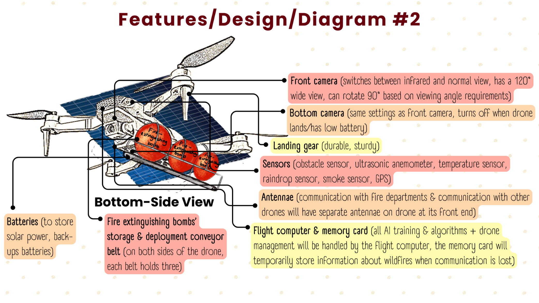
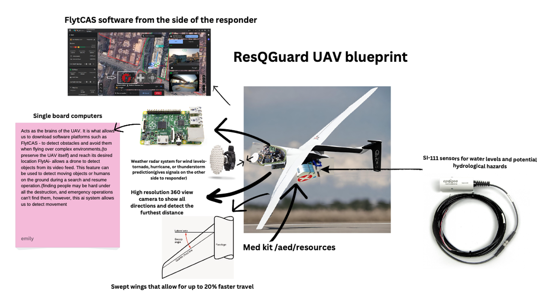
Middle School winning entry in the 2024 Dream with Us contest, drone concept diagram.

2nd Place: Aerial Disaster Response Association Team
(Adhavan B., Sanat N., Ganesh P., Carl S.)

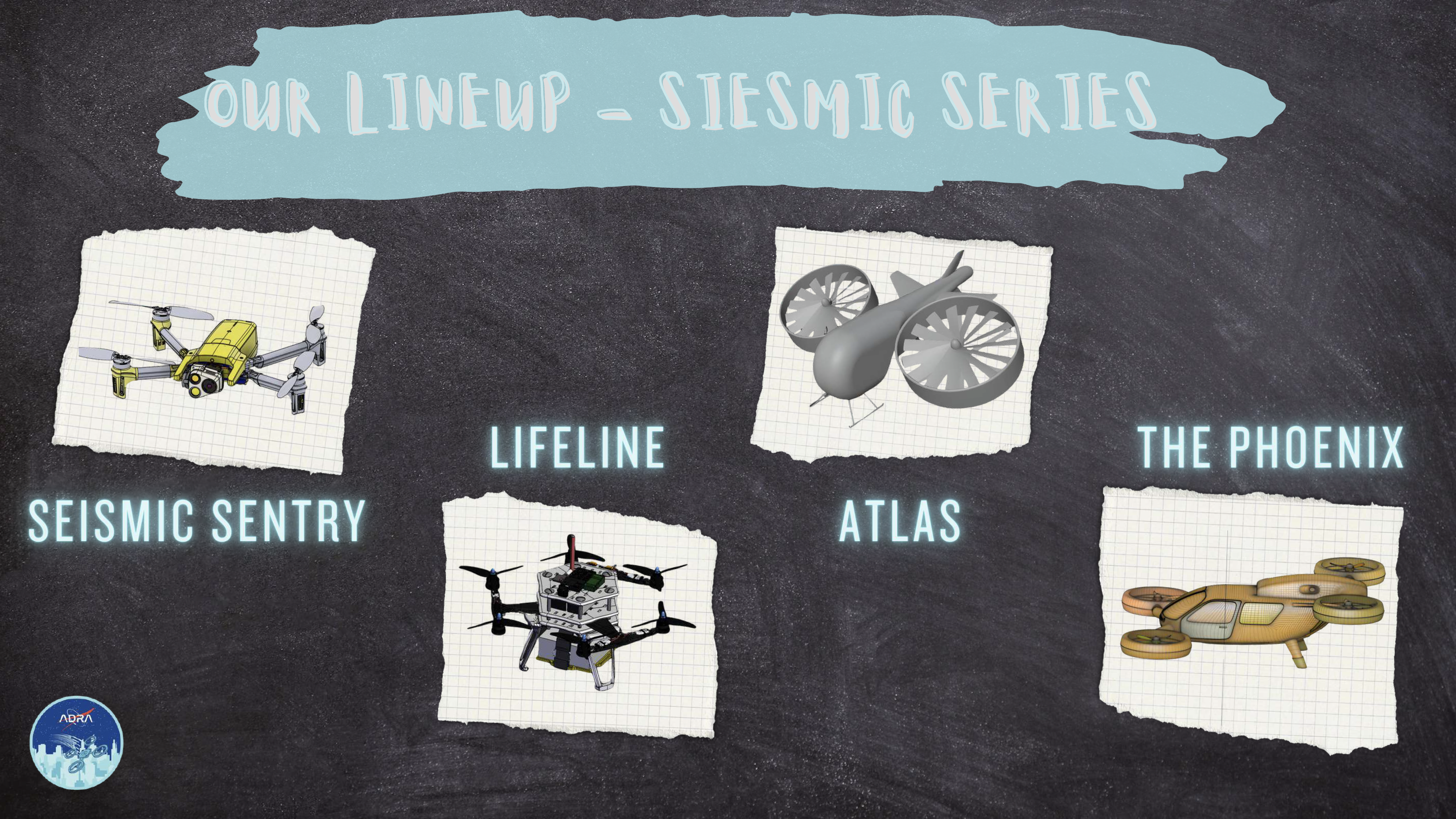
Middle School 2nd place winning entry in the 2024 Dream with Us contest, drone concepts.

3rd Place: J.A.N.S. Team
(Jason P., Aditya B., Nathan V., Sai Niranjan S.)

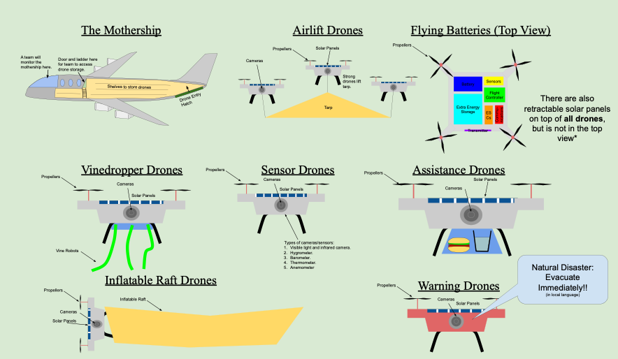
Middle School 3rd place winning entry in the 2024 Dream with Us contest, drone concepts.

High School

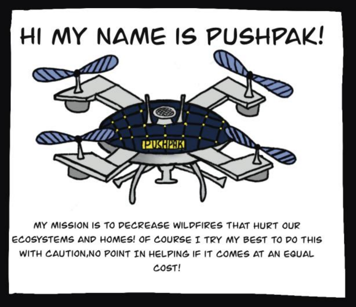
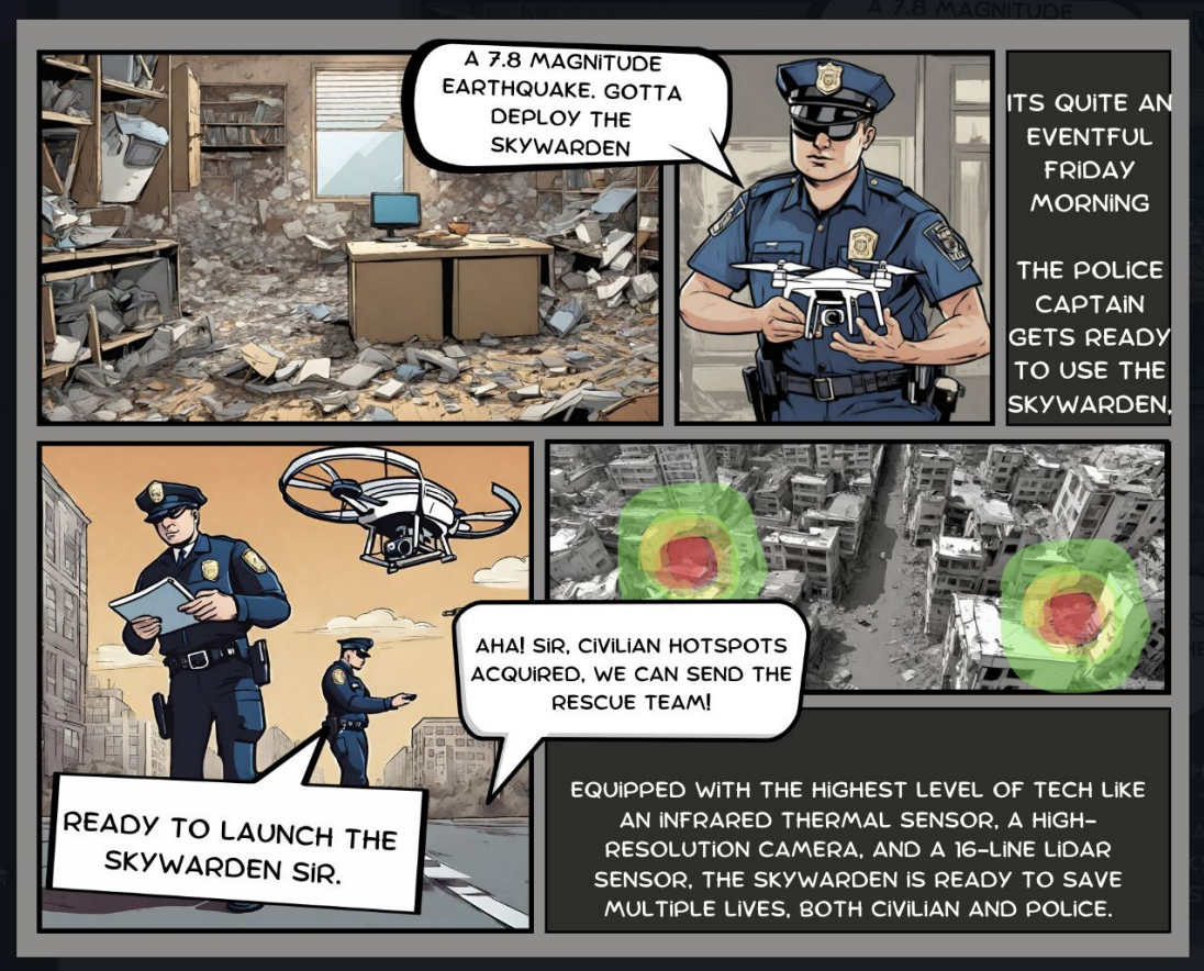
1st Place: PUSHPAK Team
(Devin W. and Isabel R.)

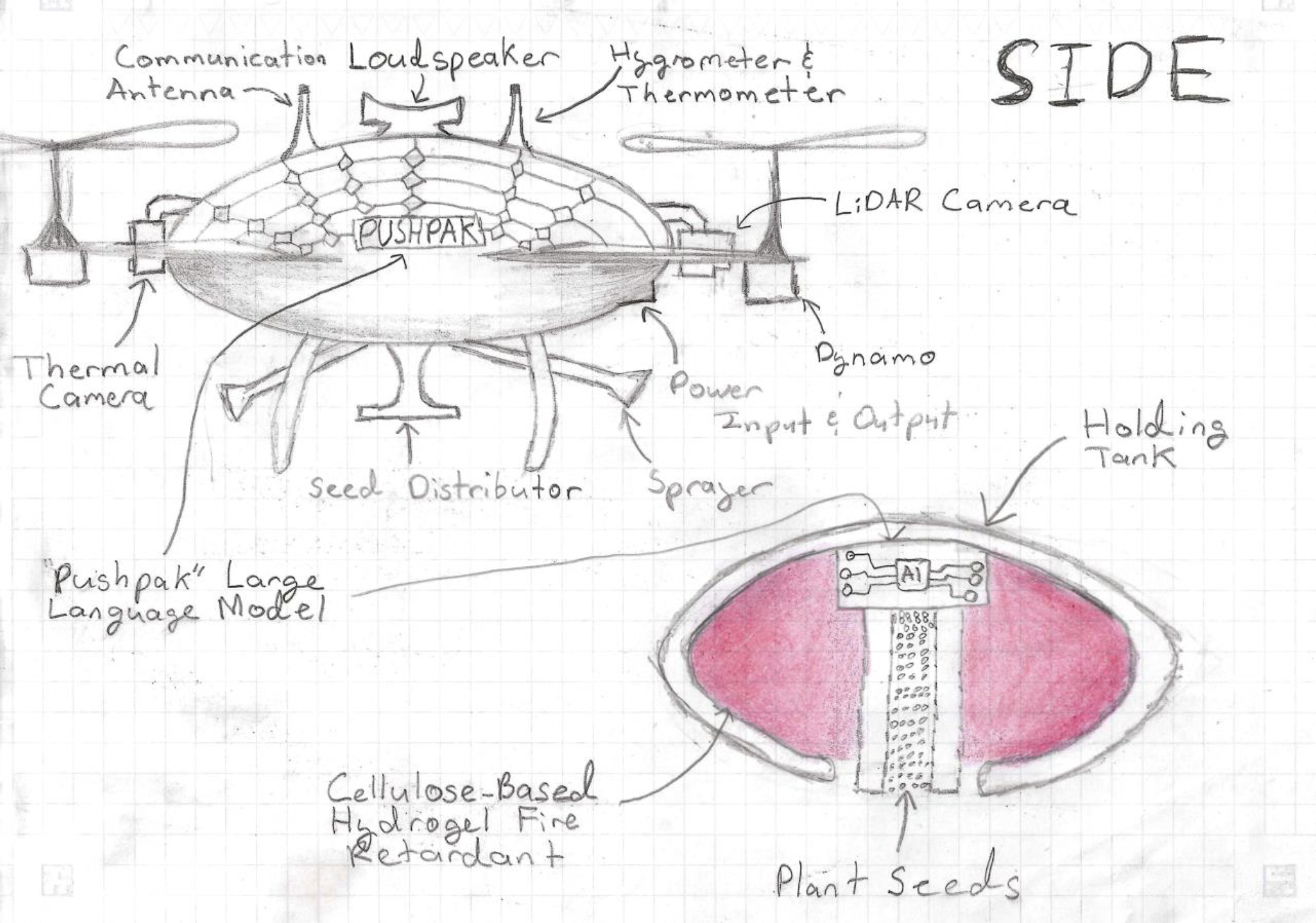
High School winning entry in the 2024 Dream with Us contest. Concept drawing of the drone.
High School winning entry in the 2024 Dream with Us contest comic concept.

2nd Place: AirRescue Team
(Sarthak K. and Advaith S.)

High School 2nd place winning entry in the 2024 Dream with Us contest poster concept.
High School 2nd place winning entry in the 2024 Dream with Us contest comic strip concept.

3rd Place: Flight Fusion Team
(Emily A. and Zahraa A.)

High School 3rd place winning entry in the 2024 Dream with Us contest, drone concept.
High School 3rd place winning entry in the 2024 Dream with Us contest, poster concept.

Share

Details

Last Updated

May 21, 2024

Editor
Lillian Gipson
Contact
Jim Banke

Powered by WPeMatico
Get The Details…
Lillian Gipson

Modeling the Hawaiian Shoreline

Modeling the Hawaiian Shoreline

The island of Hawai'i is black, with streaks of orange and purple. There is a big orange spot (near center). The water around the island is, going from left to right, orange and red. The coastline has a blue line along it, indicating high flood risk.
NASA/Lisa Tanh, Matilda Anokye, Ian Lee, Connor Racette

The island of Hawai’i and surrounding waters glow in unusual shades in this 2022 model made through NASA DEVELOP. The model was created to help the County of Hawai’i in their shoreline setback plan. The image shows areas of high flood risk (blue), as well as sea surface temperatures. Orange in the west indicates high temperatures, while red in the east represents low temperatures.

NASA DEVELOP projects bridge the gap between NASA’s Earth science data and society, addressing environmental concerns and enhancing decision-making to improve life here on Earth. Learn more about NASA’s Capacity Building Programs and applied Earth science at NASA.

Image Credit: NASA/Lisa Tanh, Matilda Anokye, Ian Lee, Connor Racette

Powered by WPeMatico

Get The Details…
Monika Luabeya

NASA’s Heliophysics Experiment to Study Sun on European Mission

NASA’s Heliophysics Experiment to Study Sun on European Mission

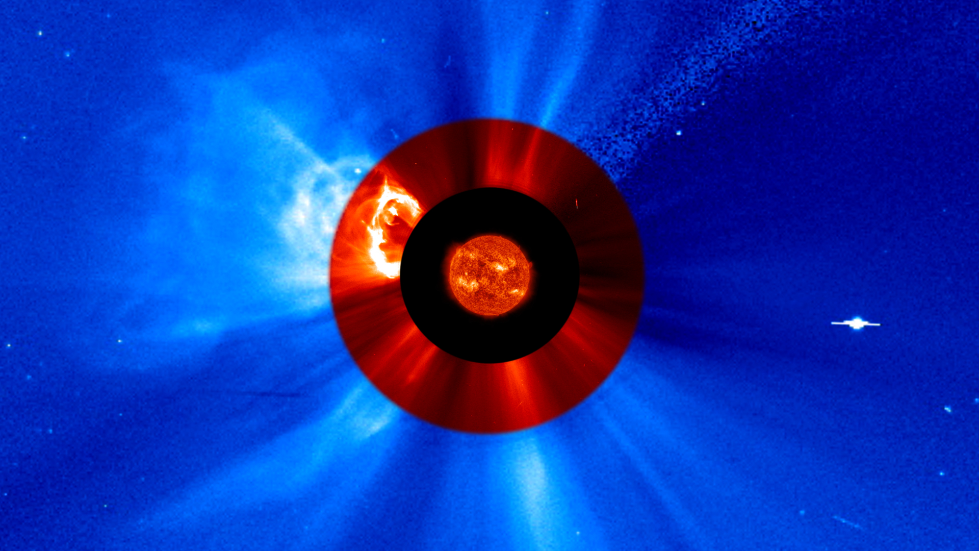
The Joint EUV coronal Diagnostic Investigation (JEDI) will fly aboard the European Space Agency’s Vigil space weather mission and capture new views that will help researchers connect features on the Sun’s surface to those in the Sun’s outer atmosphere, the corona.
Credits: NASA

NASA announced Tuesday it selected a new instrument to study the Sun and how it creates massive solar eruptions. The agency’s Joint EUV coronal Diagnostic Investigation, or JEDI, will capture images of the Sun in extreme ultraviolet light, a type of light invisible to our eyes but reveals many of the underlying mechanisms of the Sun’s activity.

Once integrated aboard the ESA’s (European Space Agency’s) Vigil space weather mission, JEDI’s two telescopes will focus on the middle layer of the solar corona, a region of the Sun’s atmosphere that plays a key role in creating the solar wind and the solar eruptions that cause space weather.

The Vigil space mission, planned to launch in 2031, is expected to provide around-the-clock space weather data from a unique position at Sun-Earth Lagrange point 5 – a gravitationally stable point about 60 degrees behind Earth in its orbit. This vantage point will give space weather researchers and forecasters a new angle to study the Sun and its eruptions. NASA’s JEDI will be the first instrument to provide a constant view of the Sun from this perspective in extreme ultraviolet light – giving scientists a trove of new data for research, while simultaneously supporting Vigil’s ability to monitor space weather. 

“JEDI’s observations will help us link the features we see on the Sun’s surface with what we measure in the solar atmosphere, the corona,” said Nicola Fox, associate administrator, Science Mission Directorate at NASA Headquarters in Washington. “Combined with Vigil’s first-of-its-kind, eagle eye view of the Sun, this will change the way we understand the Sun’s drivers of space weather – which in turn can lead to improved warnings to mitigate space weather effects on satellites and humans in space as well as on Earth.”

The project is led by Don Hassler at the Southwest Research Institute in Boulder, Colorado. The instrument is funded by the NASA Heliophysics Space Weather Program with a total cost not to exceed $45 million. Management oversight will be provided by the Living With a Star Program of the Explorers & Heliophysics Projects Division at NASA’s Goddard Space Flight Center in Greenbelt, Maryland.

For more information on NASA heliophysics missions, visit:

https://science.nasa.gov/heliophysics

-end-

Karen Fox
Headquarters, Washington
202-358-1600
karen.fox@nasa.gov

Sarah Frazier
NASA’s Goddard Space Flight Center
202-853-7191
sarah.frazier@nasa.gov

Share

Details

Last Updated

May 21, 2024

Powered by WPeMatico
Get The Details…
Tiernan P. Doyle