NASA’s Juno Gets a Close-Up Look at Lava Lakes on Jupiter’s Moon Io

NASA’s Juno Gets a Close-Up Look at Lava Lakes on Jupiter’s Moon Io

6 min read

Preparations for Next Moonwalk Simulations Underway (and Underwater)

Jupiter’s moon Io
The JunoCam instrument aboard NASA’s Juno spacecraft captured two volcanic plumes rising above the horizon of Jupiter’s moon Io. The image was taken Feb. 3 from a distance of about 2,400 miles (3,800 kilometers).
Image data: NASA/JPL-Caltech/SwRI/MSSS, Image processing by Andrea Luck (CC BY)

Infrared imagery from the solar-powered spacecraft heats up the discussion on the inner workings of Jupiter’s hottest moon.

New findings from NASA’s Juno probe provide a fuller picture of how widespread the lava lakes are on Jupiter’s moon Io and include first-time insights into the volcanic processes at work there. These results come courtesy of Juno’s Jovian Infrared Auroral Mapper (JIRAM) instrument, contributed by the Italian Space Agency, which “sees” in infrared light. Researchers published a paper on Juno’s most recent volcanic discoveries on June 20 in the journal Nature Communications Earth and Environment.

Io has intrigued the astronomers since 1610, when Galileo Galilei first discovered the Jovian moon, which is slightly larger than Earth’s Moon. Some 369 years later, NASA’s Voyager 1 spacecraft captured a volcanic eruption on the moon. Subsequent missions to Jupiter, with more Io flybys, discovered additional plumes — along with lava lakes. Scientists now believe Io, which is stretched and squeezed like an accordion by neighboring moons and massive Jupiter itself, is the most volcanically active world in the solar system. But while there are many theories on the types of volcanic eruptions across the surface of the moon, little supporting data exists.

In both May and October 2023, Juno flew by Io, coming within about 21,700 miles (35,000 kilometers) and 8,100 miles (13,000 kilometers), respectively. Among Juno’s instruments getting a good look at the beguiling moon was JIRAM.

Infrared data
Infrared data collected Oct. 15, 2023, by the JIRAM instrument aboard NASA’s Juno shows Chors Patera, a lava lake on Jupiter’s moon Io. The team believes the lake is largely covered by a thick, molten crust, with a hot ring around the edges where lava from Io’s interior is directly exposed to space.
NASA/JPL-Caltech/SwRI/ASI/INAF/JIRAM/MSSS

Designed to capture the infrared light (which is not visible to the human eye) emerging from deep inside Jupiter, JIRAM probes the weather layer down to 30 to 45 miles (50 to 70 kilometers) below the gas giant’s cloud tops. But during Juno’s extended mission, the mission team has also used the instrument to study the moons Io, Europa, Ganymede, and Callisto. The JIRAM Io imagery showed the presence of bright rings surrounding the floors of numerous hot spots.

“The high spatial resolution of JIRAM’s infrared images, combined with the favorable position of Juno during the flybys, revealed that the whole surface of Io is covered by lava lakes contained in caldera-like features,” said Alessandro Mura, a Juno co-investigator from the National Institute for Astrophysics in Rome. “In the region of Io’s surface in which we have the most complete data, we estimate about 3% of it is covered by one of these molten lava lakes.” (A caldera is a large depression formed when a volcano erupts and collapses.)

Fire-Breathing Lakes

JIRAM’s Io flyby data not only highlights the moon’s abundant lava reserves, but also provides a glimpse of what may be going on below the surface. Infrared images of several Io lava lakes show a thin circle of lava at the border, between the central crust that covers most of the lava lake and the lake’s walls. Recycling of melt is implied by the lack of lava flows on and beyond the rim of the lake, indicating that there is a balance between melt that has erupted into the lava lakes and melt that is circulated back into the subsurface system.

This animation is an artist’s concept of Loki Patera, a lava lake on Jupiter’s moon Io, made using data from the JunoCam imager aboard NASA’s Juno spacecraft. With multiple islands in its interior, Loki is a depression filled with magma and rimmed with molten lava. NASA/JPL-Caltech/SwRI/MSSS

“We now have an idea of what is the most frequent type of volcanism on Io: enormous lakes of lava where magma goes up and down,” said Mura. “The lava crust is forced to break against the walls of the lake, forming the typical lava ring seen in Hawaiian lava lakes. The walls are likely hundreds of meters high, which explains why magma is generally not observed spilling out of the paterae” — bowl-shaped features created by volcanism — “and moving across the moon’s surface.”

JIRAM data suggests that most of the surface of these Io hot spots is composed of a rocky crust that moves up and down cyclically as one contiguous surface due to the central upwelling of magma. In this hypothesis, because the crust touches the lake’s walls, friction keeps it from sliding, causing it to deform and eventually break, exposing lava just below the surface.

An alternative hypothesis remains in play: Magma is welling up in the middle of the lake, spreading out and forming a crust that sinks along the rim of the lake, exposing lava.

“We are just starting to wade into the JIRAM results from the close flybys of Io in December 2023 and February 2024,” said Scott Bolton, principal investigator for Juno at the Southwest Research Institute in San Antonio. “The observations show fascinating new information on Io’s volcanic processes. Combining these new results with Juno’s longer-term campaign to monitor and map the volcanoes on Io’s never-before-seen north and south poles, JIRAM is turning out to be one of the most valuable tools to learn how this tortured world works.”

Juno executed its 62nd flyby of Jupiter — which included an Io flyby at an altitude of about 18,175 miles (29,250 kilometers) — on June 13. The 63rd flyby of the gas giant is scheduled for July 16.

More About the Mission

NASA’s Jet Propulsion Laboratory, a division of Caltech in Pasadena, California, manages the Juno mission for the principal investigator, Scott Bolton, of the Southwest Research Institute in San Antonio. Juno is part of NASA’s New Frontiers Program, which is managed at NASA’s Marshall Space Flight Center in Huntsville, Alabama, for the agency’s Science Mission Directorate in Washington. The Italian Space Agency (ASI) funded the Jovian InfraRed Auroral Mapper. Lockheed Martin Space in Denver built and operates the spacecraft.

More information about Juno is available at:

https://science.nasa.gov/mission/juno

News Media Contacts

DC Agle
Jet Propulsion Laboratory, Pasadena, Calif.
818-393-9011
agle@jpl.nasa.gov

Karen Fox / Charles Blue
NASA Headquarters
202-385-1287 / 202-802-5345
karen.c.fox@nasa.gov / charles.e.blue@nasa.gov

Deb Schmid
Southwest Research Institute, San Antonio
210-522-2254dschmid@swri.org

Share

Details

Last Updated

Jun 26, 2024

Powered by WPeMatico

Get The Details…
Anthony Greicius

Mycotecture off Planet: En route to the Moon and Mars

Mycotecture off Planet: En route to the Moon and Mars

4 min read

Preparations for Next Moonwalk Simulations Underway (and Underwater)

Artist concept depicting a new novel aerospace concept for NIAC Phase 3 2024. Lab above Earth with LEO spacecraft above it. Moon, mars and in distance.
Artist concept depicting a new novel aerospace concept for NIAC Phase III 2024.
Credit: Lynn Rothschild

Lynn Rothschild
NASA Ames Research Center (ARC)

A turtle carries its habitat. While reliable, it costs energy in transporting mass. NASA makes the same trade-off when it transports habitats and other structures off planet “on the back” of its missions. While this approach is reliable, to save upmass and increase mission flexibility, NASA must be more like a bird, low mass, agile and building structures from local resources. We identified a novel biology-based solution to the in situ production of usable structures for space exploration: using fungal mycelial (myco) composites to grow structures off-planet, from habitats to furniture to tableware. As a living material it has the potential to self heal, self replicate, be bioengineered, and enhanced with materials such as metals and melanin. Prior performance: During Phase 1, we raised the TRL to 2 by assessing the growth of fungi on different food substrates and analyzing their use on Mars and Earth. In Phase II we completed TRL 3 for an integrated system of inflatables and myco-material production. We designed prototypes and subsystems. We performed proof-of-concepts analyzing myco-material function before and after exposure to relevant environments in a planetary simulator. Our Phase II report and publications documented analytical and experimental results on fungal and inflatable components of the system validating prediction of key parameters. Phase II developed the Phase I mission concept, with an Artemis-inspired focus towards lunar habitats with a “feed forward to Mars” concept.

We assessed fungal/algal/bacterial mixtures by testing different combinations at different temperatures with different food sources, and developed a high throughput, reproducible method for producing fungal materials. We tested sand and regolith simulant composites for in situ material construction. We developed prototypes in silicone scale models, and a 4X4 m model of inflatable architecture and grew a mycelium dome on top. We determined the effect of simulated extraterrestrial conditions on materials showing hyphal damage under UV. By tuning different steps of production, we can change the mechanical properties of the mycelium biocomposites as they undergo compression. We incorporated melanin-producing strains into experiments and models for radiation protection. We drafted designs for mycelium-based lunar habitats. We utilized the 500-Day DRM to the Apollo 15 Hadley-Apenine Region to define science objective and infrastructure requirements to support extended exploration missions to the Moon and Mars, identifying critical gaps that can be filled by mycotecture. Archetypes were drafted per this DRM. Terrestrial applications demonstrated the spin-off potential of the NIAC technology from habitats to tableware.

Innovation and Benefits: If we succeed in developing a fungal biocomposite that can grow itself, we will provide NASA with a radically new, cheaper, faster, more flexible, lighter and sustainable material for extended duration Lunar and Mars mission habitats, as well as for furniture and other structures in flight or at destination.

Milestones and Transition Strategy: The mission context of Phase I was Martian habitats. Mindful of the more immediate focus on Artemis, Phase II focused on a lunar implementation, with a DRM for a 500 day mission to the Apollo 15 Hadley-Max region and the south polar region. En route to realizing these visions, we have identified two intermediate opportunities, both of which require NIAC Phase III funding. They are to (1) test mycotecture suitability and growth in LEO by the integration into an orbiting space station, Starlab, and (2) test mycotecture habitat prototypes on the lunar surface through a CLPS mission. To participate in Starlab, we will develop prototypes for this application and then team with Starlab LLC to raise funding to produce flight-ready structures. To be competitive for a CLPS mission, we will use NIAC funding to raise the technology to TRL6 for this lunar demo mission.

Back to NIAC 2024

Share

Details

Last Updated

Jun 26, 2024

Editor
Loura Hall

Powered by WPeMatico

Get The Details…
Loura Hall

Pillars of Creation Star in New Visualization from NASA’s Hubble and Webb Telescopes

Pillars of Creation Star in New Visualization from NASA’s Hubble and Webb Telescopes

6 Min Read

Pillars of Creation Star in New Visualization from NASA’s Hubble and Webb Telescopes

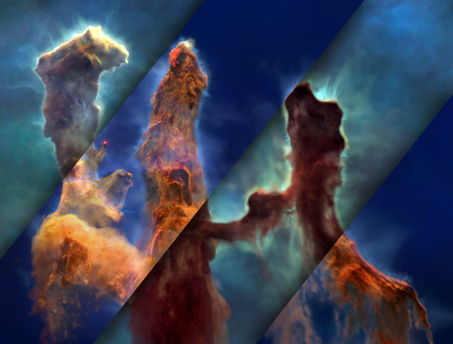
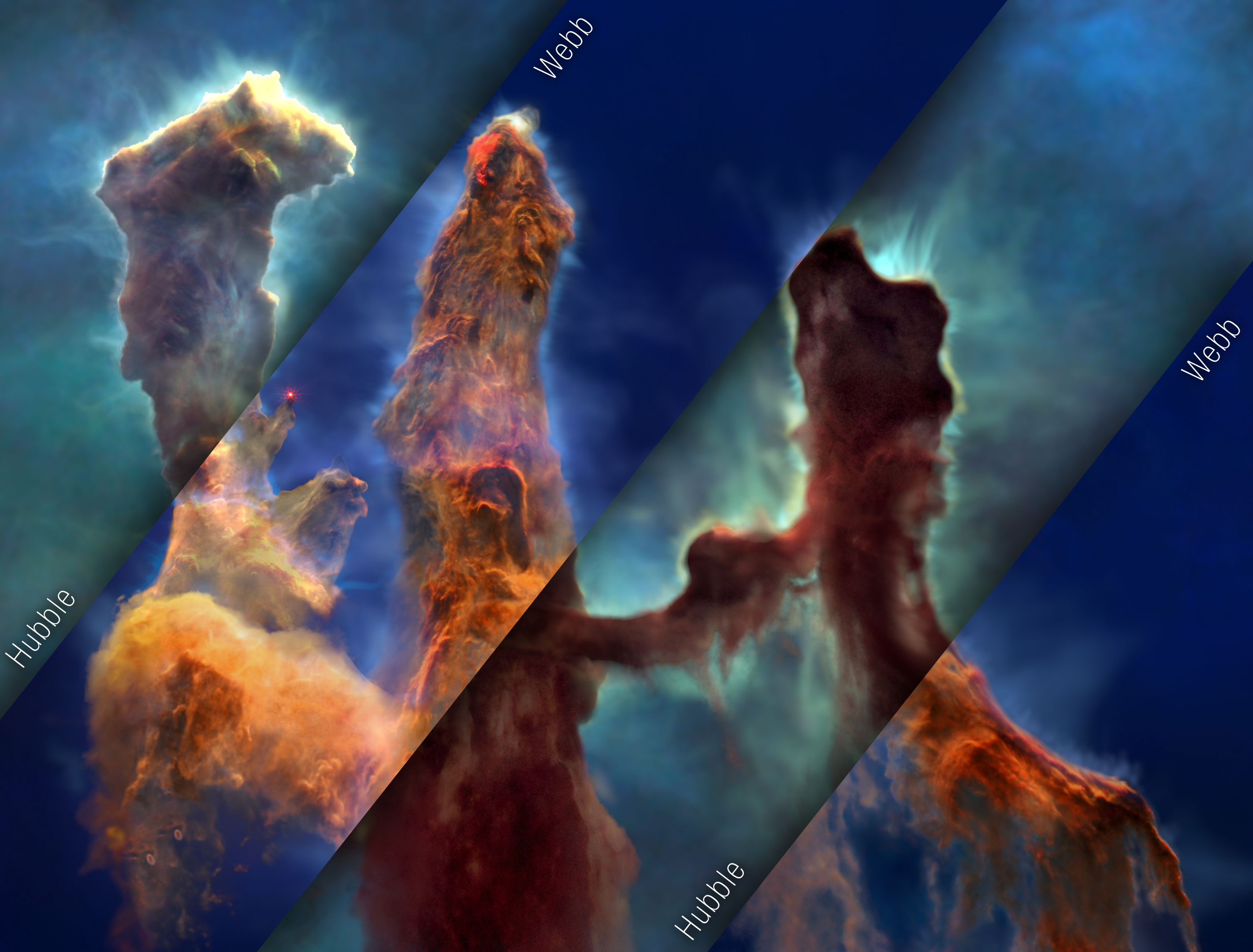
Mosaic of the Pillars of Creation visualization model, composed of 4 rectangular strips oriented 45 degrees clockwise from vertical. Strips alternate between Hubble and Webb views of the visualization model, with each strip labeled: “Hubble” at lower right corners of first and third strips; “Webb” at upper left corners of the second and fourth strips. Webb strips have drop shadows that make it look like they are overlaid on top of larger Hubble image. Mosaic shows 3 vertical structures (pillars) of thick smoke-like material. Pillar edges are glowing, with thin wisps of material moving away into space. In Hubble strips, pillars are dark brown and opaque, on greenish blue background. In Webb strips, pillars are bright orange to brown with a distinct area of bright red at the top of middle pillar. A red star appears at the tip of a peak in the left pillar and the background is deep blue.
A mosaic of visible-light (Hubble) and infrared-light (Webb) views from the same Pillars of Creation visualization frame. 
Credits:
Greg Bacon, Ralf Crawford, Joseph DePasquale, Leah Hustak, Christian Nieves, Joseph Olmsted, Alyssa Pagan, and Frank Summers (STScI), NASA’s Universe of Learning

Made famous in 1995 by NASA’s Hubble Space Telescope, the Pillars of Creation in the heart of the Eagle Nebula have captured imaginations worldwide with their arresting, ethereal beauty.

Now, NASA has released a new 3D visualization of these towering celestial structures using data from NASA’s Hubble and James Webb space telescopes. This is the most comprehensive and detailed multiwavelength movie yet of these star-birthing clouds.

“By flying past and amongst the pillars, viewers experience their three-dimensional structure and see how they look different in the Hubble visible-light view versus the Webb infrared-light view,” explained principal visualization scientist Frank Summers of the Space Telescope Science Institute (STScI) in Baltimore, who led the movie development team for NASA’s Universe of Learning. “The contrast helps them understand why we have more than one space telescope to observe different aspects of the same object.”

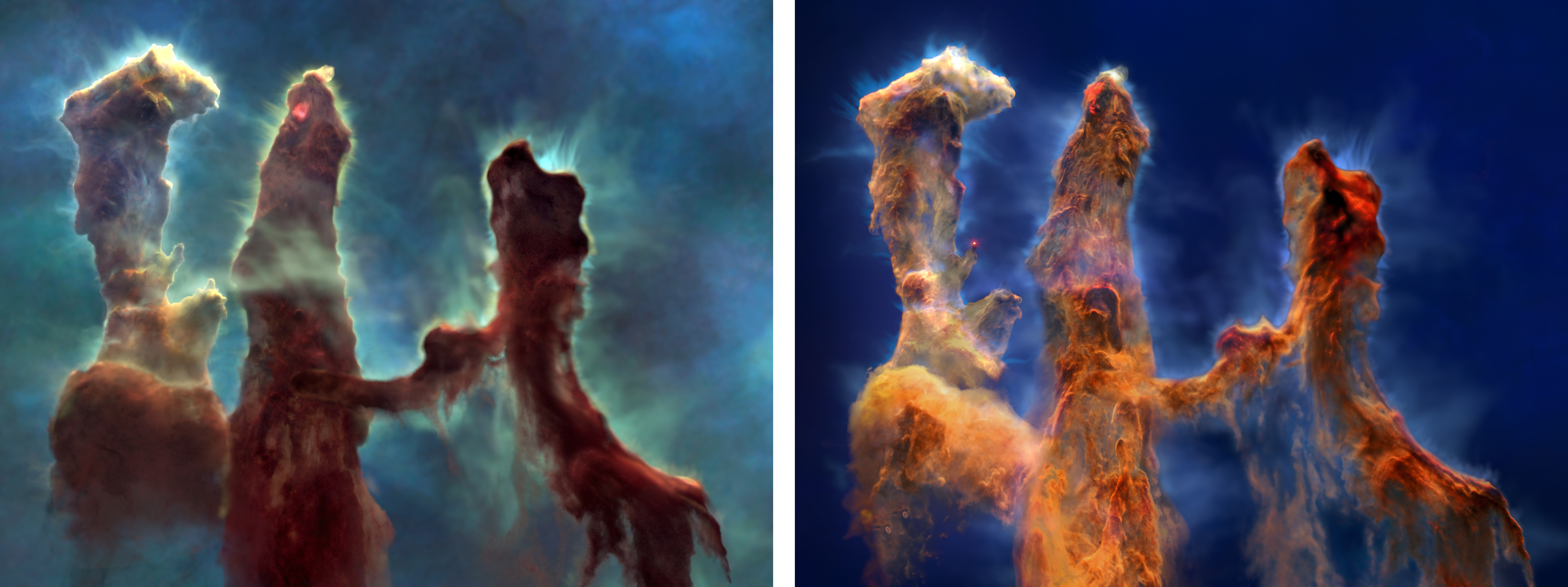
Image: Hubble Model and Webb Model

Two visualizations using Hubble and Webb data. The left image is from visible-light data collected by Hubble. The right visualization is from infrared-light data collected by Webb.
In the Hubble version of the model (left), the pillars feature dark brown, opaque dust and bright yellow ionized gas set against a greenish-blue background. The Webb version (right) showcases orange and orange-brown dust that is semi-transparent, with light blue ionized gas against a dark blue background.
Greg Bacon, Ralf Crawford, Joseph DePasquale, Leah Hustak, Christian Nieves, Joseph Olmsted, Alyssa Pagan, and Frank Summers (STScI), NASA’s Universe of Learning

The four Pillars of Creation, made primarily of cool molecular hydrogen and dust, are being eroded by the fierce winds and punishing ultraviolet light of nearby hot, young stars. Finger-like structures larger than the solar system protrude from the tops of the pillars. Within these fingers can be embedded, embryonic stars. The tallest pillar stretches across three light-years, three-quarters of the distance between our Sun and the next nearest star.

The movie takes visitors into the three-dimensional structures of the pillars. Rather than an artistic interpretation, the video is based on observational data from a science paper led by Anna McLeod, an associate professor at the University of Durham in the United Kingdom. McLeod also served as a scientific advisor on the movie project.

“The Pillars of Creation were always on our minds to create in 3D. Webb data in combination with Hubble data allowed us to see the Pillars in more complete detail,” said production lead Greg Bacon of STScI. “Understanding the science and how to best represent it allowed our small, talented team to meet the challenge of visualizing this iconic structure.”

Image: Pillars of Creation Visualization

Mosaic of the Pillars of Creation visualization model, composed of 4 rectangular strips oriented 45 degrees clockwise from vertical. Strips alternate between Hubble and Webb views of the visualization model, with each strip labeled: “Hubble” at lower right corners of first and third strips; “Webb” at upper left corners of the second and fourth strips. Webb strips have drop shadows that make it look like they are overlaid on top of larger Hubble image. Mosaic shows 3 vertical structures (pillars) of thick smoke-like material. Pillar edges are glowing, with thin wisps of material moving away into space. In Hubble strips, pillars are dark brown and opaque, on greenish blue background. In Webb strips, pillars are bright orange to brown with a distinct area of bright red at the top of middle pillar. A red star appears at the tip of a peak in the left pillar and the background is deep blue.
A mosaic of visible-light (Hubble) and infrared-light (Webb) views of the same frame from the Pillars of Creation visualization. The visualization sequence fades back and forth between these two models as the camera flies past and amongst the pillars. These contrasting views illustrate how observations from the two telescopes complement each other.
Greg Bacon, Ralf Crawford, Joseph DePasquale, Leah Hustak, Christian Nieves, Joseph Olmsted, Alyssa Pagan, and Frank Summers (STScI), NASA’s Universe of Learning

The new visualization helps viewers experience how two of the world’s most powerful space telescopes work together to provide a more complex and holistic portrait of the pillars. Hubble sees objects that glow in visible light, at thousands of degrees. Webb’s infrared vision, which is sensitive to cooler objects with temperatures of just hundreds of degrees, pierces through obscuring dust to see stars embedded in the pillars.

“When we combine observations from NASA’s space telescopes across different wavelengths of light, we broaden our understanding of the universe,” said Mark Clampin, Astrophysics Division director at NASA Headquarters in Washington. “The Pillars of Creation region continues to offer us new insights that hone our understanding of how stars form. Now, with this new visualization, everyone can experience this rich, captivating landscape in a new way.”

Produced for NASA by STScI with partners at Caltech/IPAC, and developed by the AstroViz Project of NASA’s Universe of Learning, the 3D visualization is part of a longer, narrated video that combines a direct connection to the science and scientists of NASA’s Astrophysics missions with attention to the needs of an audience of youth, families, and lifelong learners. It enables viewers to explore fundamental questions in science, experience how science is done, and discover the universe for themselves.

Several stages of star formation are highlighted in the visualization. As viewers approach the central pillar, they see at its top an embedded, infant protostar glimmering bright red in infrared light. Near the top of the left pillar is a diagonal jet of material ejected from a newborn star. Though the jet is evidence of star birth, viewers can’t see the star itself. Finally, at the end of one of the left pillar’s protruding “fingers” is a blazing, brand-new star.

Video: Pillars of Creation Visualization

Using data from NASA’s Hubble and Webb space telescopes, astronomers and artists modeled the iconic Pillars of Creation in the Eagle Nebula (Messier 16 or M16) in three dimensions, creating a movie that allows viewers to fly past and among the pillars. Credit: Producers: Greg Bacon and Frank Summers (STScI), NASA’s Universe of Learning; Visualization: Greg Bacon, Ralf Crawford, Joseph DePasquale, Leah Hustak, Danielle Kirshenblat, Christian Nieves, Joseph Olmsted, Alyssa Pagan, and Frank Summers (STScI), Robert L. Hurt (Caltech, IPAC); Science Advisor: Anna McLeod (Durham University); Music: Joseph DePasquale (STScI)

A bonus product from this visualization is a new 3D printable model of the Pillars of Creation. The base model of the four pillars used in the visualization has been adapted to the STL file format, so that viewers can download the model file and print it out on 3D printers. Examining the structure of the pillars in this tactile and interactive way adds new perspectives and insights to the overall experience.

More visualizations and connections between the science of nebulas and learners can be explored through other products produced by NASA’s Universe of Learning such as ViewSpace, a video exhibit that is currently running at almost 200 museums and planetariums across the United States. Visitors can go beyond video to explore the images produced by space telescopes with interactive tools now available for museums and planetariums.

NASA’s Universe of Learning materials are based upon work supported by NASA under award number NNX16AC65A to the Space Telescope Science Institute, working in partnership with Caltech/IPAC, Pasadena, California, Center for Astrophysics | Harvard & Smithsonian, Cambridge, Massachusetts, and Jet Propulsion Laboratory, La Cañada Flintridge, California.

Explore More

Eagle Nebula Resources from NASA’s Universe of Learning

Interactive: Explore the Pillars of Creation at Multiple Wavelengths

Hubble Goes High-Definition to Revisit Iconic ‘Pillars of Creation’

Haunting Portrait: NASA’s Webb Reveals Dust, Structure in Pillars of Creation

Hubble’s Messier Catalog: The Eagle Nebula (M16)

Downloads

Hubble Model and Webb Model Image

Pillars of Creation Visualization Image

Pillars of Creation Visualization Video

All Image and Video Products for this Article

Media Contacts

Laura Betz – laura.e.betz@nasa.gov 
Rob Gutro – rob.gutro@nasa.gov
Claire Andreoli –  claire.andreoli@nasa.gov
NASA’s Goddard Space Flight Center, Greenbelt, MD

Ann Jenkins – jenkins@stsci.edu
Christine Pulliam – cpulliam@stsci.edu
Space Telescope Science Institute, Baltimore, MD

Related For Kids

The Amazing Hubble Telescope

What is the Webb Telescope?

Interactive: Hubble’s Name that Nebula Game

Interactive: What Did Hubble See on Your Birthday?

SpacePlace for Kids

En Español

Ciencia de la NASA

NASA en español 

Space Place para niños

Powered by WPeMatico

Get The Details…

The 1998 Florida Firestorm and NASA’s Kennedy Space Center

The 1998 Florida Firestorm and NASA’s Kennedy Space Center

5 min read

Preparations for Next Moonwalk Simulations Underway (and Underwater)

Lightning Strike at Kennedy Space Center in 2014
A lightning strike at Launch Complex 39B at NASA’s Kennedy Space Center in Florida in July 2014. Bolts like this are a regular occurrence in central Florida. Similar lightning strikes sparked the 1998 Florida Firestorm.
NASA

Lightning Crashes

East central Florida’s natural environment and climate have shaped, and delayed, Kennedy Space Center launch operations since the 1960s. Torrential pop-up thunderstorms, Atlantic hurricanes, roasting heat, and other climatic phenomena, including lightning and fire, repeatedly hampered mission timelines and created dangerous conditions for astronauts and workers.

Kennedy Space Center personnel understood the dangers of lightning strikes all too well by 1998. In 1969, two bolts famously struck the Apollo 12 launch vehicle shortly after liftoff. A few years earlier, a worker was killed when lightning hit a Kennedy launch pad. These and other events motivated NASA to install new lightning rods and create new launch procedures.

The opening segment of this video highlights the two lightning bolts that struck the Apollo 12 launch vehicle shortly after launch.

Fire in the Sky

Although NASA officials were familiar with the dangers lightning posed as the twenty-first century dawned, a 1998 lightning strike created an unprecedented environmental threat to Kennedy Space Center and its launch operations.

In May 1998, lightning sparked a fire in a wooded area of eastern central Florida. This lightning strike and fire were not extraordinary events. Quite the contrary. Over the course of central Florida’s long history, lightning regularly ignited wildfires in pine forests. These blazes were often short lived, but they served an important function. Namely, they burned off flammable undergrowth and rejuvenated Florida’s wilderness environments.

Aerial view of the 1998 Fire with billowing smoke
This photograph of an area of the 1998 Firestorm was taken from a NASA Huey UH-1 helicopter. The helicopter was outfitted with a Forward Looking Infrared Radar (FLIR) camera and a portable global positioning satellite (GPS) system to support Florida’s Division of Forestry as they fought the fire.
NASA

But the 1998 fire was different. Instead of a lightning strike creating a small fire, which rain and other natural conditions eventually extinguished, it grew into a colossal inferno dubbed the 1998 Firestorm. It was an inferno fed by other lightning sparked fires, a rainy winter, spring drought conditions, and fire suppression tactics.

Beginning in the mid-1900s, residents and fire officials in central Florida regularly extinguished wildfires before they had a chance to burn off flammable undergrowth. This led to a buildup of combustible material in the area’s woodlands. It was especially the case after a rainy winter season in early 1998 led to an abundance of low-lying vegetation. Fed by this tinder and a springtime drought, the summer fires spread quickly. They ultimately burned roughly 500,000 acres and created massive clouds of billowing smoke and other environmental hazards.

At one point the smoke from the fires was so thick, officials closed a 140-mile stretch of Interstate 95 and NASCAR officials postponed the annual 400-mile race at Daytona International Speedway, traditionally held on July 4th.

View from the backseat of a NASA Huey UH-1 helicopter showing a KSC Security Services employee pointing at a screen.
The scene inside a NASA Huey UH-1 helicopter while it flies over fires burning in Volusia County, Florida.
NASA

Battling the Blaze

In response to the flames, Brevard County fire official Jeffrey Mahoney publicly requested that Florida Governor Lawton Chiles provide more firefighters and resources. Mahoney argued, and many agreed, that the 500 firefighters valiantly battling the blaze in an effort to save homes and property were no match for the raging fire. “We are asking them to do the impossible,” Mahoney told a reporter during the early days of the fire.

We are asking them to do the impossible.»

Jeffrey Mahoney

Jeffrey Mahoney

Brevard County Assistant Fire Chief

Understanding the severity of the situation, Governor Chiles and federal officials allocated more resources to fighting the fires. Ultimately, thousands of firefighters fought the blazes that raged throughout the state, including on Kennedy Space Center property.

Flames Threaten Kennedy

During the early weeks of the wildfire outbreak, NASA operations continued as usual. In early June, the agency successfully launched and landed STS-91. But ultimately the fires spread to center property and created operational concerns.

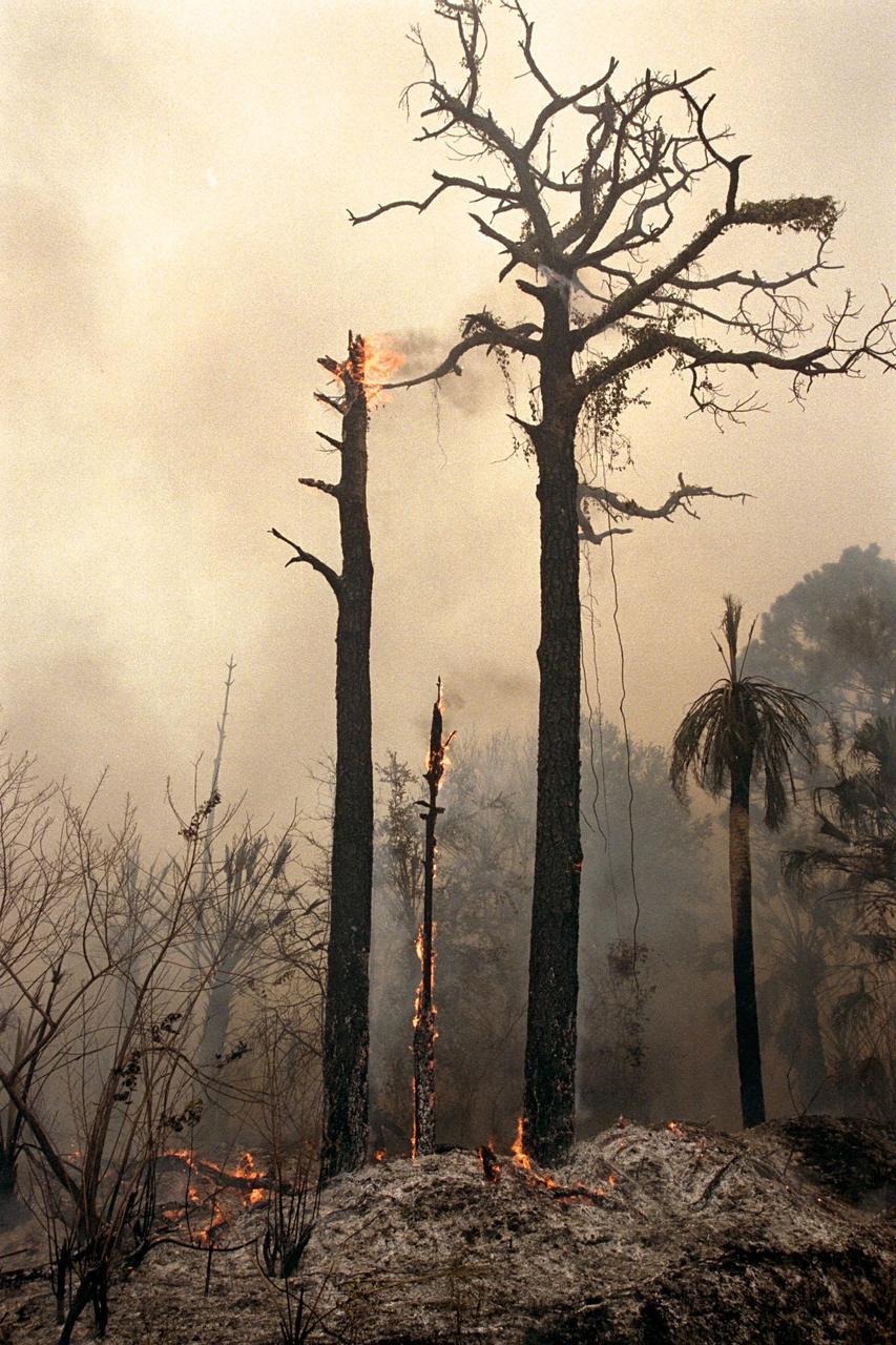
burnt trees and a smokey sky as seen on Kennedy property in June 1998
This photo of a burned wooded area on Kennedy property was taken on June 22, 1998. Around the time of this photo, fire threatened Kennedy Space Center’s South Repeater Building and other structures.
NASA

In late June, firefighters had to battle back a blaze that threatened the South Repeater Building, a fiber-optics relay station and storage facility on the south side of center property. By June 22, fires had burned 3,000 acres of the Merritt Island National Wildlife Refuge that surrounded Kennedy Space Center. The fire’s intensity and smoke even forced officials to temporarily close State Road 3.

Kennedy employee Lisa Braden was one of the last people to drive on the road before it was closed. “The smoke was so thick, you couldn’t see the road,” Braden told a reporter. “I went out on a job, and when I came back, the fire was crossing the street.”

Fortunately, by mid-July the arrival of long-hoped-for summer rains and successful fire control techniques helped extinguish most of the fires. Still, NASA launch officials remembered the firestorm in the weeks leading up to the October 1998 launch of STS-95.

Smoke and Shuttle Launches

It was in the shadows, or perhaps the smoke, of the fires that NASA created the STS-95 Flight Readiness Review. The document provides a window into the thinking and concerns of safety officials, launch controllers, NASA engineers, and more, just weeks before launch.

During the Shuttle Era, NASA’s readiness reviews accompanied the final readiness meeting the agency held two weeks before each launch. At this meeting, those involved in the mission ensured that earlier technical issues, and other concerns, had been satisfactorily resolved. Most importantly, a “go” or “no-go” launch decision was made at the end of this meeting.

Each readiness review document and meeting were unique. They each provide a window into the particulars of individual shuttle launches. The two Smoke Plume Rule diagrams in the STS-95 Flight Readiness Review, make it clear that launch officials had wildfire smoke on their minds.

Diagram entitled Smoke Plume Rule
This illustration is from the STS-95 Readiness Review. It reminded launch officials that a launch was a “no-go” if the shuttle was going to travel through a cumulus cloud attached to a smoke plume. Note the burning vegetation to the left of the shuttle.
NASA/Kennedy Space Center Archive
Diagram entitled Smoke Plum Rule where a smoke plume is not attached to a cumulus cloud
This second illustration is also from the STS-95 Flight Readiness Review. It highlights the part of the Smoke Plume Rule that states a shuttle should not be launched through a cumulus cloud that developed from a smoke plume, for at least 60 minutes after the cloud separates from the plume.
NASA/Kennedy Space Center Archive

STS-95 launched on a clear smoke-free day on October 29, 1998. Still, the charred Florida landscape Space Shuttle Discovery soared away from after liftoff stood as testament to the dangers of wildfire. With this in mind, officials took action to help ensure a fire event as widespread as the 1998 Firestorm never happened again.

Only You?

Since 1998, controlled burns have been regularly conducted throughout wooded areas of Florida and on Kennedy Space Center property. These prescribed burns were, in part, a legacy of the 1998 Firestorm. Along with prescribed burns, NASA developed and used other technologies and tactics to control wildfires on Kennedy property after 1998.

A helicopter dumps a large bucket of water on a forest
NASA used Huey UH-1 helicopters for security and medical evacuations before the 1998 fires. After the fires, NASA outfitted the helicopters with buckets designed to scoop up Florida coastal waters and drop them on wildfires. This photo, from 2000, shows a helicopter and bucket at work.
NASA

As the number of launches at Kennedy increases (in 2023 there were a record 72 orbital launches from Kennedy Space Center), and climate change makes severe weather more prevalent, prescribed burns and other wildfire control strategies are essential components of mission preparedness and environmental stewardship in and around the center.

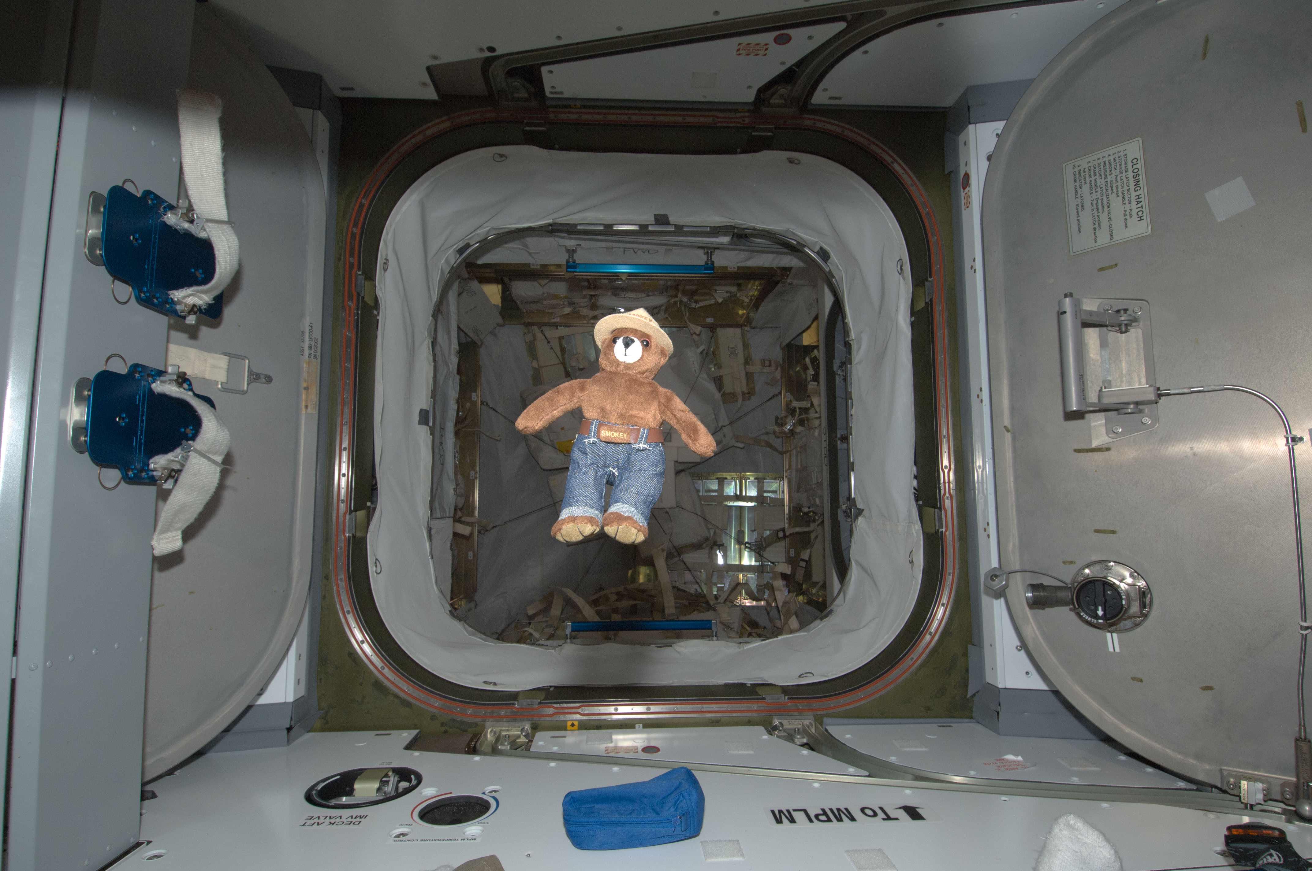
Smokey the Bear at International Space Station in 2012
On May 15, 2012, Smokey the Bear traveled to the International Space Station with NASA astronaut Joe Acaba. As a recognized symbol for wildfire prevention, Smokey’s 2012 space adventure highlighted NASA initiatives dedicated to helping researchers better understand wildfires.
NASA

About the Author

Brad Massey

Brad Massey

NASA Historian

Brad Massey is a historian at NASA’s Kennedy Space Center. His research focuses on NASA’s earth science initiatives and Florida’s environmental history.

Share

Details

Last Updated

Jun 25, 2024

Powered by WPeMatico

Get The Details…
Brad Massey

NASA, SpaceX Launch NOAA’s Latest Weather Satellite

NASA, SpaceX Launch NOAA’s Latest Weather Satellite

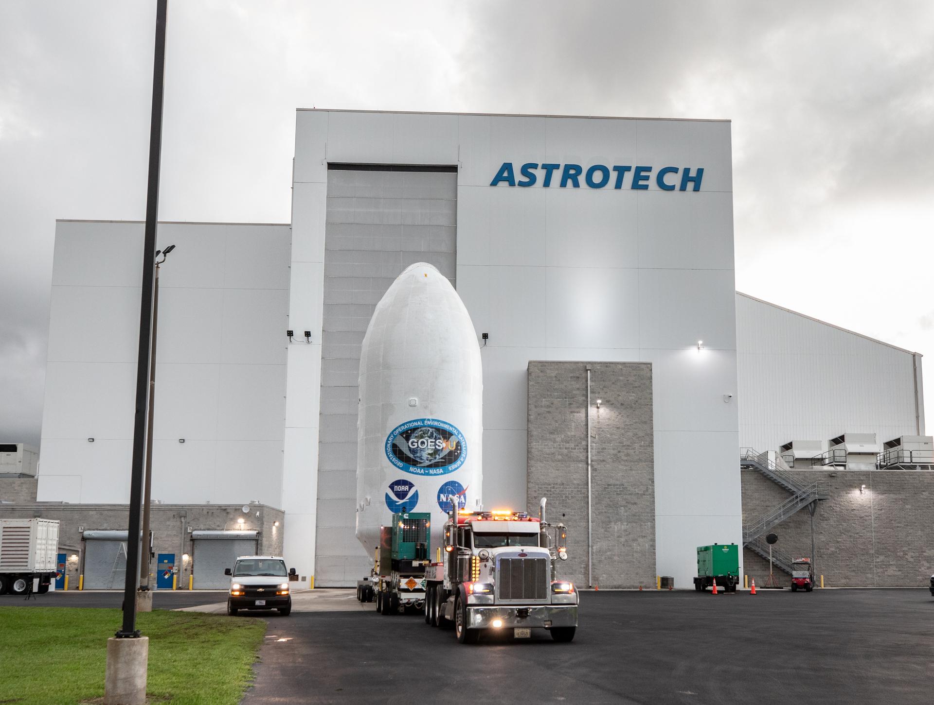
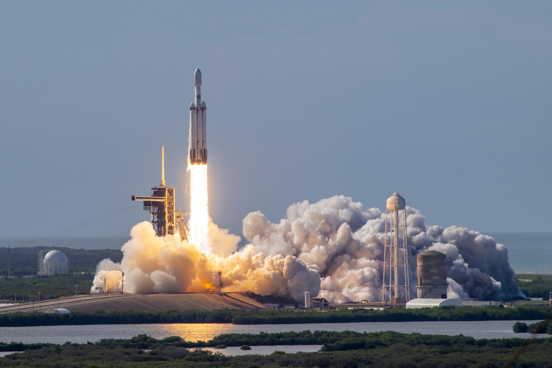
A SpaceX Falcon Heavy rocket carrying the National Oceanic and Atmospheric Administration (NOAA) GOES-U (Geostationary Operational Environmental Satellite U) lifts off from Launch Complex 39A at NASA’s Kennedy Space Center in Florida on Tuesday, June 25, 2024. The GOES-U satellite is the final satellite in the GOES-R series, which serves a critical role in providing continuous coverage of the Western Hemisphere, including monitoring tropical systems in the eastern Pacific and Atlantic oceans.
Credits: SpaceX

NASA successfully launched the fourth and final satellite in a series of advanced weather satellites for NOAA (National Oceanic and Atmospheric Administration) at 5:26 p.m. EDT Tuesday. The GOES-U (Geostationary Operational Environmental Satellite) will benefit the nation by providing continuous coverage of weather and hazardous environmental conditions across much of the Western Hemisphere.

The satellite launched on a SpaceX Falcon Heavy rocket from Launch Complex 39A at NASA’s Kennedy Space Center in Florida. Mission managers confirmed at 10:18 p.m. the spacecraft’s solar arrays successfully deployed, and the spacecraft was operating on its own power.

“As communities across the country and the world feel the effects of extreme weather, satellites like GOES-U keep a close watch to monitor weather in real time,” said NASA Administrator Bill Nelson. “NASA and NOAA have worked together for several decades to bring critical data back down to Earth to prepare for severe storms, fire detection, and much more. This fleet of advanced satellites is strengthening resilience to our changing climate, and protecting humanity from weather hazards on Earth, and in space.”

In addition to its critical role in terrestrial weather prediction, the GOES constellation of satellites helps forecasters predict space weather near Earth that can interfere with satellite electronics, GPS, and radio communications. The GOES-U satellite goes beyond the capabilities of its predecessors with  a new space weather instrument, the Compact Coronograph-1, which blocks the Sun’s bright light so scientists can observe the relatively fainter solar atmosphere.

“There are so many applications for GOES data – many of which directly impact our everyday lives here on Earth,” said Nicky Fox, associate administrator, Science Mission Directorate at NASA Headquarters in Washington. “GOES-U will add to the global data record, allowing NASA and NOAA to track changes in our climate and also provide critical information before severe weather and natural disasters strike. NASA looks forward to teaming up with NOAA again as we enter the next generation of Earth-observing satellites.”

Once GOES-U is in a geostationary orbit, about 22,200 miles above Earth, it will be renamed GOES-19. Following a successful orbital checkout of its instruments and systems, GOES-19 will go into service, keeping watch of the weather over most of North America, including the contiguous United States and Mexico, as well as Central and South America, the Caribbean, and the Atlantic Ocean to the west coast of Africa.

“The data that GOES-U will provide is critical to protecting the safety of people in the Western Hemisphere,” said John Gagosian, director, NASA’s Joint Agency Satellite Division. “With this successful launch, forecasters will have a resource to better inform and educate the public.”

NASA’s Goddard Space Flight Center in Greenbelt, Maryland, oversaw the acquisition of the GOES-R series spacecraft and instruments and built the magnetometer for GOES-U and its predecessor, GOES-T. NASA’s Launch Services Program, based at Kennedy, provided launch management for the mission.

The GOES-R Series Program is overseen by NOAA, through an integrated NOAA-NASA office that manages the ground system, operates the satellites, and distributes data to users worldwide. Lockheed Martin designs, builds, and tests the GOES-R series satellites. L3Harris Technologies provides the main instrument payload, the Advanced Baseline Imager and the ground system, which includes the antenna system for data reception.

For more information about GOES, visit:

https://www.nasa.gov/content/goes

-end-

Liz Vlock
Headquarters, Washington
202-358-1600
elizabeth.a.vlock@nasa.gov

Peter Jacobs
Goddard Space Flight Center, Greenbelt, Maryland
301-286-0535
peter.jacobs@nasa.gov

Leejay Lockhart
Kennedy Space Center, Florida
321-747-8310
leejay.lockhart@nasa.gov

Powered by WPeMatico

Get The Details…
Tiernan P. Doyle