New Commercial Artemis Moon Rovers Undergo Testing at NASA
4 min read
Preparations for Next Moonwalk Simulations Underway (and Underwater)
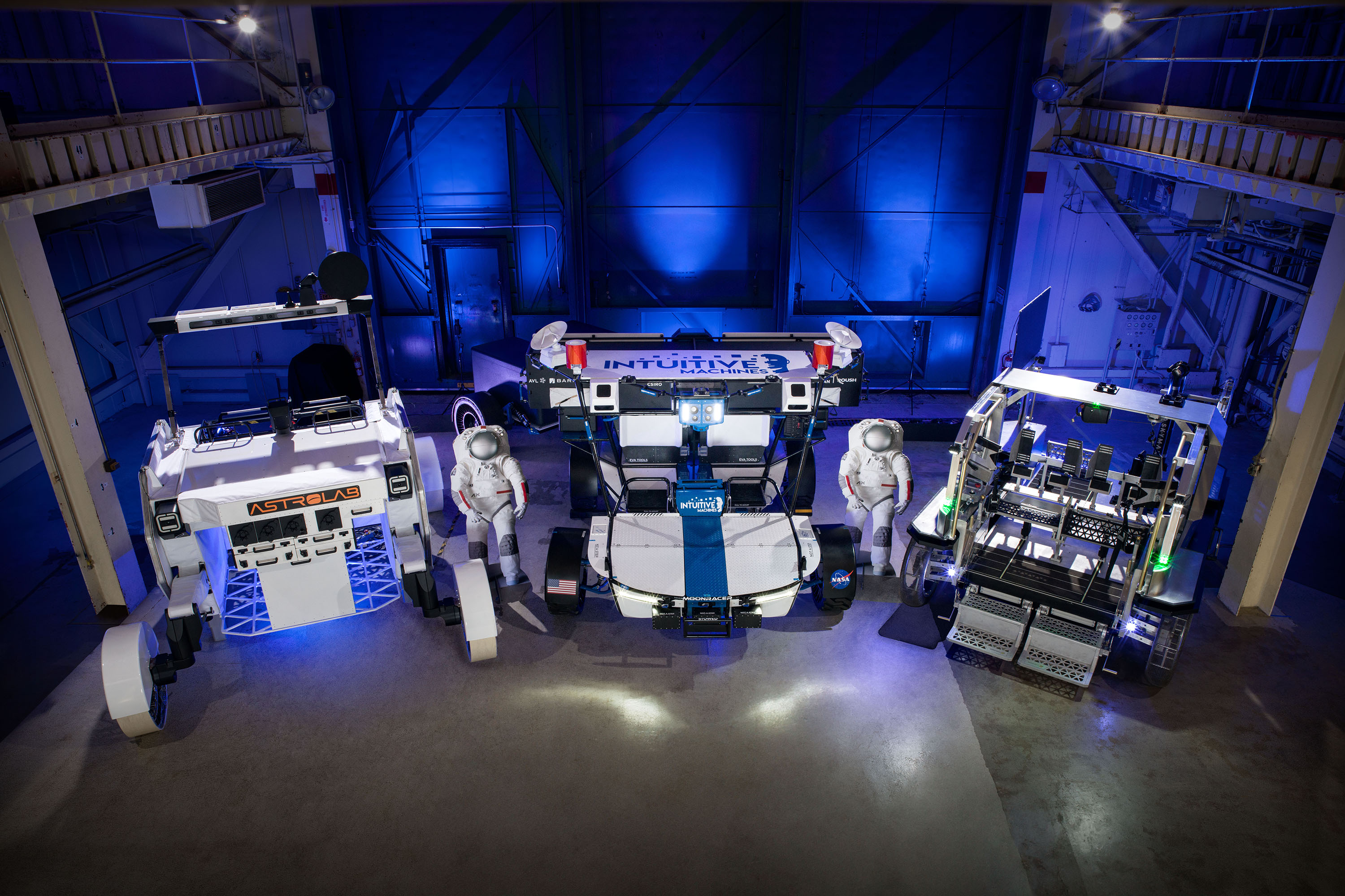
From left to right: Astrolab’s FLEX, Intuitive Machines’ Moon RACER, and Lunar Outpost’s Eagle lunar terrain vehicle at NASA’s Johnson Space Center.
NASA/Bill Stafford
Through NASA’s Artemis campaign, astronauts will land on the lunar surface and use a new generation of spacesuits and rovers as they live, work, and conduct science in the Moon’s South Pole region, exploring more of the lunar surface than ever before. Recently, the agency completed the first round of testing on three commercially owned and developed LTVs (Lunar Terrain Vehicle) from Intuitive Machines, Lunar Outpost, and Venturi Astrolab at NASA’s Johnson Space Center in Houston.
As part of an ongoing year-long feasibility study, each company delivered a static mockup of their vehicle to Johnson at the end of September, initiated rover testing in October and completed the first round of testing in December inside the Active Response Gravity Offload System (ARGOS) test facility. Lunar surface gravity is one-sixth of what we experience here on Earth, so to mimic this, ARGOS offers an analog environment that can offload pressurized suited subjects for various reduced gravity simulations.
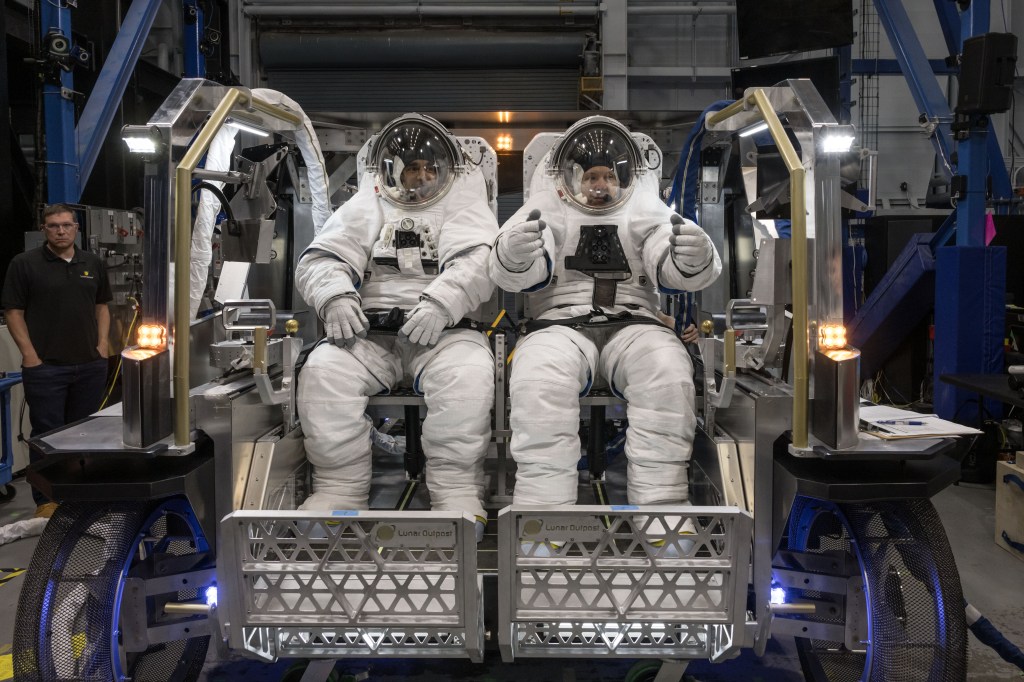
NASA astronauts Raja Chari (left) and Randy Bresnik (right) sit inside Lunar Outpost’s Eagle lunar terrain vehicle evaluating the seat configuration during testing at NASA’s Johnson Space Center.
NASA/David DeHoyos
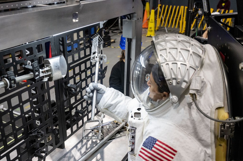
NASA astronaut Jessica Meir grabs a lunar geology tool from a tool rack on Lunar Outpost’s Eagle lunar terrain vehicle during testing at NASA’s Johnson Space Center.
NASA/James Blair
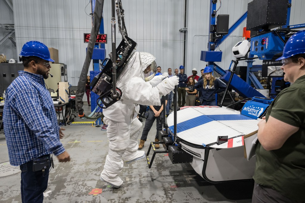
NASA astronaut Joe Acaba prepares to climb on top of Intuitive Machines’ Moon RACER lunar terrain vehicle to get to a science payload during testing at NASA’s Johnson Space Center.
NASA/Josh Valcarcel
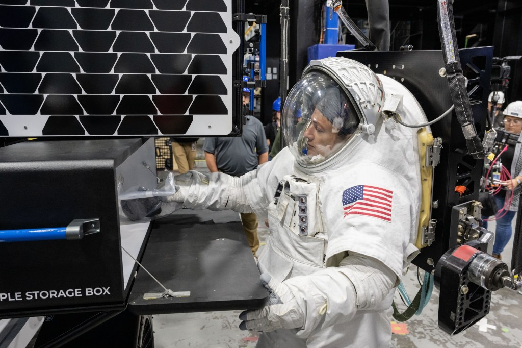
NASA astronaut Jessica Meir puts a science sample inside of a storage box on Intuitive Machines’ Moon RACER lunar terrain vehicle during testing at NASA’s Johnson Space Center.
NASA/James Blair
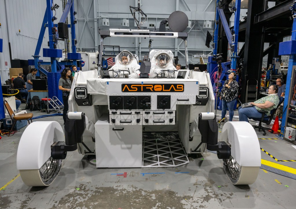
NASA astronaut Frank Rubio (left) and NASA spacesuit engineer Zach Tejral (right) sit inside Astrolab’s FLEX lunar terrain vehicle evaluating the display interfaces during testing at NASA’s Johnson Space Center.
NASA/James Blair
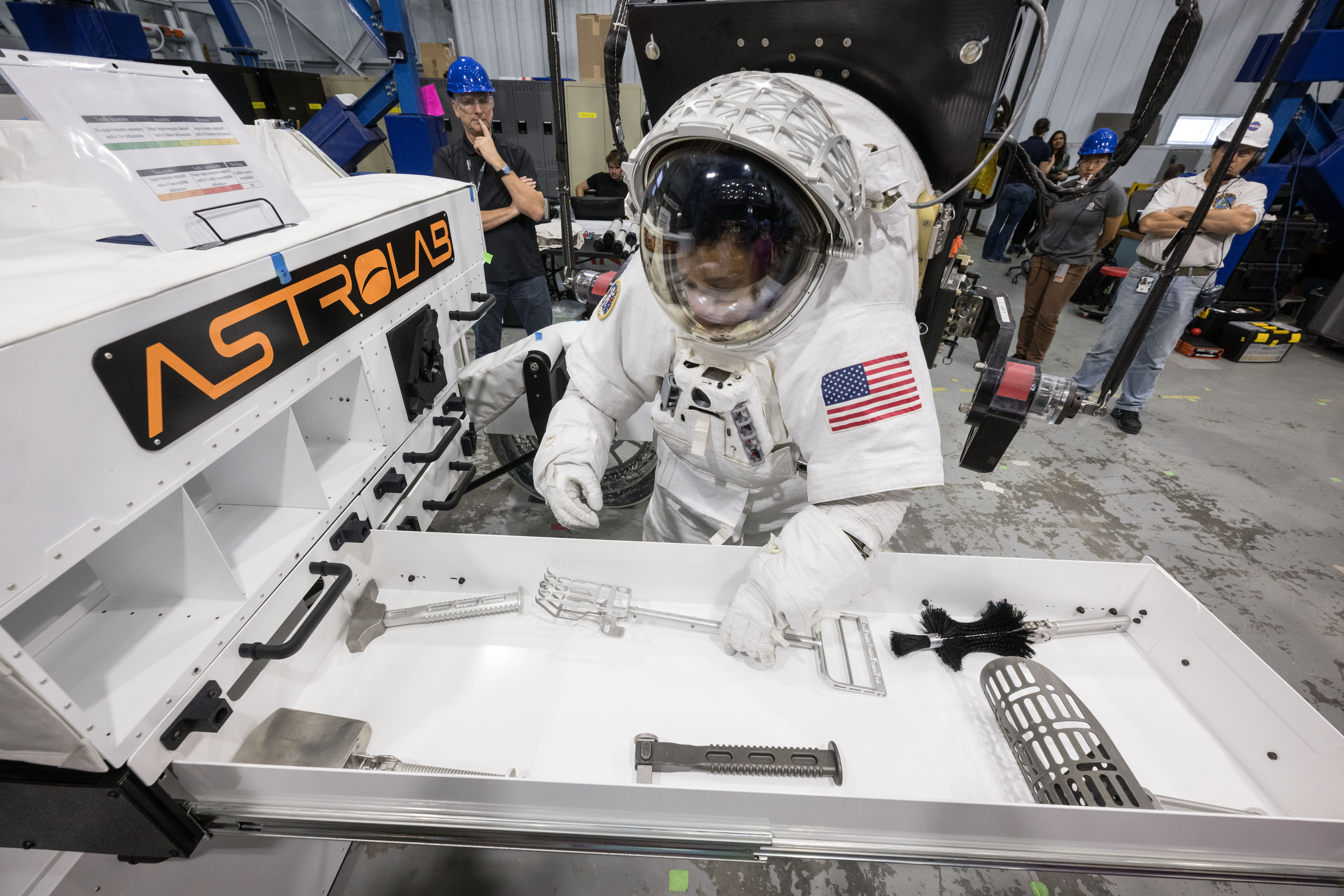
NASA astronaut Jessica Watkins stores science payloads on Astrolab’s FLEX lunar terrain vehicle during testing at NASA’s Johnson Space Center.
NASA/Robert Markowitz
This is the first major test milestone within the Lunar Terrain Vehicle Services contract and to have actual rovers delivered only four months after these companies were awarded is remarkable.
steve munday
NASA’s Lunar Terrain Vehicle Project Manager
NASA’s engineering teams conducted tests where suited NASA astronauts and engineers performed tasks, maneuvers, and emergency drills on each rover. With astronauts acting as the test subjects, these human-in-the-loop tests are invaluable as crewmembers provide critical feedback on each rover’s design functionality, evaluate display interfaces and controls, and help identify potential safety concerns or design issues. This feedback is shared directly with each commercial provider, to incorporate changes based on lessons learned as they evolve their rover design.
“We are excited to have mockups from all three LTV commercial providers here at Johnson Space Center,” said Steve Munday, LTV project manager. “This is the first major test milestone within the Lunar Terrain Vehicle Services contract and to have actual rovers delivered only four months after these companies were awarded is remarkable.”
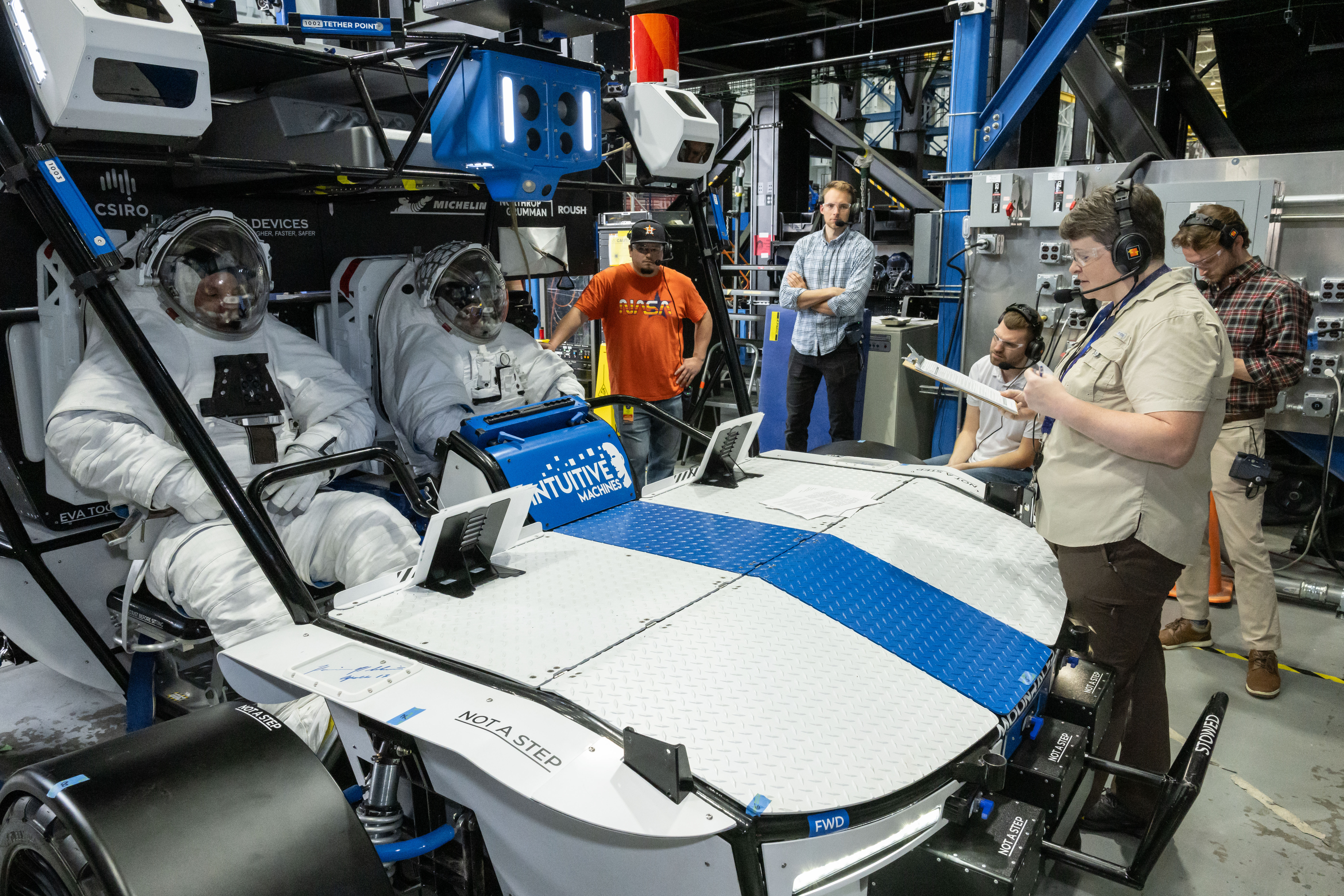
NASA engineer Dave Coan (left) and NASA astronaut Jessica Watkins (right) sit inside from Intuitive Machines’ Moon RACER lunar terrain vehicle evaluating the crew compartment during testing at NASA’s Johnson Space Center.
NASA/James Blair
Testing consisted of NASA astronauts and engineers taking turns wearing both NASA’s Exploration Extravehicular Mobility Unit planetary prototype spacesuit as well as Axiom Space’s Axiom Extravehicular Mobility Unit lunar spacesuit. The test teams performed evaluations to understand the interactions between the crew, the spacesuits, and the LTV mockups.
While wearing NASA’s prototype spacesuit, crew members were suspended from ARGOS allowing teams to mimic theone-sixth gravitational field of the lunar surface. This allowed the crew members to conduct tasks on the outside of each rover, such as gathering or storing lunar geology tools, deploying science payloads, and handling cargo equipment, as if they are walking on the Moon.
NASA astronaut Joe Acaba raises the solar array panel on Lunar Outpost’s Eagle lunar terrain vehicle during testing at NASA’s Johnson Space Center.
NASA/Robert Markowitz
While wearing Axiom Space’s pressurized spacesuit, teams evaluated the level of ease or difficulty in mobility crewmembers experienced when entering and exiting the rovers, the crew compartment and design, and the functionality of interacting with display interfaces and hand controls while wearing thick spacesuit gloves.
As part of testing, teams also conducted emergency drills, where engineers simulated rescuing an incapacitated crew member. As part of NASA’s requirements, each rover must have a design in place that enables an astronaut to single-handedly rescue their crewmates in the event of an emergency.
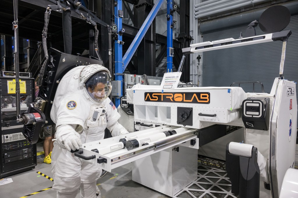
NASA astronaut Jessica Watkins picks up a lunar geology tool from a stowage drawer on Astrolab’s FLEX lunar terrain vehicle during testing at NASA’s Johnson Space Center.
NASA/Robert Markowitz
Since NASA selected the companies, Intuitive Machines, Lunar Outpost, and Venturi Astrolab have been working to meet NASA’s requirements through the preliminary design review. In 2025, the agency plans to issue a request for task order proposals to any eligible providers for a demonstration mission to continue developing the LTV, deliver it to the surface of the Moon, and validate its performance and safety ahead of Artemis V, when NASA intends to begin using the LTV for crewed operations.
Through Artemis, NASA will send astronauts – including the next Americans, and the first international partner astronaut – to explore the Moon for scientific discovery, technology evolution, economic benefits, and to build the foundation for future crewed missions to Mars.
Learn about the rovers, suits, and tools that will help Artemis astronauts to explore more of the Moon:
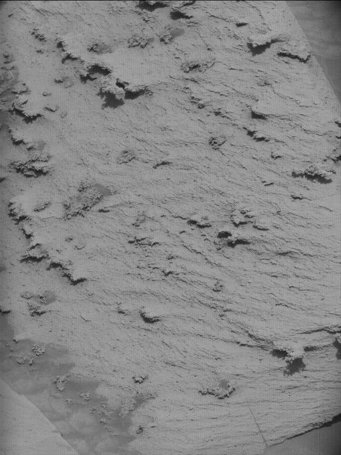
NASA’s Mars rover Curiosity acquired this image using its Right Navigation Camera on Dec. 16, 2024 at 00:22:16 UTC — sol 4394, or Martian day 4,394 of the Mars Science Laboratory mission.
NASA/JPL-Caltech
Earth planning date: Monday, Dec. 16, 2024
Over the weekend Curiosity continued her trek around the northern end of Texoli butte, taking in the beautiful views in all directions. Steep buttes reveal cross-sections through ancient sedimentary strata, while the blocks in our workspace contain nice layers and veins — a detailed record of past surface processes on Mars. Sometimes we get so used to our normal routine of rover operations that I almost forget how incredible it is to be exploring ancient sedimentary rocks on another planet and seeing new data every day. Curiosity certainly found a beautiful field site!
But the challenges are a good reminder of what it takes to safely explore Mars. We had hoped that the weekend drive could be extended a little bit using a guarded driving mode (using auto navigation), but the drive stopped early during the guarded portion. Because the drive stopped short, we did not have adequate imaging around all of the rover wheels to fully assess the terrain, which meant that unfortunately Curiosity did not pass the Slip Risk Assessment Process (SRAP) and we could not use the rover arm for contact science today. The team quickly pivoted to remote sensing, knowing there will be other chances to use the instruments on the arm in upcoming plans.
Today’s two-sol plan includes targeted science and a drive on the first sol, followed by untargeted remote sensing on the second sol. The Geology and Mineralogy Theme Group planned ChemCam LIBS and Mastcam on a target named “Avalon” to characterize a dark vein that crosscuts the bedrock in our workspace. Then Curiosity will acquire two long-distance RMI mosaics to document the first glimpse of distant boxwork structures, and a view of the top of Mount Sharp from this perspective. This Martian wonderland includes a lot of beautiful sedimentary structures and fractures, so the team planned Mastcam mosaics to assess a stratigraphic interval that may contain more climbing ripples, another mosaic to characterize the orientation of fractures, and a third mosaic to look at veins and sedimentary layers. Then Curiosity will drive about 50 meters (about 164 feet) to the southwest, and will take post-drive imaging to prepare for planning on Wednesday. The second sol is untargeted, so GEO added an autonomously selected ChemCam LIBS target. The plan includes standard DAN and REMS environmental monitoring activities, plus a dust-devil movie and Navcam line-of-sight observation to assess atmospheric dust.
I was on shift as Long-Term Planner today, so in addition to thinking about today’s plan, we’re already looking ahead at the activities that the rover will conduct over the December holidays. We’re gearing up to send Curiosity our Christmas wish list later this week, and feeling grateful for the gifts she has already sent us!
Written by Lauren Edgar, Planetary Geologist at USGS Astrogeology Science Center
2024 in Review: Highlights from NASA in Silicon Valley
7 min read
Preparations for Next Moonwalk Simulations Underway (and Underwater)
2024 intro: As NASA’s Ames Research Center in California’s Silicon Valley enters its 85th year since its founding, join us as we take a look back at some of our highlights of science, engineering, research, and innovation from 2024.
Ames Arc Jets Play Key Role in Artemis I Orion Spacecraft Heat Shield Findings
A block of Avcoat undergoes testing inside an arc jet test chamber at NASA Ames. The test article, configured with both permeable (upper) and non-permeable (lower) Avcoat sections for comparison, helped to confirm understanding of the root cause of the loss of charred Avcoat material that engineers saw on the Orion spacecraft after the Artemis I test flight beyond the Moon.
NASA
Researchers at Ames were part of the team tasked to better understand and identify the root cause of the unexpected char loss across the Artemis I Orion spacecraft’s heat shield. Using Avcoat material response data from Artemis I, the investigation team was able to replicate the Artemis I entry trajectory environment — a key part of understanding the cause of the issue — inside the arc jet facilities at NASA Ames.
Starling Swarm Completes Primary Mission
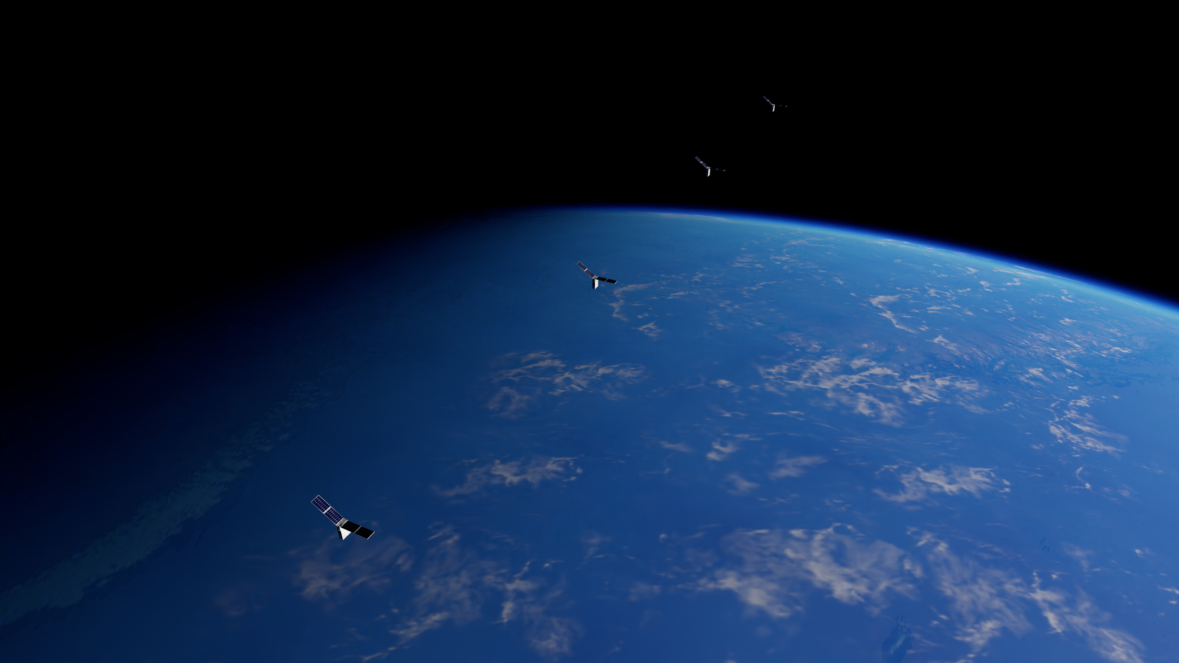
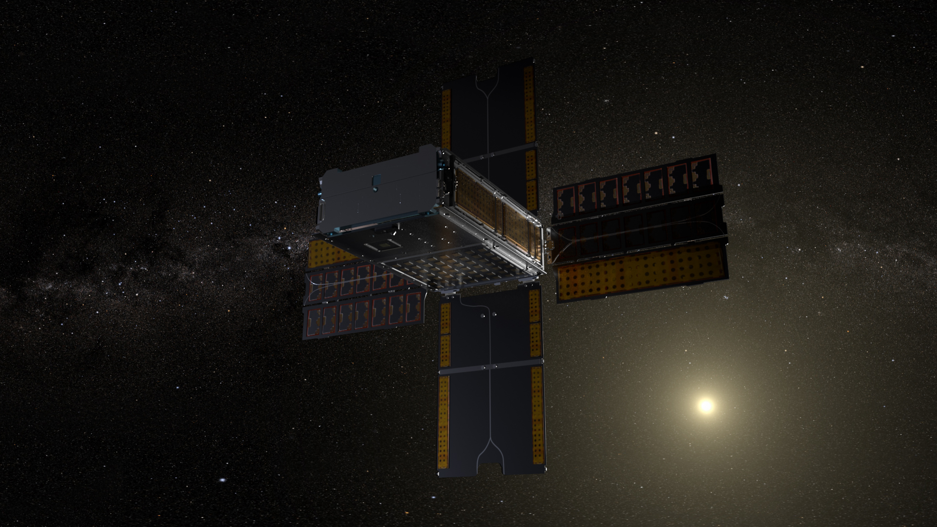
The four CubeSat spacecraft that make up the Starling swarm have demonstrated success in autonomous operations, completing all key mission objectives.
NASA
After ten months in orbit, the Starling spacecraft swarm successfully demonstrated its primary mission’s key objectives, representing significant achievements in the capability of swarm configurations in low Earth orbit, including distributing and sharing important information and autonomous decision making.
Another Step Forward for BioNutrients
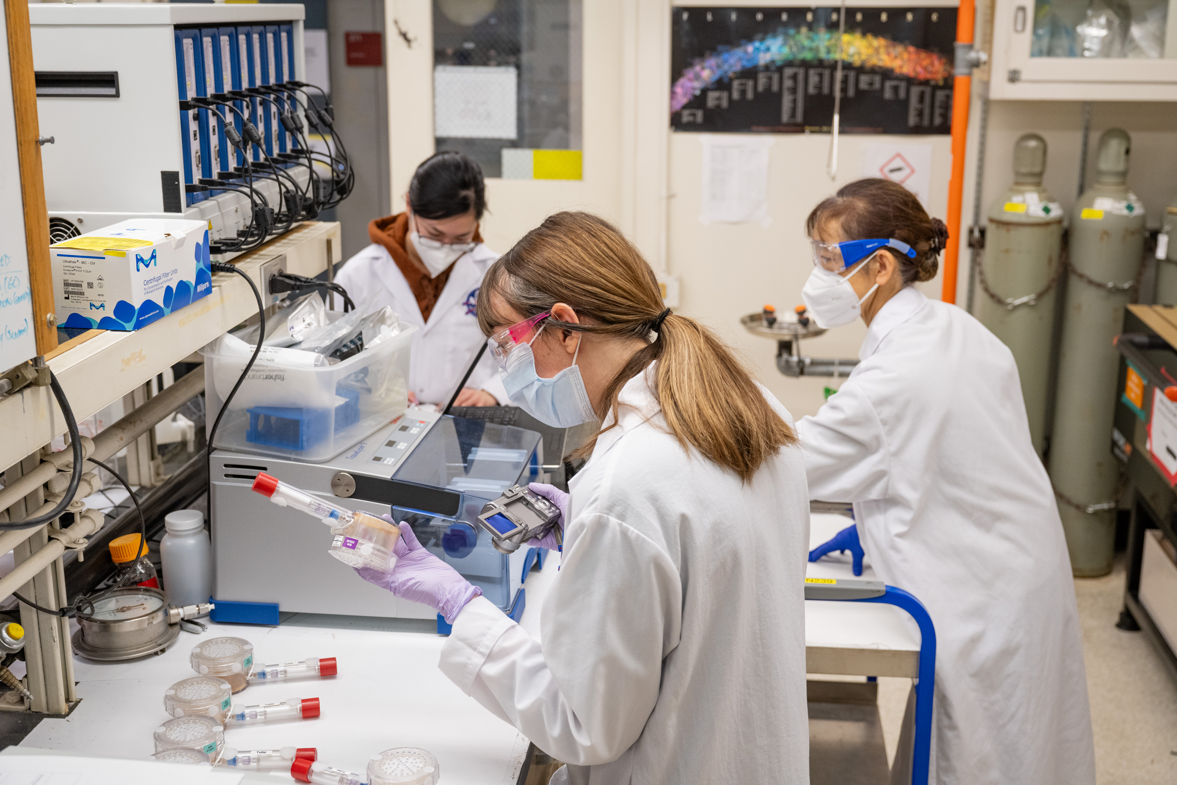
Research scientists Sandra Vu, left, Natalie Ball, center, and Hiromi Kagawa, right, process BioNutrients production packs.
NASA/Brandon Torres Navarrete
NASA’s BioNutrients entered its fifth year in its mission to investigate how microorganisms can produce on-demand nutrients for astronauts during long-duration space missions. Keeping astronauts healthy is critical and as the project comes to a close, researchers have processed production packs on Earth on the same day astronauts processed production packs in space on the International Space Station to demonstrate that NASA can produce nutrients after at least five years in space, providing confidence it will be capable of supporting crewed missions to Mars.
Hyperwall Upgrade Helps Scientists Interpret Big Data
The newly upgraded hyperwall visualization system provides four times the resolution of the previous system.
NASA/Brandon Torres Navarrete
Ames upgraded its powerful hyperwall system, a 300-square foot wall of LCD screens with over a billion pixels to display supercomputer-scale visualizations of the very large datasets produced by NASA supercomputers and instruments. The hyperwall is just one way researchers can utilize NASA’s high-end computing technology to better understand their data and advance the agency’s missions and research.
Ames Contributions to NASA Artificial Intelligence Efforts
NASA public affairs officer Melissa Howell moderates as chief scientist Kate Calvin speaks alongside chief technologist AC Charania, chief artificial intelligence officer David Salvagnini, and chief information officer Jeff Seaton at the agency’s first artificial intelligence town hall.
NASA/Bill Ingalls
Ames contributes to the agency’s artificial intelligence work through ongoing research and development, agencywide collaboration, and communications efforts. This year, NASA announced David Salvagnini as its inaugural chief artificial intelligence officer and held the first agencywide town hall on artificial intelligence sharing how the agency is safely using and developing artificial intelligence to advance missions and research.
Advanced Composite Solar Sail System Successfully Launches, Deploys Sail
NASA’s Advanced Composite Solar Sail System seeks to advance future space exploration and expand our understanding of our Sun and Solar System.
NASA’s Advanced Composite Solar Sail System successfully launched from Māhia, New Zealand, in April, and successfully deployed its sail in August to begin mission operations. The small satellite represents a new future in solar sailing, using lightweight composite booms to support a reflective polymer sail that uses the pressure of sunlight as propulsion.
Understanding Our Planet
Samuel Suleiman, an instructor on NASA’s OCEANOS student training program, gathers loose corals to place around an endangered coral species to help attract fish and other wildlife, giving the endangered coral a better chance of survival.
Revealing the Mysteries of Asteroids in Our Solar System
NASA
Ames researchers used a series of supercomputer simulations to reveal a potential new explanation for how the moons of Mars may have formed: The first step, the findings say, may have involved the destruction of an asteroid.
Using NASA’s powerful James Webb Space Telescope, another Ames scientist helped reveal the smallest asteroids ever found in the main asteroid belt.
Ames Helps Emerging Space Companies ‘Take the Heat’
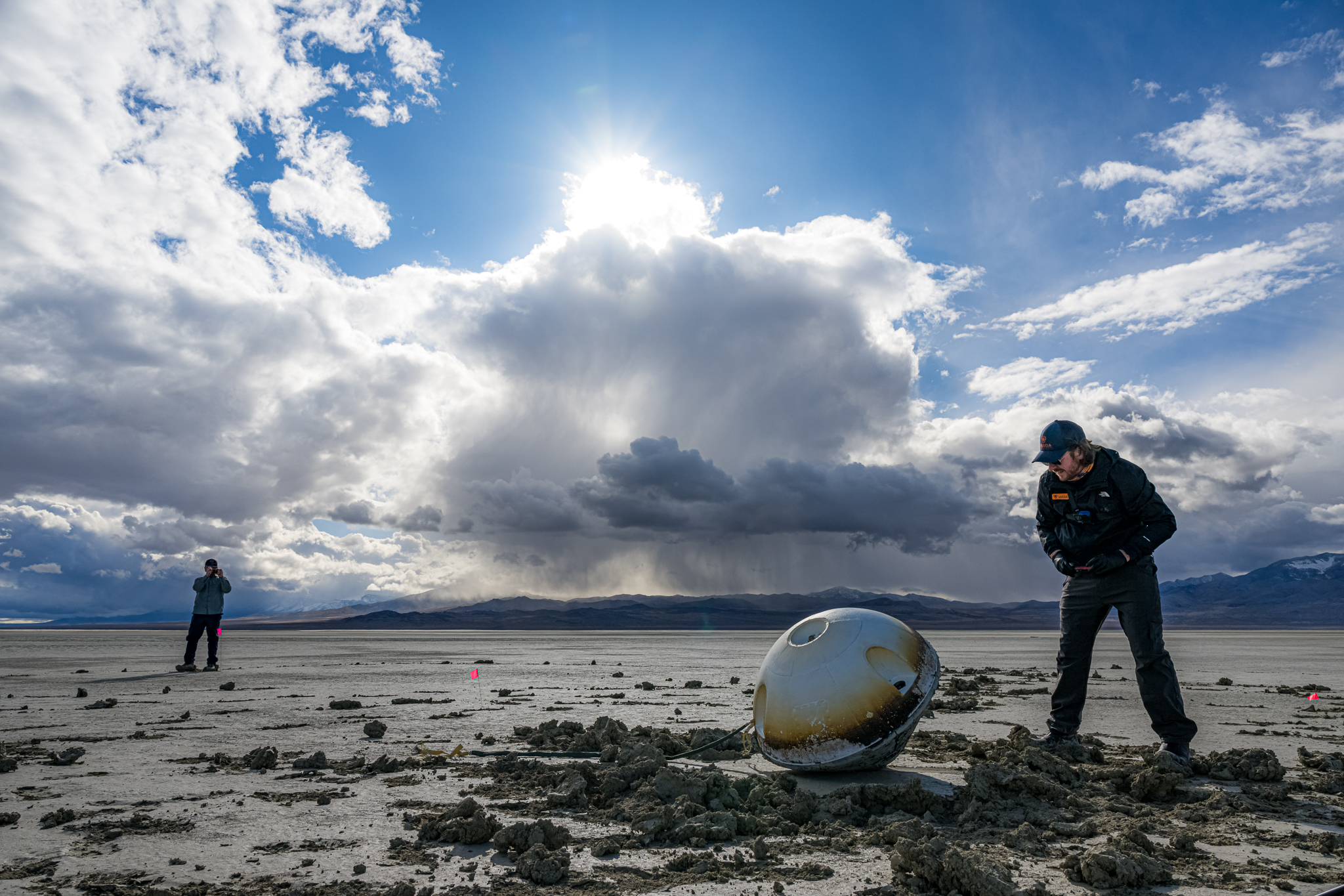
A heat shield made by NASA is visible on the blunt, upward-facing side of a space capsule after its landing in the Utah desert.
Varda Space Industries/John Kraus
A heat shield material invented and made at Ames helped to safely return a spacecraft containing the first product processed on an autonomous, free-flying, in-space manufacturing platform. February’s re-entry of the spacecraft from Varda Space Industries of El Segundo, California, in partnership with Rocket Lab USA of Long Beach, California, marked the first time a NASA-manufactured thermal protection material, called C-PICA (Conformal Phenolic Impregnated Carbon Ablator), ever returned from space.
Team Continues to Move Forward with Mission to Learn More about Our Star
This illustration lays a depiction of the sun’s magnetic fields over an image captured by NASA’s Solar Dynamics Observatory on March 12, 2016.
NASA/SDO/AIA/LMSAL
HelioSwarm’s swarm of nine spacecraft will provide deeper insights into our universe and offer critical information to help protect astronauts, satellites, and communications signals such as GPS. The mission team continues to work toward launching in 2029.
CAPSTONE Continues to Chart a New Path Around the Moon
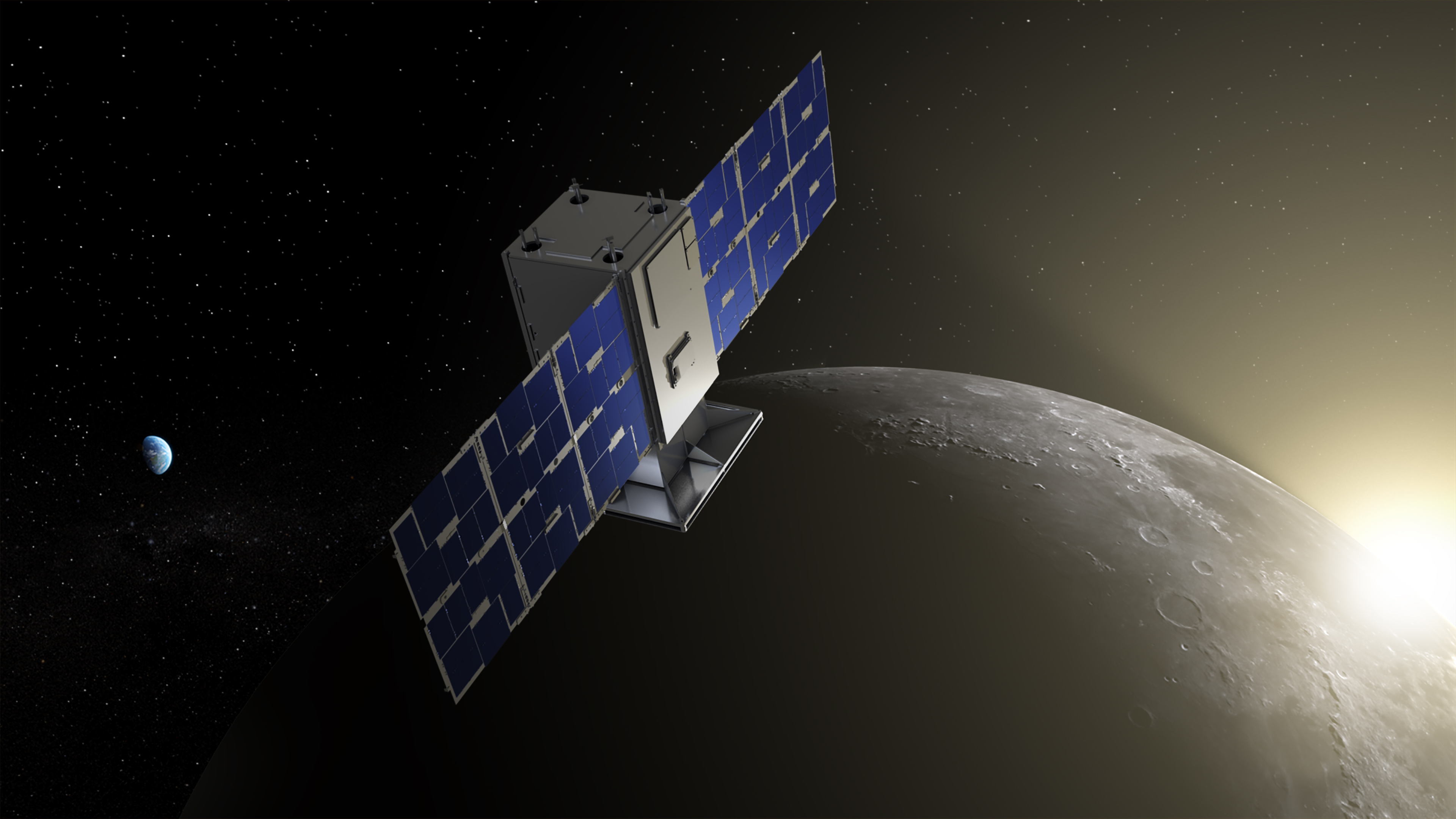
CAPSTONE revealed in lunar Sunrise: CAPSTONE will fly in cislunar space – the orbital space near and around the Moon. The mission will demonstrate an innovative spacecraft-to-spacecraft navigation solution at the Moon from a near rectilinear halo orbit slated for Artemis’ Gateway.
Credits: Illustration by NASA/Daniel Rutter
The microwave sized CubeSat, CAPSTONE, continues to fly in a cis-lunar near rectilinear halo orbit after launching in 2022. Flying in this unique orbit continues to pave the way for future spacecraft and Gateway, a Moon-orbiting outpost that is part of NASA’s Artemis campaign, as the team continues to collect data.
NASA Moves Drone Package Delivery Industry Closer to Reality
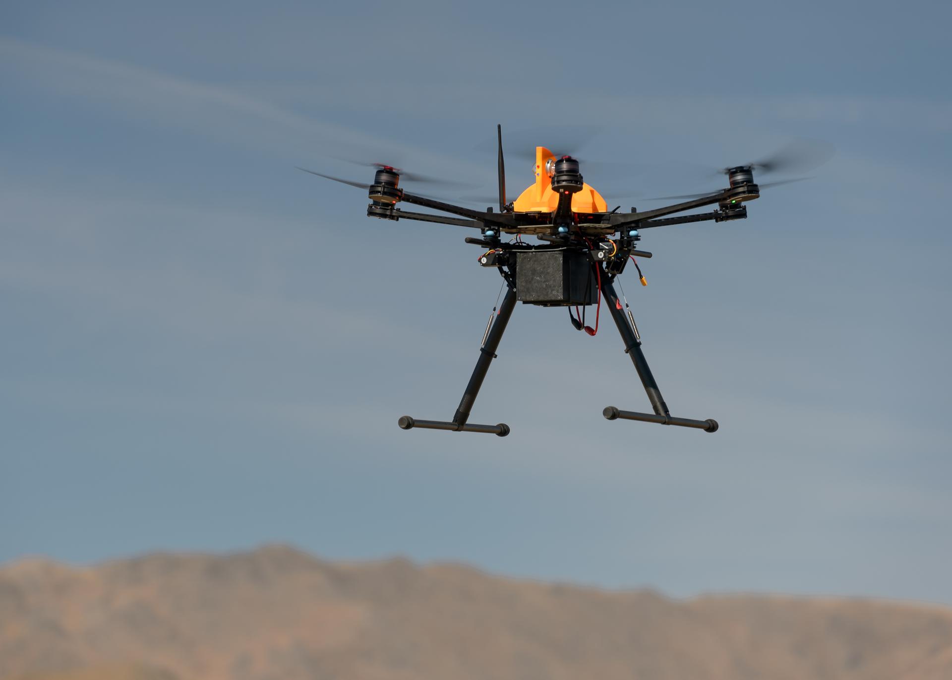
A drone is shown flying during a test of Unmanned Aircraft Systems Traffic Management (UTM) technical capability Level 2 (TCL2) at Reno-Stead Airport, Nevada in 2016. During the test, five drones simultaneously crossed paths, separated by different altitudes. Two drones flew beyond visual line of sight and three flew within line-of-sight of their operators. More UTM research followed, and it continues today.
Dominic Hart
NASA’s uncrewed aircraft system traffic management concepts paved the way for newly-approved package delivery drone flights in the Dallas area.
NASA Technologies Streamline Air Traffic Management Systems
This image shows an aviation version of a smartphone navigation app that makes suggestions for an aircraft to fly an alternate, more efficient route. The new trajectories are based on information available from NASA’s Digital Information Platform and processed by the Collaborative Departure Digital Rerouting tool.
NASA
Managing our busy airspace is a complex and important issue, ensuring reliable and efficient movement of commercial and public air traffic as well as autonomous vehicles. NASA, in partnership with AeroVironment and Aerostar, demonstrated a first-of-its-kind air traffic management concept that could pave the way for aircraft to safely operate at higher altitudes. The agency also saw continued fuel savings and reduction in commercial flight delays at Dallas Fort-Worth Airport, thanks to a NASA-developed tool that allows flight coordinators to identify more efficient, alternative takeoff routes.
Small Spacecraft Gathers Big Solar Storm Data from Deep Space
Illustration of NASA’s BioSentinel spacecraft as it enters a heliocentric orbit.
NASA/Daniel Rutter
BioSentinel – a small satellite about the size of a cereal box – is currently more than 30 million miles from Earth, orbiting our Sun. After launching aboard NASA’s Artemis I more than two years ago, BioSentinel continues to collect valuable information for scientists trying to understand how solar radiation storms move through space and where their effects – and potential impacts on life beyond Earth – are most intense. In May 2024, the satellite was exposed to a coronal mass ejection without the protection of our planet’s magnetic field and gathered measurements of hazardous solar particles in deep space during a solar storm.
NASA, FAA Partner to Develop New Wildland Fire Technologies
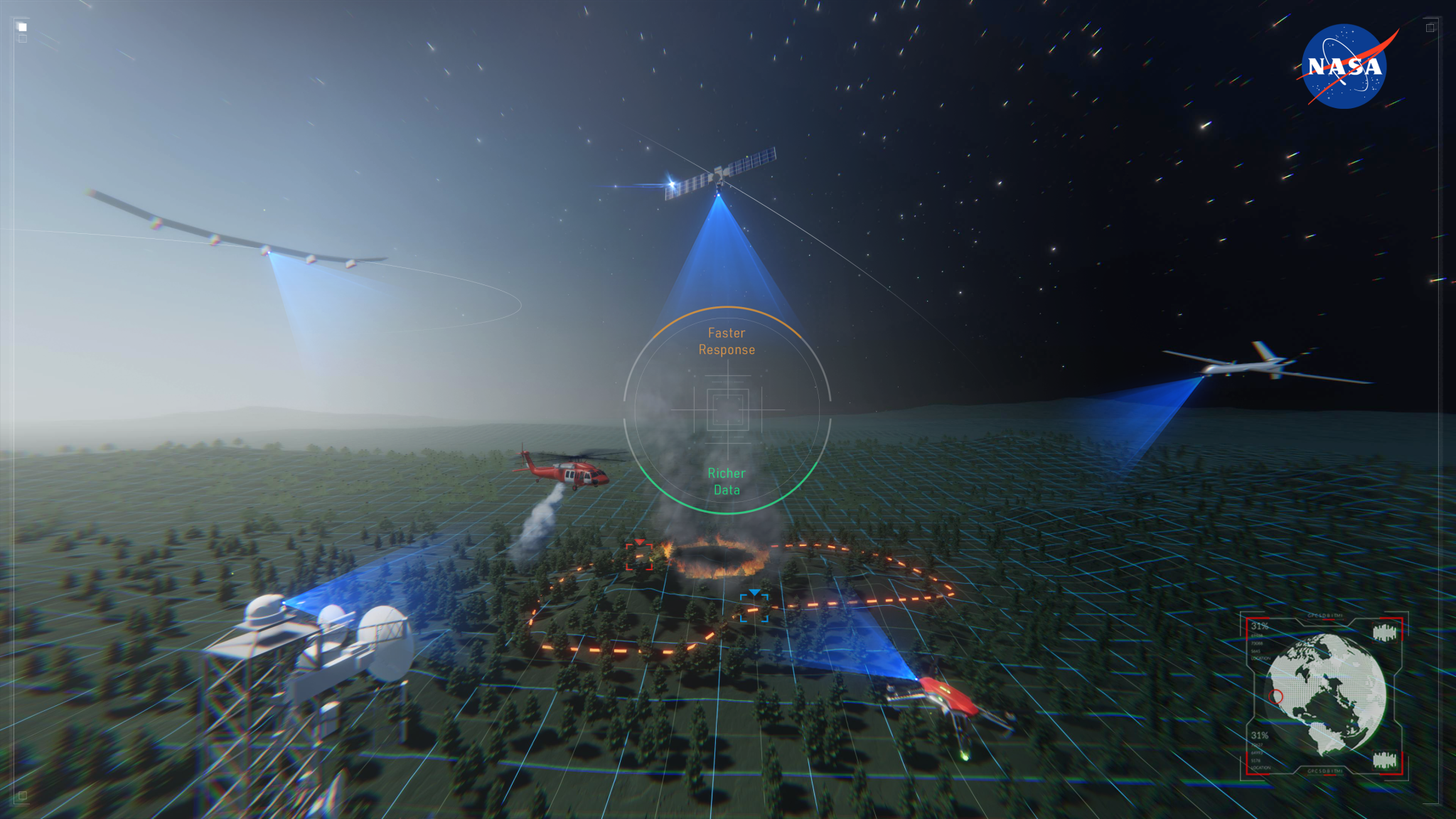
Artist’s rendering of remotely piloted aircraft providing fire suppression, monitoring and communications capabilities during a wildland fire.
NASA
NASA researchers continued to develop and test airspace management technologies to enable remotely-piloted aircraft to fight and monitor wildland fires 24 hours a day.
The Advanced Capabilities for Emergency Response Operations (ACERO) project seeks to use drones and advanced aviation technologies to improve wildland fire coordination and operations.
NASA and Forest Service Use Balloon to Help Firefighters Communicate

The Aerostar Thunderhead balloon carries the STRATO payload into the sky to reach the stratosphere for flight testing. The balloon appears deflated because it will expand as it rises to higher altitudes where pressures are lower.
Colorado Division of Fire Prevention and Control Center of Excellence for Advanced Technology Aerial Firefighting/Austin Buttlar
The Strategic Tactical Radio and Tactical Overwatch (STRATO) technology is a collaborative effort to use high-altitude balloons to improve real-time communications among firefighters battling wildland fires. Providing cellular communication from above can improve firefighter safety and firefighting efficiency.
A Fully Reimagined Visitor Center
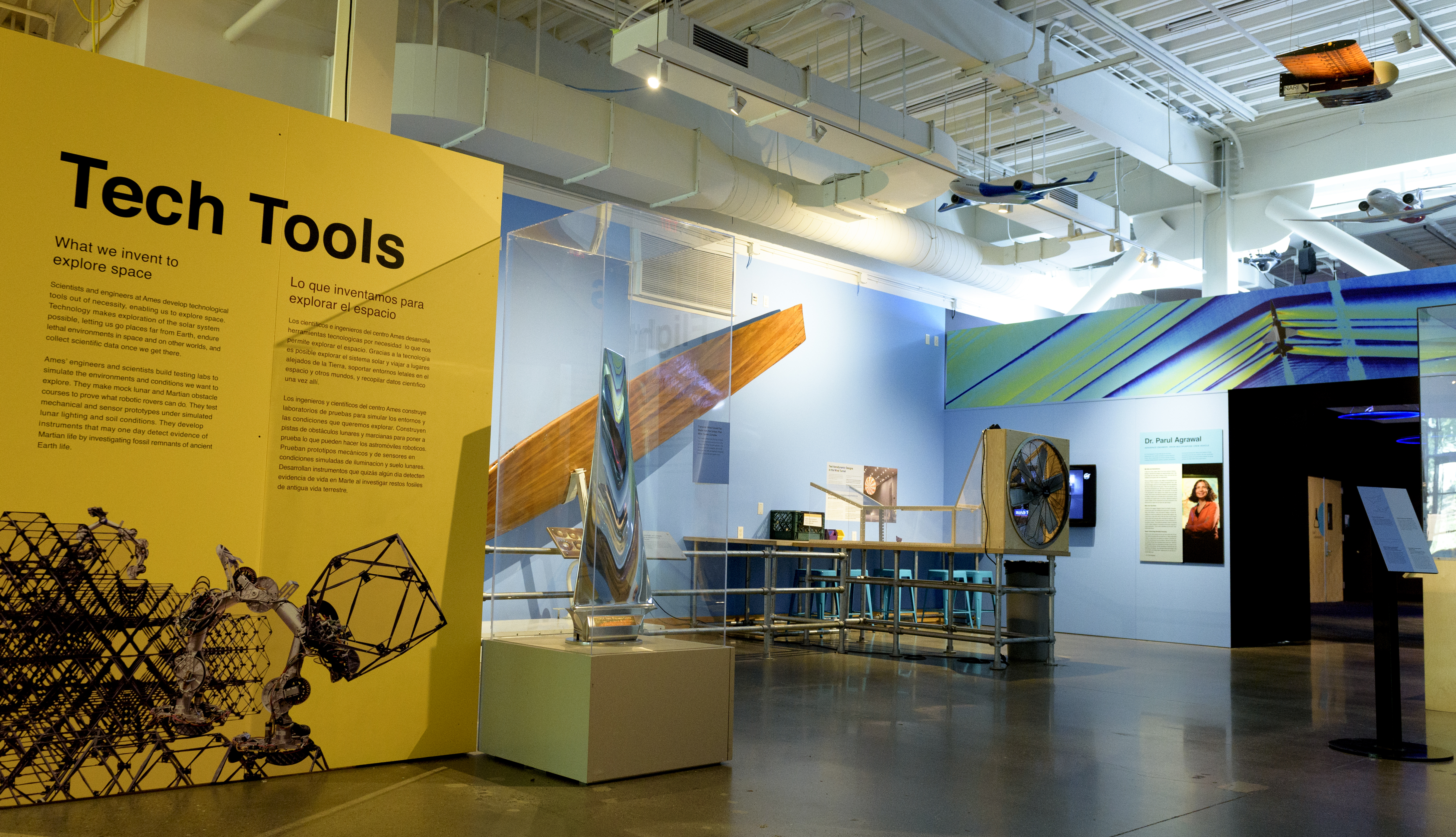
The NASA Ames Visitor Center includes exhibits and activities, sharing the work of NASA in Silicon Valley with the public.
NASA/Don Richey
The NASA Ames Visitor Center at Chabot Space & Science Center in Oakland, California includes a fully reimagined 360-degree experience, featuring new exhibits, models, and more. An interactive exhibit puts visitors in the shoes of a NASA Ames scientist, designing and testing rovers, planes, and robots for space exploration.
Ames Collaborations in the Community
Former NASA astronauts Yvonne Cagle and Kenneth Cockrell pose with Eli Toribio and Rhydian Daniels at the University of California, San Francisco Bakar Cancer Hospital. Patients gathered to meet the astronauts and learn more about human spaceflight and NASA’s cancer research efforts
NASA/Brandon Torres Navarrete
NASA astronauts, scientists, and researchers, and leadership from the University of California, San Francisco (UCSF) met with cancer patients and gathered in a discussion about potential research opportunities and collaborations as part of President Biden and First Lady Jill Biden’s Cancer Moonshot initiative on Oct. 4. During the visit with patients, NASA astronaut Yvonne Cagle and former astronaut Kenneth Cockrell answered questions about spaceflight and life in space.
Ames and the University of California, Berkeley, expanded their partnership, organizing workshops to exchange on their areas of technical expertise, including in Advanced Air Mobility, and to develop ideas for the Berkeley Space Center, an innovation hub proposed for development at Ames’ NASA Research Park. Under a new agreement, NASA also will host supercomputing resources for UC Berkeley, supporting the development of novel computing algorithms and software for a wide variety of scientific and technology areas.
Preparations for Next Moonwalk Simulations Underway (and Underwater)
NASA Deputy Administrator Pam Melroy speaks at the Microgravity Science Summit at the Eisenhower Executive Office Building, Monday, Dec. 13, 2024, in Washington.
Credit: NASA/Aubrey Gemignani
NASA leadership participated in the White House Office of Science and Technology Policy’s Microgravity Science Summit (OSTP) on Dec.16 focused on sharing information with leaders across the U.S. federal government about the benefits of microgravity research. During the summit, NASA Deputy Administrator Pam Melroy, OSTP leadership, and others highlighted the importance of the government coming together to understand the transformative power of microgravity and lay the foundation for the next generation of research and innovation.
“The value of microgravity research has never been clearer. This unique environment offers us the chance to explore fundamental questions and test cutting-edge ideas in ways that simply are not possible under the constraints of Earth’s gravity,” said Melroy. “NASA has long been at the forefront of microgravity research, working in collaboration with a growing network of government partners, international space agencies, commercial partners, and academic institutions. Together, we have established a strong foundation for microgravity science aboard the International Space Station, but our work is far from finished. In fact, it’s only just beginning.”
The theme of the summit, “Building a Coalition for the Next Generation of Microgravity Research,” covered work currently being completed on the International Space Station to bring benefit back to Earth, open space to more people, and allow humans to travel farther into space for exploration. Leaders also heard about NASA’s plan to continue the work into the future on commercial space stations and build on the government’s efforts to maintain a national research capability in orbit.
In 2023, the Biden-Harris Administration released a National Low Earth Orbit Research and Development Strategy to provide an interagency strategy and action plan to enable U.S. government-wide collaboration and support of public-private partnerships to ensure continuity of access and sustainable low Earth orbit research and development activities. The strategy supports the United States Space Priorities Framework with a focus on scientific and technological innovation, economic growth, commercial development, and space-related STEM education and workforce development. The summit also included discussion on the great strides and potential for the future in cancer research, semiconductors, wildland fire management, and in space production applications.
“The key to success will be collaboration,” said Melroy. “What we are doing is building a vision for the future—one where microgravity is not a niche area of study, but an essential part of the scientific toolkit for tackling our biggest challenges, helping to improve our national capabilities and posture. A future where space isn’t just a far-off and mysterious destination—it’s an environment for collaboration, discovery, and progress.”
On Dec. 16, NASA also released its Low Earth Orbit Microgravity strategy outlining the agency’s long-term approach to advance microgravity science, technology, and exploration.
Cutting-Edge Satellite Tracks Lake Water Levels in Ohio River Basin
5 min read
Preparations for Next Moonwalk Simulations Underway (and Underwater)
Data from the SWOT satellite was used to calculate average water levels for lakes and reservoirs in the Ohio River Basin from July 2023 to November 2024. Yellow indicates values greater than 1,600 feet (500 meters) above sea level; dark purple represents water levels less than 330 feet (100 meters).
Data from the U.S.-European Surface Water and Ocean Topography mission gives researchers a detailed look at lakes and reservoirs in a U.S. watershed.
The Ohio River Basin stretches from Pennsylvania to Illinois and contains a system of reservoirs, lakes, and rivers that drains an area almost as large as France. Researchers with the SWOT (Surface Water and Ocean Topography) mission, a collaboration between NASA and the French space agency CNES (Centre National d’Études Spatiales), now have a new tool for measuring water levels not only in this area, which is home to more than 25 million people, but in other watersheds around the world as well.
Since early 2023, SWOT has been measuring the height of nearly all water on Earth’s surface — including oceans, lakes, reservoirs, and rivers — covering nearly the entire globe at least once every 21 days. The SWOT satellite also measures the horizontal extent of water in freshwater bodies. Earlier this year, the mission started making validated data publicly available.
“Having these two perspectives — water extent and levels — at the same time, along with detailed, frequent coverage over large areas, is unprecedented,” said Jida Wang, a hydrologist at the University of Illinois Urbana-Champaign and a member of the SWOT science team. “This is a groundbreaking, exciting aspect of SWOT.”
Researchers can use the mission’s data on water level and extent to calculate how the amount of water stored in a lake or reservoir changes over time. This, in turn, can give hydrologists a more precise picture of river discharge — how much water moves through a particular stretch of river.
The visualization above uses SWOT data from July 2023 to November 2024 to show the average water level above sea level in lakes and reservoirs in the Ohio River Basin, which drains into the Mississippi River. Yellow indicates values greater than 1,600 feet (500 meters), and dark purple represents water levels less than 330 feet (100 meters). Comparing how such levels change can help hydrologists measure water availability over time in a local area or across a watershed.
Complementing a Patchwork of Data
Historically, estimating freshwater availability for communities within a river basin has been challenging. Researchers gather information from gauges installed at certain lakes and reservoirs, from airborne surveys, and from other satellites that look at either water level or extent. But for ground-based and airborne instruments, the coverage can be limited in space and time. Hydrologists can piece together some of what they need from different satellites, but the data may or may not have been taken at the same time, or the researchers might still need to augment the information with measurements from ground-based sensors.
Even then, calculating freshwater availability can be complicated. Much of the work relies on computer models. “Traditional water models often don’t work very well in highly regulated basins like the Ohio because they have trouble representing the unpredictable behavior of dam operations,” said George Allen, a freshwater researcher at Virginia Tech in Blacksburg and a member of the SWOT science team.
Many river basins in the United States include dams and reservoirs managed by a patchwork of entities. While the people who manage a reservoir may know how their section of water behaves, planning for water availability down the entire length of a river can be a challenge. Since SWOT looks at both rivers and lakes, its data can help provide a more unified view.
“The data lets water managers really know what other people in these freshwater systems are doing,” said SWOT science team member Colin Gleason, a hydrologist at the University of Massachusetts Amherst.
While SWOT researchers are excited about the possibilities that the data is opening up, there is still much to be done. The satellite’s high-resolution view of water levels and extent means there is a vast ocean of data that researchers must wade through, and it will take some time to process and analyze the measurements.
More About SWOT
The SWOT satellite was jointly developed by NASA and CNES, with contributions from the Canadian Space Agency (CSA) and the UK Space Agency. NASA’s Jet Propulsion Laboratory, managed for the agency by Caltech in Pasadena, California, leads the U.S. component of the project. For the flight system payload, NASA provided the Ka-band radar interferometer (KaRIn) instrument, a GPS science receiver, a laser retroreflector, a two-beam microwave radiometer, and NASA instrument operations. The Doppler Orbitography and Radioposition Integrated by Satellite system, the dual frequency Poseidon altimeter (developed by Thales Alenia Space), the KaRIn radio-frequency subsystem (together with Thales Alenia Space and with support from the UK Space Agency), the satellite platform, and ground operations were provided by CNES. The KaRIn high-power transmitter assembly was provided by CSA.