Hubble Spies a Spiral That May Be Hiding an Imposter

Hubble Spies a Spiral That May Be Hiding an Imposter

2 min read

Hubble Spies a Spiral That May Be Hiding an Imposter

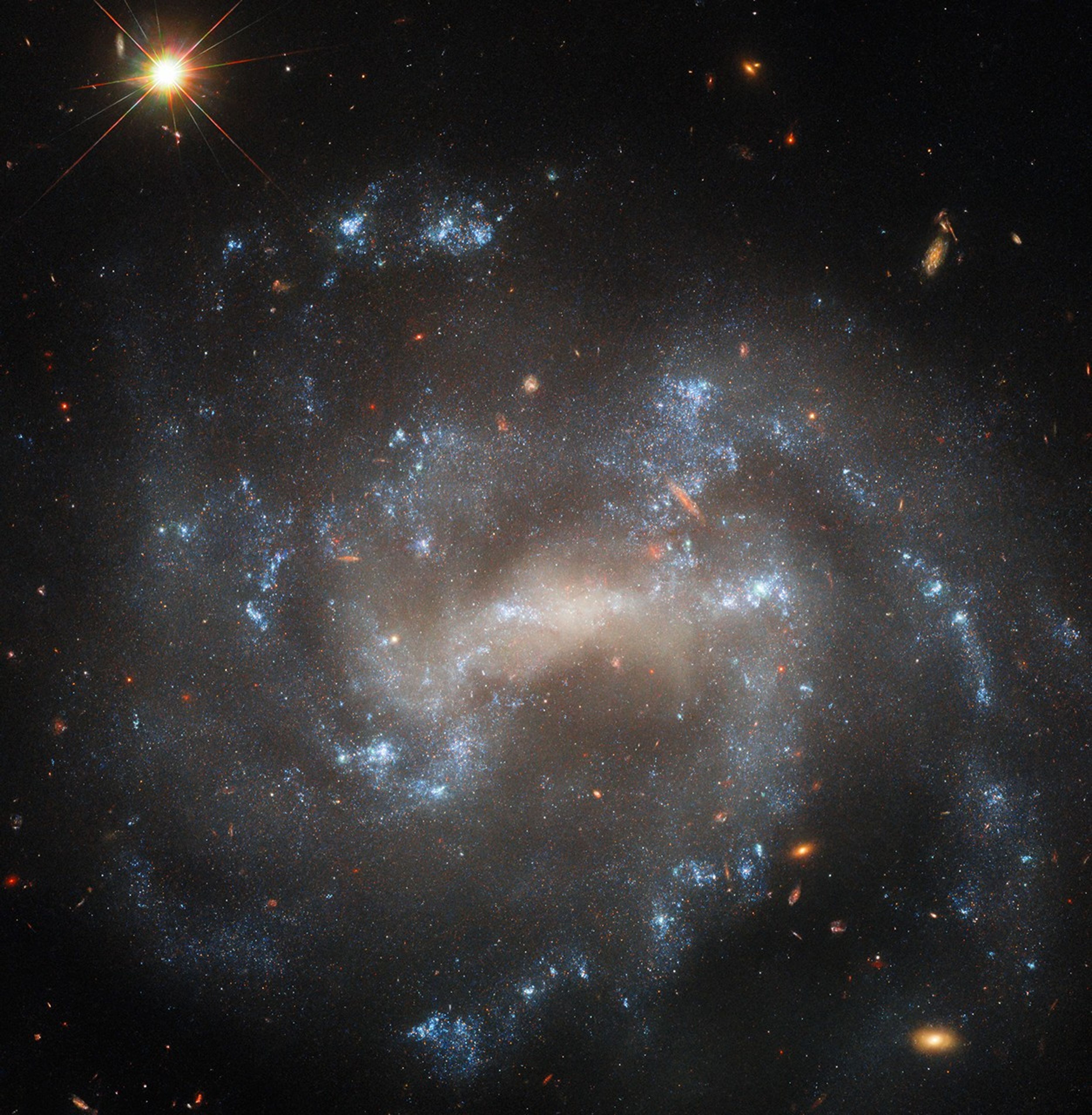
A spiral galaxy seen close to face-on. The center of its disk is a bright, pale yellowish, oval shape. Spiral arms extend from either side of the oval through the disk on irregular paths. The arms hold bright bluish-white patches of stars that mark their extent. Distant background galaxies appear as small orangish blobs around the spiral galaxy. In the top-left corner, a nearby star shines brightly, diffraction spikes are radiating from it.
The spiral galaxy UGC 5460 shines in this NASA/ESA Hubble Space Telescope image. UGC 5460 sits about 60 million light-years away in the constellation Ursa Major.
ESA/Hubble & NASA, W. Jacobson-Galán, A. Filippenko, J. Mauerhan

The sparkling spiral galaxy gracing this NASA/ESA Hubble Space Telescope image is UGC 5460, which sits about 60 million light-years away in the constellation Ursa Major. This image combines four different wavelengths of light to reveal UGC 5460’s central bar of stars, winding spiral arms, and bright blue star clusters. Also captured in the upper left-hand corner is a far closer object: a star just 577 light-years away in our own galaxy.

UGC 5460 has hosted two recent supernovae: SN 2011ht and SN 2015as. It’s because of these two stellar explosions that Hubble targeted this galaxy, collecting data for three observing programs that aim to study various kinds of supernovae.

SN 2015as was as a core-collapse supernova: a cataclysmic explosion that happens when the core of a star far more massive than the Sun runs out of fuel and collapses under its own gravity, initiating a rebound of material outside the core. Hubble observations of SN 2015as will help researchers understand what happens when the expanding shockwave of a supernova collides with the gas that surrounds the exploded star.

SN 2011ht might have been a core-collapse supernova as well, but it could also be an impostor called a luminous blue variable. Luminous blue variables are rare stars that experience eruptions so large that they can mimic supernovae. Crucially, luminous blue variables emerge from these eruptions unscathed, while stars that go supernova do not. Hubble will search for a stellar survivor at SN 2011ht’s location with the goal of revealing the explosion’s origin.

Explore More

Media Contact:

Claire Andreoli (claire.andreoli@nasa.gov)
NASA’s Goddard Space Flight CenterGreenbelt, MD

Powered by WPeMatico

Get The Details…

Sols 4458-4460: Winter Schminter

Sols 4458-4460: Winter Schminter

2 min read

Sols 4458-4460: Winter Schminter

A grayscale photograph shows a gently sloped, pyramid-shaped butte on the Martian surface, covered in innumerable rocks of varying sizes. The butte is very light gray, against a sky that’s uniformly dark gray, but slight shading differences on the butte show various layers to the feature.
NASA’s Mars rover Curiosity captured this image of the Texoli butte, a Martian landmark about 525 feet (160 meters) tall, with many layers that scientists are studying to learn more about the formation of this region of the Red Planet. The butte is on the 3-mile-high Mount Sharp, inside Gale Crater, where Curiosity landed and has been exploring since 2012. The rover acquired this image using its Left Navigation Camera on sol 4456, or Martian day 4,456 of the Mars Science Laboratory mission, on Feb. 17, 2025, at 17:51:56 UTC.
NASA/JPL-Caltech

Earth planning date: Tuesday, Feb. 18, 2025

During today’s unusual-for-MSL Tuesday planning day (because of the U.S. holiday on Monday), we planned activities under new winter heating constraints. Operating Curiosity on Mars requires attention to a number of factors — power, data volume, terrain roughness, temperature — that affect rover operability and safety. Winter means more heating to warm up the gears and mechanisms within the rover and the instruments, but energy that goes to heating means less energy for science observations. Nevertheless, we (and Curiosity) were up to the task of balancing heating and science, and planned enough observations to warm the science team’s hearts. 

We fit in DRT, APXS, and MAHLI on two different bedrock targets, “Chumash Trail” and “Wheeler Gorge,” which have different fracturing and layering features. In the workspace, ChemCam targeted a clean vertical exposure of layered bedrock at “Sierra Madre” and a lumpy-looking patch of resistant nodules at “Chiquito Basin.” 

The topography of the local terrain and our end-of-drive position after the weekend fortuitously lined up to give us a view of an exposure of the Marker Band, which we first explored on the other side of Gediz Vallis Ridge. Having a view of another exposure of this distinctive horizon helps give us further insight into its origin, so we included both RMI and Mastcam mosaics of the exposure. 

Documenting a feature that, unlike the Marker Band, has been and will be in our sights for a long time — “Texoli” butte (pictured above) — was the goal of additional Mastcam and ChemCam imaging. Observations of potential sedimentary structures on the flank of Texoli motivated acquisition of an RMI mosaic, and a chance to capture structures along its southeast face inspired a Mastcam mosaic. Good exposures of additional nearby bedrock structures at “Mount Lukens” and “Chantry Flat” drew the eye of Mastcam, while another small mosaic focused on the kind of linear troughs in the sand we often see bordering bedrock slabs. Environmental observations included Navcam cloud and dust-devil movies, Mastcam observations of dust in the atmosphere, and REMS and RAD measurements spread across the three sols of the plan.

Written by Michelle Minitti, Planetary Geologist at Framework

Share

Details

Last Updated
Feb 20, 2025

Related Terms

Powered by WPeMatico

Get The Details…

Guiding Orion: Jorge Chong’s Mission to Advance Deep Space Exploration 

Guiding Orion: Jorge Chong’s Mission to Advance Deep Space Exploration 

Jorge Chong is helping shape the future of human spaceflight, one calculation at a time. As a project manager for TRON (Tracking and Ranging via Optical Navigation) and a guidance, navigation, and control (GNC) test engineer in the Aeroscience and Flight Mechanics Division, he is leading efforts to ensure the Orion spacecraft can navigate deep space autonomously. 

Jorge Chong in front of the Mission Control Center at NASA’s Johnson Space Center in Houston when he helped with optical navigation operations during Artemis I.
Image courtesy of Jorge Chong

“GNC is like the brain of a spacecraft. It involves a suite of sensors that keep track of where the vehicle is in orbit so it can return home safely,” he said. “Getting to test the components of a GNC system makes you very familiar with how it all works together, and then to see it fly and help it operate successfully is immensely rewarding.” 

His work is critical to the Artemis campaign, which aims to return humans to the Moon and pave the way for Mars. From developing optical navigation technology that allows Orion to determine its position using images of Earth and the Moon to testing docking cameras and Light Detection and Ranging systems that enable autonomous spacecraft rendezvous, Chong is pushing the limits of exploration. He also runs high-fidelity flight simulations at Lockheed Martin’s Orion Test Hardware facility in Houston, ensuring Orion’s software is ready for the demands of spaceflight. 

Chong’s NASA career spans seven years as a full-time engineer, plus three years as a co-op student at NASA’s Johnson Space Center in Houston. In 2024, he began leading Project TRON, an optical navigation initiative funded by a $2 million Early Career Initiative award. The project aims to advance autonomous space navigation—an essential capability for missions beyond Earth’s orbit. 

Jorge Chong and his colleagues with the Artemis II docking camera in the Electro-Optics Lab at Johnson. From left to right: Paul McKee, Jorge Chong, and Kevin Kobylka. Bottom right: Steve Lockhart and Ronney Lovelace.

Thanks to Chong’s work, the Artemis Generation is one step closer to exploring the Moon, Mars, and beyond. He supported optical navigation operations during Artemis I, is writing software that will fly on Artemis II, and leads optical testing for Orion’s docking cameras. But his path to NASA wasn’t always written in the stars. 

“I found math difficult as a kid,” Chong admits. “I didn’t enjoy it at first, but my parents encouraged me patiently, and eventually it started to click and then became a strength and something I enjoyed. Now, it’s a core part of my career.” He emphasizes that perseverance is key, especially for students who may feel discouraged by challenging subjects. 

Most of what Chong has learned, he says, came from working collaboratively on the job. “No matter how difficult something may seem, anything can be learned,” he said. “I could not have envisioned being involved in projects like these or working alongside such great teams before coming to Johnson.” 

Jorge Chong (left) and his siblings Ashley and Bronsen at a Texas A&M University game.
Image courtesy of Jorge Chong

His career has also reinforced the importance of teamwork, especially when working with contractors, vendors, universities, and other NASA centers. “Coordinating across these dynamic teams and keeping the deliverables on track can be challenging, but it has helped to be able to lean on teammates for assistance and keep communication flowing,” said Chong.

And soon, those systems will help Artemis astronauts explore places no human has gone before. Whether guiding Orion to the Moon or beyond, Chong’s work is helping NASA write the next chapter of space exploration. 

“I thank God for the doors He has opened for me and the incredible mentors and coworkers who have helped me along the way,” he said. 

Powered by WPeMatico

Get The Details…
Sumer Loggins

60 Years Ago: Ranger 8 Moon Photos Aid in Apollo Site Selection 

60 Years Ago: Ranger 8 Moon Photos Aid in Apollo Site Selection 

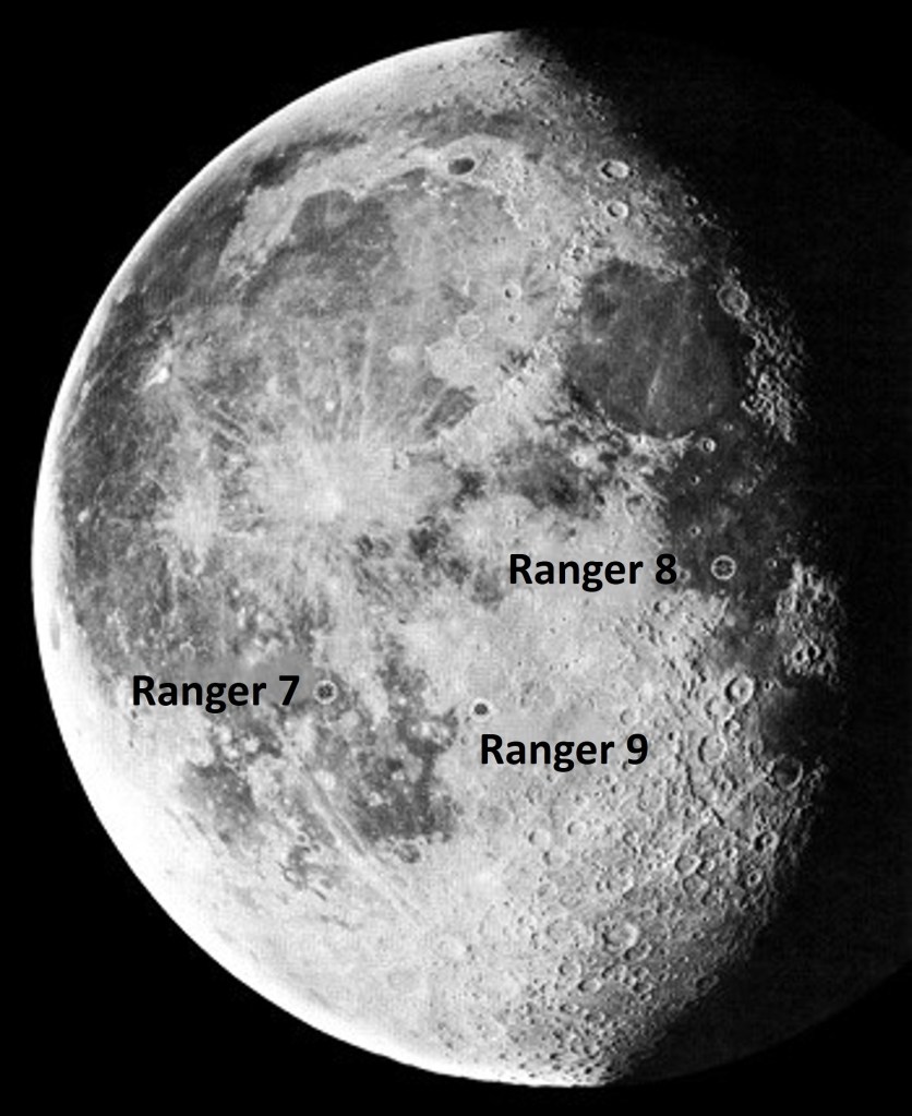
Before Apollo astronauts set foot upon the Moon, much remained unknown about the lunar surface. While most scientists believed the Moon had a solid surface that would support astronauts and their landing craft, a few believed a deep layer of dust covered it that would swallow any visitors. Until 1964, no closeup photographs of the lunar surface existed, only those obtained by Earth-based telescopes. 

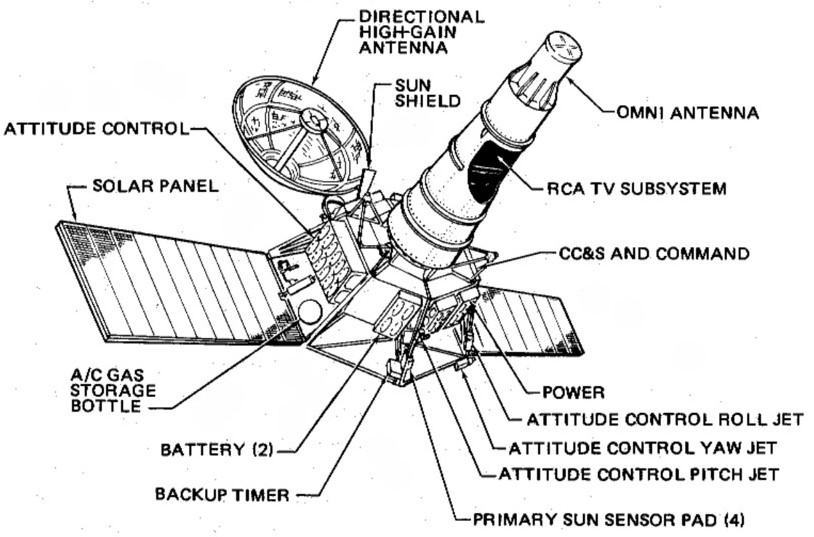
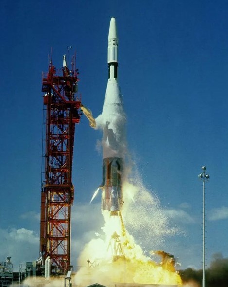
NASA’s Jet Propulsion Laboratory in Pasadena, California, managed the Ranger program, a series of spacecraft designed to return closeup images before impacting on the Moon’s surface. Ranger 7 first accomplished that goal in July 1964. On Feb. 17, 1965, its successor Ranger 8 launched toward the Moon, and three days later returned images of the Moon. The mission’s success helped the country meet President John F. Kennedy’s goal of a human Moon landing before the end of the decade. 

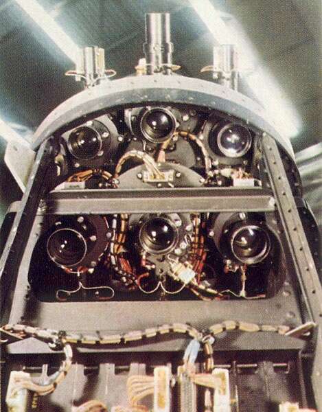
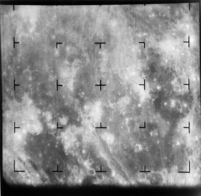
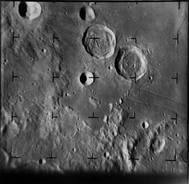
Ranger 8 lifted off from Cape Kennedy, now Cape Canaveral, Florida, on Feb. 17, 1965. The Atlas-Agena rocket first placed the spacecraft into Earth orbit before sending it on a lunar trajectory. The next day, the spacecraft carried out a mid-course correction, and on Feb. 20, Ranger 8 reached the Moon. The spacecraft’s six cameras turned on as planned, about eight minutes earlier than its predecessor to obtain images comparable in resolution to ground-based photographs for calibration purposes. Ranger 8 took its first photograph at an altitude of 1,560 miles, and during its final 23 minutes of flight, the spacecraft sent back 7,137 images of the lunar surface. The last image, taken at an altitude of 1,600 feet and 0.28 seconds before Ranger 8 impacted at 1.67 miles per second, had a resolution of about five feet. The spacecraft impacted 16 miles from its intended target in the Sea of Tranquility, ending a flight of 248,900 miles. Scientists had an interest in this area of the Moon as a possible landing zone for a future human landing, and indeed Apollo 11 landed 44 miles southeast of the Ranger 8 impact site in July 1969.  

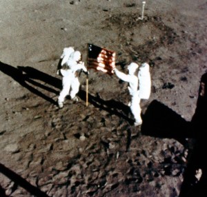
One more Ranger mission followed, Ranger 9, in March 1965. Television networks broadcast Ranger 9’s images of the Alphonsus crater and the surrounding area “live” as the spacecraft approached its impact site in the crater – letting millions of Americans see the Moon up-close as it happened. Based on the photographs returned by the last three Rangers, scientists felt confident to move on to the next phase of robotic lunar exploration, the Surveyor series of soft landers. The Ranger photographs provided confidence that the lunar surface could support a soft-landing and that the Sea of Tranquility presented a good site for the first human landing. A little more than four years after the final Ranger images, Apollo 11 landed the first humans on the Moon. 

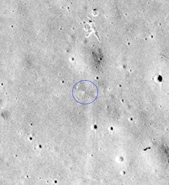
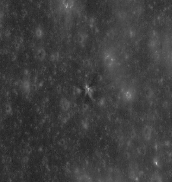
The impacts of the Ranger probes left visible craters on the lunar surface, later photographed by orbiting spacecraft. Lunar Orbiter 2 and Apollo 16 both imaged the Ranger 8 impact site at relatively low resolution in 1966 and 1972, respectively. The Lunar Reconnaissance Orbiter imaged the crash site in greater detail in 2012. 

Watch a brief video about the Ranger 8 impact on the Moon. 

Powered by WPeMatico

Get The Details…
John J. Uri

55 Years Ago: Preps for Apollo 13 and 14, Apollo 12 Crew on World Tour

55 Years Ago: Preps for Apollo 13 and 14, Apollo 12 Crew on World Tour

With two months to go before flight, the Apollo 13 prime crew of James Lovell, Thomas Mattingly, Fred Haise, and backups John Young, John Swigert, and Charles Duke continued to train for the 10-day mission planned to land in the Fra Mauro highlands region of the Moon. Engineers continued to prepare the Saturn V rocket and spacecraft at the launch pad for the April 11, 1970, liftoff and completed the Flight Readiness Test of the vehicle. All six astronauts spent many hours in flight simulators training while the Moon walkers practiced landing the Lunar Module and rehearsed their planned Moon walks. The crew for the next Moon landing mission, Apollo 14, participated in a geology field trip as part of their training for the flight then planned for October 1970. Meanwhile, NASA released Apollo 12 lunar samples to scientists and the Apollo 12 crew set off on a Presidential world goodwill tour.  

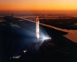
At NASA’s Kennedy Space Center in Florida, engineers completed the Flight Readiness Test of the Apollo 13 Saturn V on Feb. 26. The test ensured that all systems are flight ready and compatible with ground support equipment, and the astronauts simulated portions of the countdown and powered flight. Successful completion of the readiness test cleared the way for a countdown dress rehearsal at the end of March. 

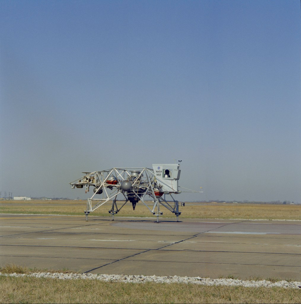
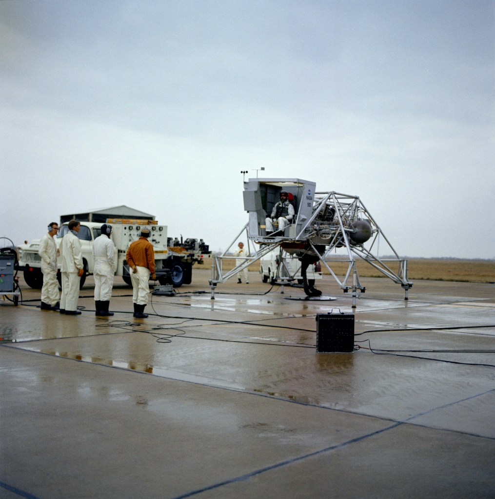
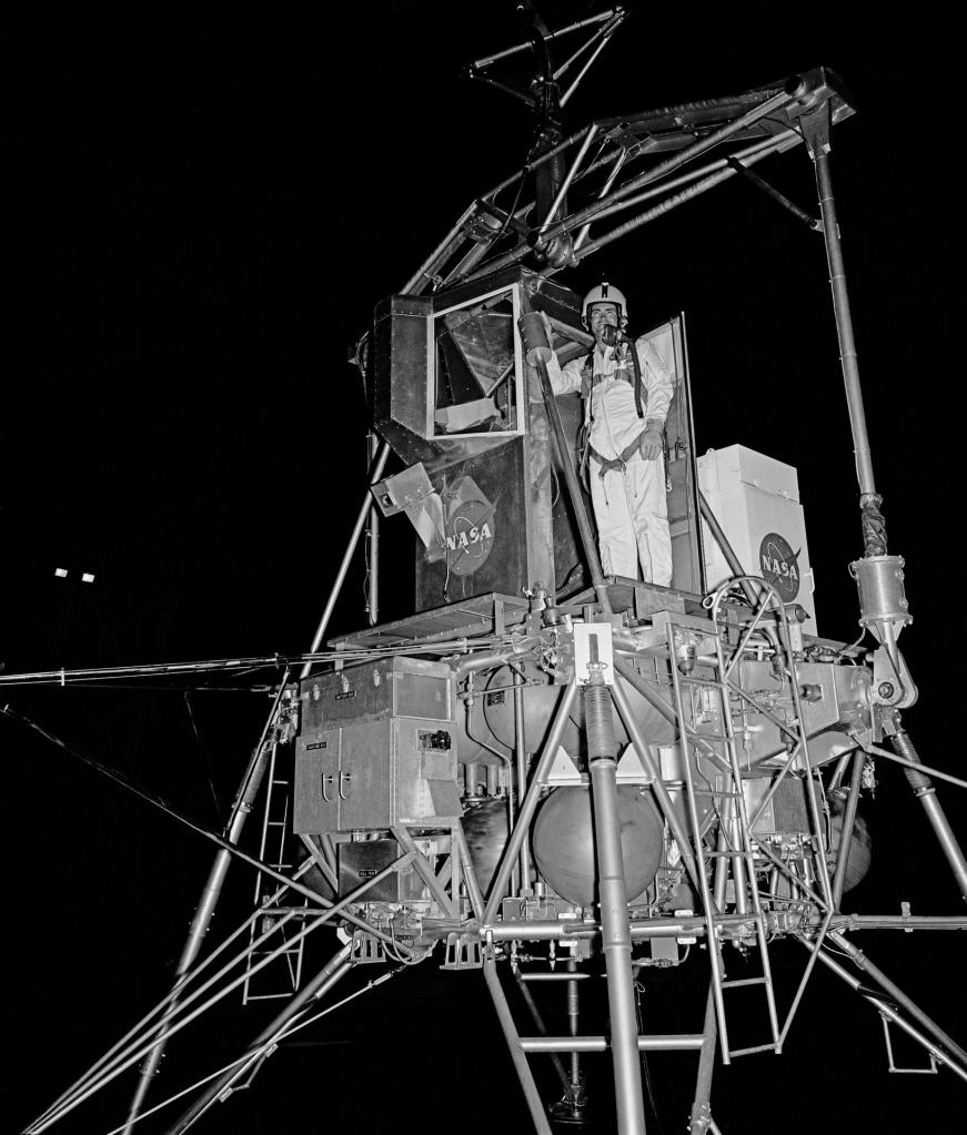
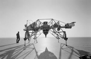
One of the greatest challenges astronauts faced during a lunar mission entailed completing a safe landing on the lunar surface. In addition to time spent in simulators, Apollo mission commanders and their backups trained for the final few hundred feet of the descent using the Lunar Landing Training Vehicle at Ellington Air Force Base near the Manned Spacecraft Center, now NASA’s Johnson Space Center, in Houston. Bell Aerosystems of Buffalo, New York, built the trainer for NASA to simulate the flying characteristics of the Lunar Module. Lovell and Young completed several flights in February 1970. Due to scheduling constraints with the trainer, lunar module pilots trained for their role in the landing using the Lunar Landing Research Facility at NASA’s Langley Research Center in Hampton, Virginia. Haise and Duke completed training sessions at the Langley facility in February. 

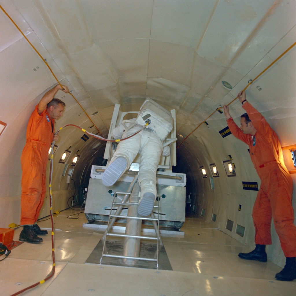
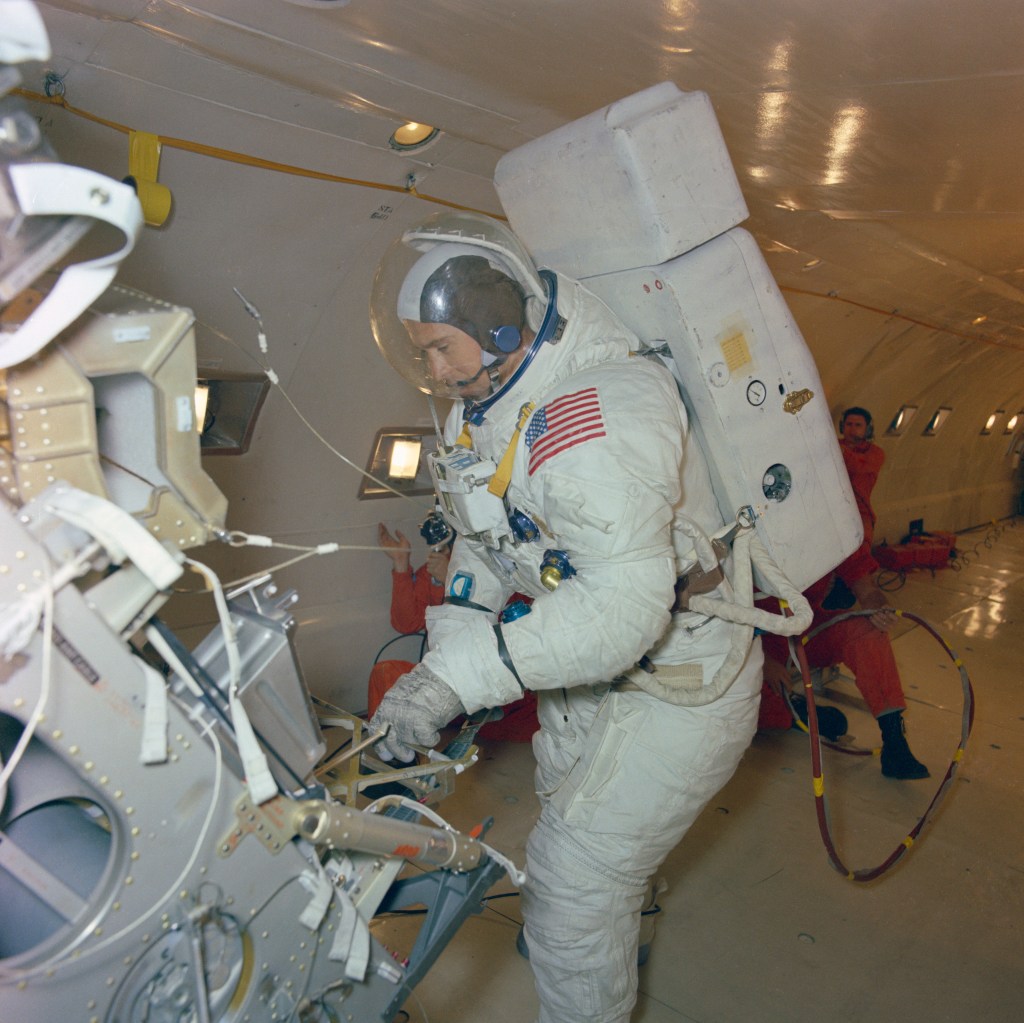
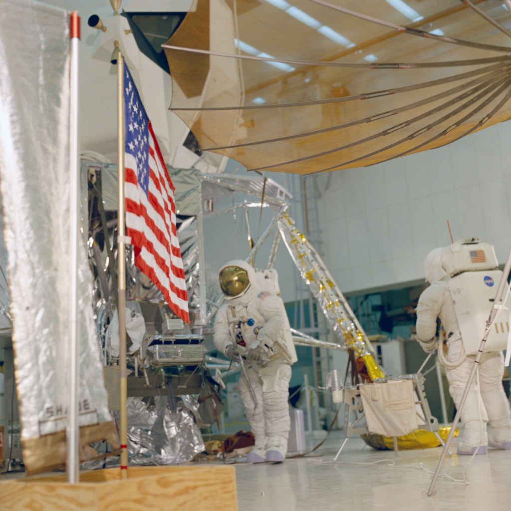
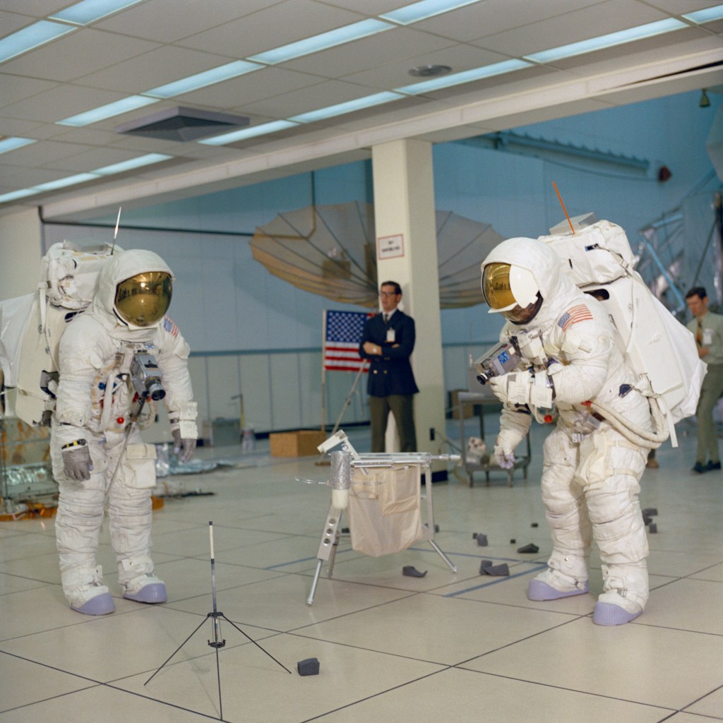
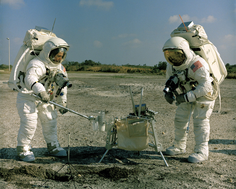
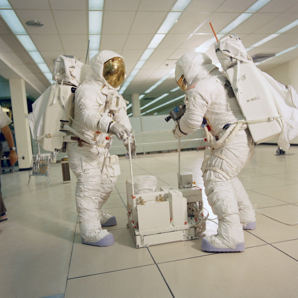
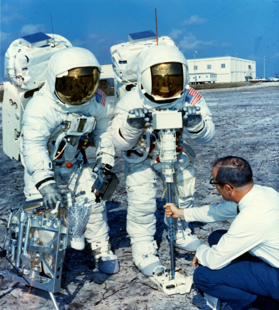
The astronauts trained for moonwalks with parabolic flights aboard NASA’s KC-135 aircraft that simulated the low lunar gravity, practicing their ladder descent to the surface. On the ground, they rehearsed the moonwalks, setting up the American flag and the large S-band communications antenna, and collecting lunar samples. Engineers improved their spacesuits to make the expected longer spacewalks more comfortable for the crew members by installing eight-ounce bags of water inside the helmets for hydration. 

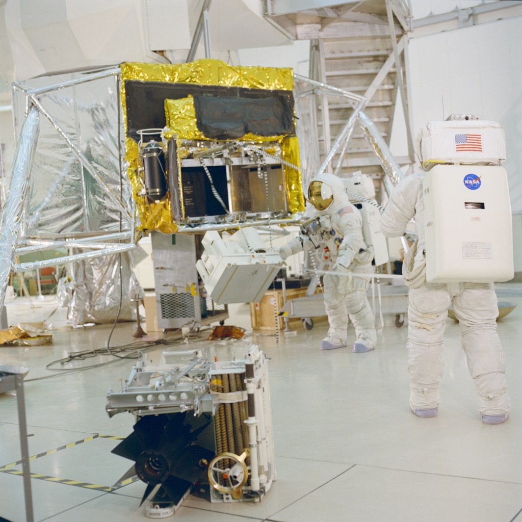
During their 35 hours on the Moon’s surface, Lovell and Haise planned to conduct two four-hour spacewalks to set up the Apollo Lunar Surface Experiment Package (ALSEP), a suite of four investigations designed to collect data about the lunar environment after the astronauts’ departure, and to conduct geologic explorations of the landing site. The four experiments included the: 

  • Charged Particle Lunar Environment Experiment designed to measure the flexes of charged particles 
  • Cold Cathode Gauge Experiment designed to measure the pressure of the lunar atmosphere 
  • Heat Flow Experiment designed to make thermal measurements of the lunar subsurface 
  • Passive Seismic Experiment designed to measure any moonquakes, either naturally occurring or caused by artificial means 

 As an additional investigation, the astronauts planned to deploy and retrieve the Solar Wind Composition experiment, a sheet of aluminum foil to collect particles from the solar wind for analysis by scientists back on Earth after about 20 hours of exposure on the lunar surface. 

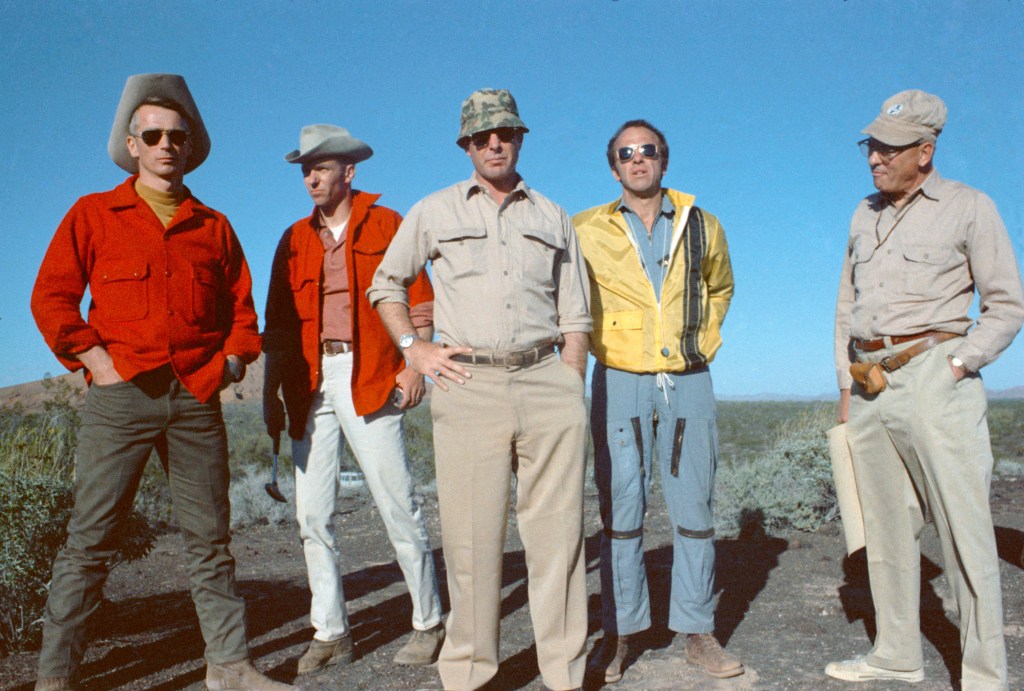
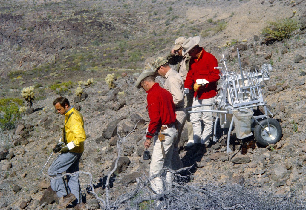
With one lunar mission just two months away, NASA continued preparations for the following flight, Apollo 14, then scheduled for October 1970 with a landing targeted for the Littrow region of the Moon, an area scientists believed to be of volcanic origin. Apollo 14 astronauts Alan Shepard, Stuart Roosa, and Edgar Mitchell and their backups Eugene Cernan, Ronald Evans, and Joe Engle  learned spacecraft systems in the simulators. Accompanied by a team of geologists led by Richard Jahns, Shepard, Mitchell, Cernan, and Engle participated in a geology expedition to the Pinacate Mountain Range in northern Mexico Feb. 14-18, 1970. The astronauts practiced using the Modular Equipment Transporter, a two-wheeled conveyance to transport tools and samples on the lunar surface. 

On Feb. 13, 1970, NASA began releasing Apollo 12 lunar samples to 139 U.S. and 54 international scientists in 16 countries, a total of 28.6 pounds of material. On Feb. 16, Apollo 12 astronauts Charles Conrad, Richard Gordon, and Alan Bean, accompanied by their wives and NASA and State Department officials, departed Houston’s Ellington Air Force Base for their 38-day Bullseye Presidential Goodwill World Tour. They first traveled to Latin America, making stops in Venezuela, Peru, Chile, and Panama before continuing on to Europe, Africa, and Asia. 

The groundbreaking science and discoveries made during Apollo missions has pushed NASA to explore the Moon more than ever before through the Artemis program. Apollo astronauts set up mirror arrays, or “retroreflectors,” on the Moon to accurately reflect laser light beamed at them from Earth with minimal scattering or diffusion. Retroreflectors are mirrors that reflect the incoming light back in the same incoming direction. Calculating the time required for the beams to bounce back allowed scientists to precisely measure the Moon’s shape and distance from Earth, both of which are directly affected by Earth’s gravitational pull. More than 50 years later, on the cusp of NASA’s crewed Artemis missions to the Moon, lunar research still leverages data from those Apollo-era retroreflectors. 

Powered by WPeMatico

Get The Details…
John J. Uri