NASA’s New Shock Detectives Project Invites Volunteers to Help Study Solar Wind

NASA’s New Shock Detectives Project Invites Volunteers to Help Study Solar Wind

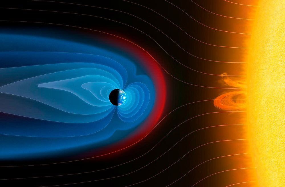
The Sun sprays an extremely fast stream of charged particles called the solar wind. At approximately 56,000 miles (90,000 kilometers) in front of the Earth toward the Sun, the solar wind collides with the Earth’s protective magnetic field, generating a long-lasting shock wave that stretches for hundreds of thousands of miles. Now, you can help scientists examine data about this “bow shock” to better understand how the solar wind affects the Earth by joining a new research project: Shock Detectives.

At this enormous shock wave boundary, the ever-changing magnetic field can either make the solar wind messy and dynamic (“chaotic”) or leave it smooth and stable (“peaceful”).

When “chaotic” plasma dominates, more energy can reach Earth’s magnetosphere, possibly leading to disruptions in GPS signals, communications, and power grids. Scientists don’t yet fully understand when the plasma changes between “peaceful” and “chaotic” states or how those changes affect energy transfer to Earth.

You can help solve this mystery. NASA’s Magnetospheric Multiscale (MMS) mission has collected more than ten years of data from this zone – more than scientists can analyze alone. As Shock Detectives, you’ll help sort the chaotic from peaceful regions of the data, giving researchers a crucial set of clues.

The value of this new knowledge doesn’t end at Earth – what scientists learn about the Earth-Sun bow shock will help them understand how the solar wind of other stars impacts their orbiting planets. Your contributions may help take Shock Detectives ‘out of this world’!  

This project is closely connected to another NASA-supported project, Space Umbrella, which also relies on MMS data and imagery. While Space Umbrella focuses on the broad boundary between Earth’s magnetic shield and the surrounding solar wind, Shock Detectives zooms in just outside that boundary on the transition region, which can be upwards of 10 miles (17 kilometers) in thickness, to better understand how plasma behaves near the shock. Together, these efforts build a more complete picture of Earth’s space environment.

Join Shock Detectives and help crack the case here: https://go.nasa.gov/4wILD6Y

Want a quick overview? Check out the introduction video.

A conceptual illustration with a large, yellow, glowing Sun on the right side. Radiating from the Sun is the solar wind, visualized as delicate, sweeping, curved light lines. In the center is a small, dark Earth, surrounded by a large, protective bubble of glowing blue light that forms a tail extending far to the left. The front of this blue bubble is a distinct, fiery red and orange curved barrier, the shock where the solar wind collides with Earth's magnetic field.
The Earth’s magnetosphere (blue) interacts with the solar wind,, creating a shock wave (red), like a sonic boom in space. Join the Shock Detectives project and help scientists study this region and better understand how the solar wind affects our lives
Mark Garlick/Science Photo Library via Getty Images

Powered by WPeMatico

Get The Details…

Farming in Ancient Lake Agassiz

Farming in Ancient Lake Agassiz

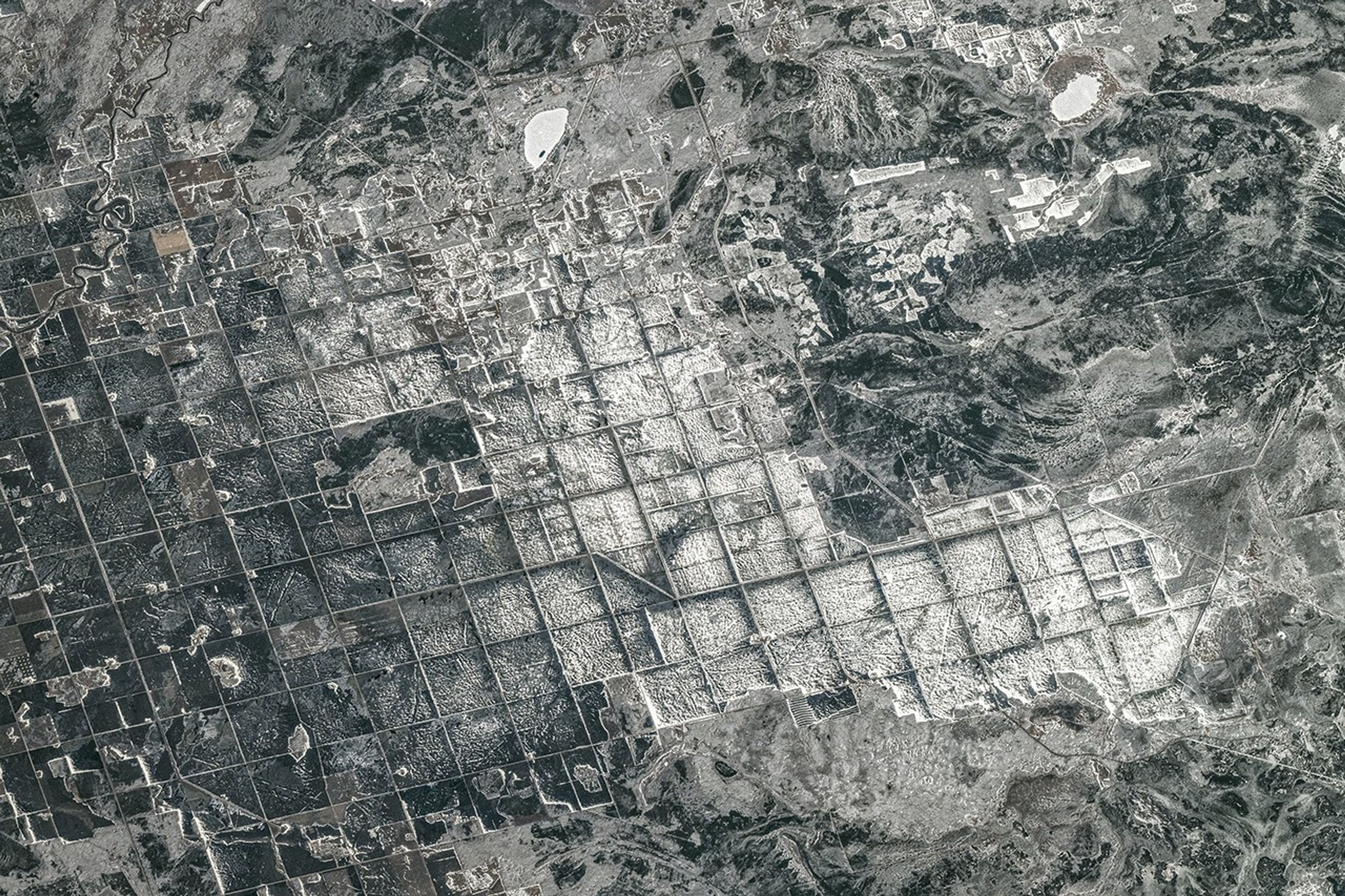
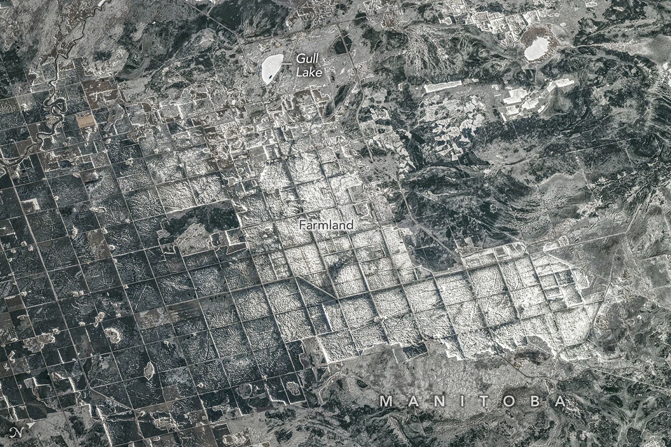
Farm fields and roads are laid out in a repeating rectangular pattern in this snowy image.

Editor’s Note: Today’s story is the answer to the May Puzzler.

About 15,000 years ago, southeastern Manitoba sat beneath tens of meters of frigid water. Lake Agassiz—which once encompassed present-day Lake Manitoba, Lake Winnipeg, and Lake of the Woods—covered an area larger than all of the Great Lakes combined. It formed in front of the retreating Laurentide Ice Sheet, which dammed rivers that otherwise might have drained into Hudson Bay, producing an expansive body of water 1,100 kilometers (700 miles) long by 300 kilometers wide that spanned parts of today’s Manitoba, Ontario, Saskatchewan, North Dakota, and Minnesota.

The lake began draining roughly 12,000 years ago, but its legacy remains visible across the region. In April 2026, an astronaut aboard the International Space Station snapped this photograph of farmland along the southern shore of Lake Winnipeg, where Lake Agassiz once deposited a thick, nearly flat bed of nutrient-rich silt and clay. Former lakebed areas like this one now support some of Canada’s most productive agricultural landscapes.

A grid-based land survey has also left its mark. The Dominion Land Survey, one of the world’s largest and most systematic surveying efforts, divided much of western Canada into one-square-mile sections after the Canadian government purchased Rupert’s Land from the Hudson’s Bay Company in 1869. The grid continues to define the layout of farm fields, roads, shelterbelts, and drainage channels.

When the photo was taken late in the afternoon on April 19, a layer of snow and ice covered the landscape. The brightest, whitest blocks appear to be snow-covered farmland or icy ponds, while the darker areas are forests, wetlands, or exposed ground with less uniform snow cover.

Wheat, barley, oats, and canola are among the crops often grown in the area. In the upper part of the image, cottages and lake houses are clustered around Gull Lake, a popular site for boating, fishing, and other water sports. Common fish species found in the lake include northern pike, walleye, and yellow perch.

Astronaut photograph ISS074-E-494130 was acquired on April 19, 2026, with a Nikon Z9 digital camera using a focal length of 560 millimeters. It is provided by the ISS Crew Earth Observations Facility and the Earth Science and Remote Sensing Unit at NASA Johnson Space Center. The image was taken by a member of the Expedition 74 crew. The image has been cropped and enhanced to improve contrast, and lens artifacts have been removed. The International Space Station Program supports the laboratory as part of the ISS National Lab to help astronauts take pictures of Earth that will be of the greatest value to scientists and the public, and to make those images freely available on the Internet. Additional images taken by astronauts and cosmonauts can be viewed at the NASA/JSC Gateway to Astronaut Photography of Earth. Story by Adam Voiland.

References & Resources

You may also be interested in:

Stay up-to-date with the latest content from NASA as we explore the universe and discover more about our home planet.

A Most Unusual Lake

4 min read

Lake Unter-See in Antarctica, sealed beneath thick ice, has unusual water chemistry and cone-shaped microbial structures resembling some of Earth’s…

Article

Finding Freshwater in Great Salt Lake

4 min read

Reed-covered mounds exposed by declining water levels reveal an unexpected network of freshwater springs that feed directly into the lake…

Article

Winter Grips the Michigan Mitten

3 min read

A blanket of snow spanned Michigan and much of the Great Lakes region following a potent cold snap.

Article

Powered by WPeMatico

Get The Details…

Curiosity Blog, Sols 4893-4899: Drilling at Campo Marte and a Visit From the Psyche Spacecraft

Curiosity Blog, Sols 4893-4899: Drilling at Campo Marte and a Visit From the Psyche Spacecraft

3 min read

Curiosity Blog, Sols 4893-4899: Drilling at Campo Marte and a Visit From the Psyche Spacecraft

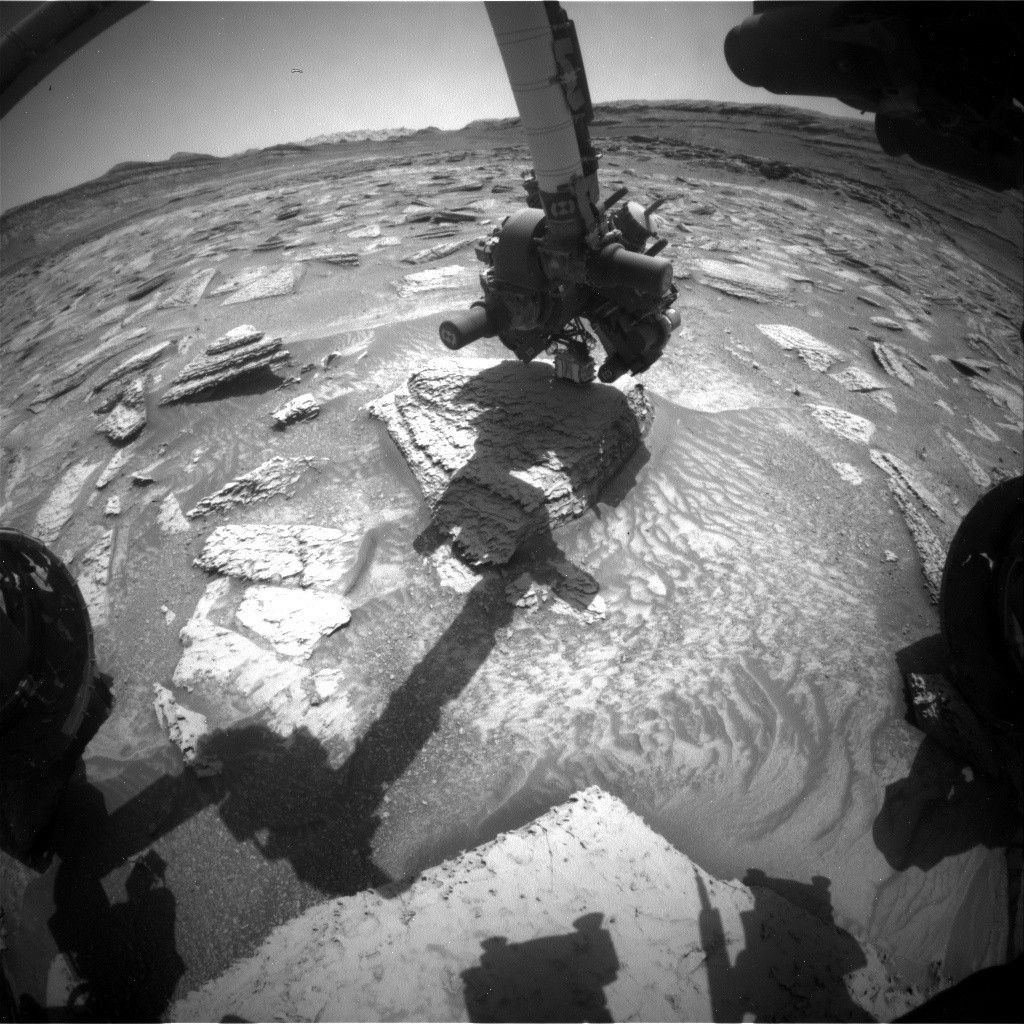
A black and white photo taken from the perspective of the Curiosity rover on Mars. In the center, the rover's robotic arm extends downward, hovering its instrument turret over a flat, light-colored rock. The arm casts a prominent, long shadow across the rocky and sandy terrain in the foreground. Parts of the rover's wheels are visible on the far left and right edges, and a distant, mountainous Martian horizon stretches across the background under a clear sky.
NASA’s Mars rover Curiosity acquired this image, as the rover used its APXS instrument to measure the composition of the “Campo Marte” block in preparation for drilling. Curiosity captured the image using its Front Hazard Avoidance Camera (Front Hazcam) on May 14, 2026 — Sol 4895, or Martian day 4,895 of the Mars Science Laboratory mission — at 16:29:02 UTC.
NASA/JPL-Caltech

Written by Lucy Lim, Planetary Scientist at NASA Goddard Space Flight Center

Earth planning date: Friday, May 15, 2026

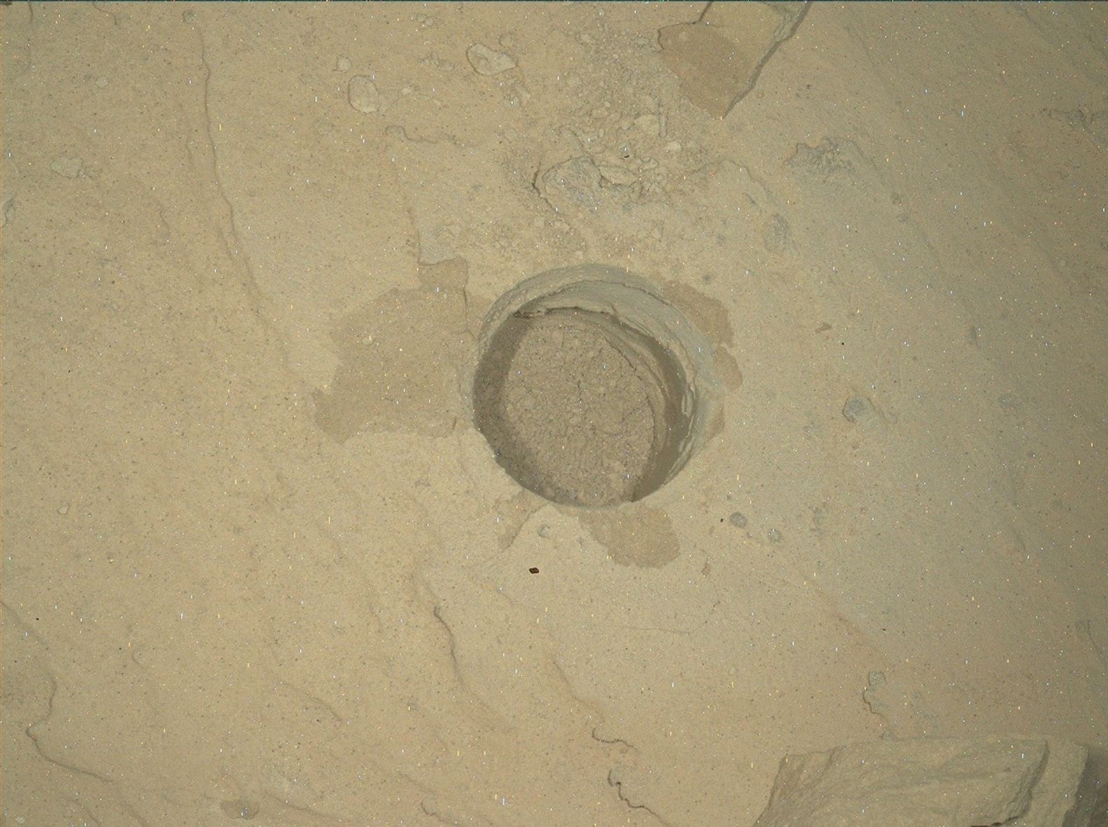
After freeing the rover’s arm from the “Atacama” block, we are ready to drill again! The new drill target will represent the same geologic stratum as Atacama, which is the layered sulfate unit above the boxwork structures. We’ve named the new block “Campo Marte” after a natural red sandstone feature in Bolivia, following the theme of choosing target names in this Martian quadrangle from locations near the Uyuni region in South America. The name can be literally translated from Spanish as “Field of Mars” or “Mars Field,” appropriate for a target on Mars. In preparation for drilling, we measured the composition of Campo Marte with the ChemCam LIBS and the APXS as well as obtaining close-up imaging with MAHLI. Additional LIBS rasters provided geochemical data on nearby blocks, including a couple of vein and nodule-like features. As we’ve seen in several rover stops in this unit, the “Paso Malo” block and several others are covered in a prominent polygonal texture.

We’ve also imaged the Campo Marte block from several angles and determined that it’s substantially thicker than the Atacama block, so we’re hoping that its greater mass will keep it on the ground after drilling so that we can withdraw the drill bit normally this time. The team did get some interesting data on the volume and density of the Atacama block from our little adventure but we don’t feel the need to repeat that particular experiment.

In the meantime, we had a chance to support another solar system exploration mission as the Psyche spacecraft flew close by Mars in order to pick up a gravitational boost on its way to the main asteroid belt.

The Psyche spacecraft’s eventual destination is the asteroid 16 Psyche, one of the largest members of an unusual spectral category of asteroids that hasn’t yet been visited by a spacecraft. Although 16 Psyche is expected to be quite different from Mars as a science target (for example, it is too small to maintain a Mars-like atmosphere) this flyby was still a valuable opportunity to exercise the spacecraft’s instruments and data analysis pipelines, and validate their calibration. Because of this the Curiosity team planned an extra set of atmospheric observations timed to coordinate with the Psyche flyby: a zenith movie with Navcam to document clouds and a Mastcam solar observation to measure atmospheric opacity. The Mastcam was also supported by a fresh set of calibration data. Together with other coordinated observations from the Mars orbiters and Perseverance rover, these are intended to contribute to the Psyche instrument validation effort. 

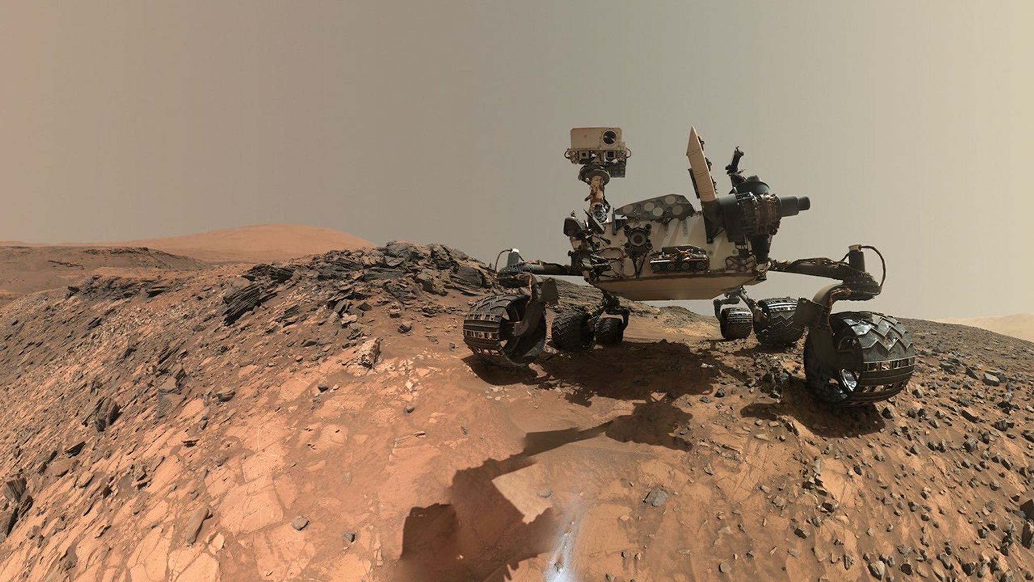
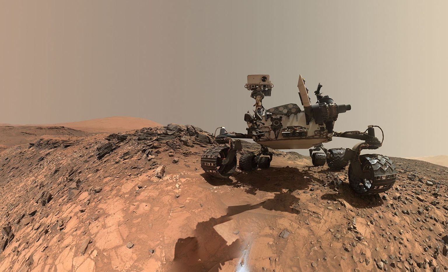
A rover sits on the hilly, orange Martian surface beneath a flat grey sky, surrounded by chunks of rock.
NASA’s Curiosity rover at the base of Mount Sharp
NASA/JPL-Caltech/MSSS

Share

Details

Last Updated
May 18, 2026

Related Terms

Powered by WPeMatico

Get The Details…
Johnson Photographers Honored for Award-Winning Portraits 

Johnson Photographers Honored for Award-Winning Portraits 

Three photographers at NASA’s Johnson Space Center who inspire the world through visual storytelling earned top honors in the portrait category at the 2025 NASA Imagery Experts Program Annual Awards. 

“Congratulations to all three on this impressive achievement and for capturing such breathtaking imagery,” said Johnson Director Vanessa Wyche. “Their work represents the collaboration, precision, and creativity that drive human space exploration forward.” 

David DeHoyos, Josh Valcarcel, and Bill Stafford were recognized during the award ceremony held April 20, 2026, in Las Vegas. 

From engineering tests to astronaut training to mission control operations, these photographers document the people and work central to NASA’s human spaceflight mission. 

First place: David DeHoyos 

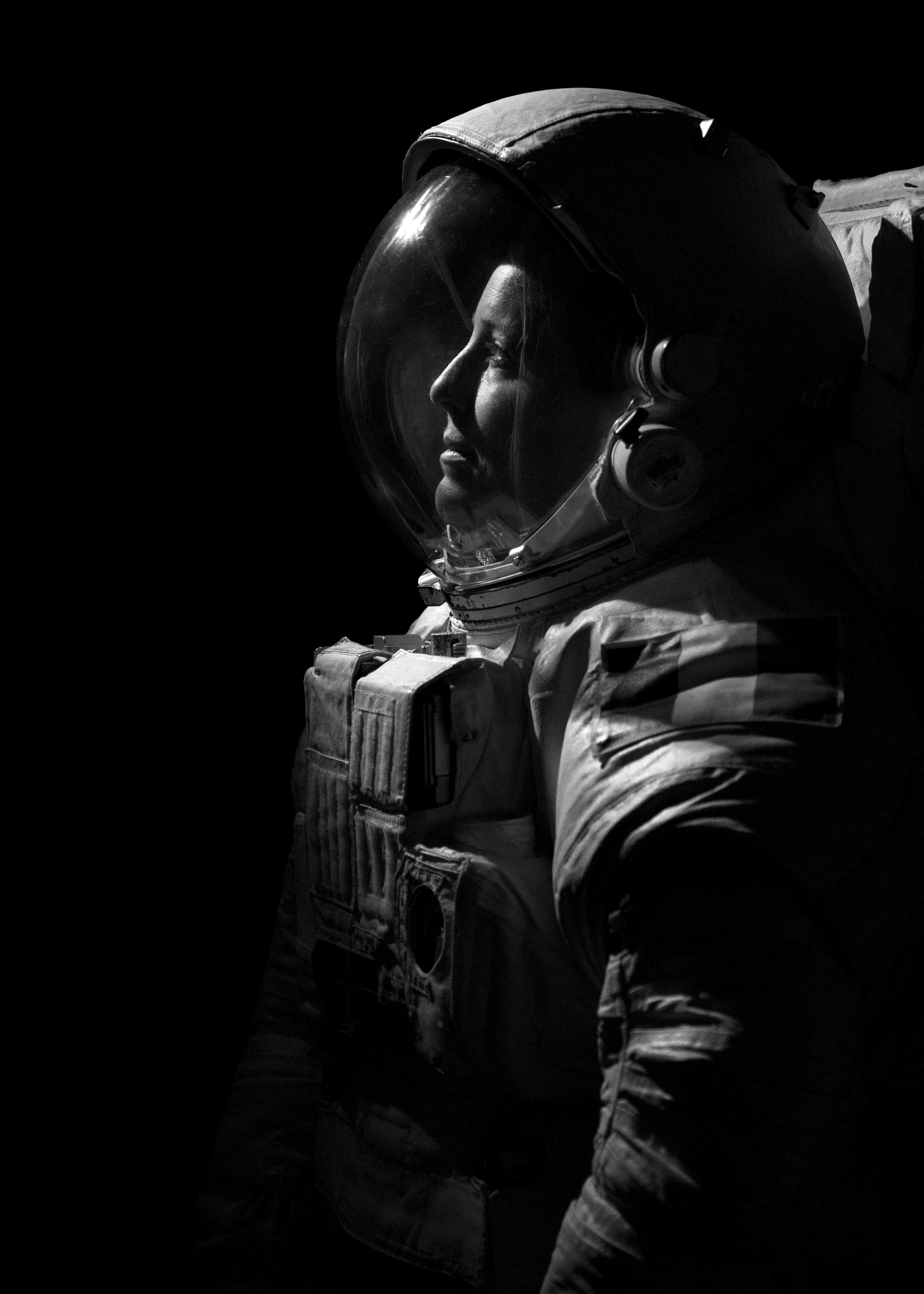
ESA (European Space Agency) astronaut Sophie Adenot pauses for a pensive moment during her official NASA portrait session at Johnson Space Center.
NASA/David DeHoyos

Sophie is so kind and friendly with a beautiful presence. Being around her made everyone feel good, which allowed my creativity to flow.

David Dehoyos

David Dehoyos

NASA Photographer

Portrait of NASA photographer David DeHoyos.

A Houston native, born in 1963, David DeHoyos’ life has been deeply shaped by the city’s dual legacy of arts and aerospace.  

DeHoyos graduated from Houston’s High School for the Performing and Visual Arts in 1981 with a specialization in photography. After spending a decade refining his technical craft in photo labs, he joined Johnson’s photography department in 1991. 

“This opportunity represented the fulfillment of a lifelong ambition,” said DeHoyos. “Growing up during the fervor of the Apollo era, I always dreamed of contributing to NASA’s mission. I am so honored and blessed to be amongst a team of wonderful people and, more importantly, friends.” 

Second place: Josh Valcarcel 

NASA Astronaut Jessica Meir sits in a chair. Her body is slightly turned to the right as she looks forward. She is wearing the bottom half of a spacesuit; the top half and gloves are on the floor next to the chair.
NASA astronaut Jessica Meir poses with an Extravehicular Mobility Unit (EMU) spacesuit during an official portrait session
NASA/Josh Valcarcel

Jessica’s quiet presence reflects years of preparation, passion, and responsibility. She understands, more clearly than most of us ever will, the fragility of the body, the precision of systems, and the narrow margins within which exploration unfolds.

Josh Valcarcel

Josh Valcarcel

NASA Photographer

Portrait of NASA scientific photographer Josh Valcarcel.

Josh Valcarcel has worked as a professional photographer and videographer for over 20 years and has been a scientific photographer at Johnson since 2017. He previously served as a staff photographer and photo editor at WIRED magazine and as a mass communication specialist in the U.S. Navy, capturing stories from flight deck operations to remote island nations across the Pacific. 

“As a NASA photographer, I’ve had the privilege of witnessing impossible dreams become reality every day,” said Valcarcel. “That experience has shown me that with the right vision, culture, and trust, what once seemed impossible can become part of everyday life.” 

Third place: Bill Stafford 

Expedition 74 crew member Christopher Williams in an EMU spacesuit.
NASA/Bill Stafford

There’s a stillness and quiet resolve in Chris’ expression that says everything about who he is and what he’s about to do.

Bill Stafford

Bill Stafford

NASA Photographer

Portrait of NASA scientific photographer Bill Stafford.

A Texas native and 1999 graduate of East Texas A&M University, Bill Stafford has served as a photographer and videographer for NASA since graduation, documenting over two decades of the nation’s space exploration milestones.  

In addition to his work with NASA, Stafford teaches photography at the Gilruth Center. He is passionate about sharing his expertise and helping others develop their skills behind the lens.  

“Photography is how I find meaning in the moments around me, and working at NASA has given me a front-row seat to some of the most remarkable stories of our time,” said Stafford. “My job is to slow things down long enough to find the moment inside the moment: the small details that tell the bigger story.” 

Powered by WPeMatico

Get The Details…
Sumer Loggins

NASA’s MAVEN Makes 1st Discovery of Atmospheric Effect at Mars

NASA’s MAVEN Makes 1st Discovery of Atmospheric Effect at Mars

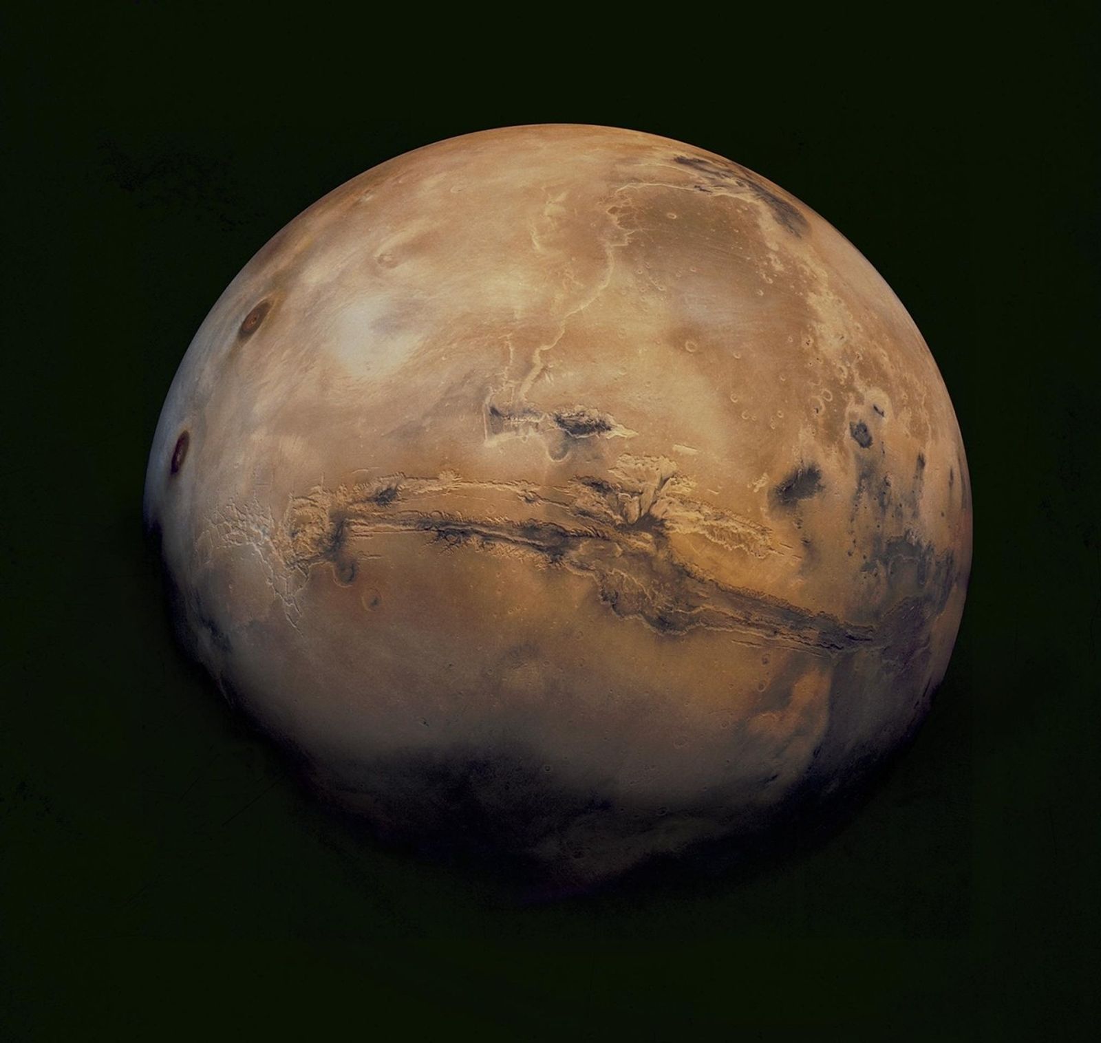
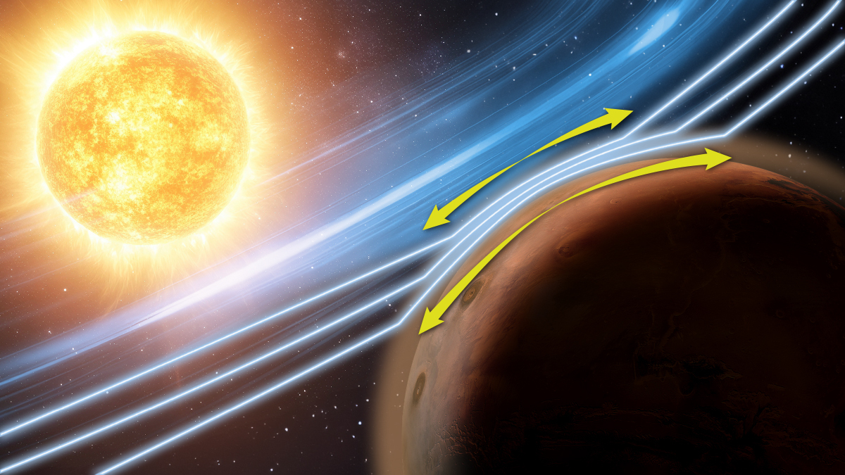
In December 2023, scientists looking at Mars data stumbled across something completely unexpected — observations of an atmospheric effect never before seen in the Red Planet’s atmosphere. Using instruments aboard NASA’s MAVEN (Mars Atmosphere and Volatile Evolution) mission, scientists identified a phenomenon known to occur in Earth’s magnetosphere, where charged particles are squeezed like toothpaste coming out of a tube along magnetic structures called flux tubes. This so-called Zwan-Wolf effect aids in the deflection of solar wind around Earth and has been observed and studied there for decades. Now, a new study published in Nature Communications provides the first comprehensive observations of the same effect in Mars’ atmosphere.

a stylized, not-to-scale, image of a yellow Sun with blue-hued waves drawn in between it and reddish Mars
An artistic representation of the Zwan-Wolf effect at Mars, as observed by NASA’s MAVEN (Mars Atmosphere and Volatile Evolution) mission. While this effect typically helps to deflect the solar wind at Earth, at Mars it is shown to “squeeze” the atmosphere and have implications on how space weather interacts with the planet. The yellow arrows represent the movement of the effect in the Martian atmosphere.
LASP/CU Boulder

“When investigating the data, I all of a sudden noticed some very interesting wiggles,” said Christopher Fowler, a research assistant professor at West Virginia University in Morgantown and lead author of the study. “I would never have guessed it would be this effect, since it’s never been seen in a planetary atmosphere before.”

The Zwan-Wolf effect was first discovered in 1976, and until now has only been observed in planetary magnetospheres, not their atmospheres. Unlike Earth, Mars is not protected by a global magnetic field, affecting how it interacts with the solar wind and space weather. In this new study, the Zwan-Wolf effect was observed in the ionosphere — deep within the Martian atmosphere below 200 km — which contains significant numbers of electrically charged particles. The data showed that these charged particles were being squeezed and distributed around Mars’ atmosphere.

Although Mars has an induced magnetosphere, a magnetic field generated by the solar wind interacting with the Martian ionosphere, it can greatly change in size and shape with large solar wind and space weather events. That is what Fowler and his team saw in the MAVEN data when a large solar storm hit Mars. Based on their findings, the Zwan-Wolf effect may be occurring constantly in the Martian ionosphere but at levels undetectable by MAVEN’s instrumentation. The impact of the space weather event appears to have amplified the effect, allowing the scientists to observe it in the data.

In the beginning, Fowler and his team came across some interesting-looking fluctuations in measurements of the magnetic field as the spacecraft flew through the atmosphere. To explain this, they dug into observations made by several instruments on MAVEN, including measurements of the charged particle environment in the ionosphere. Their sleuthing uncovered even more weird and interesting features in the data. After ruling out several other possibilities, the team was able to identify the culprit as the Zwan-Wolf effect, which explained all the features they were seeing.

“No one expected that this effect could even occur in the atmosphere,” said Fowler. “That’s what makes this even more exciting. It introduces interesting physics that we haven’t yet explored and a new way the Sun and space weather can change the dynamics in the Martian atmosphere.”

Understanding the Zwan-Wolf effect at Mars will further our understanding of how space weather affects the planet and provides new insight into how this effect might occur at similar unmagnetized bodies, such as Venus and Saturn’s moon Titan. Observations like this also highlight the importance of knowing how large space weather events can lead to changes in the environment at and around the Red Planet and potentially affect assets on or near Mars.

“Knowing how space weather interacts with Mars is essential,” said Shannon Curry, the principal investigator of MAVEN and research scientist at the Laboratory for Atmospheric Space Physics at the University of Colorado Boulder. “The MAVEN team continues making new discoveries with our datasets and finding these links between our host star and the Red Planet.”

The MAVEN spacecraft launched in November 2013 and entered Mars’ orbit in September 2014. The mission’s goal is to explore the planet’s upper atmosphere, ionosphere, and interactions with the Sun and solar wind to explore the loss of the Martian atmosphere to space. Understanding atmospheric loss gives scientists insight into the history of the Red Planet’s atmosphere and climate, liquid water, and planetary habitability. The MAVEN spacecraft, in orbit around Mars, experienced a loss of signal with ground stations on Earth on Dec. 6, 2025. In Feb. 2026, NASA launched an anomaly review board to assess the probable current state of the spacecraft and the likelihood of its recovery.

The MAVEN mission is part of NASA’s Mars Exploration Program portfolio. The mission’s principal investigator is based at the Laboratory for Atmospheric and Space Physics at the University of Colorado Boulder, which is also responsible for managing science operations and public outreach and communications. NASA’s Goddard Space Flight Center in Greenbelt, Maryland, manages the MAVEN mission. Lockheed Martin Space built the spacecraft and is responsible for mission operations. NASA’s Jet Propulsion Laboratory in Southern California provides navigation and Deep Space Network support.  

By Willow Reed
Laboratory for Atmospheric and Space Physics, University of Colorado Boulder

Media contacts:

Karen Fox / Alana Johnson
Headquarters, Washington
240-285-5155 / 202-672-4780
karen.c.fox@nasa.gov / alana.r.johnson@nasa.gov

Sarah Frazier
Goddard Space Flight Center, Greenbelt, Md.
sarah.frazier@nasa.gov

Share

Details

Last Updated
May 18, 2026
Editor
Rob Garner
Contact
Sarah Frazier
Location
Goddard Space Flight Center

Powered by WPeMatico

Get The Details…