NASA X-ray Telescopes Reveal the “Bones” of a Ghostly Cosmic Hand

NASA X-ray Telescopes Reveal the “Bones” of a Ghostly Cosmic Hand

4 min read

NASA X-ray Telescopes Reveal the “Bones” of a Ghostly Cosmic Hand
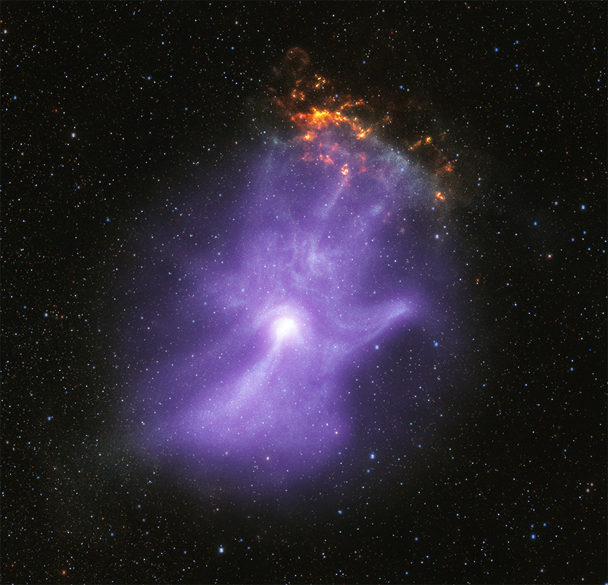
This release features a composite image of a pulsar wind nebula, which strongly resembles a ghostly purple hand with sparkling fingertips. A pulsar is a highly magnetized collapsed star that rotates and creates jets of matter flowing away from its poles. These jets, along with intense winds of particles, form pulsar wind nebulae. Here, the pulsar wind nebula known as MSH 15-52 resembles a hazy purple cloud set against a black, starry backdrop. Both NASA's Chandra X-ray Observatory and the Imaging X-ray Polarimetry Explorer (IXPE) have observed MSH 15-52. Their observations revealed that the shape of this pulsar wind nebula strongly resembles a human hand, including five fingers, a palm and wrist. The bright white spot near the base of the palm is the pulsar itself. The three longest fingertips of the hand-shape point toward our upper right, or 1:00 on a clock face. There, a small, mottled, orange and yellow cloud appears to sparkle or glow like embers. This orange cloud is part of the remains of the supernova explosion that created the pulsar. The backdrop of stars was captured in infrared light.
Credit: X-ray: NASA/CXC/Stanford Univ./R. Romani et al. (Chandra); NASA/MSFC (IXPE); Infared: NASA/JPL-Caltech/DECaPS; Image Processing: NASA/CXC/SAO/J. Schmidt)

In 1895, Wilhelm Röntgen discovered X-rays and used them to image the bones in his wife’s hand, kicking off a revolutionary diagnostic tool for medicine. Now two of NASA’s X-ray space telescopes have combined their imaging powers to unveil the magnetic field “bones” of a remarkable hand-shaped structure in space. Together, these telescopes reveal the behavior of a dead collapsed star that lives on through plumes of particles of energized matter and antimatter. 

Around 1,500 years ago, a giant star in our Galaxy ran out of nuclear fuel to burn. When this happened, the star collapsed onto itself and formed an extremely dense object called a neutron star. 

Rotating neutron stars with strong magnetic fields, or pulsars, provide laboratories for extreme physics, with conditions that cannot be replicated on Earth. Young pulsars can create jets of matter and antimatter moving away from the poles of the pulsar, along with an intense wind, forming a “pulsar wind nebula”.

This release features a composite image of a pulsar wind nebula, which strongly resembles a ghostly white hand with sparkling fingertips
By combining data from Chandra and IXPE, astronomers are learning more about how a pulsar is injecting particles into space and shaping its environment. The X-ray data are shown along with infrared data from the Dark Energy Camera in Chile. Young pulsars can create jets of matter and antimatter moving away from the poles of the pulsar, along with an intense wind, forming a “pulsar wind nebula”. This one, known as MSH 15-52, has a shape resembling a human hand and provides insight into how these objects are formed.
Credit: X-ray: NASA/CXC/Stanford Univ./R. Romani et al. (Chandra); NASA/MSFC (IXPE); Infared: NASA/JPL-Caltech/DECaPS; Image Processing: NASA/CXC/SAO/J. Schmidt

In 2001, NASA’s Chandra X-ray Observatory first observed the pulsar PSR B1509-58 and revealed that its pulsar wind nebula (referred to as MSH 15-52) resembles a human hand. The pulsar is located at the base of the “palm” of the nebula. MSH 15-52 is located 16,000 light-years from Earth.

Now, NASA’s newest X-ray telescope, the Imaging X-ray Polarimetry Explorer (IXPE), has observed MSH 15-52 for about 17 days, the longest it has looked at any single object since it launched in December 2021.

“The IXPE data gives us the first map of the magnetic field in the ‘hand’,” said Roger Romani of Stanford University in California, who led the study. “The charged particles producing the X-rays travel along the magnetic field, determining the basic shape of the nebula, like the bones do in a person’s hand.”

IXPE provides information about the electric field orientation of X-rays, determined by the magnetic field of the X-ray source. This is called X-ray polarization. In large regions of MSH 15-52 the amount of polarization is remarkably high, reaching the maximum level expected from theoretical work. To achieve that strength, the magnetic field must be very straight and uniform, meaning there is little turbulence in those regions of the pulsar wind nebula. 

“We’re all familiar with X-rays as a diagnostic medical tool for humans,” said co-author Josephine Wong, also of Stanford. “Here we’re using X-rays in a different way, but they are again revealing information that is otherwise hidden from us.” 

One particularly interesting feature of MSH 15-52 is a bright X-ray jet directed from the pulsar to the “wrist” at the bottom of the image. The new IXPE data reveal that the polarization at the start of the jet is low, likely because this is a turbulent region with complex, tangled magnetic fields associated with the generation of high-energy particles. By the end of the jet the magnetic field lines appear to straighten and become much more uniform, causing the polarization to become much larger.

A ghostly looking purple hand in space.
Credit: X-ray: NASA/CXC/Stanford Univ./R. Romani et al. (Chandra); NASA/MSFC (IXPE); Infared: NASA/JPL-Caltech/DECaPS; Image Processing: NASA/CXC/SAO/J. Schmidt

These results imply that particles are given an energy boost in complex turbulent regions near the pulsar at the base of the palm, and flow to areas where the magnetic field is uniform along the wrist, fingers and thumb.

“We’ve uncovered the life history of super energetic matter and antimatter particles around the pulsar,” said co-author Niccolò Di Lalla, also of Stanford. “This teaches us about how pulsars can act as particle accelerators.”

IXPE has also detected similar magnetic fields for the Vela and Crab pulsar wind nebulae, which implies that they may be surprisingly common in these objects.

These results are published in a new paper in The Astrophysical Journal. 

IXPE is a collaboration between NASA and the Italian Space Agency with partners and science collaborators in 12 countries. IXPE is led by Marshall. Ball Aerospace, headquartered in Broomfield, Colorado, manages spacecraft operations together with the University of Colorado’s Laboratory for Atmospheric and Space Physics in Boulder.

NASA’s Marshall Space Flight Center manages the Chandra program. The Smithsonian Astrophysical Observatory’s Chandra X-ray Center controls science operations from Cambridge, Massachusetts, and flight operations from Burlington, Massachusetts.

Read more from NASA’s Chandra X-ray Observatory.

For more Chandra images, multimedia and related materials, visit:

https://www.nasa.gov/chandra

Megan Watzke
Chandra X-ray Center
Cambridge, Mass.
617-496-7998

Jonathan Deal
Marshall Space Flight Center
Huntsville, Ala.
256-544-0034

Powered by WPeMatico

Get The Details…
Beth Ridgeway
NASA, Partners Explore Sustainable Fuel’s Effects on Aircraft Contrails

NASA, Partners Explore Sustainable Fuel’s Effects on Aircraft Contrails

3 min read

NASA, Partners Explore Sustainable Fuel’s Effects on Aircraft Contrails

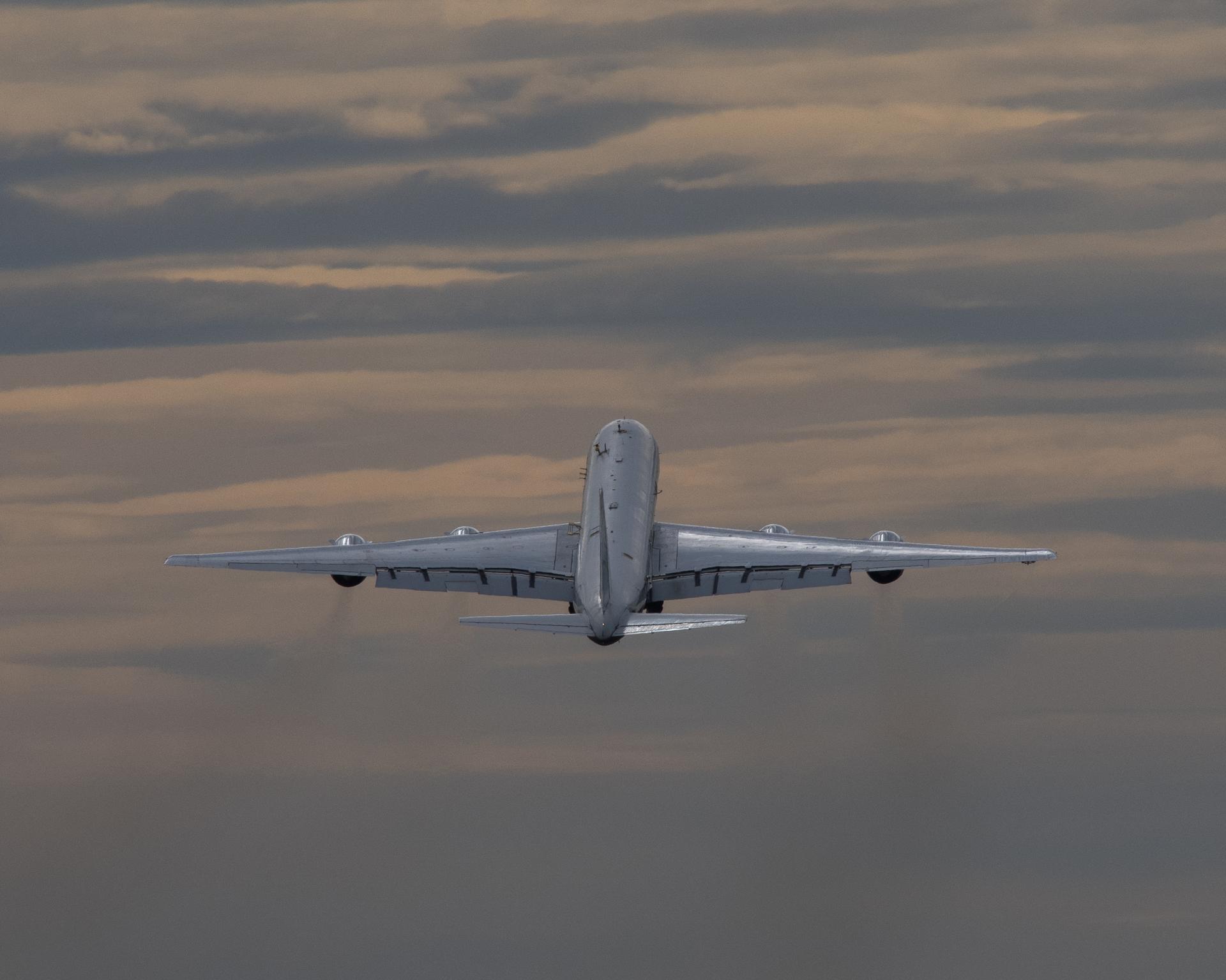
NASA Armstrong Flight Research Center’s DC-8 aircraft takes flight over the northwestern U.S. to monitor emissions from Boeing’s ecoDemonstrator Explorer aircraft.
NASA Armstrong’s DC-8 aircraft flies over the northwestern U.S. to monitor emissions from Boeing’s ecoDemonstrator Explorer aircraft.  As the largest flying science laboratory in the world, the DC-8 is equipped to collect crucial data about the sustainable aviation fuel and its effects on condensation trail formation.
NASA/Jim Ross

Contrails, the lines of clouds left by high-flying aircraft that crisscross the skies, are familiar sights, but they may have an unseen effect on the planet – trapping heat in the atmosphere. Working with Boeing, United Airlines, and other industry, government, and international partners, NASA researchers are collecting data to see how new, greener aviation fuels can help reduce the problem.

Throughout October, NASA has supported contrail research through Boeing’s ecoDemonstrator program, a multi-year effort to analyze sustainable aviation fuel its capacity to benefit the environment.

Boeing’s current ecoDemonstrator Explorer aircraft, a 737-10, has conducted test flights switching between tanks filled either with 100% sustainable aviation fuel or conventional fuel. NASA’s DC-8 aircraft, the world’s largest flying science laboratory, has followed, measuring emissions and contrail ice formation from each type of fuel. This data will help determine whether sustainable aviation fuels help reduce the formation of contrails.

“Contrails are believed to be a major source of pollution,” said Rich Moore, a research physical scientist in NASA’s Langley Aerosol Research Group Experiment. Moore was among the researchers who flew aboard the DC-8. “With this mission, we’re looking not so much at correcting contrails, but at preventing them.”

In addition to the DC-8, which is based at NASA’s Armstrong Flight Research Center in Edwards,

California, the agency contributed other critical capabilities, including a mobile laboratory for ground testing. Other collaborators for the ecoDemonstrator flights include General Electric Aerospace, the German Aerospace Center, National Research Council Canada, and the Federal Aviation Administration.

Within a year, the researchers will publish their results.

“One of the most amazing things about this collaboration is that this data will be released publicly with the world,” Moore said.

Contrail clouds form when aircraft operate in the cold temperatures at high altitudes and water vapor in engine exhaust condenses and freezes. Made up of ice particles, contrail clouds can have both a cooling and warming effect based on ambient conditions, timing, and persistence – but scientists estimate that their warming effect is greater on a global scale.

Over the past decade, NASA-funded research has shown that sustainable aviation fuels have significant benefits for reducing engine particle emissions that can influence local air quality near airports and contribute to the formation of contrails.

Efforts to develop and evaluate sustainable aviation fuels focus on delivering the performance of conventional jet fuel without releasing new carbon dioxide into the environment. These fuels can be derived from sustainable sources such as feedstocks and waste resources.

Flight testing remains the gold standard for understanding aerospace innovations and their environmental impacts, making partnerships like ecoDemonstrator and research aircrafts like NASA’s DC-8 important sources for data that can help make aviation more sustainable, protecting the environment and improving life on Earth.

Share

Details

Last Updated

Oct 30, 2023

Editor

Ryan M. Henderson

Contact

Powered by WPeMatico

Get The Details…
Ryan M. Henderson

Data From NASA’s WISE Used to Preview Lucy Mission’s Asteroid Dinkinesh

Data From NASA’s WISE Used to Preview Lucy Mission’s Asteroid Dinkinesh

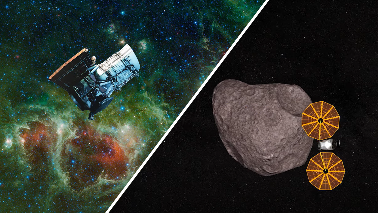
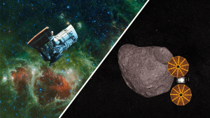
Two artist’s concepts show the WISE spacecraft, left, in front of an image of the infrared sky it observed during its prime mission, and NASA’s Lucy mission, right, during its Nov. 1 encounter with asteroid Dinkinesh.
NASA/JPL-Caltech and NASA’s Goddard Space Flight Center

Researchers have utilized infrared survey data to refine the asteroid’s size and surface brightness in support of the Nov. 1 encounter by NASA’s Lucy mission.

NASA’s Lucy mission will soon have its first asteroid encounter as the spacecraft travels through deep space en route to Jupiter’s orbit. But before the spacecraft passes 265 miles (425 kilometers) from the surface of the small asteroid Dinkinesh, researchers have used 13-year-old infrared data from NASA’s Wide-field Infrared Survey Explorer (WISE) to support the mission’s flyby. Their new study provides updated estimates of the asteroid’s size and albedo – a measurement of surface reflectivity – that could help scientists better understand the nature of some near-Earth objects.

Located between Mars and Jupiter, the main asteroid belt is home to most asteroids in our solar system, including Dinkinesh, which is following an orbit around the Sun that places it near Lucy’s path. The Lucy mission is using the Dinkinesh encounter as an opportunity to test systems and procedures that are designed to keep the asteroid within the science instruments’ fields of view as the spacecraft flies past at 10,000 mph (4.5 kilometers per second). This will help the team prepare for the mission’s primary objective: investigating the Jupiter Trojan asteroids, a population of primitive small bodies orbiting in tandem with Jupiter.

In the new study, published in the Astrophysical Journal Letters, University of Arizona researchers used observations made by the WISE spacecraft, which serendipitously scanned Dinkinesh in 2010 during its prime mission. Managed by NASA’s Jet Propulsion Laboratory in Southern California, WISE launched on Dec. 14, 2009, to create an all-sky infrared map of the universe.

Although the signal was weak in the exposures captured by WISE, the authors managed to identify 17 infrared observations of the region of sky where Dinkinesh’s signal could be seen. Then they used an algorithm to align and stack the images. The observations were made in March 2010 and represent 36.5 hours of observing time.

“Dinkinesh wasn’t initially detected by WISE, because the asteroid’s infrared signal was too weak for the software that was designed to find objects in a single exposure,” said Kiana De’Marius McFadden, a graduate student at the University of Arizona and lead author of the study. “But the asteroid’s dim infrared signal was still there, so our main challenge was to first find Dinkinesh and then to stack multiple exposures of the same region of sky to get its signal to emerge from the noise.”

Beyond WISE

Dinkinesh was discovered in 1999 – over a decade before WISE made the observations – and although its approximate size has been known, the new analysis refines not only its size, but also its albedo. The WISE observations suggest the asteroid has a diameter of about a half-mile (760 meters) and an albedo consistent with stony (S-type) asteroids.

Although WISE’s purpose wasn’t to detect asteroids, the spacecraft was sensitive to the infrared light (which is invisible to the naked eye) radiating from them as a result of sunlight heating their rocky surfaces. WISE had recorded about 190,000 asteroid observations by the end of its prime mission. In 2013, NASA reactivated WISE and renamed the mission Near-Earth Object Wide-field Survey Explorer (NEOWISE). Its purpose: to detect and track asteroids and comets that stray close to Earth’s orbit.

“Dinkinesh is the smallest main belt asteroid to be studied up-close and could provide valuable information about this type of object,” said the University of Arizona’s Amy Mainzer, a study co-author and the principal investigator for NEOWISE. “This population of main-belt asteroids overlap in size with the potentially hazardous near-Earth object population. Studying Dinkinesh could provide insights as to how these small main-belt asteroids form and where near-Earth asteroids come from.”

Targeting a late-2027 launch, NASA’s Near-Earth Object Surveyor (NEO Surveyor) will take over where NEOWISE leaves off. Scanning the sky in infrared wavelengths for hard-to-find asteroids and comets, NEO Surveyor could also utilize the same technique used to detect faint signals hiding in WISE observations, boosting the next-generation space telescope’s power. Mainzer is the principal investigator for NEO Surveyor.

More About the Mission

Lucy’s principal investigator, Hal Levison, is based at the Boulder, Colorado, branch of Southwest Research Institute, headquartered in San Antonio, Texas. NASA’s Goddard Space Flight Center in Greenbelt, Maryland, provides overall mission management, systems engineering, and safety and mission assurance. Lockheed Martin Space in Littleton, Colorado, built the spacecraft. Lucy is the 13th mission in NASA’s Discovery Program. NASA’s Marshall Space Flight Center in Huntsville, Alabama, manages the Discovery Program for the Science Mission Directorate at NASA Headquarters in Washington.

News Media Contact

Ian J. O’Neill
Jet Propulsion Laboratory, Pasadena, Calif.
818-354-2649
ian.j.oneill@jpl.nasa.gov

2023-155

Powered by WPeMatico

Get The Details…
Naomi Hartono

Rusty Red Waters in Madagascar

Rusty Red Waters in Madagascar

The waters of the Betsiboka River Delta, as seen from the International Space Station, are a vibrant orange. From left to right, the river branches off into many pathways, looking almost like the roots of a tree.
NASA

Iron-rich sediment colors the red-orange waters of the Betsiboka River Delta in Madagascar in this image taken by an astronaut on the International Space Station on Sept. 30, 2023. The sediment can clog waterways in the delta’s estuarial environment, but it can also form new islands that become colonized by mangroves. Despite its rusty color, this artery of water is important for biodiversity. Within the Betsiboka River Delta, the estuary supplies food, such as seagrasses, to the endangered green turtle and vulnerable dugong, or sea cow.

Text credit: Sara Schmidt

Image Credit: NASA

Powered by WPeMatico

Get The Details…
Monika Luabeya

See SWOT Mission’s Unprecedented View of Global Sea Levels

See SWOT Mission’s Unprecedented View of Global Sea Levels

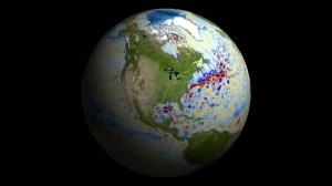
This animation shows global sea level data collected by the Surface Water and Ocean Topography satellite from July 26 to Aug. 16. Red and orange indicate higher-than-average ocean heights, while blue represents lower-than-average heights. Image Credit: NASA/JPL-Caltech

Data on sea surface heights around the world from the international Surface Water and Ocean Topography mission yields a mesmerizing view of the planet’s ocean.

The Surface Water and Ocean Topography (SWOT) satellite is sending down tantalizing views of Earth’s water, including a global composite of sea surface heights. The satellite collected the data visualized above during SWOT’s first full 21-day science orbit, which it completed between July 26 and Aug. 16.

SWOT is measuring the height of nearly all water on Earth’s surface, providing one of the most detailed, comprehensive views yet of the planet’s oceans and freshwater lakes and rivers. The satellite is a collaboration between NASA and the French space agency, CNES (Centre National d’Études Spatiales).

The animation shows sea surface height anomalies around the world: Red and orange indicate ocean heights that were higher than the global mean sea surface height, while blue represents heights lower than the mean. Sea level differences can highlight ocean currents, like the Gulf Stream coming off the U.S. East Coast or the Kuroshio current off the east coast of Japan. Sea surface height can also indicate regions of relatively warmer water – like the eastern part of the equatorial Pacific Ocean during an El Niño – because water expands as it warms.

The SWOT science team made the measurements using the groundbreaking Ka-band Radar Interferometer (KaRIn) instrument. With two antennas spread 33 feet (10 meters) apart on a boom, KaRIn produces a pair of data swaths (tracks visible in the animation) as it circles the globe, bouncing radar pulses off the water’s surface to collect surface-height measurements.

“The detail that SWOT is sending back on sea levels around the world is incredible,” said Parag Vaze, SWOT project manager at NASA’s Jet Propulsion Laboratory in Southern California. “The data will advance research into the effects of climate change and help communities around the world better prepare for a warming world.”

More About the Mission

Launched on Dec. 16, 2022, from Vandenberg Space Force Base in central California, SWOT is now in its operations phase, collecting data that will be used for research and other purposes.

SWOT was jointly developed by NASA and CNES, with contributions from CSA (Canadian Space Agency) and the UK Space Agency. JPL, which is managed for the agency by Caltech in Pasadena, California, leads the U.S. component of the project. For the flight system payload, NASA provided the KaRIn instrument, a GPS science receiver, a laser retroreflector, a two-beam microwave radiometer, and NASA instrument operations. CNES provided the Doppler Orbitography and Radioposition Integrated by Satellite (DORIS) system, the dual frequency Poseidon altimeter (developed by Thales Alenia Space), the KaRIn radio-frequency subsystem (together with Thales Alenia Space and with support from the UK Space Agency), the satellite platform, and ground operations. CSA provided the KaRIn high-power transmitter assembly. NASA provided the launch vehicle and the agency’s Launch Services Program, based at Kennedy Space Center, managed the associated launch services.

To learn more about SWOT, visit:
https://swot.jpl.nasa.gov/

News Media Contacts

Jane J. Lee / Andrew Wang
Jet Propulsion Laboratory, Pasadena, Calif.
818-354-0307 / 626-379-6874
jane.j.lee@jpl.nasa.gov / andrew.wang@jpl.nasa.gov

2023-156

Powered by WPeMatico

Get The Details…
Naomi Hartono