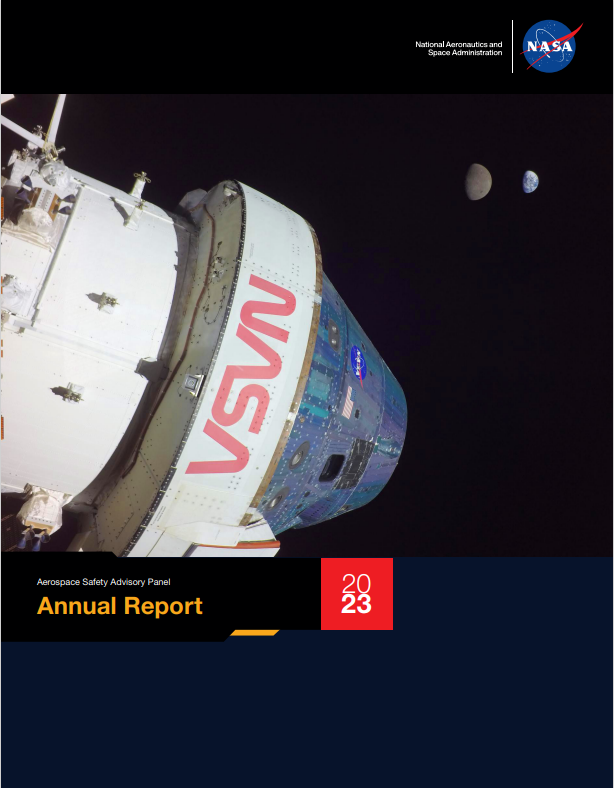
The Aerospace Safety Advisory Panel (ASAP), an advisory committee that reports to NASA and Congress, issued its 2023 annual report Thursday examining the agency’s safety performance, accomplishments, and challenges over the past year.
The report highlights 2023 activities and observations on NASA’s:
Strategic Vision and Guiding Principles
Agency Governance
Moon to Mars Program Management
In 2023, NASA continued to make meaningful progress toward meeting the intent of the broad-ranging recommendations the panel made in 2022. As a result, the ASAP’s latest report includes information on the advances NASA made in its operations, decision-making, program and personnel management, and the tasks that remain.
“This report reflects the panel’s strong emphasis on strategic-level aspects of NASA leadership, risk management, and safety culture – a primary focus over the past two years – while also giving attention to the tactical level of technical execution. We believe that the principles and processes the agency employs to evaluate and make decisions, manage programs, and communicate to its workforce have a direct and consequential impact on safety and mission assurance,” said Dr. Patricia Sanders, ASAP chair. “We also highlight some steps that the Congress can take to assist NASA in safely accomplishing its challenging mission.”
The report highlights the progress made toward top recommendations offered in 2022, including the establishment of a Moon to Mars Program Office, as well as the NASA 2040 new agencywide initiative to operationalize the agency’s vision and strategic objectives across headquarters and centers.
Furthermore, this report addresses safety assessments for both the Moon to Mars Program and the operations – current and future – in low Earth orbit. It also touches on relevant areas of human health and medicine in space, regulatory requirements for commercial space operations as they affect NASA, and the impact of budget constraints and uncertainty on safety.
The 2023 report provides details on the concrete actions the agency should take to fulfill the 2022 recommendations. It spotlights recommendations for the agency moving ahead, including the establishment of a comprehensive International Space Station to Commercial low Earth Orbit destination transition plan.
The report is based on the panel’s 2023 fact-finding and quarterly public meetings; direct observations of NASA operations and decision-making; discussions with NASA management, employees, and contractors; and the panel members’ past experiences.
Congress established the panel in 1968 to provide advice and make recommendations to the NASA administrator on safety matters after the 1967 Apollo 1 fire claimed the lives of three American astronauts.
For more information about the ASAP, view the 2023 report or reports from previous years, visit:
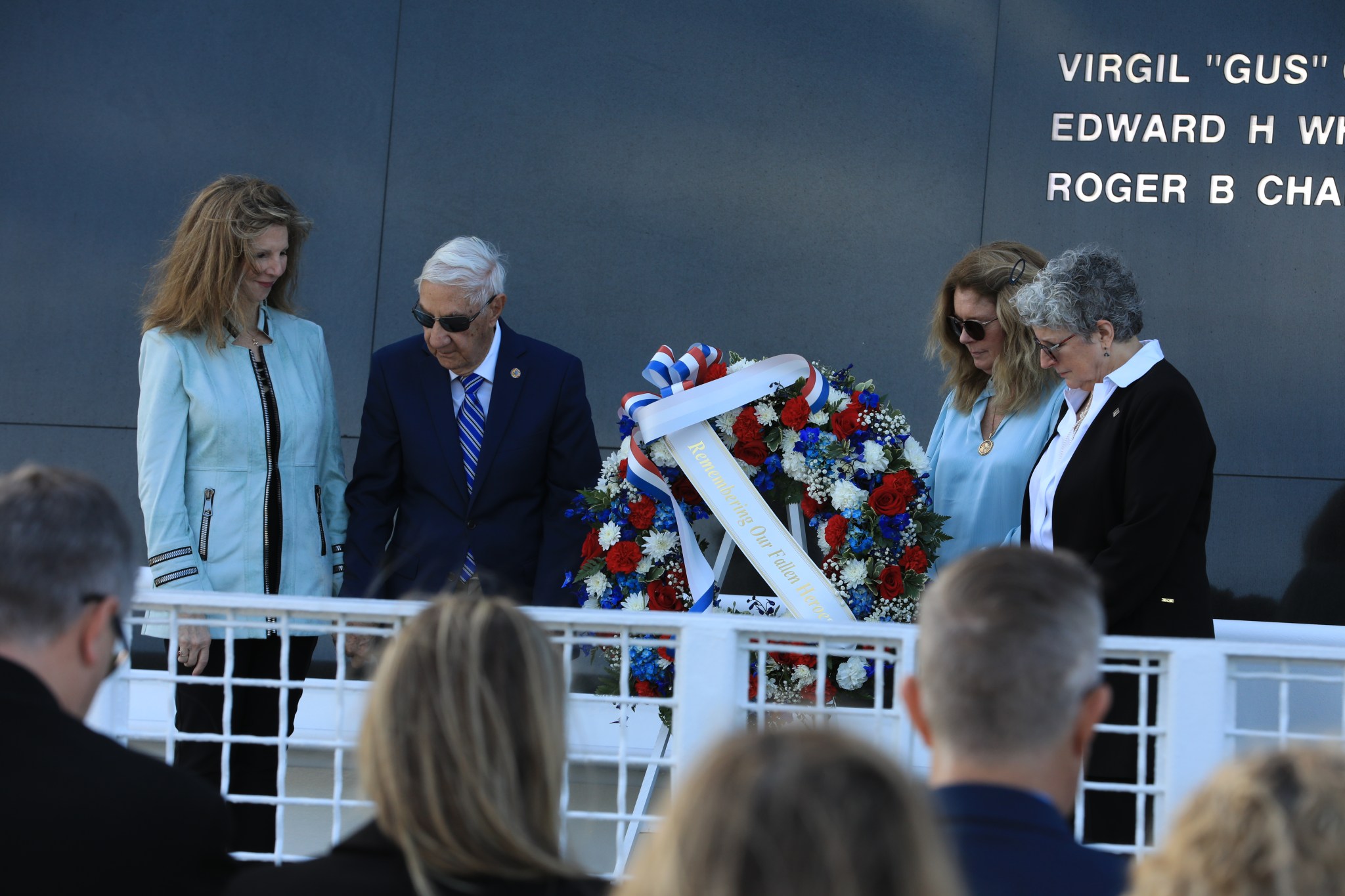
Family members of fallen astronauts Kathie Scobee Fulgham, Lowell Grissom, Sheryl Chaffee, and Karen Bassett Stevenson place a wreath at the Space Mirror Memorial at NASA’s Kennedy Space Center Visitor Complex in Florida on Thursday, Jan. 25, 2024, during the agency’s Day of Remembrance. The annual tradition pays tribute to fallen astronauts and astronaut candidates who lost their lives while furthering the cause of exploration and discovery, including the crews of Apollo 1, Challenger STS-51L, and Columbia STS-107.
Burt Summerfield, associate director, management, at NASA’s Kennedy Space Center in Florida, spoke during the annual Day of Remembrance to honor fallen astronauts and astronaut candidates. “Today is an important day for NASA and the nation to recognize the contribution and sacrifice made in pursuit of space exploration and discovery for all.” Summerfield said. “As we push forward to the Moon and continue our missions to the International Space Station, it’s vital that we always remember and implement the lessons from the past in our preparations.”
After Three Years on Mars, NASA’s Ingenuity Helicopter Mission Ends
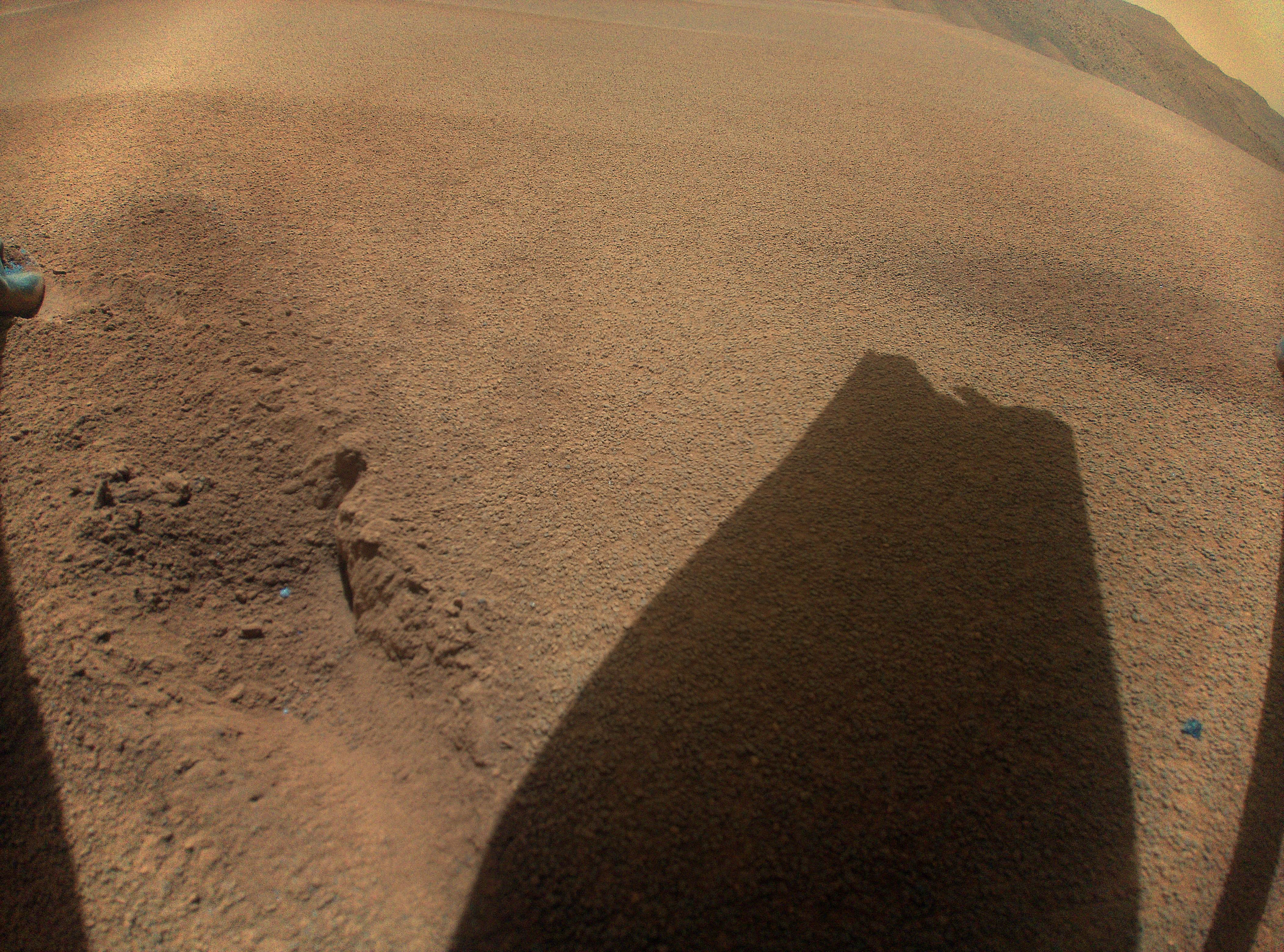
NASA’s history-making Ingenuity Mars Helicopter has ended its mission at the Red Planet after surpassing expectations and making dozens more flights than planned. While the helicopter remains upright and in communication with ground controllers, imagery of its Jan. 18 flight sent to Earth this week indicates one or more of its rotor blades sustained damage during landing, and it is no longer capable of flight.
Originally designed as a technology demonstration to perform up to five experimental test flights over 30 days, the first aircraft on another world operated from the Martian surface for almost three years, performed 72 flights, and flew more than 14 times farther than planned while logging more than two hours of total flight time.
“The historic journey of Ingenuity, the first aircraft on another planet, has come to end,” said NASA Administrator Bill Nelson. “That remarkable helicopter flew higher and farther than we ever imagined and helped NASA do what we do best – make the impossible, possible. Through missions like Ingenuity, NASA is paving the way for future flight in our solar system and smarter, safer human exploration to Mars and beyond.”
NASA to Discuss Ingenuity Mission in Media Call Today
In addition to video comments shared from Nelson about the mission’s conclusion, NASA will host a media teleconference at 5 p.m. EST today, Thursday, Jan. 25, to provide an update on Ingenuity Mars Helicopter.
Audio of the call will stream live on the agency’s website.
Participants in the call are expected to include:
Lori Glaze, director, Planetary Science Division, NASA’s Science Mission Directorate at the agency’s headquarters in Washington
Laurie Leshin, director, NASA’s Jet Propulsion Laboratory in Southern California
Teddy Tzanetos, Ingenuity project manager, NASA JPL
Media who wish to participate by phone can request dial-in information by emailing hq-media@mail.nasa.gov.
Ingenuity landed on Mars Feb. 18, 2021, attached to the belly of NASA’s Perseverance rover and first lifted off the Martian surface on April 19, proving that powered, controlled flight on Mars was possible. After notching another four flights, it embarked on a new mission as an operations demonstration, serving as an aerial scout for Perseverance scientists and rover drivers. In 2023, the helicopter executed two successful flight tests that further expanded the team’s knowledge of its aerodynamic limits.
“At NASA JPL, innovation is at the heart of what we do,” said Leshin. “Ingenuity is an exemplar of the way we push the boundaries of what’s possible every day. I’m incredibly proud of our team behind this historic technological achievement and eager to see what they’ll invent next.”
Ingenuity’s team planned for the helicopter to make a short vertical flight on Jan. 18 to determine its location after executing an emergency landing on its previous flight. Data shows that, as planned, the helicopter achieved a maximum altitude of 40 feet (12 meters) and hovered for 4.5 seconds before starting its descent at a velocity of 3.3 feet per second (1 meter per second).
However, about 3 feet (1 meter) above the surface, Ingenuity lost contact with the rover, which serves as a communications relay for the rotorcraft. The following day, communications were reestablished and more information about the flight was relayed to ground controllers at NASA JPL. Imagery revealing damage to the rotor blade arrived several days later. The cause of the communications dropout and the helicopter’s orientation at time of touchdown are still being investigated.
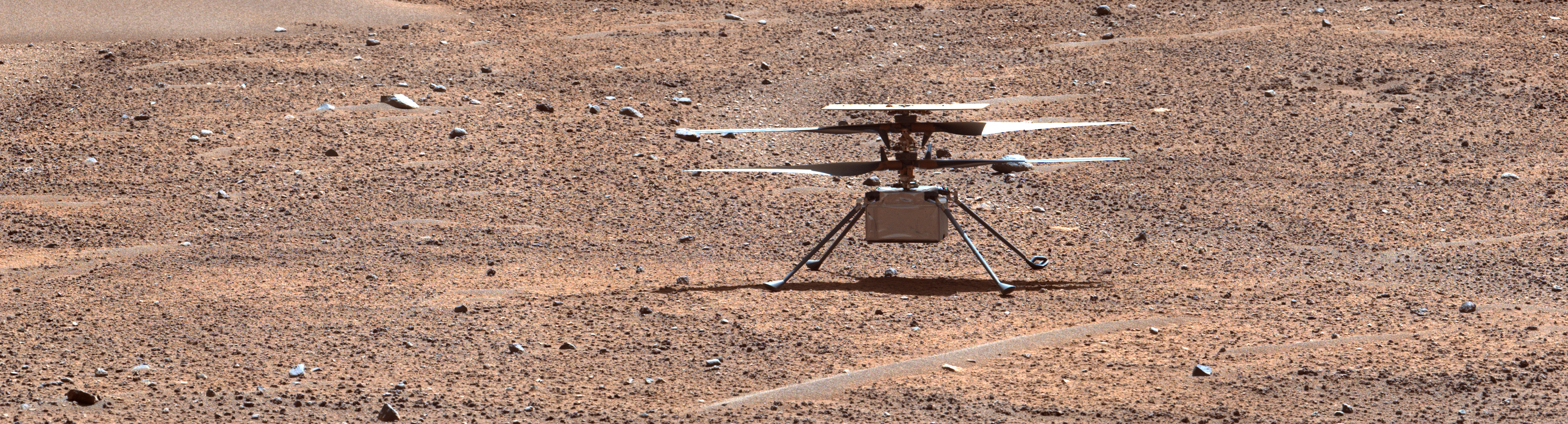
This enhanced color view of NASA’s Ingenuity Mars Helicopter was generated using data collected by the Mastcam-Z instrument aboard the agency’s Perseverance Mars rover on Aug. 2, 2023, the 871st Martian day, or sol, of the mission. The image was taken a day before the rotorcraft’s 54th flight.
After its 72nd flight on Jan. 18, 2024, NASA’s Ingenuity Mars Helicopter captured this color image showing the shadow of one of its rotor blades, which was damaged during touchdown.
NASA/JPL-Caltech
Triumphs, Challenges
Over an extended mission that lasted for almost 1,000 Martian days, more than 33 times longer than originally planned, Ingenuity was upgraded with the ability to autonomously choose landing sites in treacherous terrain, dealt with a dead sensor, cleaned itself after dust storms, operated from 48 different airfields, performed three emergency landings, and survived a frigid Martian winter.
Designed to operate in spring, Ingenuity was unable to power its heaters throughout the night during the coldest parts of winter, resulting in the flight computer periodically freezing and resetting. These power “brownouts” required the team to redesign Ingenuity’s winter operations in order to keep flying.
With flight operations now concluded, the Ingenuity team will perform final tests on helicopter systems and download the remaining imagery and data in Ingenuity’s onboard memory. The Perseverance rover is currently too far away to attempt to image the helicopter at its final airfield.
“It’s humbling Ingenuity not only carries onboard a swatch from the original Wright Flyer, but also this helicopter followed in its footsteps and proved flight is possible on another world,” said Ingenuity’s project manager, Teddy Tzanetos of NASA JPL. “The Mars helicopter would have never flown once, much less 72 times, if it were not for the passion and dedication of the Ingenuity and Perseverance teams. History’s first Mars helicopter will leave behind an indelible mark on the future of space exploration and will inspire fleets of aircraft on Mars – and other worlds – for decades to come.”
More About Ingenuity
The Ingenuity Mars Helicopter was built by NASA JPL, which also manages the project for NASA Headquarters. It is supported by NASA’s Science Mission Directorate. NASA’s Ames Research Center in California’s Silicon Valley and NASA’s Langley Research Center in Hampton, Virginia, provided significant flight performance analysis and technical assistance during Ingenuity’s development. AeroVironment Inc., Qualcomm, and SolAero also provided design assistance and major vehicle components. Lockheed Space designed and manufactured the Mars Helicopter Delivery System. At NASA Headquarters, Dave Lavery is the program executive for the Ingenuity Mars helicopter.
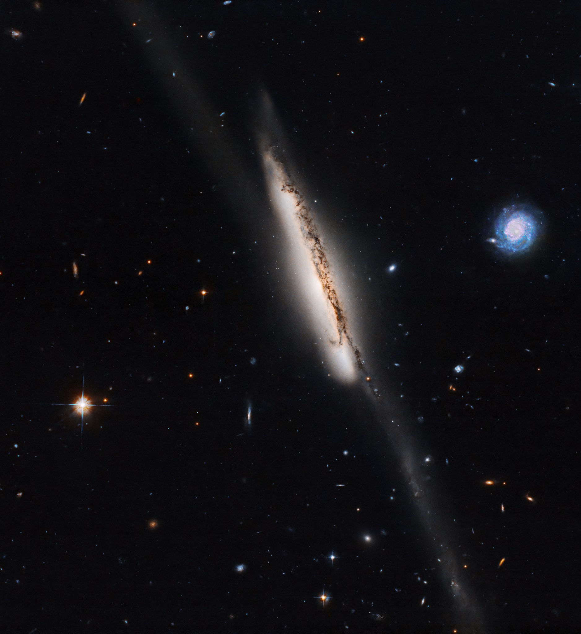
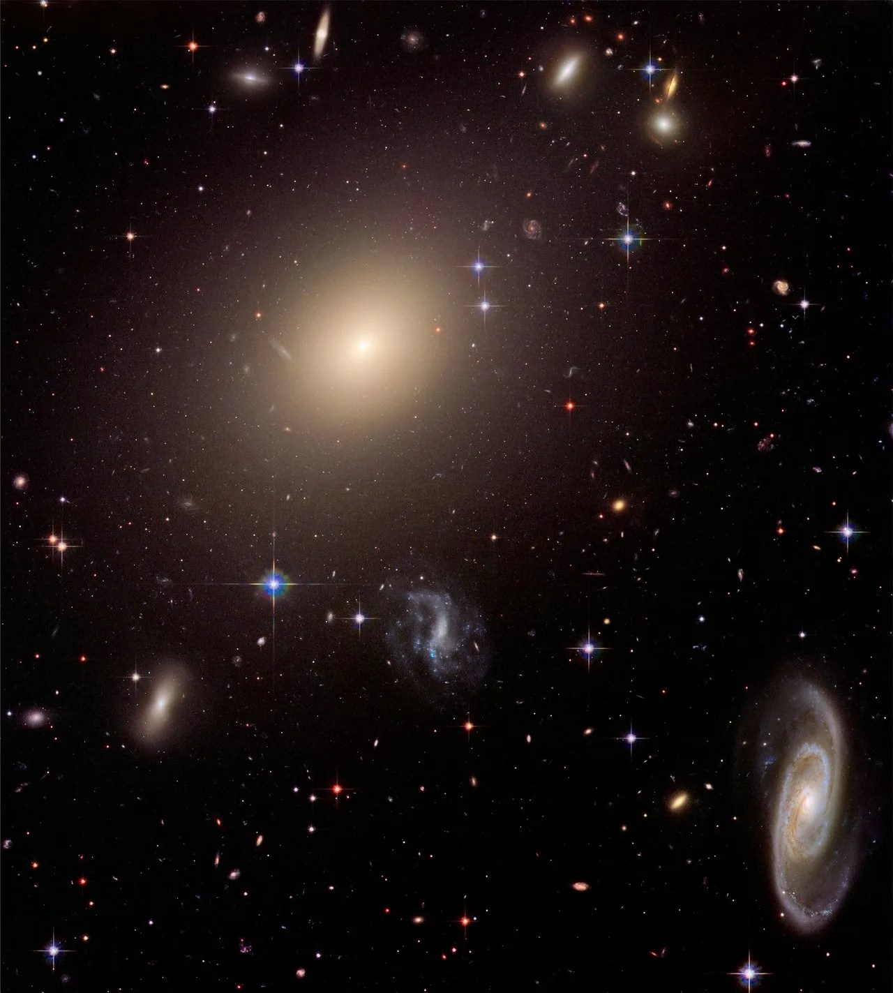
This new NASA Hubble Space Telescope image features a member of the galaxy group Arp 295.
NASA/ESA/J. Dalcanton (University of Washington)/R. Windhorst (Arizona State University)/Processing: Gladys Kober (NASA/Catholic University of America)
One of the galaxies from a galactic group known as Arp 295 is visible in this new NASA Hubble Space Telescope image, along with part of the faint 250,000-light-year-long bridge of stars and gas that stretches between two of the galaxies. The galaxies have passed close enough together that their mutual gravity created this cosmic streamer.
When galaxies pass close enough to gravitationally disrupt each other’s shape, they are known as interacting galaxies. This type of interaction happens over billions of years and repeated close passages can result in the merger of the two galaxies. Galactic mergers are thought to be common, and even our own Milky Way is expected to merge with the massive, neighboring Andromeda galaxy in about 4 billion years.
Arp 295 is made up of three spiral galaxies designated Arp 295a, Arp 295b, and Arp 295c. Arp 295a is the edge-on galaxy seen in the center of the image, and Arp 295c is the smaller and bluer face-on spiral to its right. Arp 295b is off the top left of this image and not visible here. Together, they are the largest of a loose grouping of galaxies located about 270 million light-years in the direction of the constellation Aquarius.
NASA Autonomous Flight Software Successfully Used in Air Taxi Stand-Ins
4 min read
Preparations for Next Moonwalk Simulations Underway (and Underwater)
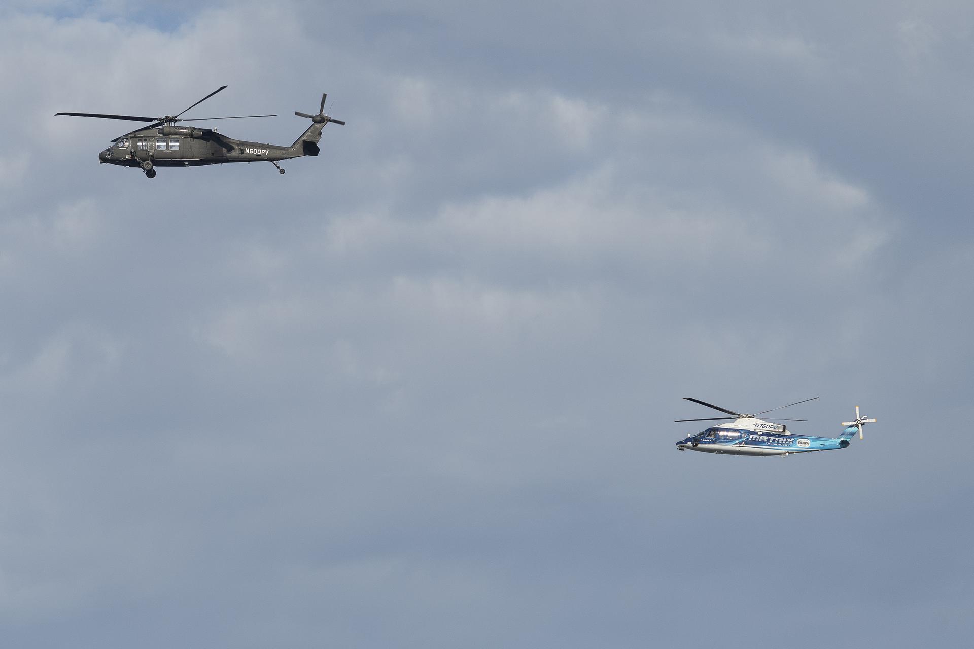
NASA pilots along with Sikorsky safety pilots flying Sikorsky’s Black Hawk Optionally Piloted Vehicle, left, and SARA S-76B over Long Island Sound Thursday, Oct. 26, 2023. These flights will allow NASA researchers to test and evaluate multiple Advanced Air Mobility autonomous flight software products designed by NASA.
NASA/Steve Freeman
In late October, two research helicopters from the manufacturer Sikorsky, a Lockheed Martin company, made a dozen test flights over Long Island Sound, Connecticut taking care to avoid other aircraft in the area around them. Except the ordinary-looking helicopters were flying autonomously – guided by NASA-designed software – and those other aircraft were virtual, part of a simulation to test pilotless flight systems. This was the first time two autonomous aircraft were flying at one another using NASA designed collision avoidance software.
The test flights were part of a collaboration by NASA, Sikorsky, and DARPA (Defense Advanced Research Projects Agency). Researchers were able to collect data that will advance completely autonomous flight —systems that can operate an aircraft without a pilot from takeoff to touchdown. The work was part of NASA’s efforts to design and evaluate technologies that could eventually lead to air taxis and other new, automated air transportation options.
For the tests, the team used two experimental helicopters adapted for autonomous systems, known as the SARA (Sikorsky Autonomy Research Aircraft) a modified S-76B and the larger OPV (Optionally Piloted Vehicle) Black Hawk. Researchers loaded five NASA-designed software systems into the helicopters, which worked with the automated flight system already integrated by Sikorsky and DARPA.
“These flight tests using Sikorsky’s SARA and OPV helicopters show how we can stack technologies together to increase automation over time in a maintainable and scalable way,” says Adam Yingling, NASA project lead. “These efforts demonstrate that we can safely integrate operations to fly the aircraft using several technologies in one navigation tablet.”
A NASA and a Sikorsky safety pilot onboard each helicopter supervised the flight tests. Sikorsky’s flight autonomy system, in combination with NASA software, running on tablets the agency designed, allowed the helicopters to fly autonomously along multiple planned routes. The tablets also enabled the safety pilots to monitor flight path options the software selected whenever course corrections needed to occur.
The safety pilots observed how the helicopters responded to software-initiated commands, and NASA researchers evaluated how the different software systems worked together to control each aircraft.
The tests also assessed how human pilots interacted with the autonomous systems. During the flights, the NASA research pilots were outfitted with specially designed glasses to understand how long they interacted with the navigation tablets and how they physiologically responded to information the tablets provided. Researchers will employ this user experience data to assist in future visual and interactive designs for the software and tablets.
The team flew 12 successful flights covering 70 different flight test maneuvers and generating more than 30 flight hours for each aircraft. The NASA collaboration with Sikorsky and DARPA offered a foundation for furthering testing of the automation technology.
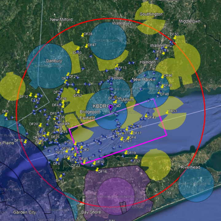
Virtual flight data is shown from the Dallas-Fort Worth urban area overlaid onto the actual flight test area over the Long Island Sound, near Bridgeport, Connecticut allowing pilots to fly in a mixed reality airspace while testing autonomous software systems.
NASA/Stewart Nelson
Mixed-Reality Airspace
The tests demonstrated the software’s capabilities in a mixed-reality setting. As the SARA and OPV helicopters flew over Long Island Sound, multiple virtual aircraft were added into the same airspace.
“For this test, we are using a model of future Advanced Air Mobility airspace with more than 150 virtual aircraft and their flight plans integrated with the flight path management software and the Sikorsky mission manager technology to fly the two helicopters in a mixed-reality mode,” said Mark Ballin, principal investigator for flight path management system development.
The NASA-designed software, which commanded both the SARA and OPV helicopters simultaneously, allowed research pilots and engineers to run planned interactions with the virtual aircrafts’ flight plans. The multiple software systems aboard the helicopters worked together, making adjustments to avoid the virtual aircraft and each other. That meant changing altitude, speed, and direction to avoid virtual “collisions” or maintain orbital patterns for landing. This NASA, Sikorsky, and DARPA collaboration will help usher in a new era of autonomy in aviation that could save lives, aircraft, and resources. NASA uses these tests to support the integration of automated systems research that will inform the Federal Aviation Administration with data on flight procedures to help introduce Advanced Air Mobility systems into the national airspace.