Spacewalk Preps and Health Checks Using Augmented Reality, Artificial Intelligence
Spacewalk preparations are underway aboard the International Space Station as two astronauts check their spacesuits and review procedures. The Expedition 74 crew also experimented with augmented reality and artificial intelligence to conduct health checks in space. Meanwhile, a U.S. cargo spacecraft nears it departure this week.
NASA flight engineers Jessica Meir and Chris Williams joined each other on Monday working on a pair of spacesuits and reviewing procedures for a spacewalk targeted for March 18. The duo partnered up in the Quest airlock and cleaned the suit cooling loops that regulate an astronaut’s temperature during a spacewalk. Meir and Williams also refilled suit components with water, inspected a suit helmet, and prepared Quest for the upcoming spacewalk operations.
The astronauts also reviewed the procedures they will use after they exit Quest in their spacesuits for a six-and-a-half-hour spacewalk. Meir and Williams will install a modification kit and route cables on the port side of the orbital outpost for a future roll-out solar array. The seventh roll-out solar array will be installed on a later spacewalk to augment the main solar arrays’ power generation capabilities.
Flight engineers Jack Hathaway of NASA and Sophie Adenot of ESA (European Space Agency) took turns performing augmented‑reality‑guided ultrasound scans using the EchoFinder-2 biomedical device inside the Columbus laboratory module. After each crew member scanned the other’s abdomen and vascular system, artificial intelligence analyzed the ultrasound image and confirmed organ identification. The objective of the human research study is to reduce reliance on ground support for medical procedures as a space crew flies farther away from Earth.
Roscosmos cosmonauts Sergey Kud-Sverchkov and Sergei Mikaev teamed up on a pair of biology experiments Monday both observing the human circulatory system in weightlessness. First, the station commander and flight engineer measured their blood pressure and more while wearing arm, wrist, and finger cuffs. Afterward, the duo applied sensors to their forehead, fingers, and toes that sent their blood flow data by Bluetooth adaptor to a laptop computer where it was recorded for analysis. Doctors will use the biomedical data to understand how living in space affects vascular health.
Flight engineer Andrey Fedyaev primarily spent his day on life support maintenance throughout the orbital outpost’s Roscosmos segment. During the first half of his shift, Fedyaev serviced the Elektron oxygen generator purging the device of nitrogen and repressurizing its components inside the Zvezda service module. After lunchtime, he filtered and transferred water between tanks to ensure the station’s drinking‑water supply chain remains clean and uncontaminated.
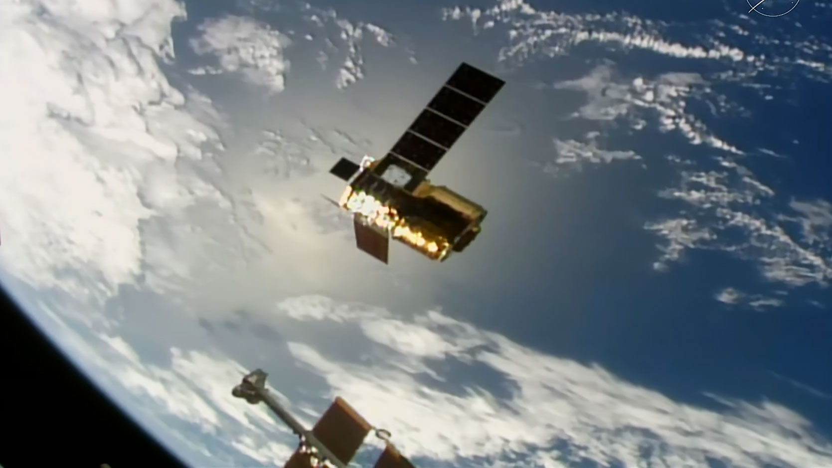
Northrop Grumman’s Cygnus XL cargo spacecraft is due to depart the station Thursday, March 12, ending a near six-month stay that began on Sept. 18, 2025. The astronauts will finalize packing Cygnus with trash and disposable cargo midweek then configure the spacecraft for its robotic removal from the Unity module. Afterward, robotics controllers will remotely command the Canadarm2 robotic arm to uninstall Cygnus from Unity then release it into Earth orbit for a fiery, but safe reentry above the South Pacific Ocean.
Watch NASA’s live coverage of undocking and departure beginning at 6:45 a.m. EDT on NASA+, Amazon Prime, and the agency’s YouTube channel. Learn how to watch NASA content through a variety of online platforms, including social media.
Learn more about station activities by following the space station blog, @space_station on X, as well as the ISS Facebook and ISS Instagram accounts.
Get the latest from NASA delivered every week. Subscribe here.
Powered by WPeMatico
Mark A. Garcia