NASA Sets Briefings for SpaceX Crew-13 Mission to Space Station
NASA and its partners will discuss the upcoming crew rotation mission to the International Space Station during a pair of news conferences on Monday, Aug. 3, from the agency’s Johnson Space Center in Houston.
Mission leadership will provide an overview of NASA’s SpaceX Crew‑13 mission at 12 p.m. EDT. Next, crew members will discuss their training and mission preparations at 2 p.m. This is Crew-13’s final media availability prior to traveling to the agency’s Kennedy Space Center in Florida for launch.
NASA will stream these events live. Learn where to watch online:
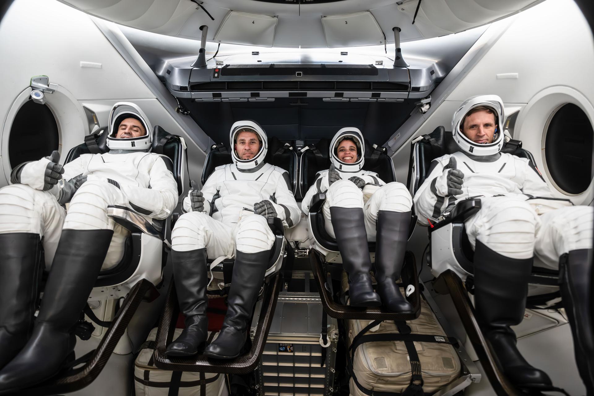
The Crew-13 mission will carry NASA astronauts Jessica Watkins and Luke Delaney, CSA (Canadian Space Agency) astronaut Joshua Kutryk, and Roscosmos cosmonaut Sergey Teteryatnikov to the orbiting laboratory. The crew will launch aboard a SpaceX Dragon spacecraft on the company’s Falcon 9 rocket from Space Launch Complex 40 at Cape Canaveral Space Force Station in Florida no earlier than mid-September.
International media attending in person must email the NASA Johnson newsroom at jsccommu@mail.nasa.gov by 5 p.m., Tuesday, July 21. United States-based media attending in person must respond by 5 p.m., Thursday, July 30. Media joining virtually must respond by 10 a.m. the day of the event. NASA’s media accreditation policy is available online.
Briefing participants are as follows (all times Eastern and subject to change based on real-time operations):
12 p.m.: Mission Overview News Conference
- Joel Montalbano, deputy associate administrator, Human Spaceflight Mission Directorate, NASA Headquarters
- Dana Weigel, manager, Low Earth Orbit Program, NASA Johnson
- Mathieu Caron, director, Astronauts, Life Sciences, and Space Medicine, CSA
- Julianna Scheiman, director, NASA Science and Dragon Programs, SpaceX
2 p.m.: Crew-13 News Conference
- Jessica Watkins, commander, NASA
- Luke Delaney, pilot, NASA
- Joshua Kutryk, mission specialist, CSA
- Sergey Teteryatnikov, mission specialist, Roscosmos
Following the news conference, crew members will be available for limited media interviews. All interview requests must be submitted by 5 p.m. on July 30, to the NASA Johnson newsroom at: jsccommu@mail.nasa.gov.
This will be the second flight to the space station for Watkins, who was selected as a NASA astronaut in 2017. Watkins grew up in Lafayette, Colorado, and earned an undergraduate degree in geological and environmental sciences from Stanford University, as well as a doctorate in geology from the University of California, Los Angeles. As a geologist, she studied the Martian surface and was a member of the Curiosity rover science team at NASA’s Jet Propulsion Laboratory in Southern California. Watkins first launched to the space station as a crew member aboard NASA’s SpaceX Crew-4 mission, spending a total of 170 days in space across space station Expeditions 67/68 in 2022. She will be the first NASA astronaut to launch aboard a SpaceX Dragon spacecraft twice.
Selected as a NASA astronaut in 2021, Delaney earned a bachelor’s degree in mechanical engineering at the University of North Florida and a master’s degree in aerospace engineering at the Naval Postgraduate School. The Florida native is a distinguished naval aviator who participated in exercises throughout the Asia Pacific region and conducted missions in support of Operation Enduring Freedom. As a test pilot, Delaney evaluated developmental aircraft systems and served as a test pilot instructor. He also worked as a research pilot at NASA’s Langley Research Center in Hampton, Virginia, where he supported airborne science missions. This is the first spaceflight for Delaney.
The Crew-13 mission also is the first spaceflight for Kutryk. Prior to his selection as a CSA astronaut in 2017, he served as a CF-18 fighter pilot, flying missions in support of Canada’s NATO, U.N., and North American Aerospace Defense Command commitments. A native of Fort Saskatchewan, Alberta, Kutryk also worked as an experimental and operational test pilot at the Aerospace Engineering Test Establishment in Cold Lake, Alberta. Kutryk received a bachelor’s degree in mechanical engineering from the Royal Military College of Canada in Kingston, Ontario, and he is a distinguished graduate of the United States Air Force Test Pilot school in Edwards, California. He has master’s degrees in space studies, flight test engineering, and defense studies.
This mission will be Teteryatnikov’s first trip to the orbiting laboratory. He graduated from the Naval Academy, St. Petersburg, Russia, in 2011 as an engineer specializing in ship power plant operations. Before his selection as a test cosmonaut, Teteryatnikov served in various naval engineering roles, including undersea vessels and specialized engine room operations. He was selected for the Gagarin Research and Test Cosmonaut Training Center Cosmonaut Corps in 2021 and has served as a test cosmonaut since 2023.
For more information about the mission, visit:
https://www.nasa.gov/mission/nasas-spacex-crew-13
-end-
Joshua Finch / Jimi Russell
Headquarters, Washington
202-358-1100
joshua.a.finch@nasa.gov / james.j.russell@nasa.gov
Leah Cheshier / Anna Schneider
Johnson Space Center, Houston
281-483-5111
leah.d.cheshier@nasa.gov / anna.c.schneider@nasa.gov
Powered by WPeMatico
Get The Details…
Jessica Taveau