Sky High Sustainability: NASA Johnson’s Pocket Prairie Flourishes Atop Building 12
Buzzing with bees, baby birds, and wildflowers, the rooftop garden atop building 12 at Johnson Space Center in Houston reflects NASA’s commitment to environmental stewardship. Originally constructed in 1963, the facility was transformed in 2012, incorporating energy-efficient features that earned it LEED Gold certification. The certification is a globally recognized symbol of sustainability achievement and leadership. Today, the building serves as a testament to NASA’s commitment to ecological innovation.
Nestled between the Mission Control Center and building 16, this hidden gem is part of a series of pioneering efforts at Johnson to demonstrate how even the most unexpected locations can become vibrant ecosystems.
Aerial views of Johnson Space Center’s rooftop garden.
NASA/Bill Stafford
Initiated by Joel Walker, director of Center Operations, and designed alongside NASA engineers, the rooftop garden exemplifies green architecture with integrated solar panels, an underfloor air distribution system, and wind turbines.
“It was something of an experiment to see what worked well and what we might use in future projects,” said Walker.
Native Texas Bluebonnet atop building 12 at NASA’s Johnson Space Center in Houston.
The Center Operations team leads sustainability efforts at Johnson, working across multiple directorates and teams. Together, they manage Johnson’s 1,600 acres, which host a diverse array of plants and wildlife.
Building 12’s green roof provides benefits such as reduced potable water and energy usage, better stormwater management, protection from UV rays, and increased stability in high winds. This unique space provides an ideal environment for nesting birds and visiting pollinators and boasts a projected lifespan of 50 years, significantly longer than the 20 to 25 years typical of a conventional roof.
“I was genuinely surprised by the variety of native species thriving in our rooftop garden,” said Johnson’s wildlife biologist Strausser. “We’ve observed far more species than we ever anticipated, which is both fascinating and encouraging for our conservation efforts.”
Johnson team members meet on the building 12 rooftop to assess and monitor the plants.
Initially, the project started with non-native ornamental plants that failed in the harsh Houston climate. Replanting the garden yielded mixed results until the team hand-scattered a blend of native grass seed and wildflowers. This method proved to be a successful, at a fraction of the cost estimated for professional planting.
“Sometimes the easiest way is the best!” said Walker. “It looks great now and is much more durable too.”
NASA Cloud-Based Platform Could Help Streamline, Improve Air Traffic
4 min read
Preparations for Next Moonwalk Simulations Underway (and Underwater)
This image shows an aviation version of a smartphone navigation app that makes suggestions for an aircraft to fly an alternate, more efficient route. The new trajectories are based on information available from NASA’s Digital Information Platform and processed by the Collaborative Departure Digital Rerouting tool.
NASA
Just like your smartphone navigation app can instantly analyze information from many sources to suggest the best route to follow, a NASA-developed resource is now making data available to help the aviation industry do the same thing.
To assist air traffic managers in keeping airplanes moving efficiently through the skies, information about weather, potential delays, and more is being gathered and processed to support decision making tools for a variety of aviation applications.
Appropriately named the Digital Information Platform (DIP), this living database hosts key data gathered by flight participants such as airlines or drone operators. It will help power additional tools that, among other benefits, can save you travel time.
Ultimately, the aviation industry… and even the flying public, will benefit from what we develop.
Swati Saxena
NASA Aerospace Engineer
“Through DIP we’re also demonstrating how to deliver digital services for aviation users via a modern cloud-based, service-oriented architecture,” said Swati Saxena, DIP project manager at NASA’s Ames Research Center in California.
The intent is not to compete with others. Instead, the hope is that industry will see DIP as a reference they can use in developing and implementing their own platforms and digital services.
“Ultimately, the aviation industry – the Federal Aviation Administration, commercial airlines, flight operators, and even the flying public – will benefit from what we develop,” Saxena said.
The platform and digital services have even more benefits than just saving some time on a journey.
For example, NASA recently collaborated with airlines to demonstrate a traffic management tool that improved traffic flow at select airports, saving thousands of pounds of jet fuel and significantly reducing carbon emissions.
Now, much of the data gathered in collaboration with airlines and integrated on the platform is publicly available. Users who qualify can create a guest account and access DIP data at a new website created by the project.
It’s all part of NASA’s vision for 21st century aviation involving revolutionary next-generation future airspace and safety tools.
Managing Future Air Traffic
During the 2030s and beyond, the skies above the United States are expected to become much busier.
Facing this rising demand, the current National Airspace System – the network of U.S. aviation infrastructure including airports, air navigation facilities, and communications – will be challenged to keep up. DIP represents a key piece of solving that challenge.
What this vision looks like is a flight environment where many types of vehicles and their pilots, as well as air traffic managers, use state-of-the-art automated tools and systems that provide highly detailed and curated information.
These tools leverage new capabilities like machine learning and artificial intelligence to streamline efficiency and handle the increase in traffic expected in the coming decades.
Digital Services Ecosystem in Action
To begin implementing this new vision, our aeronautical innovators are evaluating their platform, DIP, and services at several airports in Texas. This initial stage is a building block for larger such demonstrations in the future.
“These digital services are being used in the live operational environment by our airline partners to improve efficiency of the current airspace operations,” Saxena said. “The tools are currently in use in the Dallas/Fort Worth area and will be deployed in the Houston airspace in 2025.”
The results from these digital tools are already making a difference.
Proven Air Traffic Results
During 2022, a NASA machine learning-based tool named Collaborative Digital Departure Rerouting, designed to improve the flow of air traffic and prevent flight delays, saved more than 24,000 lbs. (10,886 kg.) of fuel by streamlining air traffic in the Dallas area.
If such tools were used across the entire country, the improvements made in efficiency, safety, and sustainability would make a notable difference to the flying public and industry.
“Continued agreements with airlines and the aviation industry led to the creation and expansion of this partnership ecosystem,” Saxena said. “There have been benefits across the board.”
DIP was developed under NASA’s Airspace Operations and Safety Program.
Learn about NASA’s Collaborative Digital Departure Rerouting tool and how it uses information from the Digital Information Platform to provide airlines with routing options similar to how drivers navigate using cellphone apps.
About the Author
John Gould
Aeronautics Research Mission Directorate
John Gould is a member of NASA Aeronautics’ Strategic Communications team at NASA Headquarters in Washington, DC. He is dedicated to public service and NASA’s leading role in scientific exploration. Prior to working for NASA Aeronautics, he was a spaceflight historian and writer, having a lifelong passion for space and aviation.
Sols 4241–4242: We Can’t Go Around It…We’ve Got To Go Through It!
2 min read
Sols 4241–4242: We Can’t Go Around It…We’ve Got To Go Through It!
This image was taken by the Front Hazard Avoidance Camera (Front Hazcam) aboard NASA’s Mars rover Curiosity on Sol 4237 – Martian day 4,237 of the Mars Science Laboratory mission – on July 7, 2024 at 14:46:38 UTC.
Earth planning date: Wednesday, July 10, 2024
Curiosity is currently trekking across Gediz Vallis channel because, as my nephew’s favorite book says, if we can’t go around it… we’ve got to go through it! Recently we’ve been parked for a while on the channel to drill “Mammoth Lakes,” (https://science.nasa.gov/blogs/sols-4222-4224-a-particularly-prickly-power-puzzle/) and are now on the move once again exploring the rubbly rocks. Today the science team planned two sols of activity for Curiosity as we venture on through and across Gediz Vallis channel.
On the first sol we undertake nearly two hours of planned science. This includes Navcam deck monitoring and a Mastcam tau, to measure dust in the atmosphere as part of our atmospheric and environmental activities, alongside some geology-focused observations. MAHLI is taking a close up image of “Donohue Pass” that we targeted with ChemCam LIBS and Mastcam imagery in the previous plan (https://science.nasa.gov/blogs/sols-4239-4240-vuggin-out/). ChemCam will take a LIBS on a rock named “Negit Island” that caught the team’s eye with a lighter base and a darker upper section. ChemCam will also take two RMIs of Gediz Vallis, one to document the wall of Gediz Vallis channel that we can see up ahead of us, and one looking at the rocks that sit within the channel. Mastcam is also taking a look at the wall of Gediz Vallis, as well as continuing a mega-mosaic started in the last plan that took 54 images of “Stubblefield Canyon.” Today we planned another 48 images to document the rest of this area named “Echo Ridge.”
ChemCam will take a passive observation of an interesting rubbly target in this region called “Wishbone Lake,” prior to a five-meter drive (about 16 feet) over to this feature. Once we have arrived, Curiosity will take some post-drive Navcam imaging and a MARDI image of our left-front wheel. After a well-deserved sleep, on the second sol of this plan Curiosity will automatically choose a LIBS target in our new workspace, before taking a dust-devil and suprahorizon movie to round off this plan.
Written by Emma Harris, Graduate Student at Natural History Museum, London
NASA to Commemorate 55th Anniversary of Apollo 11 Moon Landing
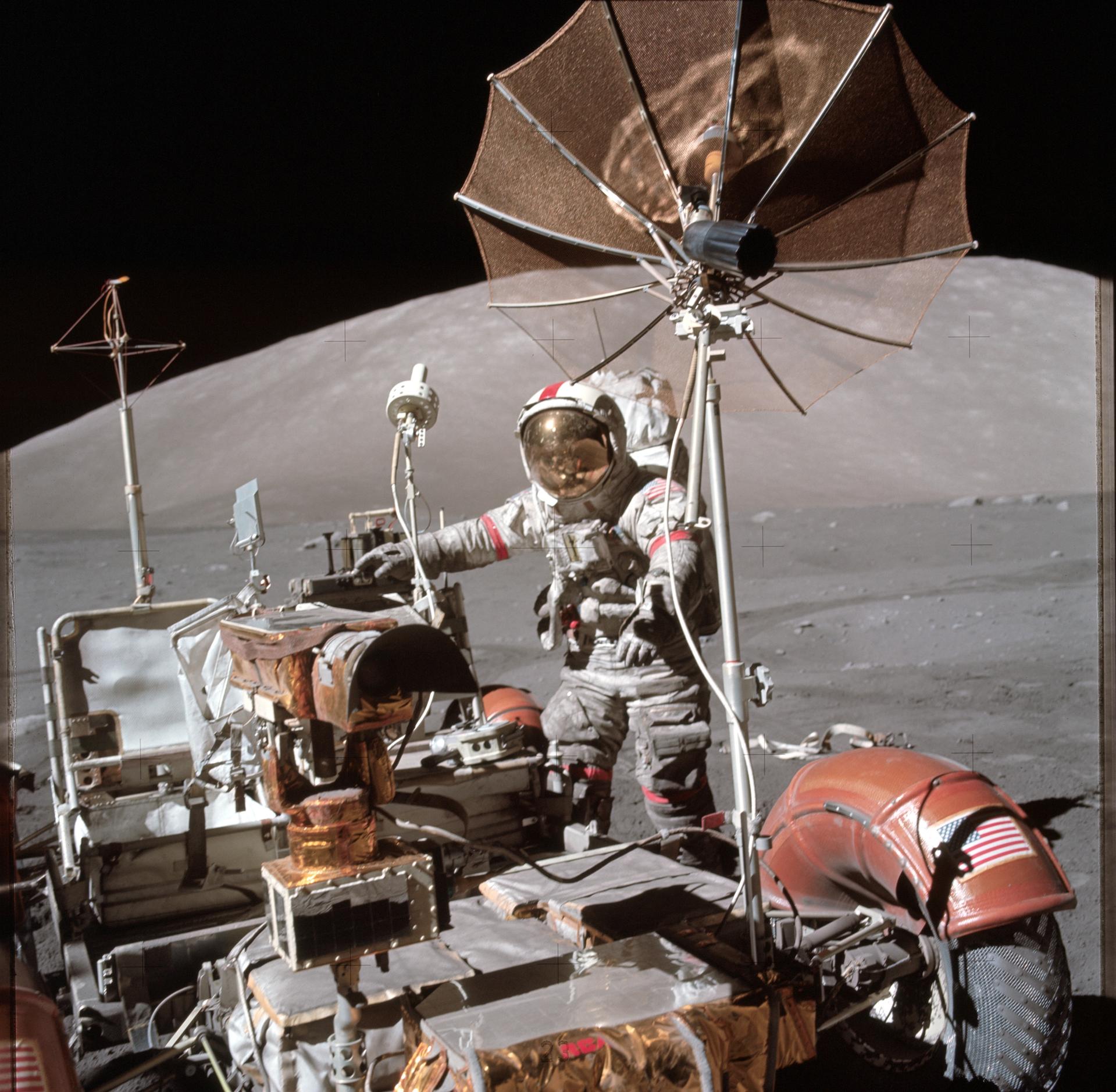
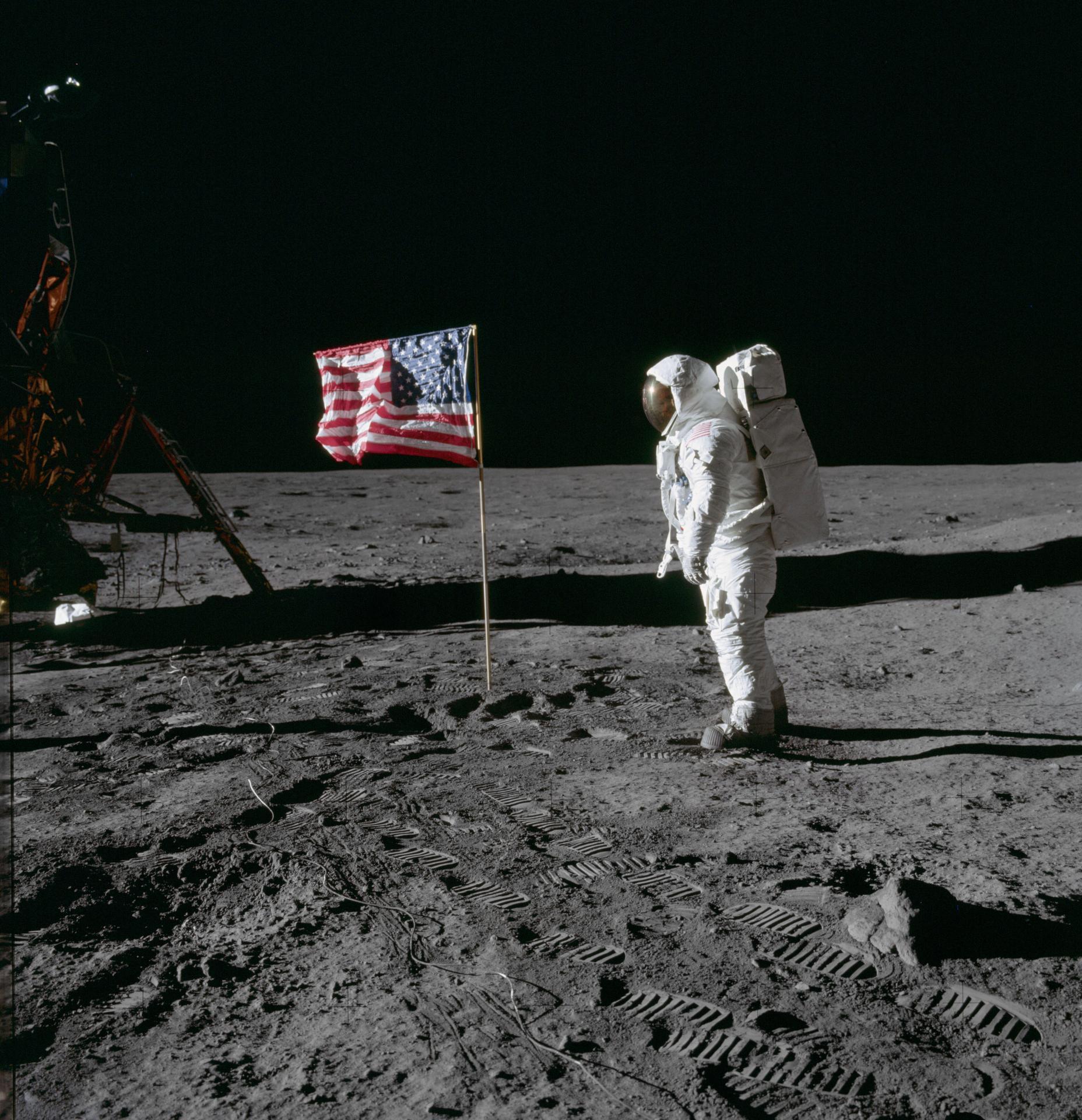
Apollo astronaut Buzz Aldrin poses for a photograph beside the deployed United States flag during an Apollo 11 moonwalk on July 20, 1969. The Lunar Module is on the left, and the footprints of the astronauts are clearly visible in the soil of the moon.
Credit: NASA
As the agency explores more of the Moon than ever before under the Artemis campaign, NASA will celebrate the 55th anniversary of the first astronauts landing on the Moon through a variety of in-person, virtual, and engagement activities nationwide between Monday, July 15, and Thursday, July 25.
Events will honor America’s vision and technology that enabled the Apollo 11 crewed lunar landing on July 20, 1969, as well as Apollo-era inventions and techniques that spread into public life, many of which are still in use today. Activities also will highlight NASA’s Artemis campaign, which includes landing the first woman, first person of color, and first international astronaut on the Moon, inspiring great achievements, exploration, and scientific discovery for the benefit of all.
NASA’s subject matter experts are available for a limited number of interviews about the anniversary. To request an interview virtually or in person, contact Jessica Taveau in the newsroom: jessica.c.taveau@nasa.gov.
During the week of July 15, the agency also will share the iconic bootprint image and the significance of Apollo 11 to NASA’s mission, as well as use the #Apollo11 hashtag, across its digital platforms online.
Additional activities from NASA include:
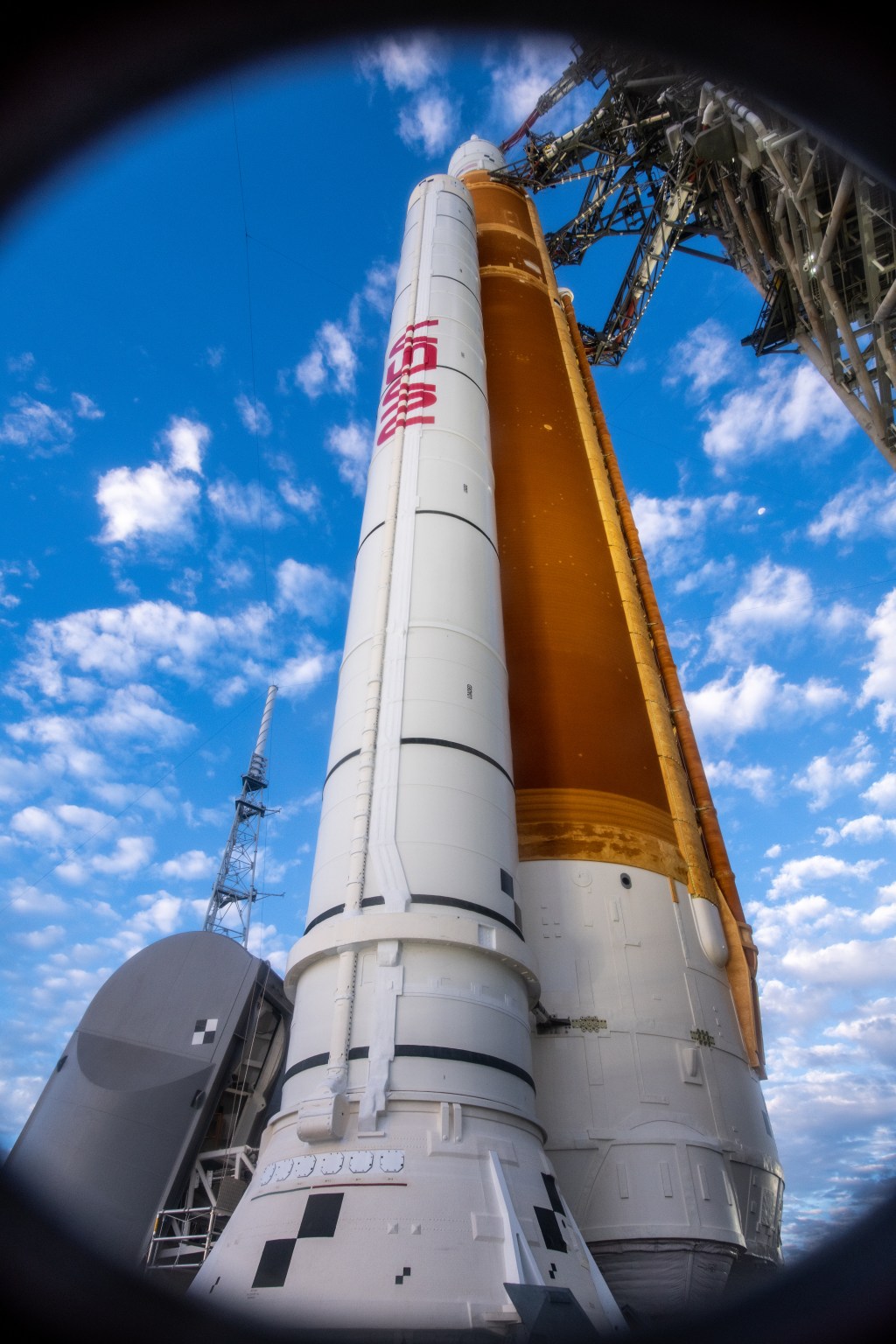
Monday, July 15 and Tuesday, July 16, NASA’s Michoud Assembly Facility in New Orleans, Louisiana: NASA will host the rollout of the agency’s Artemis II SLS (Space Launch System) core stage.
Friday, July 19, NASA’s Johnson Space Center in Houston: In a dedication and ribbon cutting, the center will name its building 12 the ‘Dorothy Vaughan Center in Honor of the Women of Apollo.’ Vaughan was a mathematician, computer programmer, and NASA’s first Black manager.
Sunday, July 21, NASA’s Goddard Space Flight Center in Greenbelt, Maryland: NASA Goddard will host a model rocket contest conducted by the National Association of Rocketry Headquarters Astro Modeling Section. This free contest is open to all model rocketeers and the public.
Other activities include:
Tuesday, July 16 through Wednesday, July 24, Space Center Houston: The center will host pop-up science labs, mission briefings, special tram tours that feature the Mission Control Center at NASA Johnson, and more.
Friday, July 19 through Saturday, July 20, National Cathedral in Washington: The cathedral will host a festival marking the 50th anniversary of its Space Window, which contains a piece of lunar rock that was donated by NASA and the crew of Apollo 11.
Thursday, July 25, San Diego Comic-Con: NASA representatives will participate in a panel entitled ‘Exploring the Moon: the Artemis Generation.’ Panelists are:
Stan Love, NASA astronaut
A.C. Charania, NASA chief technologist
Dionne Hernandez-Lugo, NASA’s Gateway Program
Jackelynne Silva-Martinez, NASA Human Health and Performance
For more details about NASA’s Apollo Program, please visit:
Two Years Since Webb’s First Images: Celebrating with the Penguin and the Egg
The distorted spiral galaxy at center, the Penguin, and the compact elliptical at left, the Egg, are locked in an active embrace. This near- and mid-infrared image combines data from NASA’s James Webb Space Telescope’s NIRCam (Near-Infrared Camera) and MIRI (Mid-Infrared Instrument), and marks the telescope’s second year of science. Webb’s view shows that their interaction is marked by a glow of scattered stars represented in blue. Known jointly as Arp 142, the galaxies made their first pass by one another between 25 and 75 million years ago, causing “fireworks,” or new star formation, in the Penguin. The galaxies are approximately the same mass, which is why one hasn’t consumed the other.
NASA, ESA, CSA, STScI
To celebrate the second science anniversary of NASA’s James Webb Space Telescope, the team has released a near- and mid-infrared image on July 12, 2024, of two interacting galaxies: The Penguin and the Egg.
Webb specializes in capturing infrared light – which is beyond what our own eyes can see – allowing us to view and study these two galaxies, collectively known as Arp 142. Their ongoing interaction was set in motion between 25 and 75 million years ago, when the Penguin (individually cataloged as NGC 2936) and the Egg (NGC 2937) completed their first pass. They will go on to shimmy and sway, completing several additional loops before merging into a single galaxy hundreds of millions of years from now.