NASA’s Planet-Hunting TESS Reveals Dazzling Night Sky

NASA’s Planet-Hunting TESS Reveals Dazzling Night Sky

3 min read

NASA’s Planet-Hunting TESS Reveals Dazzling Night Sky

NASA’s TESS (Transiting Exoplanet Survey Satellite) has released its most complete view of the starry sky to date, filling in gaps from previous observations. Nearly 6,000 colored dots scattered across the image show the locations of either confirmed or candidate exoplanets — worlds beyond our solar system — identified by the mission as of September 2025 at the end of TESS’s second extended mission.

“Over the last eight years, TESS has become a fire hose of exoplanet science,” said Rebekah Hounsell, a TESS associate project scientist at the University of Maryland Baltimore County and NASA’s Goddard Space Flight Center in Greenbelt, Maryland. “It’s helped us find planets of all different sizes, from tiny Mercury-like ones to those larger than Jupiter. Some of them are even in the habitable zone, where liquid water might be possible on the surface, an important factor in our search for life beyond Earth.”

The TESS mission scans a wide swath of the sky, called a sector, for about a month at a time using its four cameras. These long stares allow the spacecraft to track the brightness changes of tens of thousands of stars, looking for variations in their light that might come from orbiting planets.

Researchers assembled an all-sky mosaic made of 96 sectors observed between April 2018, when TESS began its work, and September 2025.

Oval projection of the TESS night sky with exoplanet markers
This view of the whole sky was constructed from 96 TESS sectors. By the end of September 2025, when the last image of this mosaic was captured, TESS had discovered 679 exoplanets (blue dots) and 5,165 candidates (orange dots). The glowing arc running through the center is the plane of the Milky Way. The Large Magellanic Cloud can be seen along the bottom edge just left of center. Black areas within the oval indicate regions TESS has not yet imaged.
NASA/MIT/TESS and Veselin Kostov (University of Maryland College Park)

The blue dots in the image mark the locations of nearly 700 confirmed planets, as of September 9. This menagerie includes worlds that may be covered by volcanoes, are being destroyed by their stars, or orbit two stars — experiencing double sunrises and sunsets each day. The orange dots represent more than 5,000 candidate planets that are awaiting verification.

To date, scientists have confirmed over 6,270 exoplanets using missions like TESS, NASA’s retired Kepler Space Telescope, and other facilities.

Also captured in the mosaic is the bright plane of our Milky Way galaxy, seen as a glowing arc through the center. The bright white ovals in the lower left are the Large and Small Magellanic Clouds. These satellite galaxies are located 160,000 and 200,000 light-years away, respectively.

“The more we dig into the large TESS dataset, especially using automated algorithms, the more surprises we find,” said Allison Youngblood, the TESS project scientist at NASA Goddard. “In addition to planets, TESS has helped us study rivers of young stars, observe dynamic galactic behavior, and monitor asteroids near Earth. As TESS fills in more of the night sky, there’s no knowing what it might see next.”

You could discover the next exoplanet! Join the Planet Hunters TESS citizen science project, and you’ll learn how to read light curves — plots of light data from distant stars — to find telltale signals from orbiting exoplanets.

By Jeanette Kazmierczak
NASA’s Goddard Space Flight Center, Greenbelt, Md.

Media Contact:
Claire Andreoli
301-286-1940
NASA’s Goddard Space Flight Center, Greenbelt, Md.

Powered by WPeMatico

Get The Details…

America’s Emerald Isle

America’s Emerald Isle

A satellite image shows several islands in Lake Michigan. The largest one, Beaver Island, is in the center. The islands are mostly green and vegetated, with bright sandy areas on their perimeters. Shallow waters near the land appear turquoise, and deeper waters are dark blue.

In a process that played out over thousands of years, a retreating ice sheet carved, scoured, and shaped the landscape of the present-day Great Lakes. In northern Lake Michigan, this sculpting left distinct ridges and valleys running north-to-south along the lake floor. Some parts of those ridges, made of erosion-resistant rock, have remained above the waves of the big lake, forming the Beaver Archipelago.

The OLI (Operational Land Imager) on Landsat 9 captured this image of several of the archipelago’s islands on August 2, 2024. These patches of land contain upland forests, dunes, wetlands, and marshes—habitats that support rare plant and bird species and provide spawning grounds for fish. The bright, sandy perimeters of the islands are surrounded by shallow, turquoise waters and deeper, dark blue areas, where depths reach up to about 330 feet (100 meters).

This image centers on Beaver Island, the largest island in Lake Michigan at 13 miles (21 kilometers) long and 6 miles (10 kilometers) wide. It is also the only inhabited island of the Beaver Archipelago, and many of its approximately 600 residents are of Irish descent. In the mid-1800s, scores of immigrants from County Donegal, Ireland, and Irish fishermen from nearby islands and ports in Michigan settled on the island, which subsequently took on the moniker of “America’s Emerald Isle.”

The farming and fishing, in particular, were productive for the new arrivals. In the 1880s, Beaver Island became the largest supplier of freshwater fish in the United States. Due to overfishing, however, such abundance would be short-lived.

Ship traffic on the Great Lakes was also increasing during this time. Two lighthouses were constructed on the island to help the growing number of vessels traveling between Chicago and the Straits of Mackinac. The Beaver Head Lighthouse operated from 1852 to 1962 on the southern end of the island. On the northern side, the Beaver Island Harbor Light, pictured below, was first lit in 1870 and remains an active beacon more than 150 years later.

A lighthouse with a white tower and a glowing red beacon at the top stands on the left side of this photograph. A large lake and cloudy skies fill the background.

Today, people travel to Beaver Island by boat or plane to explore its history and enjoy activities such as biking, fishing, and kayaking. The island’s remote location and minimal light pollution led to the establishment of the Beaver Island State Wildlife Research Area International Dark Sky Sanctuary in 2024. Sky gazers may be drawn to the sanctuary for a chance to glimpse the aurora borealis and other celestial phenomena.

Neighboring islands in the archipelago are more difficult to access and have remained relatively undisturbed. Perched, or cliff-top, sand dunes are found up to 200 feet (60 meters) above the lake level on the western side of High Island. Unique plant species, including the Pitcher’s thistle and Lake Huron tansy, grow in the island’s dunes. On Hog Island, patches of old-growth northern hardwood forest remain. Wetland communities known as Great Lakes marshes along the shoreline provide spawning grounds for perch and smallmouth bass.

NASA Earth Observatory image by Wanmei Liang, using Landsat data from the U.S. Geological SurveyPhoto by Kelcie Herald/Unsplash. Story by Lindsey Doermann.

References & Resources

You may also be interested in:

Stay up-to-date with the latest content from NASA as we explore the universe and discover more about our home planet.
A Sea of Spinning Clouds

3 min read

Icy, isolated Peter I Island stirred up a show in the atmosphere off the West Antarctic coast.

Article

Satellite Spots a Spawn

3 min read

The activity of herring around Vancouver Island in British Columbia brightened coastal waters enough to be detectable from space.

Article

Showy Swirls Around Jeju Island

2 min read

Winds blowing past the volcanic landmass near the Korean Peninsula created a trail of spiraling clouds, while murky water churned…

Article

Powered by WPeMatico
Get The Details…

NASA Langley Engineer Attends FAA Training

NASA Langley Engineer Attends FAA Training

At a busy airport, every aircraft in the area shares just a handful of radio frequencies. Spectrum and time are constrained and if multiple people speak at once, both messages can get lost. Communications like “clearance delivery,” which require long transmissions and readbacks, are challenging in high-traffic areas, particularly when weather or other factors require many aircraft to communicate with controllers at once. Going digital clears that channel for urgent, time-critical calls, among other things. And it’s the current practice at some airports, where pilots can confirm clearances with the touch of a button, that the response goes directly to the controller’s screen, and the updated information loads into their flight management system.

Will Cummings-Grande, aerospace engineer with the Systems Analysis and Concepts Directorate based at NASA’s Langley Research Center, is leading technical work that centers around Communications Architecture and Performance for Digital Clearance in NASA’s Air Traffic Management and Safety (ATMS) project. He’s researching the next layer of digital clearance, extending that same logic down to taxi instructions on the ground, so that pushback timing, routing, and runway assignments could also arrive digitally rather than over the radio.

He sought out the most current, ground-level knowledge about how digital clearance delivery works in practice — not in a research paper, but in a real tower, on real systems, with the people who run them every day. The Federal Aviation Administration (FAA) offers the training he wanted to air traffic controllers, so he reached out to the FAA Academy “on a hope and a prayer” that they might accept him as a student.

And in early April, Cummings-Grande traveled to the Mike Monroney Aeronautical Center (MMAC) in Oklahoma City to complete the Tower Data Link Services (TDLS) Application Specialist training — the same two-day, hands-on course required of working controllers at the 72 U.S. airports currently equipped with digital clearance delivery capability.

Will Cummings-Grande, aerospace engineer with the Systems Analysis and Concepts Directorate, based at NASA’s Langley Research Center
Credit: NASA

The air traffic control tower at the Mike Monroney Aeronautical Center in Oklahoma City, where Cummings-Grande visited to observe the Tower Data Link Services system in live operation.
Credit: Will Cummings-Grande/NASA

In the Classroom

Cumming-Grande shadowed a working controller during exercises, trading off at the terminal during breaks so both got time on the system. His classmates were application specialists from Seattle, Sacramento, San Jose, and Fort Lauderdale, all controllers with day jobs managing high-traffic airspace who were there to become the designated system maintainers at their home airports. During breaks, Cummings-Grande had a luxury: time to test. “I got to bounce some of my ideas and concepts off of controllers who are out there interacting with the TDLS and all of the tools it touches in the current system,” he said. “It was great to have both — here’s what the controller-in-training gets, and here’s what I get as a researcher — kind of lumped into the same experience.”

The FAA Academy also connected him with the systems engineers responsible for developing, testing, and implementing new TDLS hardware and software versions, and arranged a visit to the OKC tower to observe the system in live operation.

What He Found

The TDLS runs on fully air-gapped software, completely isolated from standard operating systems — a deliberate cybersecurity design that made the hands-on experience revelatory in ways a research paper couldn’t replicate. “Interacting with the system was just very eye-opening as to how different these systems are from other computers that we commonly interact with,” he said.

The more significant discovery came from the curriculum itself. Reviewing the FAA’s system architecture during training, Cummings-Grande noticed something he didn’t know to look for: a link between the TDLS and the Terminal Flight Data Manager (TFDM), which does not yet exist operationally. That gap is now the center of his research questions. “I didn’t realize I was missing this piece until I took this course,” he said.

Building on Two Decades of Homework

The research Cummings-Grande is pursuing connects to a long thread of NASA work on surface safety and digital communications, including the Terminal Area Productivity program, the Surface Operation Automation Research (SOAR) project, the Low Visibility Landing and Surface Operations (LVLASO) project, and Surface Trajectory Based Operations (STBO) studies. These efforts kicked off in the mid-90s to inform FAA NextGen and demonstrated digital taxi clearances in a series of simulations at multiple facilities and ultimately flight tests at the Atlanta Airport. Those findings showed meaningful workload reductions, but the cost-benefit case wasn’t there yet, and the technology wasn’t ready in the fleet or in the facilities.

What’s changed, in Cummings-Grande’s view, is the convergence of new infrastructure investments, including the rollout of systems derived from Airspace Technology Demonstration (ATD-2) technologies like the Spot and Runway Departure Advisor and the Precision Departure Release Capability through the TFDM, with renewed industry interest from a partner on the aircraft side. “We have all this homework that people have been doing for the last 20-30 years,” he said. “Can we take advantage of the renewed interest from FAA and industry to enable this safety-enhancement?”

His timeline estimate for a fully implemented system leans somewhere in the range of five to ten years. And the payoff, he says, will be tangible to anyone who flies. “This means that your flight will be safer than ever, and that your pilots will be focused on the right things during taxi. Instead of relying on pilots to write down their taxi clearance correctly or be familiar with the airport, the airplane will know and can double-check what the pilot is doing.”

A Case for Partnership

Cummings-Grande isn’t aware of another NASA researcher having taken this FAA course, and he thinks the model is worth repeating. He pointed to terminal procedures design (TERPS) as another area where FAA Academy training could benefit researchers working on urban air mobility and small UAS integration. “Anytime someone needs to do a deep dive into one of the systems — understanding the current state of practice, here are the buttons you push to make this happen — I think it’d be great to have an ongoing partnership with the FAA Academy and make that possible.”

The FAA Academy team was, by all accounts, a willing partner.

Cummings-Grande extends his special thanks to the FAA’s Eric Gandrud and Carol Raiford.

Will Cummings-Grande met an unexpected security detail during his final day at MMAC — a goose standing guard over a vintage Lear Fan 2100 parked outside the Civil Aerospace Medical Institute. “I hear a hiss, and I look down, and there’s a goose who is defending their favorite airplane.”
Credit: Will Cummings-Grande/NASA

Powered by WPeMatico

Get The Details…
Sondra Woodward

Perseverance Stuns in New Selfie

Perseverance Stuns in New Selfie

NASA’s Perseverance Mars rover appears to look into the camera in this selfie. The rover is at a rocky outcrop nicknamed “Arethusa”.
NASA/JPL-Caltech/MSSS

NASA’s Perseverance rover recently took a self-portrait against a sweeping backdrop of ancient Martian terrain at a location the science team calls “Lac de Charmes.” Assembled from 61 individual images, the selfie shows Perseverance training its mast on a rocky outcrop in the foreground after creating a circular abrasion patch, with the western rim of Jezero Crater stretching into the background. During abrading, the rover grinds down a portion of the rock’s surface, allowing the science team to analyze what’s inside. The selfie was captured on March 11, the 1,797th Martian day (or sol) of the mission, during the rover’s deepest push west beyond the crater.

Read more about Perseverance’s recent exploration.

Image credit: NASA/JPL-Caltech/MSSS

Powered by WPeMatico
Get The Details…
HQ Web Team

NASA’s Perseverance Rover Snaps Selfie in Mars’ Western Frontier 

NASA’s Perseverance Rover Snaps Selfie in Mars’ Western Frontier 

6 min read

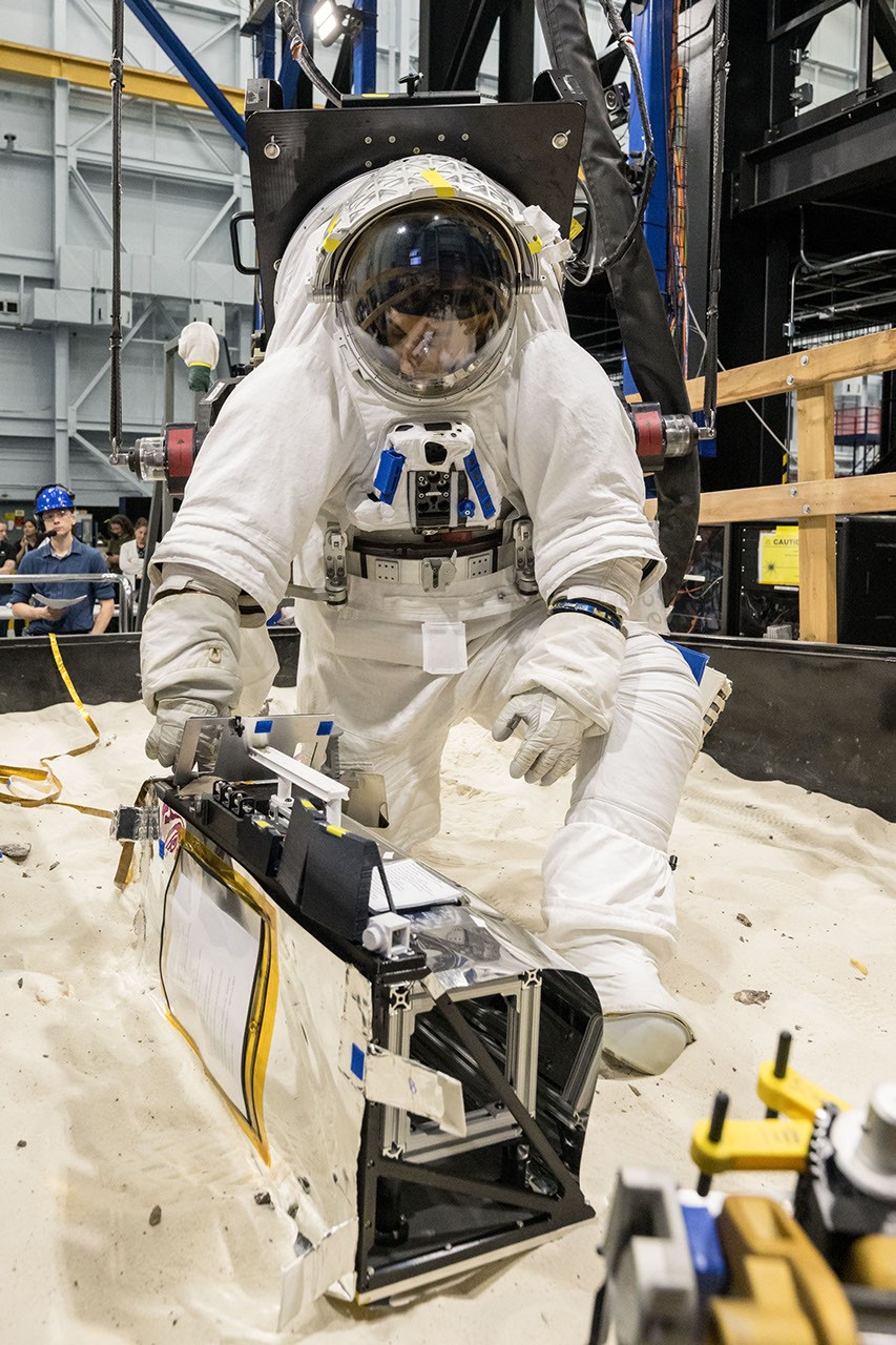
Preparations for Next Moonwalk Simulations Underway (and Underwater)

NASA’s Perseverance looks down at a rocky outcrop nicknamed “Arethusa” and then appears to look into the camera in this animated selfie, which is composed of 61 images taken March 11, 2026, during the rover’s deepest push west beyond Jezero Crater.
NASA/JPL-Caltech/MSSS

NASA’s Perseverance Mars rover recently took a self-portrait against a sweeping backdrop of ancient Martian terrain at a location the science team calls “Lac de Charmes.” Assembled from 61 individual images, the selfie shows Perseverance training its mast on a rocky outcrop on which it had just made a circular abrasion patch, with the western rim of Jezero Crater stretching into the background. The selfie was captured on March 11, the 1,797th Martian day, or sol, of the mission, during the rover’s deepest push west beyond the crater.  

Perseverance is in its fifth science campaign, known as the Northern Rim Campaign, of its mission on the Red Planet. The Lac de Charmes region represents some of the most scientifically compelling terrain the rover has visited.

Undulating terrain of reddish-brown soil and loose rocks stretches toward a rugged horizon. The sky above is hazy and pale. The image’s bottom edge is a jagged black border, indicating the edges of the frames stitched together to create the mosaic.
NASA’s Perseverance captured this enhanced-color panorama of an area nicknamed “Arbot” on April 5, the 1,882nd Martian day, or sol, of the mission. Made of 46 images, the panorama offers one of the richest geological vistas of the rover’s mission, revealing a windswept landscape of diverse rock textures.
NASA/JPL-Caltech/ASU/MSSS

“We took this image when the rover was in the ‘Wild West’ beyond the Jezero Crater rim — the farthest west we have been since we landed at Jezero a little over five years ago,” said Katie Stack Morgan, Perseverance’s project scientist at NASA’s Jet Propulsion Laboratory in Southern California. “We had just abraded and analyzed the ‘Arethusa’ outcrop, and the rover was sitting in a spot that provided a great view of both the Jezero Rim and the local terrain outside of the crater.” 

During abrading, the rover grinds down a portion of the rock’s surface, allowing the science team to analyze what’s inside. The technique enabled the team to determine that the Arethusa outcrop is composed of igneous minerals that likely predate the formation of Jezero Crater. Igneous rocks with large mineral crystals form underground as molten rock cools and solidifies. Perseverance acquired the selfie — its sixth since landing on Mars in 2021 — using the WATSON (Wide Angle Topographic Sensor for Operations and eNgineering) camera mounted at the end of its robotic arm, which made 62 precision movements over approximately one hour to build the composite image (learn more about how selfies are made).

Significant science

Along with the selfie, Perseverance used Mastcam-Z, located on its mast, to capture a mosaic of the “Arbot” area in Lac de Charmes on April 5, or Sol 1882. Made of 46 images, the panorama offers one of the richest geological vistas of the mission, revealing a windswept landscape of diverse rock textures.  

The image provides the team a clear road map for investigating the ridgeline and the area’s ancient rock variety, including what appear to be megabreccia — large fragments (some the size of skyscrapers) hurled by a massive meteorite impact that occurred on the plain called Isidis Planitia about 3.9 billion years ago. 

“What I see in this image is excellent exposure of likely the oldest rocks we are going to investigate during this mission,” said Ken Farley, Perseverance’s deputy project scientist at Caltech in Pasadena. “There is a sharp ridgeline visible in the mosaic whose jagged, angular texture contrasts starkly with the rounded boulders in the foreground. We also see a feature that may be a volcanic dike, a vertical intrusion of magma that hardened in place and was left standing as the softer surrounding material eroded away over billions of years.”  

The rock color in the mosaic offers less information to the science team than the distinctive textures, which help them differentiate the rock types. Unlike Jezero Crater’s river delta, which is composed of sedimentary rock, some rocks here appear to be extrusive igneous rocks (molten rock that reached the surface as lava flows) and impactites (rocks created or modified by a meteorite impact) believed to have formed before the crater about 4 billion years ago, offering a window into the planet’s deep early crust. 

New ballgame, near-marathon distance

“The rover’s study of these really ancient rocks is a whole new ballgame,” said Stack Morgan. “These rocks — especially if they’re from deep in the crust — could give us insights applicable to the entire planet, like whether there was a magma ocean on Mars and what initial conditions eventually made it a habitable planet.” 

After studying Arethusa, Perseverance drove northwest to the Arbot area, where it has been analyzing other rocky outcrops. When the team is satisfied with the work accomplished there, the rover will drive south to “Gardevarri,” a site with a notably clear exposure of olivine-bearing rocks. Formed in cooling magma, these types of rocks contain information that can help scientists better understand Mars’ volcanic history and provide context for large-scale geological processes. From there, the rover is expected to head southeast toward a region the team is calling “Singing Canyon” for more insights into the planet’s early crust.  

After more than five years of surface operations, Perseverance has abraded 62 rocks, collected 27 rock cores in its sample tubes (25 sealed, 2 unsealed), and traveled almost 26 miles (42 kilometers) — in other words, just shy of a marathon (26.2 miles, or 42.195 kilometers).  

“Having the benefit of four previous rover missions, the Perseverance team has always known our mission was a marathon and not a sprint,” said acting Perseverance project manager Steve Lee at JPL. “We’ve almost reached marathon distance. Our selfie may show that the rover is a bit dusty, but its beauty is more than skin deep. Perseverance is in great shape as we continue our explorations and extend into ultramarathon drive distances.”

More about Perseverance 

NASA’s Jet Propulsion Laboratory, which is managed for the agency by Caltech, built and manages operations of the Perseverance rover on behalf of NASA’s Science Mission Directorate in Washington, as part of NASA’s Mars Exploration Program portfolio. The WATSON imaging system was built by, and is operated by, Malin Space Science Systems in San Diego.

To learn more about NASA’s Perseverance:

https://science.nasa.gov/mission/mars-2020-perseverance

News Media Contacts

DC Agle 
Jet Propulsion Laboratory, Pasadena, Calif.
818-393-9011
agle@jpl.nasa.gov 

Karen Fox / Alana Johnson 
NASA Headquarters, Washington
240-285-5155 / 202-672-4780
karen.c.fox@nasa.gov / alana.r.johnson@nasa.gov

2026-032

Powered by WPeMatico

Get The Details…
scarney1