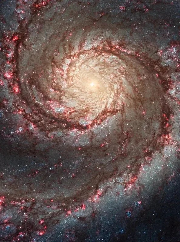
This NASA/ESA Hubble Space Telescope image features the spiral galaxy NGC 2566.
ESA/Hubble & NASA, D. Thilker
This NASA/ESA Hubble Space Telescope image features the spiral galaxy NGC 2566, which sits 76 million light-years away in the constellation Puppis. A prominent bar of stars stretches across the center of this galaxy, and spiral arms emerge from each end of the bar. Because NGC 2566 appears tilted from our perspective, its disk takes on an almond shape, giving the galaxy the appearance of a cosmic eye.
As NGC 2566 appears to gaze at us, astronomers gaze right back, using Hubble to survey the galaxy’s star clusters and star-forming regions. The Hubble data are especially valuable for studying stars that are just a few million years old; these stars are bright at the ultraviolet and visible wavelengths to which Hubble is sensitive. Using these data, researchers can measure the ages of NGC 2566’s stars, which helps piece together the timeline of the galaxy’s star formation and the exchange of gas between star-forming clouds and the stars themselves.
Hubble regularly teams up with other astronomical observatories to examine objects like NGC 2566, including the NASA/ESA/CSA James Webb Space Telescope. Webb data complements Hubble’s by going beyond the infrared wavelengths of light Hubble can see, better defining areas of warm, glowing dust. At even longer wavelengths, the Atacama Large Millimeter/submillimeter Array (ALMA) of 66 radio telescopes that work together can capture detailed images of the clouds of gas and dust in which stars form. Together, Hubble, Webb, and ALMA provide an overview of the formation, lives, and deaths of stars in galaxies across the universe.
Sols 4398-4401: Holidays Ahead, Rocks Under the Wheels
4 min read
Sols 4398-4401: Holidays Ahead, Rocks Under the Wheels
NASA’s Mars rover Curiosity acquired this image using its Left Navigation Camera on Dec. 17, 2024, at 23:24:13 UTC — Sol 4396, or Martian day 4,396, or the Mars Science Laboratory mission.
NASA/JPL-Caltech
Earth planning date: Wednesday, Dec. 18, 2024
It’s almost holiday time, and preparations are going ahead on Earth and Mars! For myself that means having a packed suitcase sitting behind me to go on my holiday travels tomorrow morning. For Curiosity that means looking forward to a long semi-rest, as we will not do our usual planning for the geology and mineralogy, but will still be monitoring the atmospheric conditions throughout. Today should have been a normal planning day with lots of contact and remote science. Well, Mars had other ideas.
The regular readers of this blog know that we are driving through quite difficult terrain. The image above gives a good impression on what the rover is dealing with: lots of rocks embedded in sand. I think even hiking would be quite difficult there, let alone driving autonomously. Curiosity, thanks to our excellent rover drivers, makes it successfully most of the time, but here and there Mars just doesn’t play nice. Thus, the rover stopped after 14 meters (about 46 feet) of a planned much longer drive. One of the wheels had caught a low spot between two rocks, and — safety first — the rover stopped and waited for our assessment. The rover drivers found no major problem, as it’s just the middle wheel that hit a bit of a rough patch, and driving can continue in this plan. But better safe than sorry, especially on another planet where there are no tow trucks to get us out of difficulty!
There was, however, quite a bit of discussion before we decided that course of action. Not because of the wheels themselves, but because the rover also stands in a position where it can only communicate directly with Earth in limited ways as the antenna is not facing the expected direction after the sudden stop. Of course, we still have the orbiters to talk to our rover, so we know it’s all fine. And — all things are three — this all happened on the penultimate plan of the year! Friday we’ll be planning a large set of sols that the rover will be executing on its own on Mars, monitoring the atmosphere and taking regular images of its surroundings, while the Earth-based team enjoys the well-deserved break. We really want to make sure to have everything going right on a day like today, so we all can enjoy the holidays without worrying about the rover!
With today being the last day of normal science planning, we had lots of ideas, but had to keep the arm stowed. The drive fault also meant that we had to forego arm movements, as the rover was sitting on a few rocks, and one of the wheels in that little depression that stopped us, all in ways that meant that a shift of rover weight (such as occurs when we move the arm) could make the rover move. Avoiding this situation, the team kept the arm stowed and focused on remote observations today. ChemCam observes a vein target called “Monrovia Peak” and takes remote images on the target “Jawbone Canyon” and up Mount Sharp toward the yardang unit. Mastcam looks at the target “Circle X Ranch” to investigate the material around the rocks embedded in the sand, looks at “Anacapa Island,” which is a vein target, “Channel Islands,” which is an aeolian ripple, and target “Gould Mesa,” which gets the team especially excited as this is the first glimpse of the so-called boxwork structures, which we saw from orbit even before Curiosity landed. Finally, we drive away from the spot that held us up today. Let’s hope Mars has read the script this time!
For the looooong break, we are planning autonomous and remote investigations only, and this starts before Friday’s planning, so that we know all is ok! Thus, the other three sols in today’s planning have Aegis, the automated ChemCam LIBS observation, a Mastcam 360° mosaic, and many, many atmospheric observations. It’s going to be a feast for DAN, REMS, and generally the atmospheric science on Mars, while here on Earth we enjoy the treats of the season. The Curiosity team hopes you do, too. See you in 2025!
Written by Susanne Schwenzer, Planetary Geologist at The Open University
NASA Cameras to Capture Interaction Between Blue Ghost, Moon’s Surface
4 min read
Preparations for Next Moonwalk Simulations Underway (and Underwater)
The six SCALPSS cameras mounted around the base of Blue Ghost will collect imagery during and after descent and touchdown. Using a technique called stereo photogrammetry, researchers at Langley will use the overlapping images to produce a 3D view of the surface.
Image courtesy of Firefly.
Say cheese again, Moon. We’re coming in for another close-up.
For the second time in less than a year, a NASA technology designed to collect data on the interaction between a Moon lander’s rocket plume and the lunar surface is set to make the long journey to Earth’s nearest celestial neighbor for the benefit of humanity.
Developed at NASA’s Langley Research Center in Hampton, Virginia, Stereo Cameras for Lunar Plume-Surface Studies (SCALPSS) is an array of cameras placed around the base of a lunar lander to collect imagery during and after descent and touchdown. Using a technique called stereo photogrammetry, researchers at Langley will use the overlapping images from the version of SCALPSS on Firefly’s Blue Ghost — SCALPSS 1.1 — to produce a 3D view of the surface. An earlier version, SCALPSS 1.0, was on Intuitive Machines’ Odysseus spacecraft that landed on the Moon last February. Due to mission contingencies that arose during the landing, SCALPSS 1.0 was unable to collect imagery of the plume-surface interaction. The team was, however, able to operate the payload in transit and on the lunar surface following landing, which gives them confidence in the hardware for 1.1.
The SCALPSS 1.1 payload has two additional cameras — six total, compared to the four on SCALPSS 1.0 — and will begin taking images at a higher altitude, prior to the expected onset of plume-surface interaction, to provide a more accurate before-and-after comparison.
These images of the Moon’s surface won’t just be a technological novelty. As trips to the Moon increase and the number of payloads touching down in proximity to one another grows, scientists and engineers need to be able to accurately predict the effects of landings.
How much will the surface change? As a lander comes down, what happens to the lunar soil, or regolith, it ejects? With limited data collected during descent and landing to date, SCALPSS will be the first dedicated instrument to measure the effects of plume-surface interaction on the Moon in real time and help to answer these questions.
“If we’re placing things – landers, habitats, etc. – near each other, we could be sand blasting what’s next to us, so that’s going to drive requirements on protecting those other assets on the surface, which could add mass, and that mass ripples through the architecture,” said Michelle Munk, principal investigator for SCALPSS and acting chief architect for NASA’s Space Technology Mission Directorate at NASA Headquarters in Washington. “It’s all part of an integrated engineering problem.”
Under the Artemis campaign, the agency’s current lunar exploration approach, NASA is collaborating with commercial and international partners to establish the first long-term presence on the Moon. On this CLPS (Commercial Lunar Payload Services) initiative delivery carrying over 200 pounds of NASA science experiments and technology demonstrations, SCALPSS 1.1 will begin capturing imagery from before the time the lander’s plume begins interacting with the surface until after the landing is complete.
The final images will be gathered on a small onboard data storage unit before being sent to the lander for downlink back to Earth. The team will likely need at least a couple of months to
process the images, verify the data, and generate the 3D digital elevation maps of the surface. The expected lander-induced erosion they reveal probably won’t be very deep — not this time, anyway.
One of the SCALPSS cameras is visible here mounted to the Blue Ghost lander.
Image courtesy of Firefly.
“Even if you look at the old Apollo images — and the Apollo crewed landers were larger than these new robotic landers — you have to look really closely to see where the erosion took place,” said Rob Maddock, SCALPSS project manager at Langley. “We’re anticipating something on the order of centimeters deep — maybe an inch. It really depends on the landing site and how deep the regolith is and where the bedrock is.”
But this is a chance for researchers to see how well SCALPSS will work as the U.S. advances human landing systems as part of NASA’s plans to explore more of the lunar surface.
“Those are going to be much larger than even Apollo. Those are large engines, and they could conceivably dig some good-sized holes,” said Maddock. “So that’s what we’re doing. We’re collecting data we can use to validate the models that are predicting what will happen.”
The SCALPSS 1.1 project is funded by the Space Technology Mission Directorate’s Game Changing Development Program.
NASA is working with several American companies to deliver science and technology to the lunar surface under the CLPS initiative. Through this opportunity, various companies from a select group of vendors bid on delivering payloads for NASA including everything from payload integration and operations, to launching from Earth and landing on the surface of the Moon.
Perseverance Blasts Past the Top of Jezero Crater Rim
3 min read
Perseverance Blasts Past the Top of Jezero Crater Rim
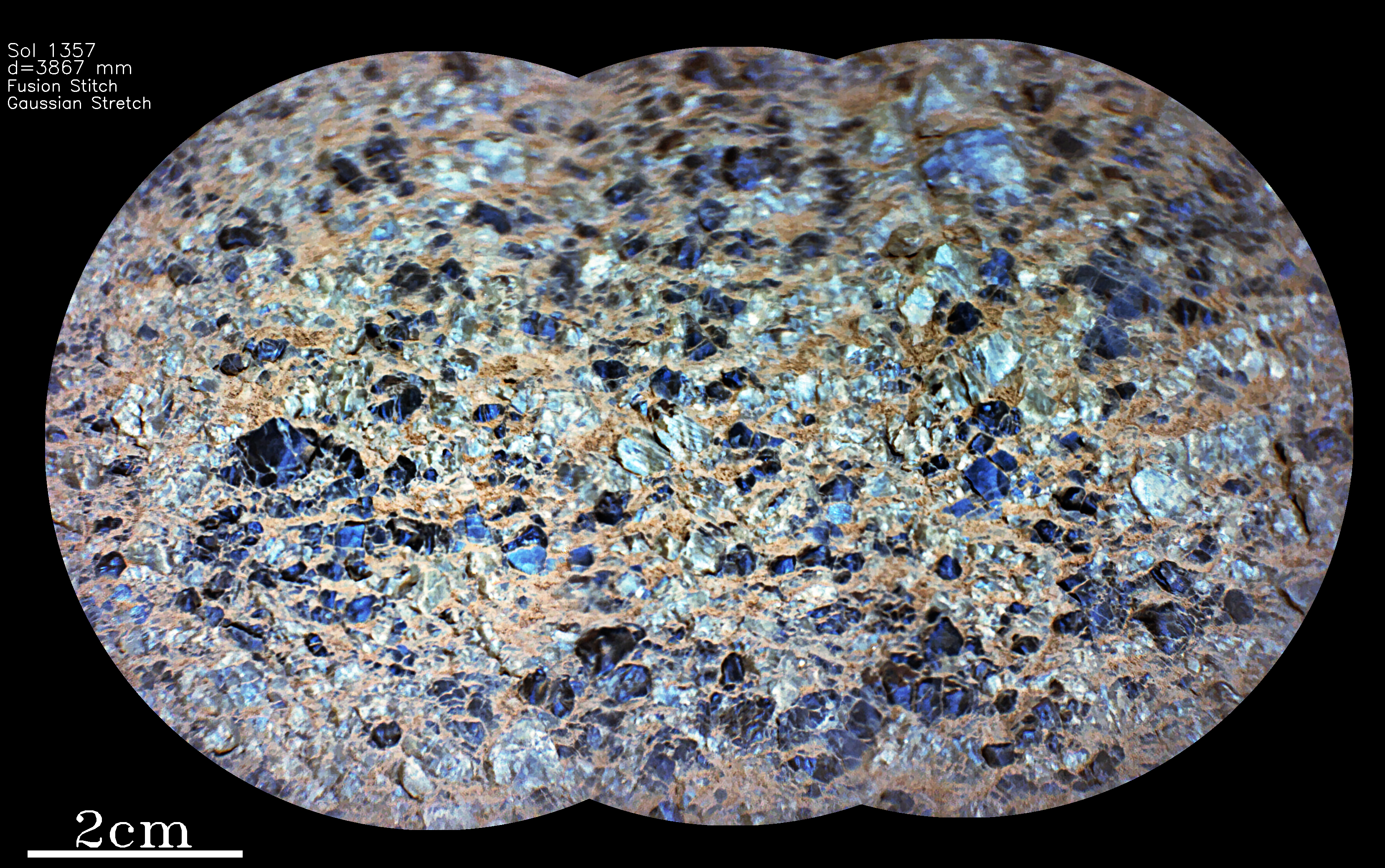
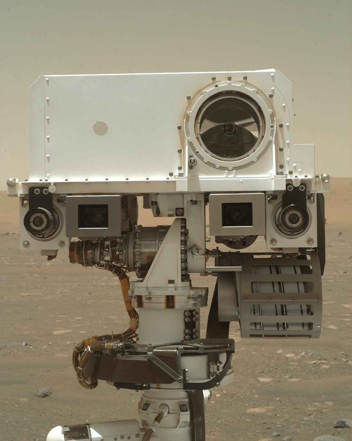
This SuperCam Remote Micro-Imager (RMI) mosaic shows part of the target “Duran,” observed on Sol 1357 near the top of Jezero crater’s rim. It was processed using a color-enhancing Gaussian stretch algorithm.
NASA/JPL-Caltech/LANL/CNES/IRAP.
I have always loved the mountains. Growing up on the flat plains of Midwestern USA, every summer I looked forward to spending a few days on alpine trails while on vacation. Climbing upward from the trailhead, the views changed constantly. After climbing a short distance, the best views were often had by looking back down on where we had started. As we climbed higher, views of the valleys below eventually became shrouded in haze. Near the top we got our last views of the region behind us; then it disappeared from view as we hiked over the pass and started down the other side. Approaching the summit held a special reward, as the regions beyond the pass slowly revealed themselves. Frequent stops to catch our breath during our ascent were used to check the map to identify the new peaks and other features that came into view. Sometimes the pass was an exciting gateway to a whole new area to explore.
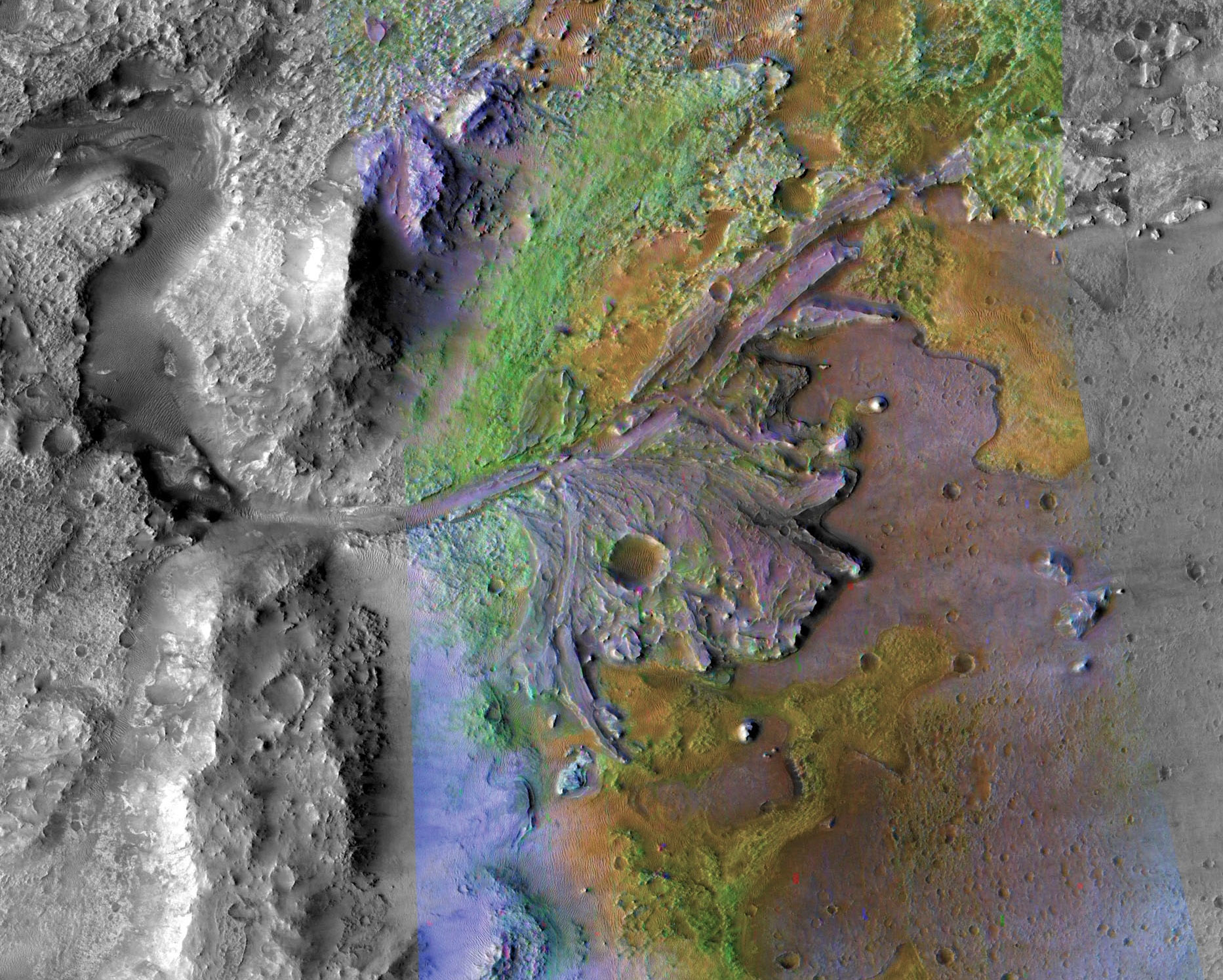
This ever-changing landscape has been our constant companion over the last five months as Perseverance first climbed out of Neretva Vallis, then past “Dox Castle,” and “Pico Turquino.” We stopped at “Faraway Rock” on Sol 1282 to get a panorama of the crater floor. More recently, we could see many more peaks of the crater rim. As Perseverance crested the summit of “Lookout Hill,” half a mile (800 meters) above the traverse’s lowest point, we got our first views beyond the crater rim, out into the great unknown expanse of Mars’ Nili Planum, including the upper reaches of Neretva Vallis and the locations of two other candidate landing sites that were once considered for Perseverance. As the rover crested the summit, Mastcam-Z took a large panoramic mosaic, and team members are excitedly poring over the images, looking at all the new features. With Perseverance’s powerful cameras we can analyze small geological features such as boulders, fluvial bars, and dunes more than 5 miles (8 kilometers) distant, and major features like mountains up to 35 miles (60 kilometers) away. One of our team members excitedly exclaimed, “This is an epic moment in Mars exploration!”
While Curiosity has been climbing “Mount Sharp” for 10 years, and Spirit and Opportunity explored several smaller craters, no extraterrestrial rover has driven out of such a huge crater as Jezero to see a whole new “continent” ahead. We are particularly excited because it is potentially some of the most ancient surface on the Red Planet. Let’s go explore it!
Perseverance is now in Gros Morne quad, named for a beautiful Canadian national park in Newfoundland, and we will be naming our targets using locations and features in the national park. For the drive ahead, described in a video in a recent press release, our next destination is on the lower western edge of the Jezero crater rim at a region named “Witch Hazel Hill.”
Perseverance made more than 250 meters of progress over the weekend (about 820 feet) and is already at the upper part of Witch Hazel Hill, a location called “South Arm.” Much of the climb up the crater rim was on sandy material without many rocks to analyze. Witch Hazel Hill appears to have much more exposed rock, and the science team is excited about the opportunity for better views and analyses of the geology directly beneath our wheels.
Written by Roger C. Wiens, Principal Investigator of the SuperCam instrument, Purdue University
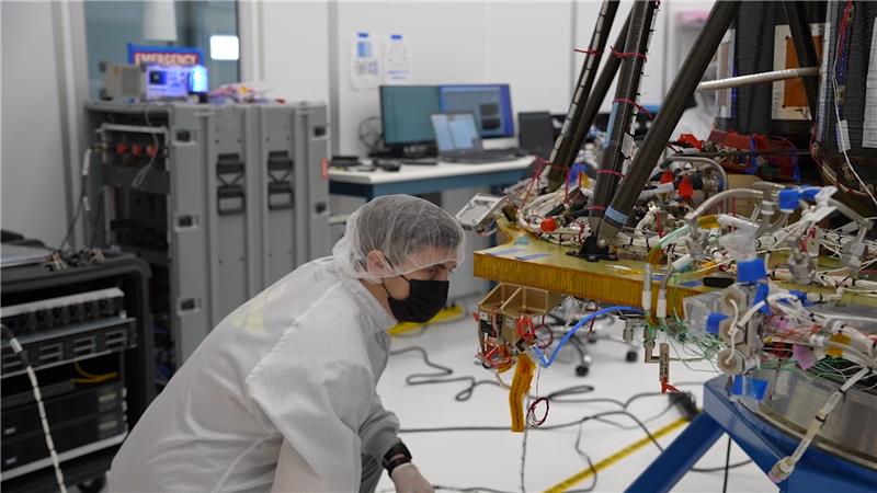
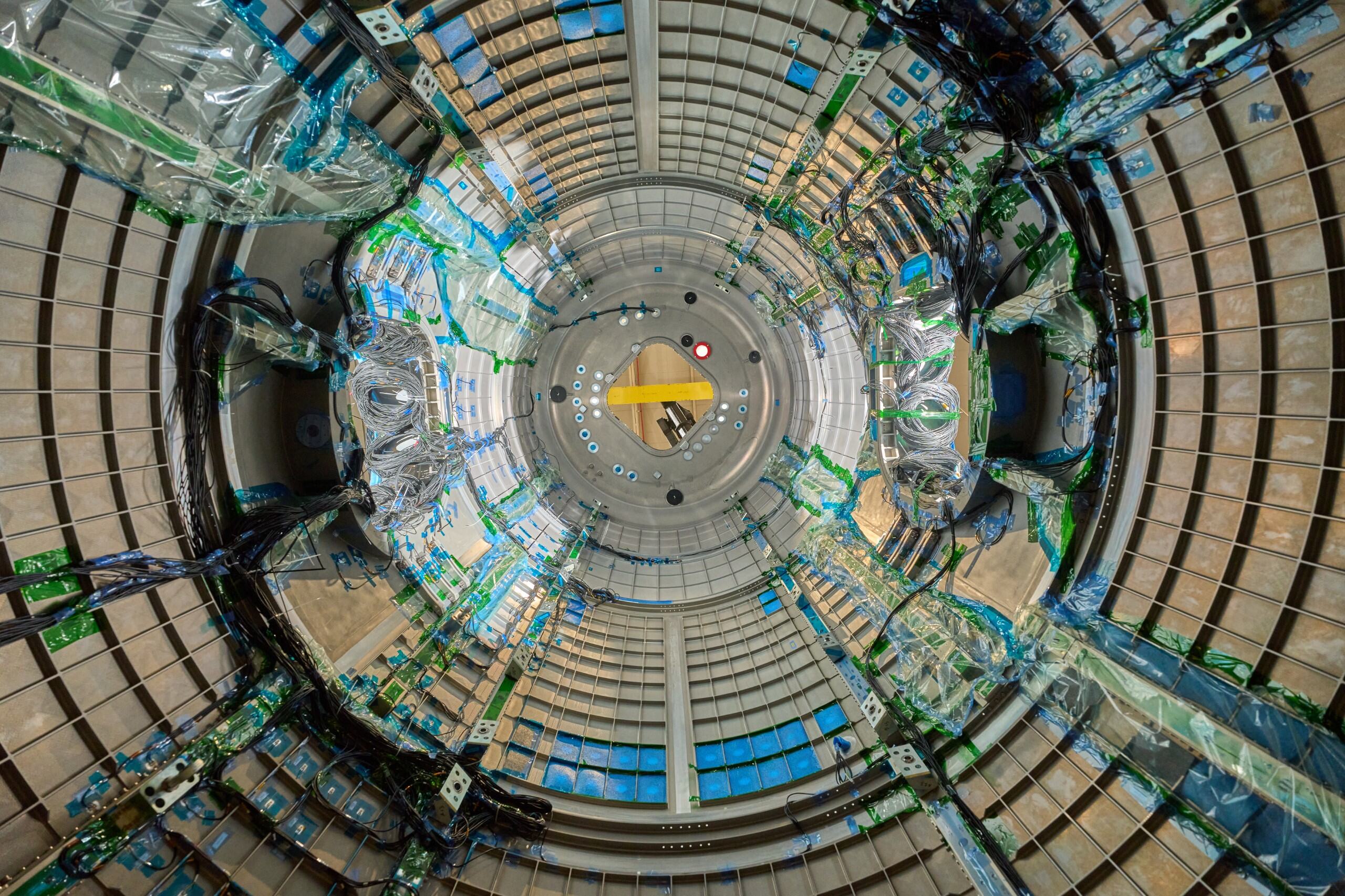
A maze of cables and sensors snakes through a major piece of Gateway, humanity’s first space station around the Moon, during a key testing phase earlier this year to ensure the lunar-orbiting science lab can withstand the harsh conditions of deep space.
HALO (Habitation and Logistics Outpost) is one of four Gateway modules where international teams of astronauts will live, conduct science, and prepare for missions to the lunar South Pole region. Other elements will be provided by the European Space Agency, Japanese Aerospace Exploration Agency, and the Mohammed Bin Rashid Space Centre of the United Arab Emirates. The Canadian Space Agency is providing Gateway’s Canadarm3 advanced robotics system.
HALO is provided by Northrop Grumman and their subcontractor, Thales Alenia Space. The module completed testing in Turin, Italy, before its expected arrival to the United States in 2025. Northrop Grumman will complete final outfitting of HALO and integrate it with Gateway’s Power and Propulsion Element for launch ahead of the Artemis IV mission on a SpaceX Falcon Heavy rocket.