NASA to Talk Science, Tech Aboard Next Intuitive Machines Moon Flight

NASA to Talk Science, Tech Aboard Next Intuitive Machines Moon Flight
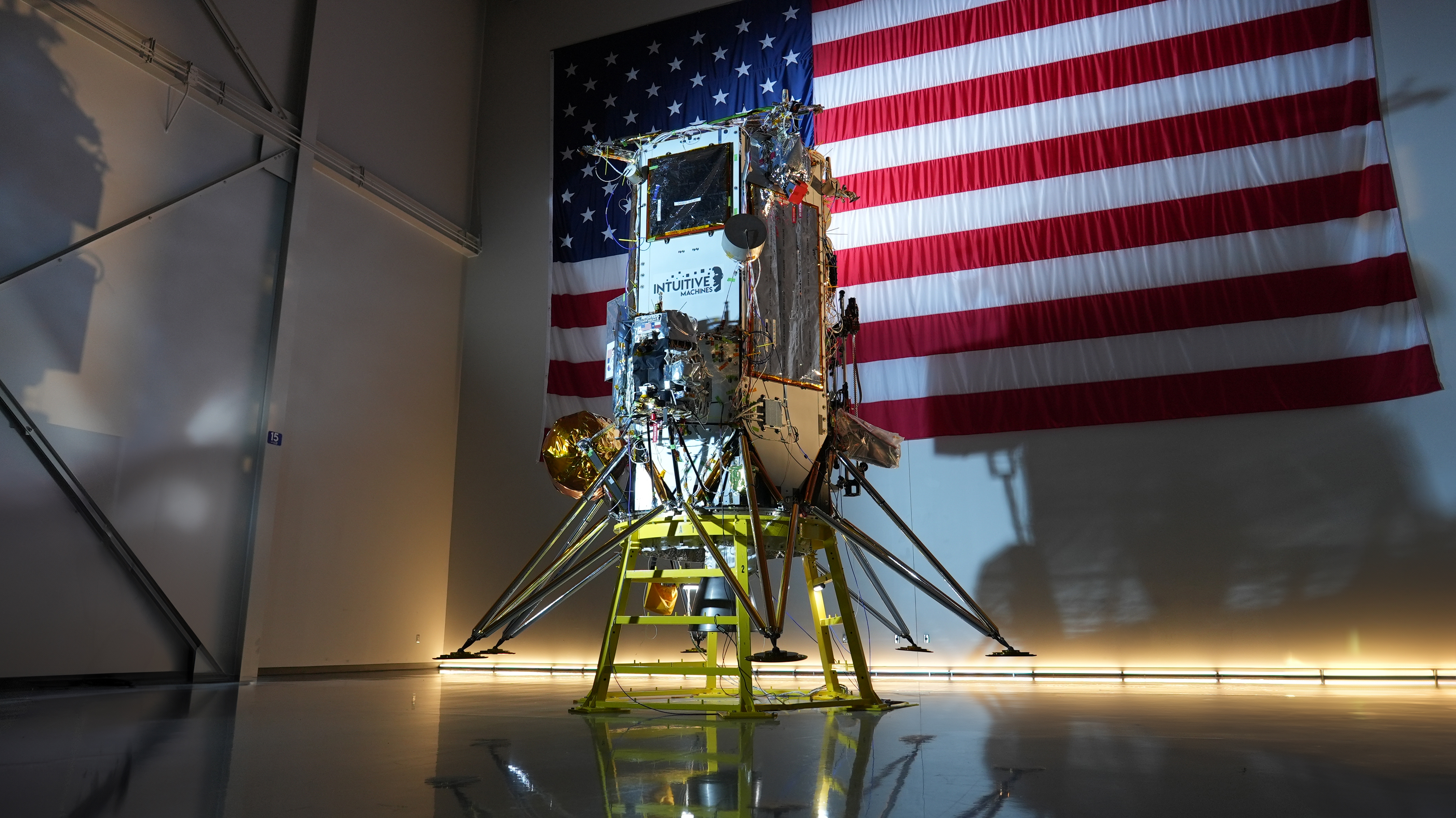
As part of NASA’s CLPS (Commercial Lunar Payload Services) initiative and Artemis campaign, Intuitive Machines’ second delivery to the Moon will carry NASA technology demonstrations and science investigations on their Nova-C class lunar lander. Credit: Intuitive Machines
As part of NASA’s CLPS (Commercial Lunar Payload Services) initiative and Artemis campaign, Intuitive Machines’ second delivery to the Moon will carry NASA technology demonstrations and science investigations on their Nova-C class lunar lander.
Credit: Intuitive Machines

NASA will host a media teleconference at 1 p.m. EST Friday, Feb. 7, to discuss the agency’s science and technology flying aboard Intuitive Machines’ second flight to the Moon. The mission is part of NASA’s CLPS (Commercial Lunar Payload Services) initiative and Artemis campaign to establish a long-term lunar presence. 

Audio of the call will stream on the agency’s website at:

https://www.nasa.gov/live

Briefing participants include:

  • Nicky Fox, associate administrator, Science Mission Directorate, NASA Headquarters
  • Niki Werkheiser, director, technology maturation, Space Technology Mission Directorate, NASA Headquarters
  • Trent Martin, senior vice president, space systems, Intuitive Machines

To participate by telephone, media must RSVP no later than two hours before the briefing to: ksc-newsroom@mail.nasa.gov. NASA’s media accreditation policy is available online.

Intuitive Machines’ lunar lander, Athena, will launch on a SpaceX Falcon 9 rocket from Launch Complex 39A at NASA’s Kennedy Space Center in Florida. The four-day launch window opens no earlier than Wednesday, Feb. 26.

Among the items on Intuitive Machines’ lander, the IM-2 mission will be one of the first on site, or in-situ, demonstrations of resource utilization on the Moon. A drill and mass spectrometer will measure the potential presence of volatiles or gases from lunar soil in Mons Mouton, a lunar plateau near the Moon’s South Pole. In addition, a passive Laser Retroreflector Array on the top deck of the lander will bounce laser light back at any orbiting or incoming spacecraft to give future spacecraft a permanent reference point on the lunar surface. Other technology instruments on this delivery will demonstrate a robust surface communications system and deploy a propulsive drone that can hop across the lunar surface.

Launching as a rideshare with the IM-2 delivery, NASA’s Lunar Trailblazer spacecraft also will begin its journey to lunar orbit, where it will map the distribution of the different forms of water on the Moon.

Under the CLPS model, NASA is investing in commercial delivery services to the Moon to enable industry growth and support long-term lunar exploration. As a primary customer for CLPS deliveries, NASA is one of many customers for these flights.

For updates, follow on:

https://blogs.nasa.gov/artemis

-end-

Alise Fisher / Jasmine Hopkins
Headquarters, Washington
202-358-2546
alise.m.fisher@nasa.gov / jasmine.s.hopkins@nasa.gov

Natalia Riusech / Nilufar Ramji
Johnson Space Center, Houston
281-483-5111
nataila.s.riusech@nasa.gov / nilufar.ramji@nasa.gov

Antonia Jaramillo
Kennedy Space Center, Florida
321-867-2468
antonia.jaramillobotero@nasa.gov

Powered by WPeMatico

Get The Details…
Roxana Bardan
What’s Up: February 2025 Skywatching Tips from NASA

What’s Up: February 2025 Skywatching Tips from NASA

A Month of Bright Planets

Venus blazes at its brightest for the year after sunset, then Mars and Jupiter to rule the night amid the menagerie of bright winter stars.

Skywatching Highlights

All Month – Planet Visibility:

  • Mercury: Pops up just above the horizon in late February, looking relatively bright as sunset fades
  • Venus: Looking brilliant in the west after sunset all month
  • Mars: Bright and amber-orange colored, high in the east each evening. It’s the last planet to set in the west a couple of hours before sunrise
  • Jupiter: Find the giant planet high overhead in the evening, looking very bright
  • Saturn: Somewhat faint, but visible low in the west for the first hour after sunset; increasingly lower as the month goes on

Daily Highlights:

February 1 – Venus & Moon: The crescent Moon cozies up to brilliant Venus tonight in the west after sunset. Saturn hangs below them.

February 5 – Moon & Pleiades: Look for the Moon only a finger’s width west of the Pleiades at nightfall, then crossing in front of the star cluster before setting

February 6 – Moon & Jupiter: The Moon is high overhead at nightfall, forming a line with bright Jupiter and reddish star Aldebaran in Taurus

February 9 – Moon & Mars: Find the nearly full Moon in the east tonight after dark, about three finger widths below reddish Mars. Bright stars Pollux and Castor in Gemini are just to its north.

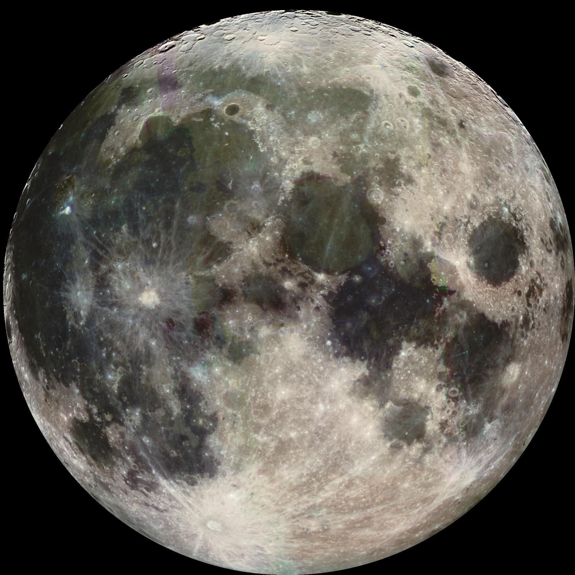
February 12 – Full Moon

Transcript

What’s Up for February? The Moon’s many engagements, what’s the right term for a planetary rendezvous, and the goddess of love draws near.

Moon & Planets

Starting with the Moon’s journey across the sky this month, you’ll find the slim crescent of Earth’s natural satellite cozied up to the planet Venus on the 1st. It then visits the Pleiades on the 5th, and hops over Jupiter on the 6th, looking increasingly fuller, before arriving right next to Mars on February 9th.

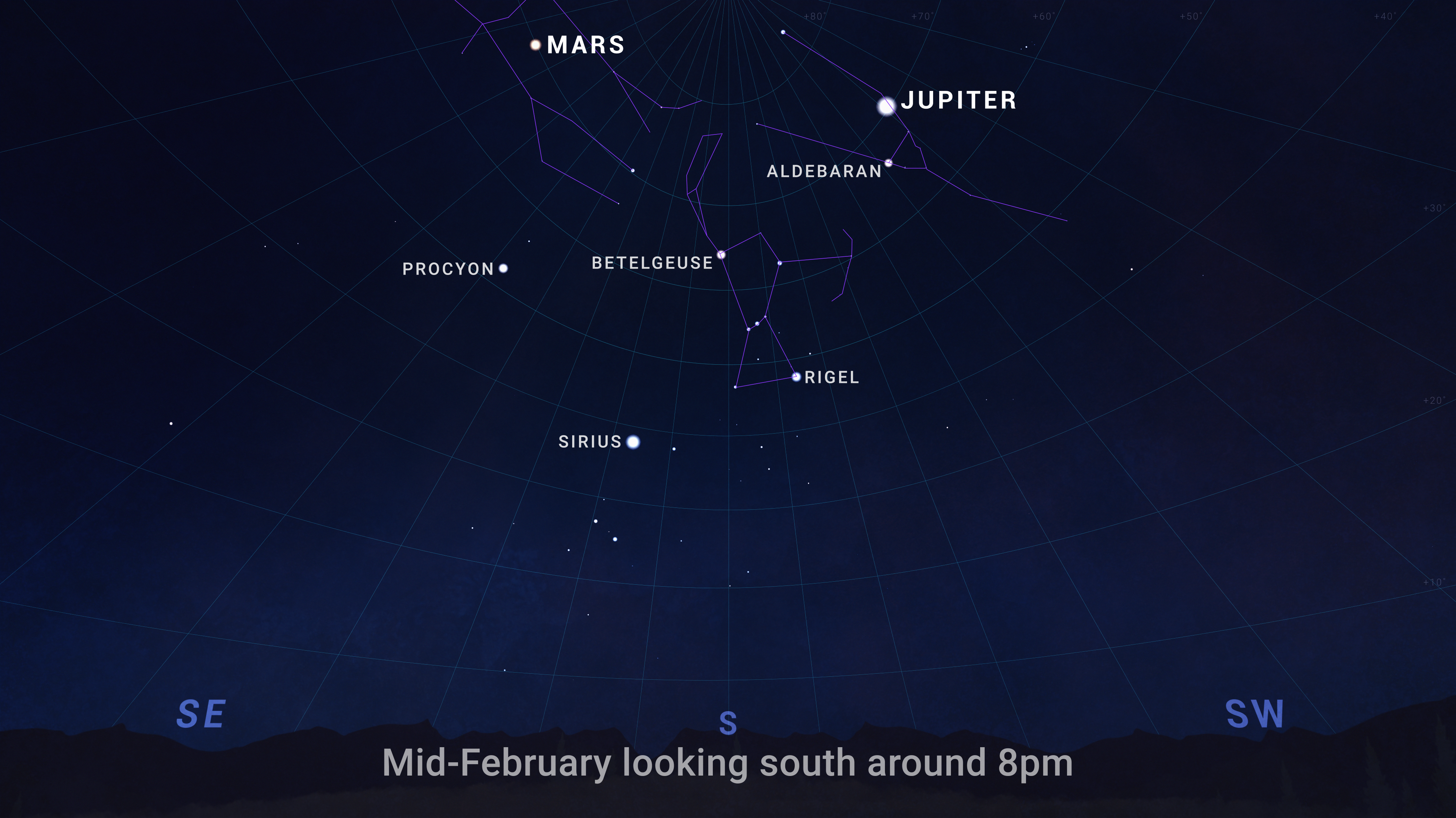
An illustrated sky chart shows the evening sky in mid-February, facing south around 8pm. Jupiter is marked as a bright white dot near the top, right of center. Mars is a slightly smaller dot at top, left of center. Across the center of the chart are the winter constellations Orion, Taurus, and Gemini, plus the bright star Sirius.
Sky chart showing Jupiter and Mars high overhead after nightfall in February 2025.

Jupiter and Mars rule the sky on February nights. You’ll find them high overhead in the evening, together with the winter constellations of Orion, Taurus, and Gemini.

Appulses

Astronomers sometimes get picky about their terminology. For instance, the apparent close approaches of objects on the sky, like two planets, or the Moon and a planet, are commonly called “conjunctions,” and we often use that term in this video series.

However, most of the time, the technically correct term is an “appulse.” Conjunctions technically occur when two objects have the same right ascension, and they don’t have to appear close together in the sky. (Right ascension is a way of indicating where an object is along the sky from east to west, similar to how we measure longitude on Earth’s surface.)

Appulses are simply the times when two objects appear at their closest in the sky, regardless of whether they have to have the same “space coordinates.” The term comes from a Latin word meaning “brought near” or “driven toward.” And now that you know the distinction, you can choose to keep it casual or impress others with some next-level astronomy knowledge. Either way, it’s all about enjoying the view.

Venus Draws Near

February is a month for love, so what better time to spotlight Venus, which is associated with the Roman goddess of love? This month, Venus shines at its brightest for the year. It’ll remain dazzling through the start of March as it slowly descends from its late-January high point in the sky. By mid-March, it will disappear into the glare of sunset, only to reappear as a morning object in April.

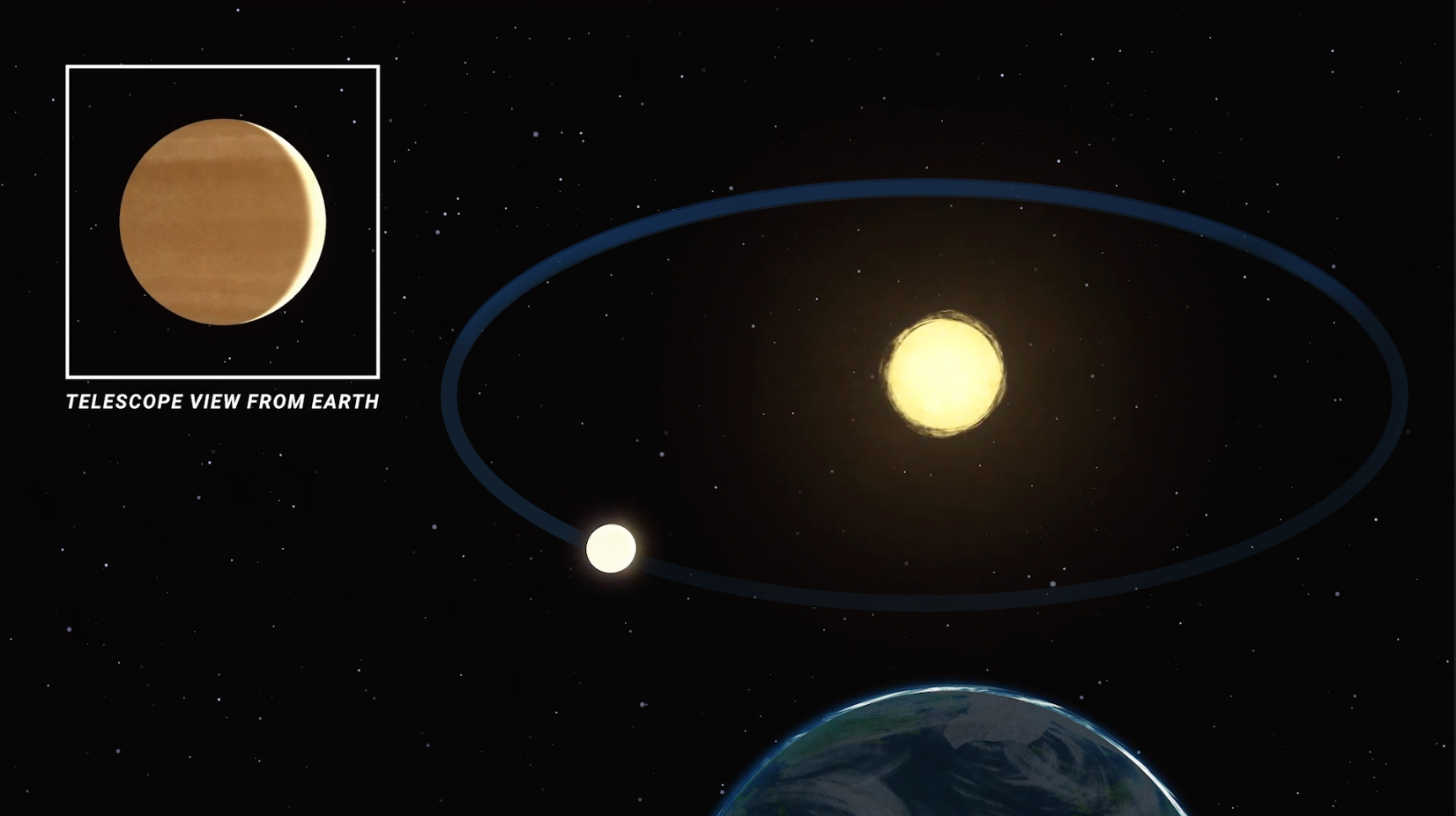
A still frame from an animation shows a view above Earth looking toward the Sun, with the orbit of the planet Venus drawing an ellipse in space. Venus appears as a bright dot on the near side of its orbit, close to Earth. At upper left, an inset image shows an illustration of how Venus appears as a large crescent phase when viewed at this time through a telescope.
Through a telescope, Venus becomes larger as it comes closer to Earth in its orbit. It also becomes a slimmer crescent. Nonetheless, this is when the planet is at its brightest in our skies.
NASA/JPL-Caltech

Now, you may have heard that Venus goes through phases, just like the Moon. You can see these phases with a modest telescope. But there’s a surprising twist: unlike the Moon, Venus isn’t at its brightest when it’s “full.” Instead, it shines most brilliantly in our skies when it’s a thinner crescent! It all comes down to distance. See, Venus only appears fuller when it’s on the far side of the Sun, and much farther from Earth. As it comes closer to us, its phase becomes a crescent, but the planet also looks much larger in the sky. Even as a crescent, the light from its closer position more than makes up for the smaller phase.

So, remember this Valentine’s proverb: “The goddess of love is at her most radiant when nearby!”

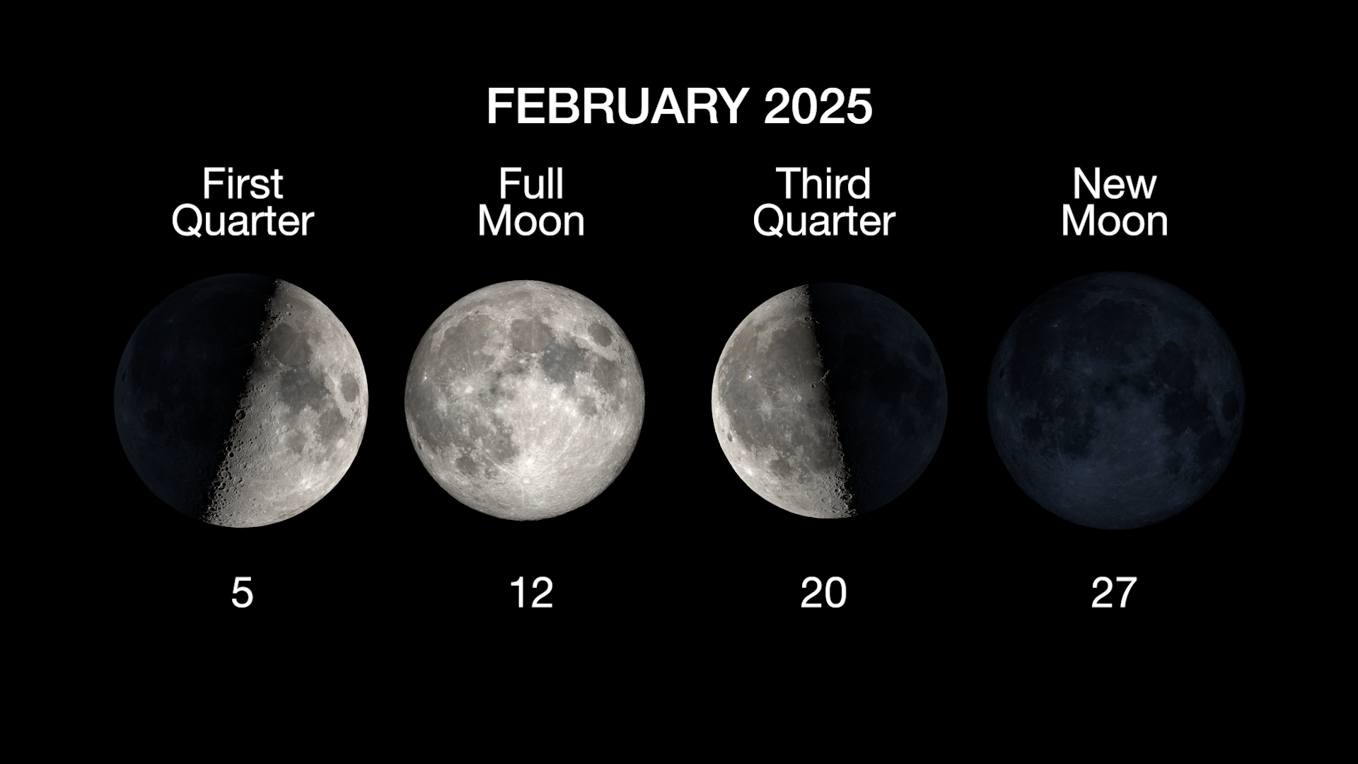
Moon Phases

An illustrated sky chart shows the evening sky in mid-February, facing south around 8pm. Jupiter is marked as a bright white dot near the top, right of center. Mars is a slightly smaller dot at top, left of center. Across the center of the chart are the winter constellations Orion, Taurus, and Gemini, plus the bright star Sirius.
Sky chart showing Jupiter and Mars high overhead after nightfall in February.
NASA/JPL-Caltech

Above are the phases of the Moon for February. Stay up to date on all of NASA’s missions exploring the solar system and beyond at science.nasa.gov. I’m Preston Dyches from NASA’s Jet Propulsion Laboratory, and that’s What’s Up for this month.

Keep Exploring

Discover More Topics From NASA

Powered by WPeMatico

Get The Details…

NASA Radar Imagery Reveals Details About Los Angeles-Area Landslides

NASA Radar Imagery Reveals Details About Los Angeles-Area Landslides

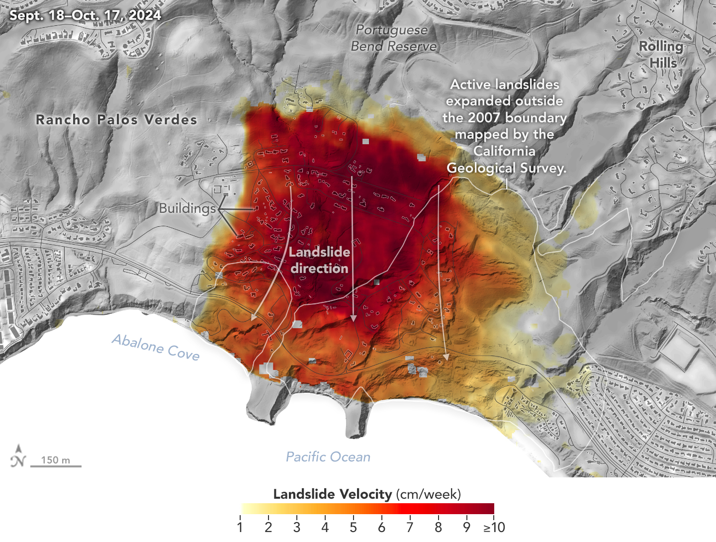
A topographic map of Rancho Palos Verdes, CA (Sept. 18–Oct. 17, 2024) shows landslide velocity in cm/week, with red areas moving fastest (≥10 cm/week). The slide extends beyond the 2007 boundary toward Abalone Cove. An arrow marks the landslide direction southward.
NASA’s UAVSAR airborne radar instrument captured data in fall 2024 showing the motion of landslides on the Palos Verdes Peninsula following record-breaking rainfall in Southern California in 2023 and another heavy-precipitation winter in 2024. Darker red indicates faster motion.
NASA Earth Observatory

Analysis of data from NASA radar aboard an airplane shows that the decades-old active landslide area on the Palos Verdes Peninsula has expanded.

Researchers at NASA’s Jet Propulsion Laboratory in Southern California used data from an airborne radar to measure the movement of the slow-moving landslides on the Palos Verdes Peninsula in Los Angeles County. The analysis determined that, during a four-week period in the fall of 2024, land in the residential area slid toward the ocean by as much as 4 inches (10 centimeters) per week.

Portions of the peninsula, which juts into the Pacific Ocean just south of the city of Los Angeles, are part of an ancient complex of landslides and has been moving for at least the past six decades, affecting hundreds of buildings in local communities. The motion accelerated, and the active area expanded following record-breaking rainfall in Southern California in 2023 and heavy precipitation in early 2024.

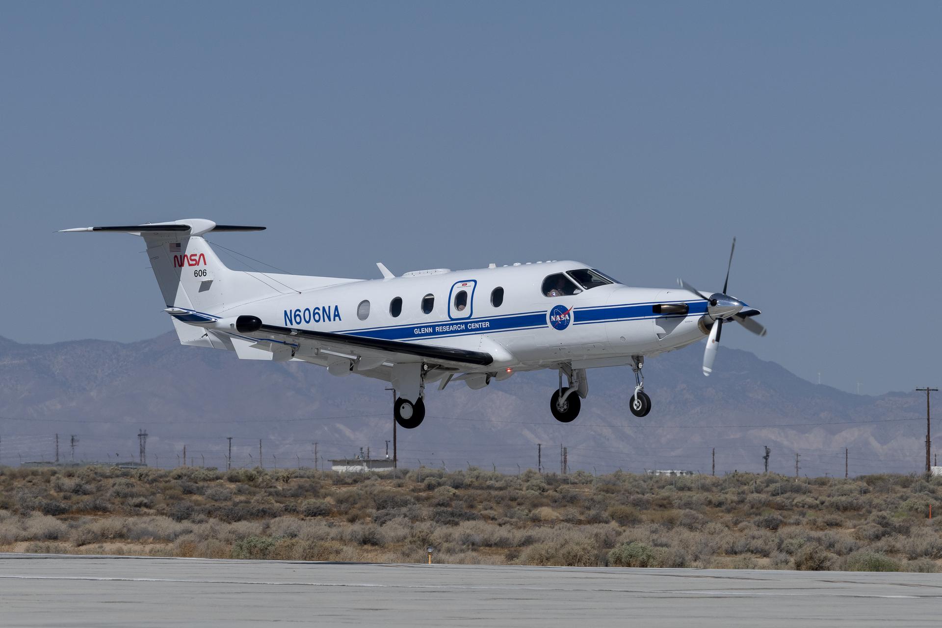
To create this visualization, the Advanced Rapid Imaging and Analysis (ARIA) team used data from four flights of NASA’s Uninhabited Aerial Vehicle Synthetic Aperture Radar (UAVSAR) that took place between Sept. 18 and Oct. 17. The UAVSAR instrument was mounted to a Gulfstream III jet flown out of NASA’s Armstrong Flight Research Center in Edwards, California, and the four flights were planned to estimate the speed and direction of the landslides in three dimensions.

In the image above, colors indicate how fast parts of the landslide complex were moving in late September and October, with the darkest reds indicating the highest speeds. The arrows represent the direction of horizontal motion. The white solid lines are the boundaries of the active landslide area as defined in 2007 by the California Geological Survey.

“In effect, we’re seeing that the footprint of land experiencing significant impacts has expanded, and the speed is more than enough to put human life and infrastructure at risk,” said Alexander Handwerger, the JPL landslide scientist who performed the analysis.

The insights from the UAVSAR flights were part of a package of analyses by the ARIA team that also used data from ESA’s (the European Space Agency’s) Copernicus Sentinel-1A/B satellites. The analyses were provided to California officials to support the state’s response to the landslides and made available to the public at NASA’s Disaster Mapping Portal.

Handwerger is also the principal investigator for NASA’s upcoming Landslide Climate Change Experiment, which will use airborne radar to study how extreme wet or dry precipitation patterns influence landslides. The investigation will include flights over coastal slopes spanning the California coastline.

More About ARIA, UAVSAR

The ARIA mission is a collaboration between JPL and Caltech, which manages JPL for NASA, to leverage radar and optical remote-sensing, GPS, and seismic observations for science as well as to aid in disaster response. The project investigates the processes and impacts of earthquakes, volcanoes, landslides, fires, subsurface fluid movement, and other natural hazards.

UAVSAR has flown thousands of radar missions around the world since 2007, studying phenomena such as glaciers and ice sheets, vegetation in ecosystems, and natural hazards like earthquakes, volcanoes, and landslides.

News Media Contacts

Andrew Wang / Jane J. Lee
Jet Propulsion Laboratory, Pasadena, Calif.
626-379-6874 / 818-354-0307
andrew.wang@jpl.nasa.gov / jane.j.lee@jpl.nasa.gov

2025-012

Powered by WPeMatico

Get The Details…
Naomi Hartono

NASA Flight Tests Wildland Fire Tech Ahead of Demo

NASA Flight Tests Wildland Fire Tech Ahead of Demo

An FVR90 unmanned aerial vehicle (UAV) lifts off from the Monterey Bay Academy Airport near Watsonville, California, during the Advanced Capabilities for Emergency Response Operations (ACERO) Shakedown Test in November 2024.
NASA/Don Richey

NASA is collaborating with the wildfire community to provide tools for some of the most challenging aspects of firefighting – particularly aerial nighttime operations.  

In the future, agencies could more efficiently use drones, both remotely piloted and fully autonomous, to help fight wildfires. NASA recently tested technologies with teams across the country that will enable aircraft – including small drones and helicopters outfitted with autonomous technology for remote piloting – to monitor and fight wildfires 24 hours a day, even during low-visibility conditions. 

Current aerial firefighting operations are limited to times when aircraft have clear visibility – otherwise, pilots run the risk of flying into terrain or colliding with other aircraft. NASA-developed airspace management technology will enable drones and remotely piloted aircraft to operate at night, expanding the window of time responders have to aerially suppress fires.

“We’re aiming to provide new tools – including airspace management technologies – for 24-hour drone operations for wildfire response,” said Min Xue, project manager of the Advanced Capabilities for Emergency Response Operations (ACERO) project within NASA’s Aeronautics Research Mission Directorate. “This testing will provide valuable data to inform how we mature this technology for eventual use in the field.” 

Over the past year, ACERO researchers developed a portable airspace management system (PAMS) drone pilots can use to safely send aircraft into wildfire response operations when operating drones from remote control systems or ground control stations.  

Each PAMS, roughly the size of a carry-on suitcase, is outfitted with a computer for airspace management, a radio for sharing information among PAMS units, and an Automatic Dependent Surveillance-Broadcast receiver for picking up nearby air traffic – all encased in a durable and portable container. 

NASA software on the PAMS allows drone pilots to avoid airborne collisions while remotely operating aircraft by monitoring and sharing flight plans with other aircraft in the network. The system also provides basic fire location and weather information. A drone equipped with a communication device acts as an airborne communication relay for the ground-based PAMS units, enabling them to communicate with each other without relying on the internet.  

Engineers fly a drone at NASA’s Langley Research Center in Hampton, Virginia, to test aerial coordination capabilities.
NASA/Mark Knopp

To test the PAMS units’ ability to share and display vital information, NASA researchers placed three units in different locations outside each other’s line of sight at a hangar at NASA’s Ames Research Center in California’s Silicon Valley. Researchers stationed at each unit entered a flight plan into their system and observed that each unit successfully shared flight plans with the others through a mesh radio network. 

Next, researchers worked with team members in Virginia to test an aerial communications radio relay capability. 

Researchers outfitted a long-range vertical takeoff and landing aircraft with a camera, computer, a mesh radio, and an Automatic Dependent Surveillance-Broadcast receiver for air traffic information. The team flew the aircraft and two smaller drones at NASA’s Langley Research Center in Hampton, Virginia, purposely operating them outside each other’s line of sight.  

The mesh radio network aboard the larger drone successfully connected with the small drones and multiple radio units on the ground. 

Yasmin Arbab front-right frame, Alexey Munishkin, Shawn Wolfe, with Sarah Mitchell, standing behind, works with the Advanced Capabilities for Emergency Response Operations (ACERO) Portable Airspace Management System (PAMS) case at the Monterey Bay Academy Airport near Watsonville, California.
NASA/Don Richey

NASA researchers then tested the PAMS units’ ability to coordinate through an aerial communications relay to simulate what it could be like in the field.  

At Monterey Bay Academy Airport in Watsonville, California, engineers flew a winged drone with vertical takeoff and landing capability by Overwatch Aero, establishing a communications relay to three different PAMS units. Next, the team flew two smaller drones nearby.  

Researchers tested the PAMS units’ ability to receive communications from the Overwatch aircraft and share information with other PAMS units. Pilots purposely submitted flight plans that would conflict with each other and intentionally flew the drones outside preapproved flight plans. 

The PAMS units successfully alerted pilots to conflicting flight plans and operations outside preapproved zones. They also shared aircraft location with each other and displayed weather updates and simulated fire location data. 

The test demonstrated the potential for using PAM units in wildfire operations.  

“This testing is a significant step towards improving aerial coordination during a wildfire,” Xue said. “These technologies will improve wildfire operations, reduce the impacts of large wildfires, and save more lives,” Xue said.  

This year, the team will perform a flight evaluation to further mature these wildfire technologies. Ultimately, the project aims to transfer this technology to the firefighting community community. 

This work is led by the ACERO project under NASA’s Aeronautics Research Mission Directorate and supports the agency’s Advanced Air Mobility mission.  

Powered by WPeMatico

Get The Details…
Hillary Smith

Building an Antenna

Building an Antenna

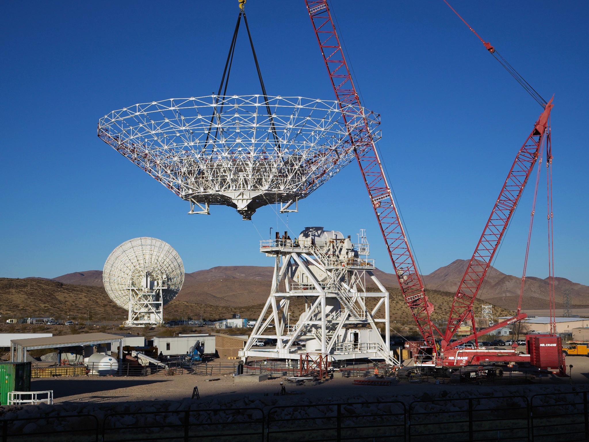
A large red crane lowers a cone-shaped frame. There is a large white metal structure behind it that has stairs running around it, all the way to the top. In the background at left, a completed antenna faces away from us. Farther away in the background are brown mountains.
NASA/JPL-Caltech

A crane lowers the 112-foot-wide (34-meter-wide) steel framework for the Deep Space Station 23 (DSS-23) reflector dish into position on Dec. 18, 2024, at the Deep Space Network’s (DSN) Goldstone Space Communications Complex near Barstow, California. Once online in 2026, DSS-23 will be the fifth of six new beam waveguide antennas to be added to the network; DSS-23 will boost the DSN’s capacity and enhance NASA’s deep space communications capabilities for decades to come.

The DSN allows missions to track, send commands to, and receive scientific data from faraway spacecraft. More than 100 NASA and non-NASA missions rely on the DSN and Near Space Network, including supporting astronauts aboard the International Space Station and future Artemis missions, supporting lunar exploration, and uncovering the solar system and beyond.

Watch a time-lapse video of construction activities on Dec. 18.

Image credit: NASA/JPL-Caltech

Powered by WPeMatico

Get The Details…
Monika Luabeya