Patagonia Glacier retreat, Chile

Patagonia Glacier retreat, Chile


before
after

Patagonia, Chile. Left: September 18, 1986. Right: August 5, 2002. The 1986 image shows the region prior to a major retreat of the glaciers. The 2002 image shows a retreat of nearly 10 kilometers (6.2 miles) of the glacier on the left side. The smaller glacier on the right has receded more than 2 kilometers (1.2 miles). In front of the smaller glacier, two ribbon lakes have formed behind the debris left by the glacier's advance. Scientists and government managers are using satellite imagery like this to monitor the retreat of the glaciers and the impact on water bodies caused by the changes in the glaciers’ size and direction.   Left image taken by the Thematic Mapper sensor onboard Landsat 5. Right image taken by the Enhanced Thematic Mapper Plus sensor onboard Landsat 7. Source: USGS Landsat Missions Gallery,
Patagonia, Chile. Left: September 18, 1986. Right: August 5, 2002. The 1986 image shows the region prior to a major retreat of the glaciers. The 2002 image shows a retreat of nearly 10 kilometers (6.2 miles) of the glacier on the left side. The smaller glacier on the right has receded more than 2 kilometers (1.2 miles). In front of the smaller glacier, two ribbon lakes have formed behind the debris left by the glacier’s advance. Scientists and government managers are using satellite imagery like this to monitor the retreat of the glaciers and the impact on water bodies caused by the changes in the glaciers’ size and direction. Left image taken by the Thematic Mapper sensor onboard Landsat 5. Right image taken by the Enhanced Thematic Mapper Plus sensor onboard Landsat 7. Source: USGS Landsat Missions Gallery, “Patagonia Region – Retreating Glaciers,” U.S. Department of the Interior / U.S. Geological Survey.
NASA/USGS

Before and After

Patagonia Glacier retreat, Chile

September 18, 1986 – August 5, 2002


Patagonia, Chile. Left: September 18, 1986. Right: August 5, 2002. The 1986 image shows the region prior to a major retreat of the glaciers. The 2002 image shows a retreat of nearly 10 kilometers (6.2 miles) of the glacier on the left side. The smaller glacier on the right has receded more than 2 kilometers (1.2 miles). In front of the smaller glacier, two ribbon lakes have formed behind the debris left by the glacier’s advance. Scientists and government managers are using satellite imagery like this to monitor the retreat of the glaciers and the impact on water bodies caused by the changes in the glaciers’ size and direction. Left image taken by the Thematic Mapper sensor onboard Landsat 5. Right image taken by the Enhanced Thematic Mapper Plus sensor onboard Landsat 7. Source: USGS Landsat Missions Gallery, “Patagonia Region – Retreating Glaciers,” U.S. Department of the Interior / U.S. Geological Survey.

Downloads

Image 1

JPEG

(3 MB)

Image 2

JPEG

(3 MB)

Powered by WPeMatico

Get The Details…

Meet NASA’s Artemis II Moon Mission Masterminds

Meet NASA’s Artemis II Moon Mission Masterminds

Teams at NASA’s Kennedy Space Center in Florida participate in the first joint integrated launch countdown simulation for Artemis I inside Firing Room 1 of the Launch Control Center on July 8, 2021. Seen at the top of the room is Charlie Blackwell-Thompson (right), launch director.
Credit: NASA/Ben Smegelsky

As four astronauts venture around the Moon on NASA’s Artemis II test flight in 2026, many people will support the journey from here on Earth. Teams directing operations from the ground include the mission management team, launch control team, flight control team, and the landing and recovery team, each with additional support personnel who are experts in every individual system and subsystem. The teams have managed every aspect of the test flight and ensure NASA is prepared to send humans beyond our atmosphere and into a new Golden Age of innovation and exploration.

Mission management team

Reviews of mission status and risk assessments are conducted by the mission management team, a group of 15 core members and additional advisors. Amit Kshatriya, NASA’s deputy associate administrator, Moon to Mars Program, will serve as the mission management team chair for the test flight.

Two days prior to launch, the mission management team will assemble to review mission risks and address any lingering preflight concerns. With more than 20 years of human spaceflight experience, Kshatriya will conduct polls at key decision points, providing direction for the relevant operations team. If circumstances during the flight go beyond established decision criteria or flight rules outlined ahead of the mission, the team will assess the situation based on the information available and decide how to respond. 

Matt Ramsey, serving as the Artemis II mission manager, will oversee all elements of mission preparedness prior to the mission management team assembly two days before launch and serve as deputy mission management team chair throughout the mission. With more than two decades of experience at NASA, Ramsey managed the SLS (Space Launch System) Engineering Support Center for Artemis I. 

Launch control team

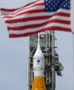
The launch control team coordinates launch operations from NASA’s Kennedy Space Center in Florida. Charlie Blackwell-Thompson serves as the agency’s Artemis launch director, responsible for integrating and coordinating launch operations for the SLS, Orion, and Exploration Ground Systems Programs, including developing and implementing plans for countdown, troubleshooting, and timing.

Two days before liftoff, when the countdown for launch begins, Blackwell-Thompson’s team will begin preparations for launch from their console positions in Firing Room 1 in Kennedy’s Launch Control Center. On the day of launch, Blackwell-Thompson and her team will manage countdown progress, propellent loading, and launch commit criteria. The criteria include standards for systems involved in launch, and the team will monitor the rocket until it lifts off from the launchpad.

Rick Henfling, flight director, monitors systems in the Flight Control Center at NASA’s Johnson Space Center in Houston.
Credit: NASA

Flight control team

From solid rocket booster ignition until the crew is safely extracted from the Orion capsule following splashdown in the Pacific Ocean at the end of their mission, the flight control team oversees operations from the Mission Control Center at NASA’s Johnson Space Center in Houston. Multiple flight directors will take turns leading the team throughout the 10-day mission to support operations around the clock. Jeff Radigan, bringing more than 20 years of International Space Station experience to Artemis II, will serve as lead flight director for the mission. The work for this role begins well in advance of the mission with building mission timelines; developing flight rules and procedures; leading the flight control team through simulations that prepare them for the flight test; and then helping them carry out the plan.

On launch day, the ascent flight control team will be led by Judd Frieling, an Artemis I flight director who also supported more than 20 shuttle missions as a flight controller. Frieling is responsible for overseeing the crew’s ascent to space, including performance of SLS core stage engines, solid rocket boosters, and propulsion systems from the moment of launch until the separation of Orion from the Interim Cryogenic Propulsion Stage. As Orion is propelled toward the Moon, guidance of operations will pass to the next flight director.

At the opposite end of the mission, Rick Henfling will take the lead for Orion’s return to Earth and splashdown. Orion will reenter Earth’s atmosphere at roughly 25,000 mph to about 20 mph for a parachute-assisted splashdown. Drawing from a background supporting space shuttle ascent, entry, and abort operations and 10 years as a space station flight director, Henfling and the team will monitor weather forecasts for landing, watch over Orion’s systems through the dynamic entry phase, and to ensure the spacecraft is safely shutdown before handing over operations to the recovery team.

At any point during the mission, a single voice will speak to the crew in space on behalf of all members of the flight control team: the capsule communicator, or CapCom. The CapCom ensures the crew in space receives clear and concise communication from the teams supporting them on the ground. NASA astronaut Stan Love will serve as the lead CapCom for Artemis II. Love flew aboard STS-122 mission and has acted as CapCom for more than a dozen space station expeditions. He is also part of the astronaut office’s Rapid Prototyping Lab, which played a key role in development of Orion’s displays and controls.

Landing, recovery team

Retrieval of the crew and Orion crew module will be in the hands of the landing and recovery team, led by Lili Villarreal. The team will depart San Diego on a Department of Defense ship, and head to the vicinity of the landing site several days before splashdown for final preparations alongside the U.S. Navy and DOD.

The recovery team is made up of personnel operating from the ship, land, and air to recover both astronauts and the capsule. Decision-making authority during the recovery phase of mission operations belongs to Villarreal, who served as deputy flow director for Artemis I and worked in the operations division for the space station.

The success of Artemis II will pave the way for the next phase of the agency’s campaign, landing on the lunar South Pole region on Artemis III. These teams, along with the four crew members and countless NASA engineers, scientists, and personnel, are driving humanity’s exploration on the Moon, Mars, and beyond.

Powered by WPeMatico

Get The Details…
Lauren E. Low

Strap In! NASA Aeroshell Material Takes Extended Space Trip

Strap In! NASA Aeroshell Material Takes Extended Space Trip

4 min read

Preparations for Next Moonwalk Simulations Underway (and Underwater)

Robert Mosher, HIAD materials and processing lead at NASA Langley, holds up a piece of f webbing material, known as Zylon, which comprise the straps of the HIAD.
Robert Mosher, HIAD materials and processing lead at NASA Langley, holds up a piece of webbing material, known as Zylon, which comprise the straps of the HIAD.
NASA/Joe Atkinson

Components of a NASA technology that could one day help crew and cargo enter harsh planetary environments, like that of Mars, are taking an extended trip to space courtesy of the United States Space Force.

On Aug. 21, several pieces of webbing material, known as Zylon, which comprise the straps of the HIAD (Hypersonic Inflatable Aerodynamic Decelerator) aeroshell developed by NASA’s Langley Research Center in Hampton, Virginia, launched to low Earth orbit along with other experiments aboard the Space Force’s X-37B Orbital Test Vehicle. This trip will help researchers characterize how the Zylon webbing responds to long-duration exposure to the harsh vacuum of space.

The strap material on the HIAD aeroshell serves two purposes – short strap lengths hold together HIAD’s inflatable rings and longer pieces help to distribute the load more evenly across the cone-shaped structure. The HIAD aeroshell technology could allow larger spacecraft to safely descend through the atmospheres of celestial bodies like Mars, Venus, and even Saturn’s moon, Titan.

“We’re researching how HIAD technology could help get humans to Mars. We want to look at the effects of long-term exposure to space – as if the Zylon material is going for a potential six to nine-month mission to Mars,” said Robert Mosher, HIAD materials and processing lead at NASA Langley. “We want to make sure we know how to protect those structural materials in the long term.”

The Zylon straps are visible here during the inflation of LOFTID as part of a November 2022 orbital flight test.
The Zylon straps are visible here during the inflation of LOFTID as part of a November 2022 orbital flight test. LOFTID was a version of the HIAD aeroshell — a technology that could allow larger spacecraft to safely descend through the atmospheres of celestial bodies like Mars, Venus, and even Saturn’s moon, Titan.
NASA

Flying Zylon material aboard the Space Force’s X-37B mission will help NASA researchers understand what kind of aging might occur to the webbing on a long space journey before it experiences the extreme environments of atmospheric entry, during which it has to retain strength at high temperatures.

Multiple samples are in small canisters on the X-37B. Mosher used two different techniques to put the strap material in the canisters. Some he tightly coiled up, others he stuffed in.

“Typically, we pack a HIAD aeroshell kind of like you pack a parachute, so they’re compressed,” he said. “We wanted to see if there was a difference between tightly coiled material and stuff-packed material like you would normally see on a HIAD.”

Some of the canisters also include tiny temperature and humidity sensors set to collect readings at regular intervals. When the Space Force returns the samples from the X-37B flight, Mosher will compare them to a set of samples that have remained in canisters here on Earth to look for signs of degradation.

The material launched to space aboard the Space Force’s X-37B Orbital Test Vehicle, seen here earlier this year.
Courtesy of the United States Space Force

“Getting this chance to have the Zylon material exposed to space for an extended period of time will begin to give us some data on the long-term packing of a HIAD,” Mosher said.

Uninflated HIAD aeroshells can be packed into small spaces within a spacecraft. This results in a decelerator that can be much larger than the diameter of its launch vehicle and can therefore land much heavier loads and deliver them to higher elevations on a planet or other celestial body.

Rigid aeroshells, the sizes of which are dictated by the diameters of their launch vehicles, typically 4.5 to 5 meters, are capable of landing well-equipped, car-sized rovers on Mars. By contrast, an inflatable HIAD, with an 18-20m diameter, could land the equivalent of a small, fully furnished ranch house with a car in the garage on Mars.

NASA’s HIAD aeroshell developments build on the success of the agency’s LOFTID (Low-Earth Orbit Flight Test of an Inflatable Decelerator) mission that launched on Nov. 10, 2022, resulting in valuable insights into how this technology performs under the stress of re-entering Earth’s atmosphere after being exposed to space for a short time period.

Learn more: https://www.nasa.gov/space-technology-mission-directorate/tdm/

About the Author

Joe Atkinson

Public Affairs Officer, NASA Langley Research Center

Powered by WPeMatico

Get The Details…
Joseph Atkinson

NASA Seeks Volunteers to Track Artemis II Mission

NASA Seeks Volunteers to Track Artemis II Mission

2 Min Read

NASA Seeks Volunteers to Track Artemis II Mission

On the 19th day of the Artemis I mission, the Moon grows larger in frame as Orion prepares for the return powered flyby on Dec. 5, when it will pass approximately 79 miles above the lunar surface.

On the 19th day of the Artemis I mission, Dec. 4, 2022, a camera mounted on the Orion spacecraft captured the Moon just in frame.

Credits:
NASA

NASA seeks volunteers to passively track the Artemis II Orion spacecraft as the crewed mission travels to the Moon and back to Earth.

The Artemis II test flight, a launch of the agency’s SLS (Space Launch System) rocket and Orion spacecraft, will send NASA astronauts Reid Wiseman, Victor Glover, and Christina Koch, along with CSA (Canadian Space Agency) astronaut Jeremy Hansen, on an approximately 10-day mission around the Moon.

The mission, targeted for no later than April 2026, will rely on NASA’s Near Space Network and Deep Space Network for primary communications and tracking support throughout its launch, orbit, and reentry. However, with a growing focus on commercialization, NASA wants to further understand industry’s tracking capabilities.  

This collaboration opportunity builds upon a previous request released by NASA’s SCaN (Space Communication and Navigation) Program during the Artemis I mission, where ten volunteers successfully tracked the uncrewed Orion spacecraft in 2022 on its journey thousands of miles beyond the Moon and back.

During the Artemis I mission, participants – ranging from international space agencies, academic institutions, commercial companies, nonprofits, and private citizens – attempted to receive Orion’s signal and use their respective ground antennas to track and measure changes in the radio waves transmitted by Orion.

This data will help inform our transition to a commercial-first approach, ultimately strengthening the infrastructure needed to support long-term Moon to Mars objectives.

Kevin Coggins

Kevin Coggins

Deputy Associate Administrator for SCaN

“By offering this opportunity to the broader aerospace community, we can identify available tracking capabilities outside the government,” said Kevin Coggins, NASA’s deputy associate administrator for SCaN at NASA Headquarters in Washington. “This data will help inform our transition to a commercial-first approach, ultimately strengthening the infrastructure needed to support Artemis missions and our long-term Moon to Mars objectives.” 

Responses are due by 5 p.m. EDT on Monday, Oct. 27.

NASA’s SCaN Program serves as the management office for the agency’s space communications and navigation systems. More than 100 NASA and non-NASA missions rely on SCaN’s two networks, the Near Space Network and the Deep Space Network, to support astronauts aboard the International Space Station and future Artemis missions, monitor Earth’s weather, support lunar exploration, and uncover the solar system and beyond.

Artemis II will help confirm the systems and hardware needed for human deep space exploration. This mission is the first crewed flight under NASA’s Artemis campaign and is another step toward new U.S.-crewed missions on the Moon’s surface that will help the agency prepare to send American astronauts to Mars.

Share

Details

Last Updated

Aug 27, 2025

Editor
Goddard Digital Team
Contact
Joshua A. Finch
Location
Goddard Space Flight Center

Powered by WPeMatico

Get The Details…
Katrina Lee

Portrait of an Astronaut

Portrait of an Astronaut

A black and white photo of a woman wearing a spacesuit and helmet. She looks upward toward the right. The photo shows only her head and shoulders.
NASA/Josh Valcarcel

NASA astronaut Zena Cardman poses for a portrait in a photography studio on March 22, 2024, at NASA’s Johnson Space Center in Houston, Texas.

Cardman is currently aboard the International Space Station, where she perform research, technology demonstrations, and maintenance activities. Recently, she took a robotics test on a computer for the portion of the CIPHER study that measures space-caused changes to her brain structure and function; she also installed high-definition cameras on a spacesuit helmet.

Cardman launched to the space station on NASA’s SpaceX Crew-11 mission. Members of Crew-11 will contribute to NASA’s Artemis campaign by simulating Moon landing scenarios that future crews may encounter near the lunar South Pole.

Learn more about station activities by following the space station blog.

Image credit: NASA/Josh Valcarcel

Powered by WPeMatico

Get The Details…
Monika Luabeya