NASA Radar Imagery Reveals Details About Los Angeles-Area Landslides

NASA Radar Imagery Reveals Details About Los Angeles-Area Landslides

A topographic map of Rancho Palos Verdes, CA (Sept. 18–Oct. 17, 2024) shows landslide velocity in cm/week, with red areas moving fastest (≥10 cm/week). The slide extends beyond the 2007 boundary toward Abalone Cove. An arrow marks the landslide direction southward.
NASA’s UAVSAR airborne radar instrument captured data in fall 2024 showing the motion of landslides on the Palos Verdes Peninsula following record-breaking rainfall in Southern California in 2023 and another heavy-precipitation winter in 2024. Darker red indicates faster motion.
NASA Earth Observatory

Analysis of data from NASA radar aboard an airplane shows that the decades-old active landslide area on the Palos Verdes Peninsula has expanded.

Researchers at NASA’s Jet Propulsion Laboratory in Southern California used data from an airborne radar to measure the movement of the slow-moving landslides on the Palos Verdes Peninsula in Los Angeles County. The analysis determined that, during a four-week period in the fall of 2024, land in the residential area slid toward the ocean by as much as 4 inches (10 centimeters) per week.

Portions of the peninsula, which juts into the Pacific Ocean just south of the city of Los Angeles, are part of an ancient complex of landslides and has been moving for at least the past six decades, affecting hundreds of buildings in local communities. The motion accelerated, and the active area expanded following record-breaking rainfall in Southern California in 2023 and heavy precipitation in early 2024.

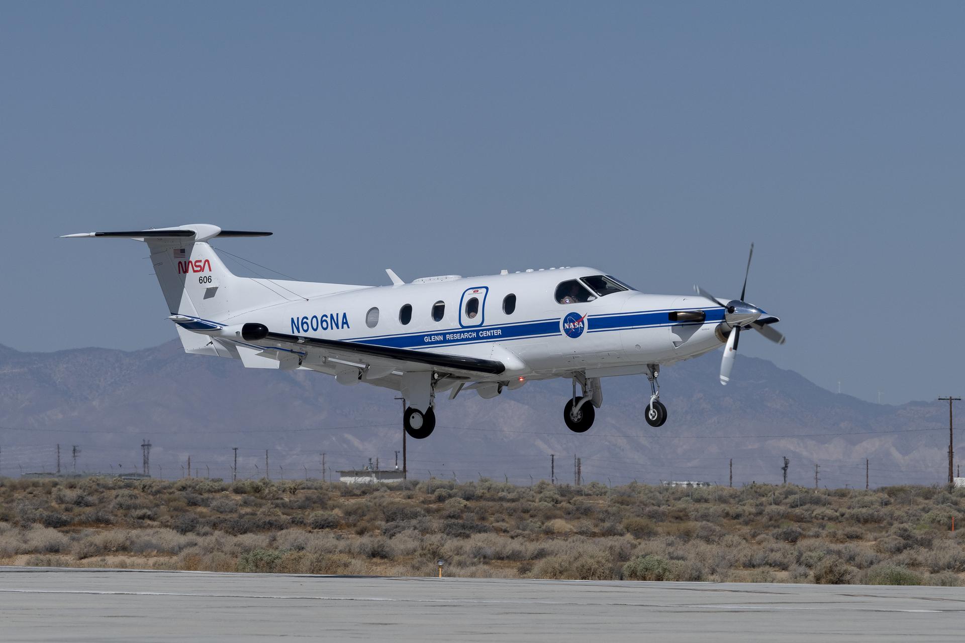
To create this visualization, the Advanced Rapid Imaging and Analysis (ARIA) team used data from four flights of NASA’s Uninhabited Aerial Vehicle Synthetic Aperture Radar (UAVSAR) that took place between Sept. 18 and Oct. 17. The UAVSAR instrument was mounted to a Gulfstream III jet flown out of NASA’s Armstrong Flight Research Center in Edwards, California, and the four flights were planned to estimate the speed and direction of the landslides in three dimensions.

In the image above, colors indicate how fast parts of the landslide complex were moving in late September and October, with the darkest reds indicating the highest speeds. The arrows represent the direction of horizontal motion. The white solid lines are the boundaries of the active landslide area as defined in 2007 by the California Geological Survey.

“In effect, we’re seeing that the footprint of land experiencing significant impacts has expanded, and the speed is more than enough to put human life and infrastructure at risk,” said Alexander Handwerger, the JPL landslide scientist who performed the analysis.

The insights from the UAVSAR flights were part of a package of analyses by the ARIA team that also used data from ESA’s (the European Space Agency’s) Copernicus Sentinel-1A/B satellites. The analyses were provided to California officials to support the state’s response to the landslides and made available to the public at NASA’s Disaster Mapping Portal.

Handwerger is also the principal investigator for NASA’s upcoming Landslide Climate Change Experiment, which will use airborne radar to study how extreme wet or dry precipitation patterns influence landslides. The investigation will include flights over coastal slopes spanning the California coastline.

More About ARIA, UAVSAR

The ARIA mission is a collaboration between JPL and Caltech, which manages JPL for NASA, to leverage radar and optical remote-sensing, GPS, and seismic observations for science as well as to aid in disaster response. The project investigates the processes and impacts of earthquakes, volcanoes, landslides, fires, subsurface fluid movement, and other natural hazards.

UAVSAR has flown thousands of radar missions around the world since 2007, studying phenomena such as glaciers and ice sheets, vegetation in ecosystems, and natural hazards like earthquakes, volcanoes, and landslides.

News Media Contacts

Andrew Wang / Jane J. Lee
Jet Propulsion Laboratory, Pasadena, Calif.
626-379-6874 / 818-354-0307
andrew.wang@jpl.nasa.gov / jane.j.lee@jpl.nasa.gov

2025-012

Powered by WPeMatico

Get The Details…
Naomi Hartono

NASA Flight Tests Wildland Fire Tech Ahead of Demo

NASA Flight Tests Wildland Fire Tech Ahead of Demo

An FVR90 unmanned aerial vehicle (UAV) lifts off from the Monterey Bay Academy Airport near Watsonville, California, during the Advanced Capabilities for Emergency Response Operations (ACERO) Shakedown Test in November 2024.
NASA/Don Richey

NASA is collaborating with the wildfire community to provide tools for some of the most challenging aspects of firefighting – particularly aerial nighttime operations.  

In the future, agencies could more efficiently use drones, both remotely piloted and fully autonomous, to help fight wildfires. NASA recently tested technologies with teams across the country that will enable aircraft – including small drones and helicopters outfitted with autonomous technology for remote piloting – to monitor and fight wildfires 24 hours a day, even during low-visibility conditions. 

Current aerial firefighting operations are limited to times when aircraft have clear visibility – otherwise, pilots run the risk of flying into terrain or colliding with other aircraft. NASA-developed airspace management technology will enable drones and remotely piloted aircraft to operate at night, expanding the window of time responders have to aerially suppress fires.

“We’re aiming to provide new tools – including airspace management technologies – for 24-hour drone operations for wildfire response,” said Min Xue, project manager of the Advanced Capabilities for Emergency Response Operations (ACERO) project within NASA’s Aeronautics Research Mission Directorate. “This testing will provide valuable data to inform how we mature this technology for eventual use in the field.” 

Over the past year, ACERO researchers developed a portable airspace management system (PAMS) drone pilots can use to safely send aircraft into wildfire response operations when operating drones from remote control systems or ground control stations.  

Each PAMS, roughly the size of a carry-on suitcase, is outfitted with a computer for airspace management, a radio for sharing information among PAMS units, and an Automatic Dependent Surveillance-Broadcast receiver for picking up nearby air traffic – all encased in a durable and portable container. 

NASA software on the PAMS allows drone pilots to avoid airborne collisions while remotely operating aircraft by monitoring and sharing flight plans with other aircraft in the network. The system also provides basic fire location and weather information. A drone equipped with a communication device acts as an airborne communication relay for the ground-based PAMS units, enabling them to communicate with each other without relying on the internet.  

Engineers fly a drone at NASA’s Langley Research Center in Hampton, Virginia, to test aerial coordination capabilities.
NASA/Mark Knopp

To test the PAMS units’ ability to share and display vital information, NASA researchers placed three units in different locations outside each other’s line of sight at a hangar at NASA’s Ames Research Center in California’s Silicon Valley. Researchers stationed at each unit entered a flight plan into their system and observed that each unit successfully shared flight plans with the others through a mesh radio network. 

Next, researchers worked with team members in Virginia to test an aerial communications radio relay capability. 

Researchers outfitted a long-range vertical takeoff and landing aircraft with a camera, computer, a mesh radio, and an Automatic Dependent Surveillance-Broadcast receiver for air traffic information. The team flew the aircraft and two smaller drones at NASA’s Langley Research Center in Hampton, Virginia, purposely operating them outside each other’s line of sight.  

The mesh radio network aboard the larger drone successfully connected with the small drones and multiple radio units on the ground. 

Yasmin Arbab front-right frame, Alexey Munishkin, Shawn Wolfe, with Sarah Mitchell, standing behind, works with the Advanced Capabilities for Emergency Response Operations (ACERO) Portable Airspace Management System (PAMS) case at the Monterey Bay Academy Airport near Watsonville, California.
NASA/Don Richey

NASA researchers then tested the PAMS units’ ability to coordinate through an aerial communications relay to simulate what it could be like in the field.  

At Monterey Bay Academy Airport in Watsonville, California, engineers flew a winged drone with vertical takeoff and landing capability by Overwatch Aero, establishing a communications relay to three different PAMS units. Next, the team flew two smaller drones nearby.  

Researchers tested the PAMS units’ ability to receive communications from the Overwatch aircraft and share information with other PAMS units. Pilots purposely submitted flight plans that would conflict with each other and intentionally flew the drones outside preapproved flight plans. 

The PAMS units successfully alerted pilots to conflicting flight plans and operations outside preapproved zones. They also shared aircraft location with each other and displayed weather updates and simulated fire location data. 

The test demonstrated the potential for using PAM units in wildfire operations.  

“This testing is a significant step towards improving aerial coordination during a wildfire,” Xue said. “These technologies will improve wildfire operations, reduce the impacts of large wildfires, and save more lives,” Xue said.  

This year, the team will perform a flight evaluation to further mature these wildfire technologies. Ultimately, the project aims to transfer this technology to the firefighting community community. 

This work is led by the ACERO project under NASA’s Aeronautics Research Mission Directorate and supports the agency’s Advanced Air Mobility mission.  

Powered by WPeMatico

Get The Details…
Hillary Smith

Building an Antenna

Building an Antenna

A large red crane lowers a cone-shaped frame. There is a large white metal structure behind it that has stairs running around it, all the way to the top. In the background at left, a completed antenna faces away from us. Farther away in the background are brown mountains.
NASA/JPL-Caltech

A crane lowers the 112-foot-wide (34-meter-wide) steel framework for the Deep Space Station 23 (DSS-23) reflector dish into position on Dec. 18, 2024, at the Deep Space Network’s (DSN) Goldstone Space Communications Complex near Barstow, California. Once online in 2026, DSS-23 will be the fifth of six new beam waveguide antennas to be added to the network; DSS-23 will boost the DSN’s capacity and enhance NASA’s deep space communications capabilities for decades to come.

The DSN allows missions to track, send commands to, and receive scientific data from faraway spacecraft. More than 100 NASA and non-NASA missions rely on the DSN and Near Space Network, including supporting astronauts aboard the International Space Station and future Artemis missions, supporting lunar exploration, and uncovering the solar system and beyond.

Watch a time-lapse video of construction activities on Dec. 18.

Image credit: NASA/JPL-Caltech

Powered by WPeMatico

Get The Details…
Monika Luabeya

6 Things to Know About SPHEREx, NASA’s Newest Space Telescope

6 Things to Know About SPHEREx, NASA’s Newest Space Telescope

5 min read

Preparations for Next Moonwalk Simulations Underway (and Underwater)

NASA’s SPHEREx observatory undergoes testing
NASA’s SPHEREx observatory undergoes testing at BAE Systems in Boulder, Colorado, in August 2024. Launching no earlier than Feb. 27, 2025, the mission will make the first all-sky spectroscopic survey in the near-infrared, helping to answer some of the biggest questions in astrophysics.
BAE Systems/NASA/JPL-Caltech

Shaped like a megaphone, the upcoming mission will map the entire sky in infrared light to answer big questions about the universe.

Expected to launch no earlier than Thursday, Feb. 27, from Vandenberg Space Force Base in California, NASA’s SPHEREx space observatory will provide astronomers with a big-picture view of the cosmos like none before. Short for Spectro-Photometer for the History of the Universe, Epoch of Reionization and Ices Explorer, SPHEREx will map the entire celestial sky in 102 infrared colors, illuminating the origins of our universe, galaxies within it, and life’s key ingredients in our own galaxy. Here are six things to know about the mission.

1. The SPHEREx space telescope will shed light on a cosmic phenomenon called inflation.

In the first billionth of a trillionth of a trillionth of a second after the big bang, the universe increased in size by a trillion-trillionfold. Called inflation, this nearly instantaneous event took place almost 14 billion years ago, and its effects can be found today in the large-scale distribution of matter in the universe. By mapping the distribution of more than 450 million galaxies, SPHEREx will help scientists improve our understanding of the physics behind this extreme cosmic event.

2. The observatory will measure the collective glow from galaxies near and far.

Scientists have tried to estimate the total light output from all galaxies throughout cosmic history by observing individual galaxies and extrapolating to the trillions of galaxies in the universe. The SPHEREx space telescope will take a different approach and measure the total glow from all galaxies, including galaxies too small, too diffuse, or too distant for other telescopes to easily detect. Combining the measurement of this overall glow with other telescopes’ studies of individual galaxies will give scientists a more complete picture of all the major sources of light in the universe.

3. The mission will search the Milky Way galaxy for essential building blocks of life.

Life as we know it wouldn’t exist without basic ingredients such as water and carbon dioxide. The SPHEREx observatory is designed to find these molecules frozen in interstellar clouds of gas and dust, where stars and planets form. The mission will pinpoint the location and abundance of these icy compounds in our galaxy, giving researchers a better sense of their availability in the raw materials for newly forming planets.

Rho Ophiuchi dark cloud
Molecular clouds like this one, called Rho Ophiuchi, are collections of cold gas and dust in space where stars and planets can form. SPHEREx will survey such regions through-out the Milky Way galaxy to measure the abundance of water ice and other frozen mole-cules.
NASA/JPL-Caltech

4. It adds unique strengths to NASA’s fleet of space telescopes.

Space telescopes like NASA’s Hubble and Webb have zoomed in on many corners of the universe to show us planets, stars, and galaxies in high resolution. But some questions — like how much light do all the galaxies in the universe collectively emit? — can be answered only by looking at the big picture. To that end, the SPHEREx observatory will provide maps that encompass the entire sky. Objects of scientific interest identified by SPHEREx can then be studied in more detail by targeted telescopes like Hubble and Webb.

5. The SPHEREx observatory will make the most colorful all-sky map ever.

The SPHEREx observatory “sees” infrared light. Undetectable to the human eye, this range of wavelengths is ideal for studying stars and galaxies. Using a technique called spectroscopy, the telescope can split the light into its component colors (individual wavelengths), like a prism creates a rainbow from sunlight, in order to measure the distance to cosmic objects and learn about their composition. With SPHEREx’s spectroscopic map in hand, scientists will be able to detect evidence of chemical compounds, like water ice, in our galaxy. They’ll not only measure the total amount of light emitted by galaxies in our universe, but also discern how bright that total glow was at different points in cosmic history. And they’ll chart the 3D locations of hundreds of millions of galaxies to study how inflation influenced the large-scale structure of the universe today.

6. The spacecraft’s cone-shaped design helps it stay cold and see faint objects.

The mission’s infrared telescope and detectors need to operate at around minus 350 degrees Fahrenheit (about minus 210 degrees Celsius). This is partly to prevent them from generating their own infrared glow, which might overwhelm the faint light from cosmic sources. To keep things cold while also simplifying the spacecraft’s design and operational needs, SPHEREx relies on an entirely passive cooling system — no electricity or coolants are used during normal operations. Key to making this feat possible are three cone-shaped photon shields that protect the telescope from the heat of Earth and the Sun, as well as a mirrored structure beneath the shields to direct heat from the instrument out into space. Those photon shields give the spacecraft its distinctive outline.

More About SPHEREx

SPHEREx is managed by NASA’s Jet Propulsion Laboratory for the agency’s Astrophysics Division within the Science Mission Directorate at NASA Headquarters in Washington. BAE Systems (formerly Ball Aerospace) built the telescope and the spacecraft bus. The science analysis of the SPHEREx data will be conducted by a team of scientists located at 10 institutions in the U.S., two in South Korea, and one in Taiwan. Data will be processed and archived at IPAC at Caltech, which manages JPL for NASA. The mission principal investigator is based at Caltech with a joint JPL appointment. The SPHEREx dataset will be publicly available at the NASA/IPAC Infrared Science Archive.

For more information about the SPHEREx mission visit:

https://www.jpl.nasa.gov/missions/spherex

News Media Contact

Calla Cofield
Jet Propulsion Laboratory, Pasadena, Calif.
626-808-2469
calla.e.cofield@jpl.nasa.gov

2025-011

Powered by WPeMatico

Get The Details…
Anthony Greicius

Meet the Space Ops Team: Lindsai Bland

Meet the Space Ops Team: Lindsai Bland

3 min read

Preparations for Next Moonwalk Simulations Underway (and Underwater)

With more than 17 years of experience at NASA, Lindsai Bland has been an integral part of the agency, contributing to multiple Earth observing system missions at NASA’s Goddard Space Flight Center in Greenbelt, Maryland. Now, Bland ensures the agency’s communications and navigation resources meet overall needs and requirements as the Mission Operations Interface Lead for NASA’s SCaN (Space Communications and Navigation) program. 

A large antenna, part of the Deep Space Network, sits on top of a hill at sunset. The sky around the antenna is a bright orange but bleeds into a dark blue around the edges of the image.
This sunset photo shows Deep Space Station 14 (DSS-14), the 230-foot-wide (70-meter) antenna at the Goldstone Deep Space Communications Complex near Barstow, California, part of NASA’s Deep Space Network. The network’s three complexes around the globe support communications with dozens of deep space missions. DSS-14 is also the agency’s Goldstone Solar System Radar, which is used to observe asteroids that come close to Earth.

The program, managed through the agency’s Space Operations Mission Directorate, is responsible for all of NASA’s space communications operations, including the Near Space Network and Deep Space Network, which have enabled the success of more than 100 NASA and non-NASA missions. Astronauts aboard the International Space Station, missions monitoring Earth’s weather and effects of climate change, and spacecraft exploring the Moon and beyond all depend on NASA’s Near Space and Deep Space Networks to provide robust communications services. As interface lead, Bland works with teams to guarantee that critical data is transmitted between spacecraft and desired control center.  

“Working with the SCaN program gives me the opportunity to be a part of a variety of mission types with endless science objectives,” said Bland. “Joining this team has been a highlight of my career, and tackling new challenges has been incredibly rewarding.” 

Looking ahead, Bland envisions that NASA will persevere in expanding the boundaries of space exploration, especially as the agency partners with international and U.S. industry in support of commercially owned and operated low Earth orbit destinations. 

Lindsai Bland, Mission Operations Interface Lead for the Space Communications and Navigation Division

“I think NASA will continue to push the boundaries of the aerospace industry and physical science studies,” she says. “NASA will take risks in exploration, bringing along industries and businesses to help further our goals.” 

Outside of her work at NASA, Bland is passionate about the arts. She was an avid dancer from a young age, training in ballet, modern, and jazz. Bland also enjoys making her own cosmetics. She believes strongly in giving back to her community and dedicates some of her personal time to community services effort around Montgomery County, Maryland. 

Bland’s career at NASA is a testament to her dedication, expertise, and passion for science and space exploration. Bland will continue to NASA’s mission in expand our understanding and study of our solar system and universe in captivating new ways. 

NASA’s Space Operations Mission Directorate maintains a continuous human presence in space for the benefit of people on Earth. The programs within the directorate are the heart of NASA’s space exploration efforts, enabling Artemis, commercial space, science, and other agency missions through communication, launch services, research capabilities, and crew support. 

To learn more about NASA’s Space Operation Mission Directorate, visit:  

https://www.nasa.gov/directorates/space-operations

Powered by WPeMatico

Get The Details…
Heather Monaghan