Sols 4484-4485: Remote Sensing on a Monday

Sols 4484-4485: Remote Sensing on a Monday

4 min read

Sols 4484-4485: Remote Sensing on a Monday

A grayscale photograph of the Martian surface by the Curiosity rover captures medium gray soil next to the rover with exposed medium-sized, lighter-colored rocks scattered around. Most of the rocks appear layered, with dividing lines making them look like features drawn on a topographic map. The bottom of the frame shows parts of the rover, running from the middle left edge to the lower right corner of the image, including part of its robotic arm which carries a nameplate imprinted with “Curiosity” outlined in white, all-capital letters, and to the right of that a line drawing of the rover.
NASA’s Mars rover Curiosity acquired this image using its Left Navigation Camera on March 17, 2025 — sol 4483, or Martian day 4,483 of the Mars Science Laboratory mission — at 09:38:17 UTC.
NASA/JPL-Caltech

Written by Conor Hayes, Graduate Student at York University

Earth planning date: Monday, March 17, 2025

Last week I was in Houston, Texas, at the Lunar and Planetary Science Conference. The mid-March weather in Houston is often more like mid-summer weather here in Toronto, so it has been a bit of a shock coming home to temperatures that are hovering around freezing rather than being in the upper 20s (degrees Celsius, or the low to mid 80s for those of you still using Fahrenheit). Still, Toronto is positively balmy compared to Gale Crater, where temperatures usually range between minus 80°C and minus 20°C (or minus 110°F to minus 5°F) during this part of the year. These cold temperatures and their associated higher demands on the rover’s available power for heating are continuing to motivate many of the decisions that we make during planning.

We received the double good news this morning that the weekend’s drive completed successfully, including the mid-drive imaging of the other side of “Humber Park” that Michelle mentioned in Friday’s blog, and that our estimates of the weekend plan’s power consumption ended up being a little conservative. So we started planning exactly where we wanted to be, and with more power to play around with than we had expected. Yay!

The weekend’s drive left us parked in front of some rocks with excellent layering and interesting ripples that we really wanted to get a closer look at with MAHLI. (See the cover image for a look at these rocks as seen by Navcam.) Sadly, we also ended up parked in such a way that presented a slip hazard if the arm was unstowed. As much as we would have loved to get close-up images of these rocks, we love keeping Curiosity’s arm safe even more, so we had to settle for a remote sensing-only plan instead.

Both the geology and mineralogy (GEO) and the environmental science (ENV) teams took full advantage of the extra power gifted to us today to create a plan packed full of remote sensing observations. Because we’re driving on the first sol of this two-sol plan, any “targeted” observations, i.e. those where we know exactly where we want to point the rover’s cameras, must take place before the drive. The first sol is thus packed full of Mastcam and ChemCam observations, starting with a 14×3 Mastcam mosaic of the area in front of us that’s outside of today’s workspace. Individual targets then get some Mastcam love with mosaics of various ripple and layering features at “Verdugo Peak,” “Silver Moccasin Trail,” and “Jones Peak.” Mastcam and ChemCam also team up on a LIBS target, “Trancas Canyon,” and some more long-distance mosaics of Gould Mesa, a feature about 100 meters away from us (about 328 feet) that we’ll be driving to the south of as we continue to head toward the “boxwork” structures.

After a drive, there often aren’t many activities scheduled other than the imaging of our new location that we’ll need for the next planning day. However, in this plan ENV decided to take advantage of the fact that Navcam observations can take place at the same time that the rover is talking to one of the spacecraft that orbit Mars. This is a useful trick when power is tight as it allows us to do more science without adding additional awake time (since the rover needs to be awake anyway to communicate with the orbiters). Today, it’s being used to get some extra cloud observations right before sunset, a time that we don’t often get to observe. These observations include a zenith movie that looks straight up over the rover and a “phase function sky survey,” which takes a series of nine movies that form a dome around the rover to examine the properties of the clouds’ ice crystals. 

The second sol of this plan is much more relaxed, as post-drive sols often are because we don’t know exactly where we’ll be after a drive. Today, we’ve just got our usual ChemCam AEGIS activity, followed by a pair of Navcam cloud and cloud shadow movies to measure the altitude of clouds over Gale. As always, we’ve also got our usual set of REMS, RAD, and DAN activities throughout this plan.

Share

Details

Last Updated
Mar 20, 2025

Related Terms

Powered by WPeMatico

Get The Details…

Muscle, Bone, and Blood Studies on Station Promoting Space and Earth Health

Muscle, Bone, and Blood Studies on Station Promoting Space and Earth Health

City lights dot the Canadian landscape underneath an atmospheric glow and an aurora borealis in this photograph taken from the International Space Station 262 miles above North America at approximately 12:15 a.m. local time.
NASA

The Expedition 72 crew with its four newest members is returning to science operations following a busy period of crew swap activities. Human research was Thursday’s main focus as the International Space Station residents studied how living in space affects bones, muscles, and brain blood flow.

Astronauts are living in space for months at a time and scientists have been continuously studying how their bodies adapt to weightlessness. Results are especially important as NASA and its international partners plan long-duration crewed missions to the Moon, Mars, and beyond that are less dependent on Earth.

NASA Flight Engineer Nichole Ayers processed her blood samples for analysis to understand and treat space-caused bone loss as well as bone conditions on Earth such as osteoporosis. Veteran NASA Flight Engineer Don Pettit worked out on the advanced resistive exercise device for an investigation exploring how exercising during spaceflight impacts the muscles and bones.

A new experiment on the orbital outpost, Drain Brain 2.0, is investigating how blood flows from a crew member’s brain toward the heart in microgravity. Flight Engineer Takuya Onishi from JAXA (Japan Aerospace Exploration Agency) attached sensors and electrodes to his neck and chest for the human research study. The experiment measures blood volume changes in the neck to assess the risk of cardiovascular conditions during spaceflight. Results may improve health screening in space for astronauts and benefit patients with heart problems on Earth.

NASA Flight Engineer Anne McClain who is on her second space station mission joined Pettit during the first part of the day configuring the SpaceX Dragon crew spacecraft for docked operations. At the end of her shift on Thursday she joined Ayers, Onishi, and Roscosmos cosmonaut Kirill Peskov and reviewed emergency hardware location and usage procedures. Pettit and station Commander Alexey Ovchinin assisted the new crewmates who are still in their first week aboard the orbiting lab.

Ovchinin also participated in space biology research on Thursday with fellow Roscosmos cosmonaut Ivan Vagner. The duo, who have been aboard the station with Pettit since Sept. 11, 2024, collected blood pressure measurements for an investigation exploring blood circulation in microgravity. Peskov inspected video recording equipment before continuing his familiarization with life on orbit.

Learn more about station activities by following the space station blog, @space_station and @ISS_Research on X, as well as the ISS Facebook and ISS Instagram accounts.

Get the latest from NASA delivered every week. Subscribe here: https://www.nasa.gov/subscribe

Powered by WPeMatico

Get The Details…

Mark A. Garcia

NASA Selects 14 Finalist Teams for the 2025 RASC-AL Competition

NASA Selects 14 Finalist Teams for the 2025 RASC-AL Competition

RASC-AL banner image featuring astronauts working on the Moon
This year’s RASC-AL competition invited undergraduate and graduate students from across the nation to develop new, innovative concepts to improve our ability to operate on the Moon, Mars, and beyond.ASA
NASA

Fourteen university teams have been selected as finalists for NASA’s 2025 Revolutionary Aerospace Systems – Academic Linkage (RASC-AL) Competition. This year’s competition invited undergraduate and graduate students from across the nation to develop new, innovative concepts to improve our ability to operate on the Moon, Mars, and beyond. Finalists will present their proposed concepts to a panel of NASA and aerospace industry leaders.  

The 2025 Finalists are: 

  • Sustained Lunar Evolution – An Inspirational Moment: 
  • Massachusetts Institute of Technology, “M.I.S.T.R.E.S.S. – Moon Infrastructure for Sustainable Technologies, Resource Extraction, and Self-Sufficiency” 
  • Tulane University, “Scalable Constructs for Advanced Lunar Activities and Research (SCALAR)” 
  • Virginia Polytechnic Institute and State University, “Project Aeneas” 
  • Virginia Polytechnic Institute and State University, “Project Khonsu” 
  • Advanced Science Missions and Technology Demonstrators for Human-Mars Precursor Campaign:  
  • Auburn University, “Dynamic Ecosystems for Mars ECLSS Testing, Evaluation, and Reliability (DEMETER)” 
  • University of Illinois, Urbana-Champaign, “MATER: Mars Architecture for Technology Evaluation and Research” 
  • Virginia Polytechnic Institute and State University, “Project Vehicles for Engineering Surface Terrain Architectures (VESTA)” 
  • Small Lunar Servicing and Maintenance Robot:  
  • Arizona State University, “DIANA – Diagnostic and Intelligent Autonomously Navigated Assistant” 
  • South Dakota State University, “Next-gen Operations and Versatile Assistant (NOVA)” 
  • South Dakota State University, “MANTIS: Maintenance and Navigation for Technical Infrastructure Support” 
  • Texas A&M University, “R.A.M.S.E.E.: Robotic Autonomous Maintenance System for Extraterrestrial Environments” 
  • University of Maryland, “Servicing Crane Outfitted Rover for Payloads, Inspection, Operations, N’stuff (SCORPION)” 
  • University of Puerto Rico, Mayagüez, “Multi-functional Operational Rover for Payload Handling and Navigation (MORPHN)” 
  • Virginia Polytechnic Institute & State University, “Adaptive Device for Assistance and Maintenance (ADAM)” 

The RASC-AL Competition is designed to engage university students and academic institutions in innovation within the field of aerospace engineering. By providing a platform for students to develop and present their ideas, NASA aims to cultivate foundational research for new concepts and technologies for the future of space exploration. This year’s RASC-AL projects include scalable lunar infrastructure and services, a lunar robot that can work autonomously or be controlled remotely, and a concept for a science or technology demonstration mission using human-scale launch, transportation, entry, and landing capabilities at Mars. All of these functions are critical to future NASA missions. 

“This year’s RASC-AL projects are not just academic exercises; they will contribute real solutions to some of the most pressing challenges we currently face. The competition continues to highlight the importance of innovation and interdisciplinary collaboration in aerospace,” said Daniel Mazanek, RASC-AL program sponsor and senior space systems engineer from NASA’s Langley Research Center in Hampton, VA. 

These finalist teams will move forward to the next phase of the competition, where they will prepare and submit a detailed technical paper outlining their designs, methodologies, and anticipated impacts. Each team will present their concepts at the 2025 RASC-AL Competition Forum in June 2025 showcasing their work to a judging panel of NASA and industry experts for review and discussion. 

“The ingenuity and out-of-the-box designs showcased by these students is inspiring,” added Dr. Christopher Jones, RASC-AL program sponsor and chief technologist for the Systems Analysis and Concepts Directorate at NASA’S Langley  “We are excited to see how their ideas can contribute to NASA’s ongoing missions and future exploration goals. This is just the beginning of their journey, and we are proud to be part of it.” 

To learn more about NASA’s RASC-AL Competition, visit NASA’s RASC-AL Competition Website. RASC-AL is sponsored by the Strategy and Architecture Office within the Exploration Systems Development Mission Directorate at NASA Headquarters, and by the Space Mission Analysis Branch within the Systems Analysis and Concepts Directorate at NASA’s Langley Research Center. It is administered by the National Institute of Aerospace. 

Genevieve Ebarle / Victoria O’Leary
National Institute of Aerospace

Powered by WPeMatico

Get The Details…
Joseph Scott Atkinson

The Earth Observer Editor’s Corner: January–March 2025

The Earth Observer Editor’s Corner: January–March 2025

Editor's Corner header

11 min read

The Earth Observer Editor’s Corner: January–March 2025

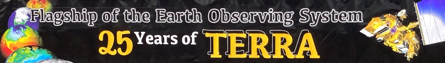
NASA’s Earth Observing fleet continues to age gracefully. While several new missions have joined the fleet in the past year, scientists and engineers work to extend the life of existing missions and maximize their science along the way. The crowning example is the first Earth Observing System (EOS) Flagship mission, Terra, which celebrated a quarter-century in orbit on December 18, 2024.

Terra continues to collect daily morning Earth observations using five different instruments: Advanced Spaceborne Thermal Emission and Reflection Radiometer (ASTER), Clouds and the Earth’s Radiant Energy System (CERES), Multi-angle Imaging SpectroRadiometer (MISR), Moderate Resolution Imaging Spectroradiometer (MODIS), and Measurement of Pollution in the Troposphere (MOPITT). Collectively, these observations have established a robust satellite record of global scientific processes to track changes in temperature, glaciers, clouds, vegetation, land-use, air quality, and natural hazards such as hurricanes, wildfires, and volcanic eruptions.

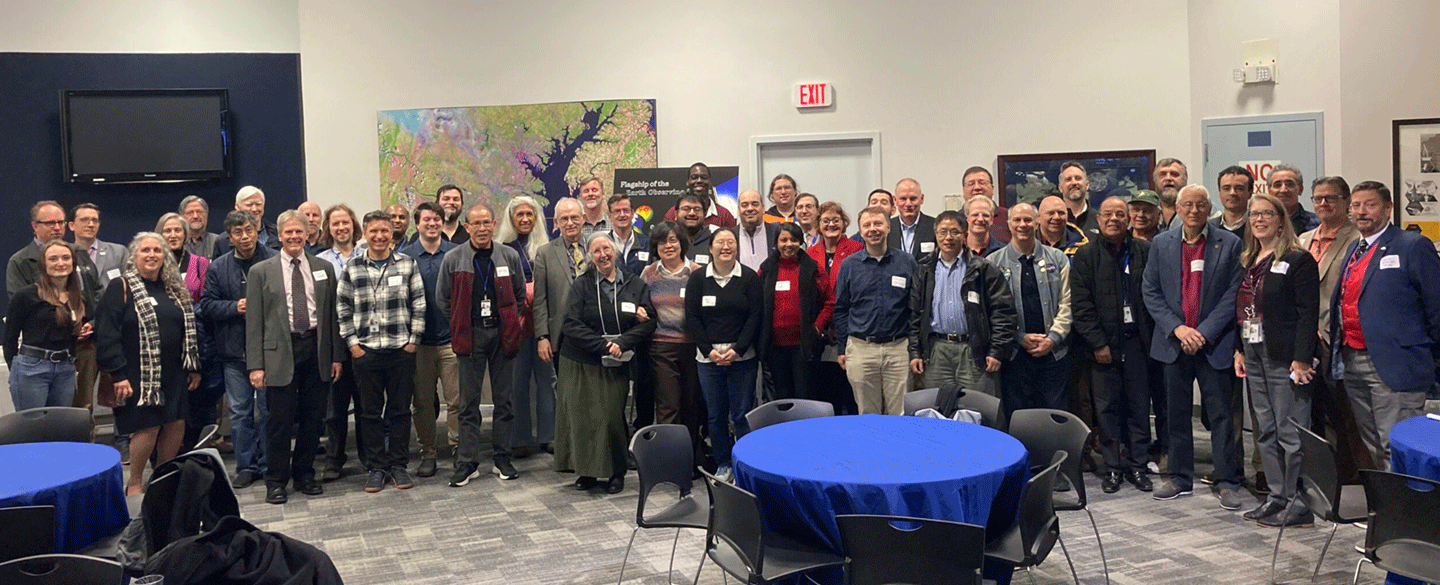
Originally designed for a six-year prime mission, Terra continues to deliver data used by emergency managers, researchers, and modelers over a quarter-of-a-century later. On December 18th, 2024, NASA celebrated the 25th anniversary of Terra’s launch with a celebration at the Goddard Space Flight Center (GSFC) Visitor’s Center. NASA Senior management [from Headquarters and GSFC] as well as other key figures from Terra’s long history gave brief remarks and perspectives on Terra’s development and achievements. To read a review of the celebration, see “Celebrating 25 Years of Terra.”

Terra-related sessions (poster and oral) during the Fall American Geophysical Union (AGU) meeting were well-attended. The Terra team took advantage of the meeting to have a celebratory anniversary dinner that included attendees representing each of the five instruments.

Another mission to recently reach a longevity milestone is NASA’s Orbiting Carbon Observatory-2 (OCO-2), which celebrated 10 years in space last summer. OCO-2, which launched on July 2, 2014, from the Vandenburg Air Force (now Space Force) Base in California, was originally designed as a pathfinder mission to measure carbon dioxide (CO2) with the precision and accuracy needed to quantify where, when, and how the Earth inhales and exhales this important greenhouse gas seasonally. OCO-2 was part of the international Afternoon Constellation, or “A-Train,” which also included Aqua, Aura, CloudSat, and CALIPSO, as well as international partner missions.

Since its launch, OCO-2 data have revealed unprecedented insights into how the carbon cycle operates – from observing the impact and recovery of tropical land and ocean ecosystems during El Niño events to revealing the outsized impacts of extreme events (e.g., floods, droughts, and fires) on ecosystem health and functioning. Researchers from around the world use OCO-2 data, opening new opportunities for understanding the response of the carbon cycle to human-driven perturbations, such as the impact of COVID lockdowns on atmospheric CO2 and improved quantification of emissions from large power plants and cities.

OCO-2 also maps vegetation fluorescence, which shows promise as a reliable early warning indicator of flash drought. During photosynthesis, plants “leak” unused photons, producing a faint glow known as solar-induced fluorescence (SIF). The stronger the fluorescence, the more CO2 a plant is taking from the atmosphere to power its growth. Ancillary SIF measurements from OCO-2 will help scientists better predict flash droughts, and understand how these impact carbon emissions.

Ten years into the mission, OCO-2 has become the gold standard for CO2 measurements from space. The spacecraft and instrument continue to perform nominally, producing data leading to new scientific discoveries.

OCO–3, built from spare parts during the build of OCO-2 and launched to the International Space Station (ISS) in 2019, also celebrated a milestone, marking five years in orbit on May 4, 2024. While the follow-on has the same instrument sensitivity and makes essentially the same measurements as OCO-2, the precessing vantage point on the ISS (as opposed to OCO-2’s polar orbit) and the use of a new pointing mirror assembly (PMA) results in significant day-to-day spatial and temporal sampling differences that allows CO2 tracking for diurnal variability. In addition, the flexible PMA system allows for a much more dynamic observation-mode schedule.

Further out in space, about 1 million mi (~1.1 million km) from Earth, orbiting the “L1” Lagrange point between Earth and Sun, the Deep Space Climate Observatory (DSCOVR) celebrated the 10th anniversary of its launch on February 11, 2025. The two NASA Earth observing instruments on DSCOVR are the Earth Polychromatic Camera (EPIC) and National Institute of Standards and Technology (NIST) Advanced Radiometer [NISTAR].

The 10th DSCOVR EPIC NISTAR Science Team Meeting was held October 16–18, 2024 at Goddard Space Flight Center. Former U.S. Vice President Al Gore opened the meeting with remarks that focused on remote sensing and the future of Earth observations. Following Gore’s remarks, DSCOVR mission leadership and representatives from GSFC and the National Oceanic and Atmospheric Administration (NOAA) gave presentations on DSCOVR operations, EPIC calibration, and NISTAR Status and Science.

The meeting provided an opportunity for participants to learn the status of DSCOVR’s Earth-observing instruments, the status of recently released Level-2 (geophysical) data products, and the resulting science. As more people use DSCOVR data worldwide, the science team hopes to hear from users and team members at its next meeting. The latest updates from the mission can be found on the EPIC website. For more details, see the Summary of the 10th DSCOVR EPIC and NISTAR Science Team Meeting.

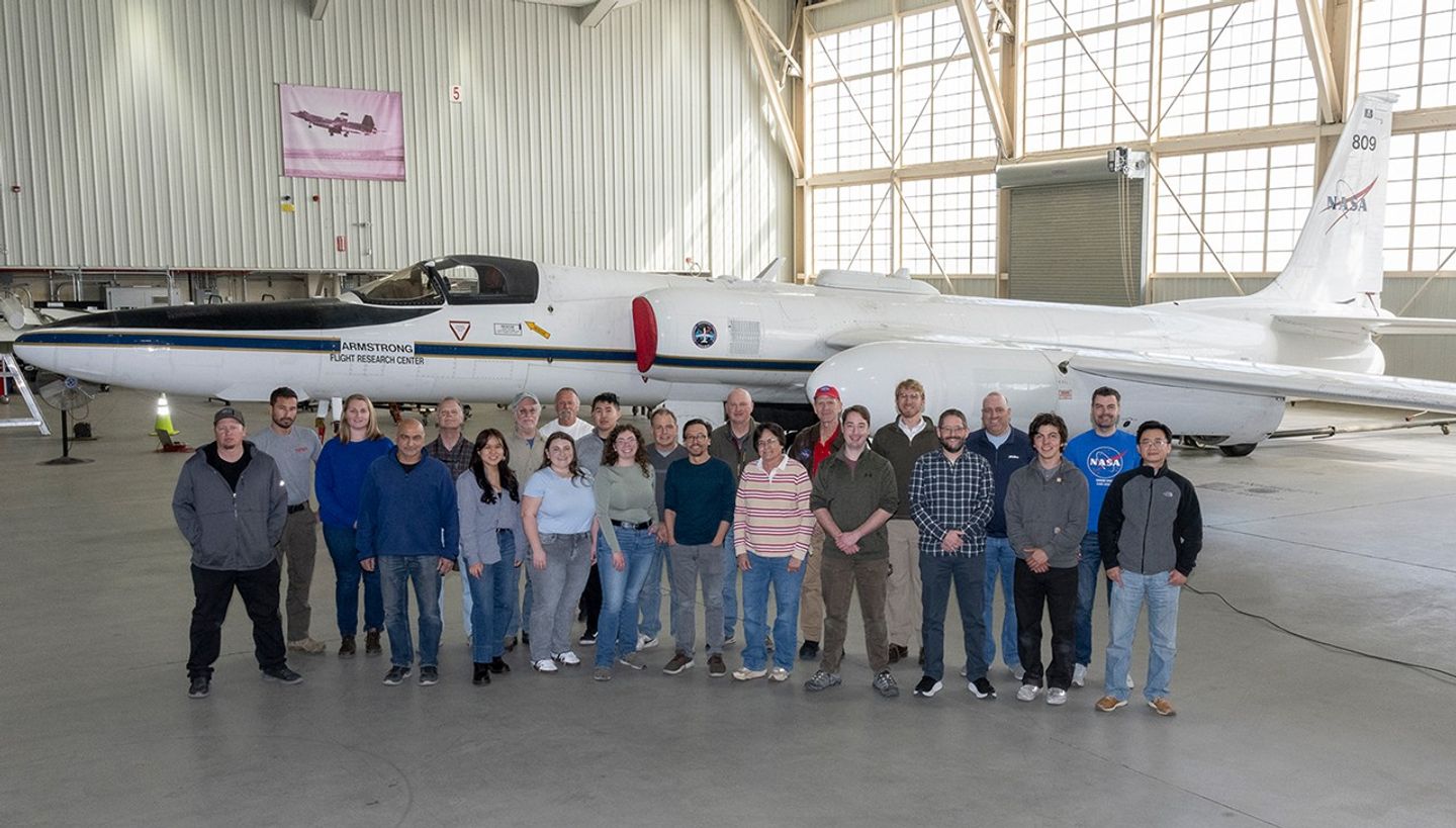
Flying in the space between satellites and ground-based observations, NASA’s Airborne Science Program operates a fleet of aircraft, unpiloted aerial vehicles, and even kites to study Earth and space science. Since 1987, a highly modified McDonnell Douglas DC-8 aircraft has been a mainstay of ASP’s fleet ­­– see Photo 1. The aircraft, located at NASA’s Armstrong Flight Research Center (AFRC) in California, flew countless missions as a science laboratory, producing science data for the national and global scientific communities. NASA decided to retire the venerable DC-8 aircraft, which made its last science flight in April 2024. The DC-8 is being replaced with a similarly refurbished Boeing 777 aircraft, which will be even more capable than the DC-8 and is located at the NASA Langley Research Center (LaRC).

The NASA History Office and NASA Earth Science Division cohosted a workshop, titled “Contributions of the DC-8 to Earth System Science at NASA,” on October 24–25, 2024 at the Mary W. Jackson NASA Headquarters (HQ) Building in Washington, DC – for more details on the DC-8 event, see the article The NASA DC-8 Retires: Reflections on its Contributions to Earth System Science.

DC8 Photo 1
Photo 1. NASA’s DC-8 flying laboratory flew Earth science missions from 1987 to 2024. Expert maintenance allowed the aircraft to conduct research on six continents and study ice fields on the seventh, Antarctica.
Image Credit: Lori Losey/NASA

There are also updates from three recent NASA field campaigns – where ground observations are timed and coordinated with aircraft flights (often at more than one altitude) and with satellite overpasses to gain a comprehensive (i.e., multilayered, multiscale) picture of the atmosphere over a certain area. 

The Westcoast & Heartland Hyperspectral Microwave Sensor Intensive Experiment (WHyMSIE) campaign was held from October 17- November 18, 2024. Serving as a future NASA planetary boundary-layer (PBL) mission prototype, WHyMSIE aimed to capture a wide variety of thermodynamic, moisture, and PBL regimes across a variety of surface types. WHyMSIE was an initial step towards an integrated and affordable PBL observing system of systems, with multiple observing nodes – i.e., space, suborbital, and ground – from passive and active sensors to enable a comprehensive and coherent picture of essential PBL variables and hydrometeors that is not possible with any single sensor, observational approach, or scale. As a partnership between NASA and NOAA, this field campaign flew a first-of-its-kind hyperspectral microwave airborne measurements (CoSMIR-H) that was complemented by other passive (thermal emission, solar reflectance) and active (lidar, radar) sensors flying onboard the NASA ER-2 (AFRC) and G-III (LaRC), with coordination over a variety of ground-based sensor facilities.

The GSFC Lidar Observation and Validation Experiment (GLOVE) was conducted in February 2025 at Edwards Air Force Base, California – see Photo 2. GLOVE flew the Cloud Physics Lidar (CPL), Roscoe lidar, enhanced MODIS Airborne Simulator (eMAS) imaging scanner, and Cloud Radar System (CRS) on the ER-2 to validate NASA ICESat-2 atmospheric data products and validate ESA’s recently launched EarthCARE lidar, radar, and spectrometer products.

NASA’s Earth Science Division FireSense project focuses on delivering NASA’s unique Earth science and technological capabilities to operational agencies, striving to address challenges in US wildland fire management. Together with agency, academic, and private partners, FireSense completed an airborne campaign in a wildfire smoke-impacted airshed in Missoula, MT on August 27–29, 2024. During the three-day campaign, a NASA Uninhabited Aerial System (UAS) team conducted eight data-collection flights, partnering these launches with weather balloon launches.

FireSense uses airborne campaigns to evaluate capabilities and technologies to support decision making in wildland fire management and air quality forecasting. Targeted data collection produces better forecasts and more successful technology transfer to wildland fire operations. In the future, the FireSense Program will coordinate two airborne campaigns for spring 2025 at Geneva State Forest, Alabama and Kennedy Space Center located within Merritt Island National Wildlife Refuge, Florida. Both 2025 campaigns will incorporate data collection before, during, and after prescribed fire operations. Beyond NASA, the campaign works in close partnership with the U.S. Forest Service, National Weather Service, U.S. Fish and Wildlife Service, Department of Defense, as well as partners in academia and the private sector. For more information on FireSense’s most recent campaign in Montana see the Editor’s Corner supplemental summary of “The FireSense Project.”

Editor's Corner Winter Photo 2
Photo 2. NASA personnel stand in front of theNASA ER-2 at Edwards Air Force Base, California, during the GSFC Lidar Observation and Validation Experiment (GLOVE) in February 2025.
Image credit: John Yorks/NASA

Congratulations to Jack Kaye, Associate Director for research with the Earth Science Division within NASA’s Science Mission Directorate, who has received the William T. Pecora Award for his vision and creative leadership in multidisciplinary Earth science research, as well as spurring advancements in the investigator community, supporting development of sensors, and shaping NASA satellite and aircraft missions and research programs at the highest levels. To read more about this accomplishment, see “Kaye Honored with Pecora Award.

On the outreach front, AGU returned to Washington, DC, for its annual meeting from December 9–14, 2024. NASA continued to uphold its long-standing tradition as an AGU partner and exhibitor, leveraging the meeting as an opportunity to share the agency’s cutting-edge research, data, and technology with the largest collection of Earth and planetary science professionals in the world. Many of the estimated 25,000 students, scientists, and industry personnel who attended the conference visited the NASA Science exhibit, interacting with NASA subject matter experts and listening to Hyperwall presentations throughout the week.

As the final event in a busy calendar of annual scientific conferences, AGU is often an opportunity for NASA scientists to publish findings from the previous year and set goals for the year ahead. The agency’s robust portfolio of missions and programs will continue to set new records, such as NASA’s Parker Solar Probe pass of the Sun, and conduct fundamental research in Earth and space science. To read more about AGU 2024, see the article: AGU 2024: NASA Science on Display in the Nation’s Capital.

Ending on a somber note, we recently posted three notable obituaries. Each of these individuals made significant contributions to EOS history, which are highlighted in the In Memoriam articles linked below.  

Jeff Dozier, an environmental scientist, snow hydrologist, researcher, academic, and former EOS Project Scientist, died on November 17, 2024. Jeff embraced remote sensing with satellites to measure snow properties and energy balance. As a Project Scientist with the Earth Observing System Data and Information System (EOSDIS), he contributed to the design and management of very large information systems that would impact spatial modeling and environmental informatics.

Berrien Moore, Dean of the College of Atmospheric and Geographic Sciences at the University of Oklahoma (OU), died on December 17, 2024. Berrien served in several roles with NASA, including as a committee member and later chair of the organization’s Space and Earth Science Advisory Committee, Chair of the Earth Observing System Payload Advisory Committee, member and Chair of NASA’s Earth Science and Applications Committee, and member of the NASA Advisory Council. Berrien received NASA’s highest civilian honor, the Distinguished Public Service Medal, for outstanding service and the NOAA Administrator’s Recognition Award.

Pierre Morel, the first director of the World Climate Research Programme (WCRP) and founding member of WCRP’s Global Energy and Water Exchanges (GEWEX) Core project, died on December 10, 2024. Pierre’s work played an integral role in the development of tools used to study the atmosphere, many of which are still active today. Pierre was the recipient of the 2008 Alfred Wegener Medal & Honorary Membership for his outstanding contributions to geophysical fluid dynamics, his leadership in the development of climate research, and the applications of space observation to meteorology and the Earth system science.

Steve Platnick
EOS Senior Project Scientist

Share

Details

Last Updated
Mar 20, 2025

Related Terms

Powered by WPeMatico

Get The Details…

Celebrating 25 Years of Terra

Celebrating 25 Years of Terra

EC Supplemental banner

5 min read

Celebrating 25 Years of Terra

Expanded coverage of topics from “The Editor’s Corner” in The Earth Observer

EC Supplemental Terra Banner photo
Terra anniversary banner
Image credit: NASA
EC Supplemental Terra Group photo
NASA personnel gather to celebrate Terra’s 25th anniversary at the Visitor Center at NASA’s Goddard Space Flight Center on December 18, 2024.
Image credit: NASA

On December 18, 2024, Terra—the first EOS Flagship mission celebrated the 25th anniversary of its launch from Vandenberg Space Force (then Air Force) Base. Some 70 individuals gathered at the Goddard Space Flight Center’s (GSFC) Visitor Center to celebrate this remarkable achievement for the venerable mission – with 75 more participating virtually. 

The gathering began with a reception culminating with some informal remarks in the main area of the Visitor’s Center outside the auditorium from Marc Dinardo [Lockheed Martin, emeritus] who was involved in the design of Terra. He explained that – at the time it was being built in the 1990s – Terra represented a “big step forward” for Lockheed Martin compared to projects the company had done prior to this. He discussed several engineering feats, e.g., fitting spacecraft components into the Atlas rocket used to launch Terra, moving from tape recorders to solid state recorders for data storage, the (at the time) novel thermal system developed to reject heat and protect instruments, and the direct broadcast capabilities.

After the initial remarks, the in-person participants moved into the auditorium where they heard from representatives from NASA Senior management [both from Headquarters and GSFC] as well as from several key figures in Terra’s long history. Each speaker gave brief remarks and shared their perspectives on Terra’s development and achievements. Short summaries of each presentation follow below.

Julie Robinson [NASA HQ—Deputy Director of the Earth Science Division] began by noting that this feels like a family celebration.  She said her first  personal experience with Terra was submitting a proposal as a young scientist to do research that would use data from Terra. At that time the idea of studying Earth as a system of systems was brand new.  She had no idea at that time that more than a quarter-century later, she’d be involved  in planning the “next generation” Earth System Observatory (ESO). 

Shawn Domagal-Goldman [Deputy Director of the Sciences and Exploration Directorate] spoke about how some of the biggest science questions we try to answer are interdisciplinary and cross-instrument, spanning missions and generations. He said that the expertise and diverse skillsets of those who have worked on the Terra team over the past 25 years embodies this goal.

Tom Neumann [GSFC—Deputy Director of Earth Science Division (GSFC)] reflected on his early involvement in the Terra–Aqua–Aura proposal reviews. He noted the sheer number of people involved in the mission and the logistical challenges that organizing that size group presented at the time.  He also commented on the feeling of family surrounding the Team and how this surely contributed to its remarkable achievements over the past 25 years.

Guennadi Kroupnik [Canadian Space Agency—Director General of Space Utilization] extended congratulations to NASA and Terra team for 25 years of operations. He commented that this “six-year” mission has endured far beyond what was planned. Canada’s contribution was the Measurement of Pollution in the Troposphere (MOPITT) instrument with Jim Drummond [University of Toronto] as Principal Investigator. Kroupnik noted that MOPITT Is longest continuously running instrument in Canadian history. He is pleased that CSA has been able to partner with NASA on Terra and looks forward to future collaboration on the Atmospheric Observing System (AOS), which is one of the missions planned as part of ESO.

Jack Kaye [NASA Headquarters—Associate Director for Research of the Earth Science Division] spoke of Terra’s remarkable scientific accomplishments, the creativity of the team, and the intentional emphasis placed on validating the data, and the creativity of the Team. He also noted that the direct broadcast capability was extremely useful and led to many applications. Kaye remarked that the late Yoram Kauffman referred to the Advanced Spaceborne Thermal Emission and Reflection Radiometer (ASTER) as the “zoom lens of Terra.”

Miguel Román [GSFC—Deputy Director for Atmospheres] described himself as a “child of Terra,” as he began his science career at around the same time that Terra launched and has been involved in various capacities ever since. Román recalled the launch taking place at Vandenberg, which is near vineyards, where the team celebrated the successful launch with local wine. He also remembered finally sharing a bottle of wine with the late Piers Sellers (who served as the first Terra project scientist) at one of the final gatherings Piers threw before he passed from cancer. Román also mentioned the Our Changing Planet book that four Earth Scientists – including former EOS Senior Project Scientist and Moderate Resolution Imaging Spectroradiometer (MODIS) Science Team Leader Michael King and former Aqua Project Scientist Claire Parkinson—both GSFC emeritus – collaborated to write that was published in 2007. This book made use of numerous images and data from Terra’s five instruments – as well as other EOS data.

Kurt Thome [GSFC—Terra Project Scientist] rounded out the presentations, emphasizing again what several have stated in their individual comments – the Terra Team truly is a family. He commented that he’s only been leading the mission for the past ten years and that his work builds on the shoulders of those who came before him. In particular, he acknowledged the slide Miguel Román showed briefly during his presentation that honored those who were part of the Terra family who have passed away – e.g., Piers Sellers, Yoram Kauffman. 

Steve Platnick
EOS Senior Project Scientist

Share

Details

Last Updated
Mar 20, 2025

Related Terms

Powered by WPeMatico

Get The Details…